

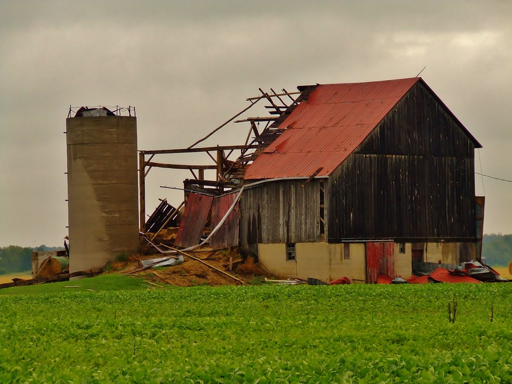
This heavily rain-wrapped F2 tornado first touched down near the intersection of Forest Road and Churchill Line to the east of Wyoming and tracked to south of Watford. Its path was 11 kilometres long and 500 metres wide, travelling through sparsely populated areas of Lambton County.
Trees were snapped and uprooted, barns were destroyed, and six steel Hydro One transmission towers were twisted and toppled, leaving 60,000 people without power and earning the tornado its high-end F2 rating. It dissipated south of Watford.
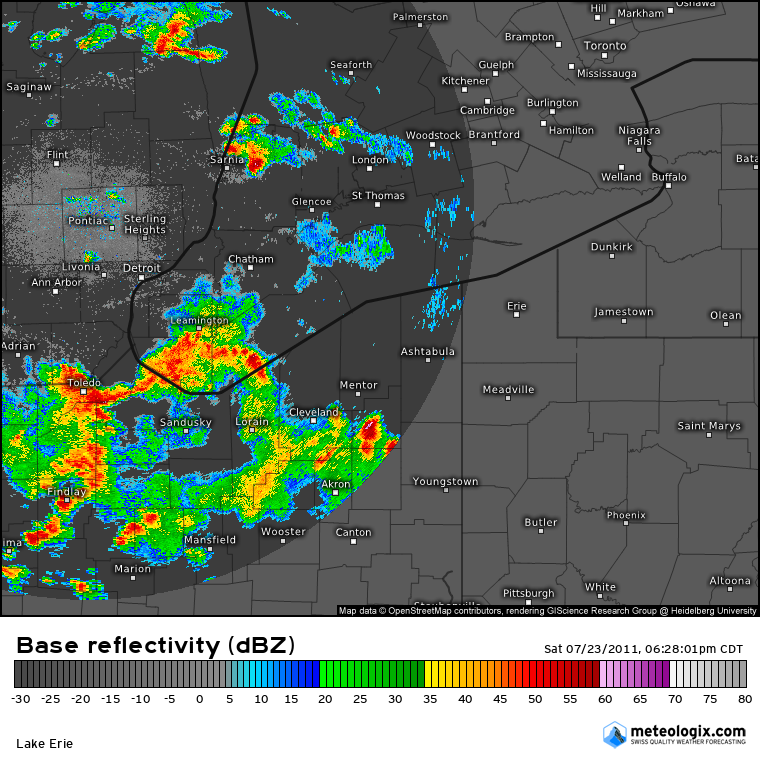
Figure 2 depicts the radar imagery at 7:28 pm, which shows a supercell with a classic ‘hook echo’ just east of Sarnia, ON. This storm was responsible for the strong F2 tornado east of Wyoming on this day.
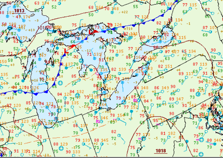
Figure 3 shows the surface observations at 8:00 pm EDT, which shows southerly winds across southwestern Ontario. Storms initiated in eastern Michigan and crossed into Ontario in the evening hours.
Sources
Lochem, V. (2011). Blow Apart [online]. Retrieved from https://www.flickr.com/photos/37967119@N08/11328821663/in/photolist-ig6aZr-6tY8R-6RsQ5E-fdwTR5-gUa5n-6RrRHk-Jo2MQh-yu7jv5-6tYir-oSWjDg-6Rp8PK-6tXMW-cpbcZ5-8fQ4RX-57X7VX-afuMrY-pahcUy-6tXJL-6tYbn-cBZYjL-jBGsv-6tXMk-6tYgZ-6SiFns-6V4TA5-oSVZz7-oSQyfg-aKgh5i-9SSZkZ-oRau1R-4Ycmeu-9YHnbS-djJWBN-prYnCS-afhNJ6-89nauk-fc1Ri-e916co-o41yt6-afs12k-oSVXE5-pa7aZF-6tXLR-ig8g5T-7vDd93-afuFK9-aftY2x-6tXKq-p8hc77-pajpMa/
NWS Weather Prediction Center Surface Analysis Archive. (2017). Surface analysis 00Z Sun Jul 24 2011. Retrieved from: https://www.wpc.ncep.noaa.gov/archives/web_pages/sfc/sfc_archive.php