

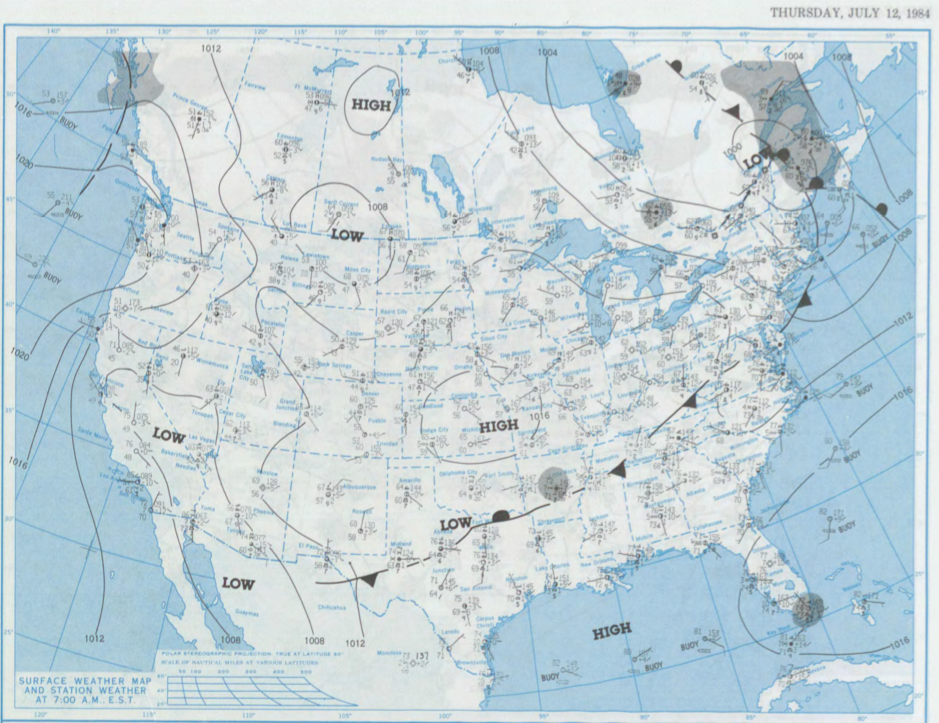
Figure 1 shows the surface observations at 7:00 am CDT, which shows a low pressure developing on the Saskatchewan/Montana border. This low brought southerly flow across southern Manitoba. The complex interactions between lake-breeze and terrain interactions with the Manitoba Escarpment likely triggered thunderstorms in the afternoon/early evening hours of July 12th, which ultimately led to this F1 tornado.
According to Environment and Climate Change Canada (2018), an F1 tornado touched down at 7:00 pm CDT near Wawanesa, MB. The track and width of the tornado was not documented by ECCC. The tornado caused no fatalities, no injuries and no property damage.
Sources
NOAA Central Library. (2020). U.S. Daily Weather Maps. Thursday July 12, 1984 [PDF]. Retrieved from https://library.noaa.gov/Collections/Digital-Collections/US-Daily-Weather-Maps
Environment and Climate Change Canada Data. (2018). Canadian National Tornado Database: Verified Events (1980-2009) – Public. Retrieved from: http://donnees.ec.gc.ca/data/weather/products/canadian-national-tornado-database-verified-events-1980-2009-public/