


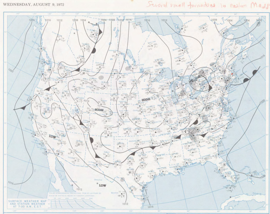
Figure 2 depicts the surface observations at 8:00 am EDT, which shows a stationary front across southern Quebec and a strong high pressure across the southeastern United States. This stationary front brought southerly winds to western Massachusetts throughout the morning hours of August 28th.
The surface map in Figure 2 does not give a complete picture of what is happening in the atmosphere on this day. Figure 3, which depicts the vertical profile of the atmosphere in Albany, New York in the morning of August 29th, gives us a hint of the volatile environment that led to this strong tornado in western Massachusetts and eastern New York.
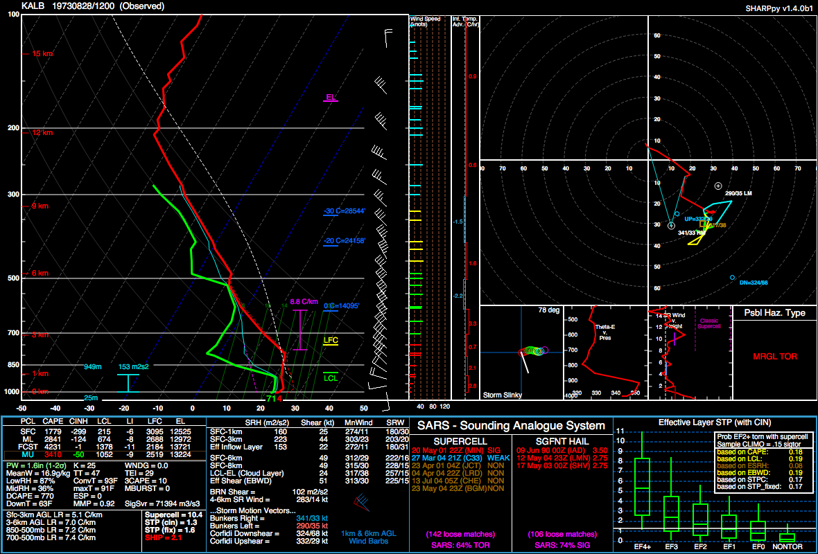
Figure 3 depicts steep lapse rates in the 7.2 C/km range, strong mixed-layer instability (MLCAPE) at 2841 J/kg and forecast to be 4231 J/kg. The surface to 1 km storm relative helicity (SRH) is impressive at 160 m2/s2 and the surface to 3 km at 223 m2/s2. This gives a 0-1 km shear of 25 knots and a 0-3 km shear of 44 knots. A very moist profile is observed at the surface with a 71 F dew point, an elevated mixed-layer (EML) and a convective temperature of 93 F.
All this combined, it is a very impressive profile for a morning sounding. The EML would suggest isolated classic supercells, rather than messy multi-cells. This morning profile seems to be upstream of the state line (West Stockbridge) environment and can be roughly extrapolated to be the environment present around the time of this F4 tornado on the NY/MA line.
The West Stockbridge, MA F4 tornado of August 28, 1973 impacted Berkshire County in Massachusetts. According to NOAA (2019), the F4 tornado caused 4 fatalities, injured 36 people and caused $25 million dollars in property damage. The tornado touched down east of Canaan, NY at 1:40 pm EDT. The tornado travelled for 6.4 miles from the NY/MA state line and had a maximum width of 313 yards.
Sources
Schenectady Gazette. (Aug. 29, 1973). Tornado Kills 4, Injures 31 Along Berkshire State Line. Retrieved from https://news.google.com/newspapers?id=4GhGAAAAIBAJ&sjid=FekMAAAAIBAJ&pg=3390,3084969&dq=tornado+kills+4+in+massachusetts&hl=en
SHARpy. (2019). Albany, New York 12Z Observed sounding for August 28, 1973.
NOAA Central Library. (2019). U.S. Daily Weather Maps. Tuesday August 28, 1973 [PDF]. Retrieved from https://library.noaa.gov/Collections/Digital-Collections/US-Daily-Weather-Maps
NOAA National Centers for Environmental Information (2019). Storm Events Database. Retrieved from: https://www.ncdc.noaa.gov/stormevents/