

This was the second of two tornadoes that ravaged Essex County during the dinner hour on August 24, the first of which struck the town of LaSalle. This was the more destructive of the two, and it tore through the east side of Windsor, passing through residential neighbourhoods and an industrial park near the airport. It travelled to the northeast for 8km with a path that was up to 200m wide.
Shortly after touching down, the tornado tore through northern sections of the Devonshire Heights subdivision. It ripped apart houses, shattering windows, tearing up roofing and siding and leaving them pockmarked by debris. Although the destruction through the neighbourhood was widespread, damage here was mostly EF0 and EF1; however, the tornado was steadily intensifying as it approached the industrial park just east of the subdivision. Here the tornado’s damage was most intense, in the area near Walker Road and EC Row Expressway, particularly along Denziel Drive. Over a dozen factories were torn apart with debris from the demolished buildings scattered for hundreds of meters. Three workers were transported to hospital to be treated for non-life-threatening injuries when the factory they were in was torn apart. The most severe single example of damage was to a large, single-storey factory that was destroyed to its foundation and swept away.
As it raged, shocked residents of the city captured terrifying photos and videos of the tornado, a large wedge laden with the debris of shredded buildings, churning through the city. In some videos, power flashes can be seen at the base of the funnel as transformers snap and explode in the winds. In others, the tornado can be seen passing precariously between car-filled roadways as panicked city motorists navigated through the storm. For a time a narrow horizontal vortex darted out the side of the tornado, a characteristic often associated with particularly violent tornadoes. Given the intensity of the tornado, it’s track through such a heavily populated area, and the total lack of warning, it is truly amazing that there were not more injuries or deaths associated with this powerful tornado.
According to Sills, Hong, Jaffe, Stevenson and Kopp (2018), The Windsor tornado travelled for 12.7 km and had a maximum width of 300 metres.
The Forecast
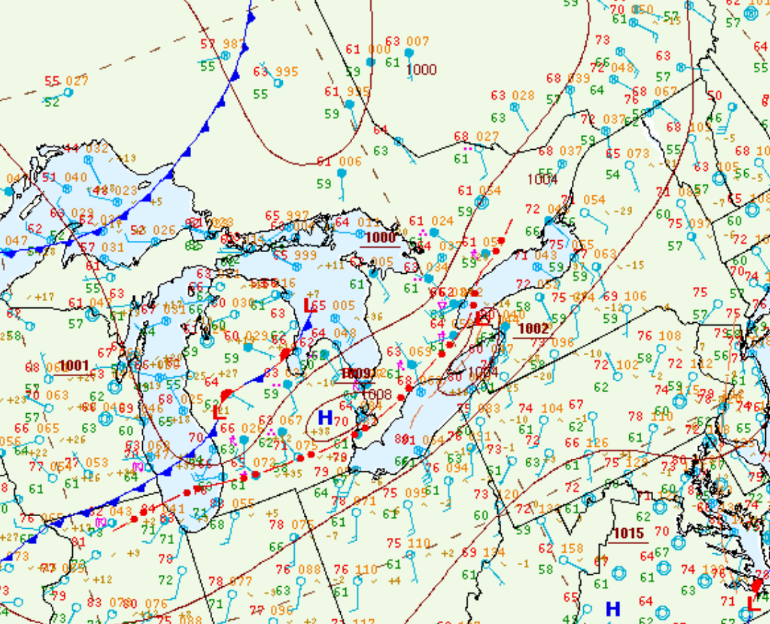
Figure 1 depicts the surface observations at 8:00 pm EDT, which shows a strong cold front moving across the U.S. Midwest, a prefrontal trough in northern Ontario and an ongoing thunderstorm (marked as a red ‘R’) over Detroit. This thunderstorm was responsible for two strong tornadoes in the late evening hours of August 24th.
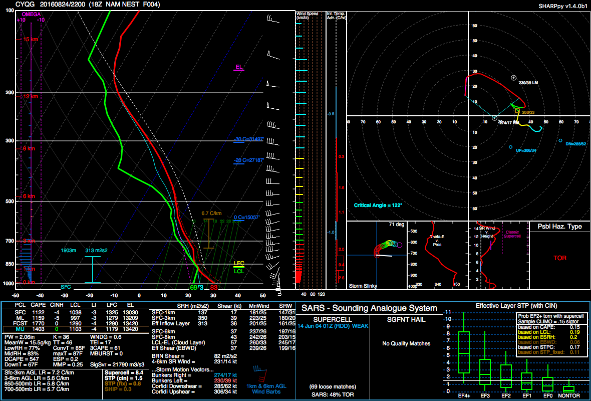
Figure 2 shows a forecast sounding at 6:00 pm, prior to the tornadoes. Figure 2 depicts a classic inverted-V sounding, a large and elongated hodograph, good shear, modest instability and around 5.8 C/km lapse rates. While this is not the most impressive sounding, it certainly depicts an environment conductive for tornadoes.
Sources
Sills, D., Hong, E., Jaffe, A., Stevenson, S. A. & Kopp, G. A. (2018). THE ‘CROSS-BORDER’ TORNADO OUTBREAK OF 24 AUGUST 2016 – ANALYSIS OF THE TWO TORNADOES IN ONTARIO. Proceedings of 29th Conference on Severe Local Storms, Stowe, VT.
NWS Weather Prediction Center Surface Analysis Archive. (2017). Surface analysis 00Z Thu Aug 25 2016. Retrieved from: https://www.wpc.ncep.noaa.gov/archives/web_pages/sfc/sfc_archive.php