

Witnesses reported seeing a funnel cloud in the Winthrop area at around 6:20 pm. Over its 2 kilometre-long path, the tornado caused damage to trees, knocked over a silo and destroyed two old barns, tossing debris up to 500 metres away. This was one of two tornadoes that occurred on May 15; the other was a an F1 at Kuhryville.
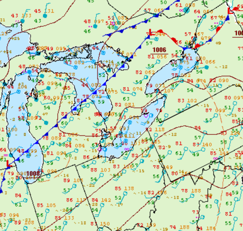
Figure 1 depicts the surface observations at 2:00 pm EDT, which shows a cold front slicing through southern Ontario, where a moist and unstable atmosphere is present. This cold front initiated thunderstorms in the afternoon hours of May 15th, which ultimately led to two F1 tornadoes.
According to Environment and Climate Change Canada (2018), an F1 tornado touched down at 6:20 pm near Winthrop, ON. The tornado travelled for 19.9 km, but its width was not documented by ECCC. The tornado caused no fatalities or injuries, but caused $100 thousand dollars in property damage.
Sources
NWS Weather Prediction Center Surface Analysis Archive. (2017). Surface analysis 18Z Tue May 15 2007. Retrieved from: https://www.wpc.ncep.noaa.gov/archives/web_pages/sfc/sfc_archive.php
Environment and Climate Change Canada Data. (2018). Canadian National Tornado Database: Verified Events (1980-2009) – Public. Retrieved from: http://donnees.ec.gc.ca/data/weather/products/canadian-national-tornado-database-verified-events-1980-2009-public/