

At 7:00 pm, witnesses reported observing this tornado, capturing a photo of a funnel cloud extending halfway to the ground. A house was shifted off of its foundation and a garage was destroyed.
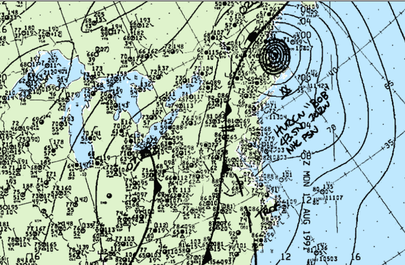
Figure 1 depicts the surface maps at 5:00 pm EDT. Some interesting features we notice right away is hurricane Bob off the east coast. A low pressure is also seen just south of Lake Erie. This low is bringing southerly winds across the lake. Lake-breeze interactions likely played a role in the development of storms and ultimately this F1 tornado.
According to Environment and Climate Change Canada (2018), an F1 tornado touched down at 7:00 pm EDT near Woodslee, ON and moved northeast. The track and the width of the tornado was not documented by ECCC. The tornado caused no injuries or fatalities, but caused $30 thousand dollars in property damage.
Sources
NWS Weather Prediction Center Surface Analysis Archive. (2017). Surface analysis 21Z Mon Aug 19 1991. Retrieved from: https://www.wpc.ncep.noaa.gov/archives/web_pages/sfc/sfc_archive.php
Environment and Climate Change Canada Data. (2018). Canadian National Tornado Database: Verified Events (1980-2009) – Public. Retrieved from: http://donnees.ec.gc.ca/data/weather/products/canadian-national-tornado-database-verified-events-1980-2009-public/