

This landspout tornado touched down briefly at 4:30 pm and was only on the ground for 100m, downing one tree. Witnesses observed a dusty debris cloud that had the appearance of circulating smoke.
Figure 1 depicts the surface observations at 5:00 pm EDT, which shows a cold front slicing through southern Ontario. This front became the focus for thunderstorms, which ultimately led to this tornado.
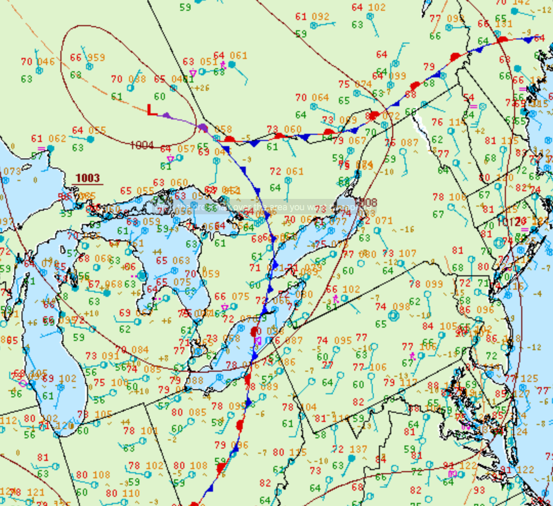
According to Environment and Climate Change Canada (2018), an F0 tornado touched down at 4:30 pm near Woodstock, ON. The tornado travelled for 100 metres, but its width was not documented by ECCC. The tornado caused no fatalities, injuries or property damage.
Sources
NWS Weather Prediction Center Surface Analysis Archive. (2017). Surface analysis 21Z Sun Jul 26 2009. Retrieved from: https://www.wpc.ncep.noaa.gov/archives/web_pages/sfc/sfc_archive.php
Environment and Climate Change Canada Data. (2018). Canadian National Tornado Database: Verified Events (1980-2009) – Public. Retrieved from: http://donnees.ec.gc.ca/data/weather/products/canadian-national-tornado-database-verified-events-1980-2009-public/