

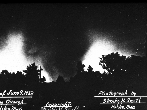
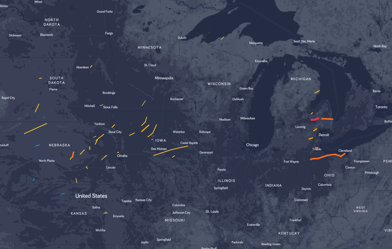
Two significant tornadoes impacted Massachusetts on June 9, 1953: this F4 and an F3 tornado from Worcester County to Bristol County. These tornadoes were part of a multi-day outbreak that began in the Central Plains (Figure 2) on June 7th, which included an F4 tornado in Nebraska. On June 8th, the outbreak targeted the Great Lakes, which spawned two F4 tornadoes and one F5 tornado in Michigan as well as one long-track F4 tornado in Ohio.
To this day, it remains one of the two strongest tornadoes to hit the state, the other being an F4, which began in New York and tracked into the extreme western part of Massachusetts. This F4 is also the state’s costliest tornado, sitting at $250M in property damage.
The tornado touched down in Worcester County southeast of Petersham at 3:30 pm EDT and travelled 34.9 miles to lift just south of Southborough, but not before impacting the northern side of Worcester a little over 5:00 pm. According to several newspapers, including WCVB (2019) and Boston.com (2017), around 4000 homes were damaged as a result of this tornado.

The forecast
Figure 4 depicts the surface observations at 2:30 am EDT, which shows a large cold front moving across the Midwest of the United States and a warm front stretching across Massachusetts. This cold front became the focus for intense thunderstorms in the afternoon hours of June 9th.
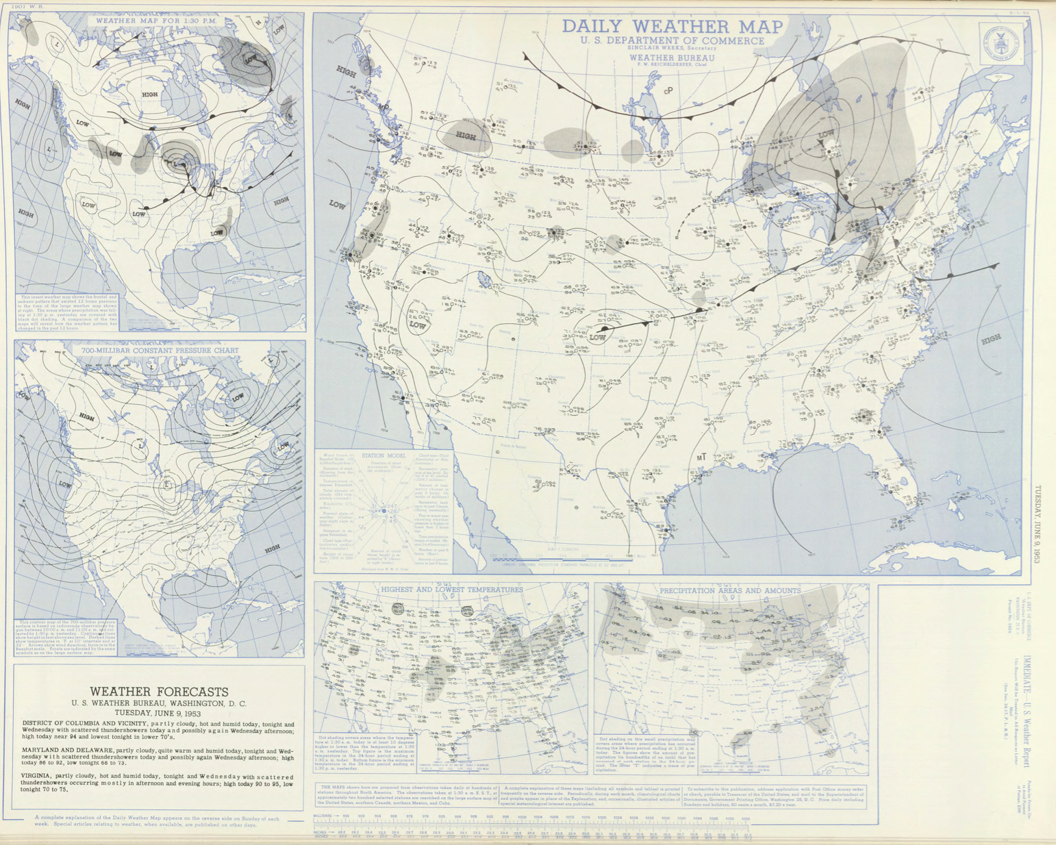
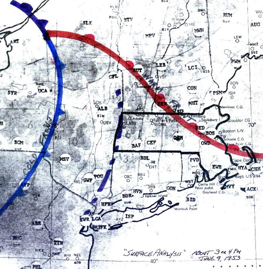
Figure 5 depicts a hand-analysis around 3:00 pm EDT, which depicts the cold front moving across New York state and a line of pre-frontal thunderstorms (squall line) entering Massachusetts. This squall line was responsible for this F4 tornado and an F3 tornado near Millbury.
Recap
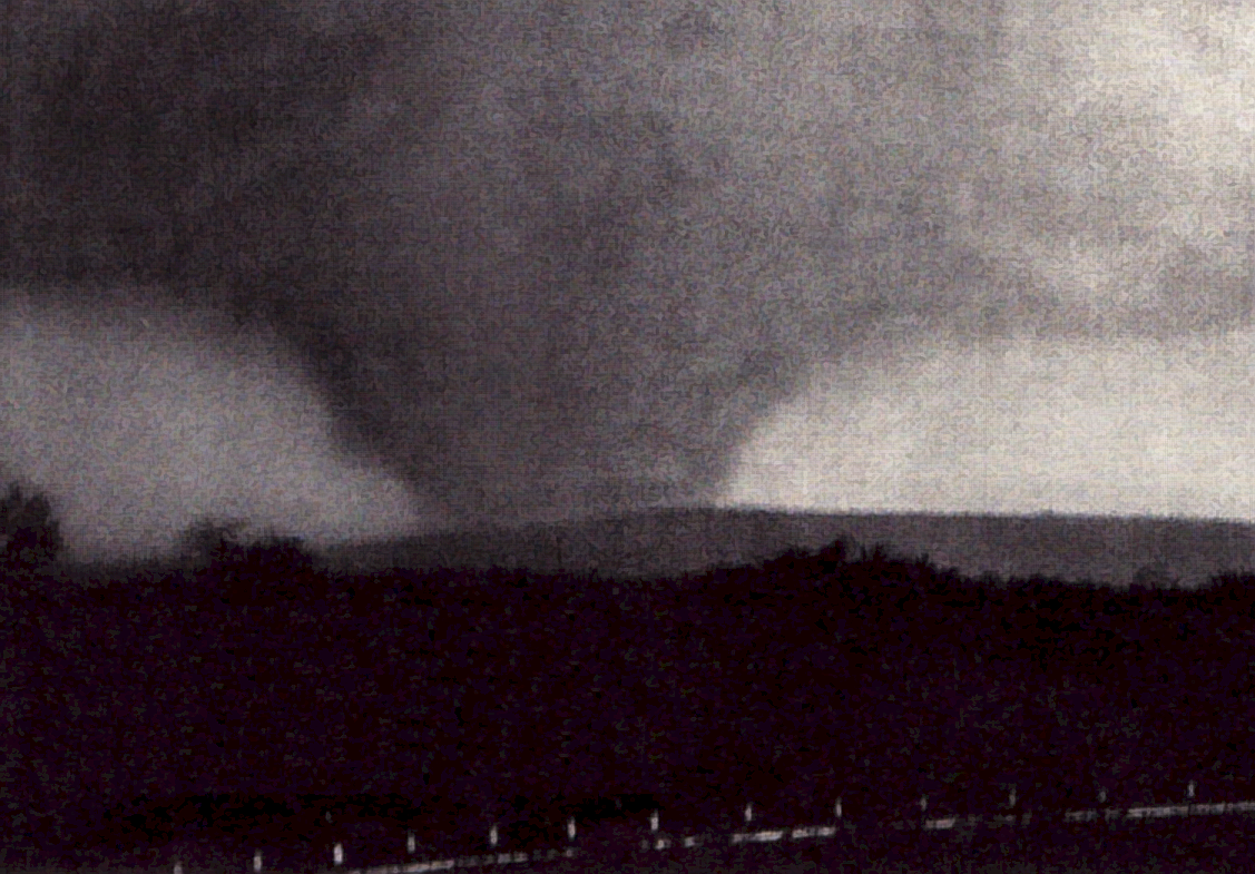
In total, the Worcester, MA F4 tornado of June 9, 1953 impacted Worcester County in Massachusetts. According to NOAA (2019), the F4 tornado killed 90 people, injured 1228 and caused $250 million dollars in property damage. The tornado touched down in Worcester County southeast of Petersham at 3:30 pm EDT and travelled 34.9 miles to lift just south of Southborough. This F4 had a maximum width of 900 yards (half mile wide).
Sources
National Weather Museum & Science Center (NWMS). (2018). Worcester, MA Tornado 1953. Retrieved from https://nationalweathermuseum.com/worcester-ma-tornado-1953/
WCVB. (2019). June 9, 1953: Remembering deadly Worcester tornado. Retrieved from https://www.wcvb.com/article/june-9-1953-remembering-deadly-worcester-tornado/8112644
Boston.com. (2017). Remembering the deadly F4 tornado that ravaged Worcester. Retrieved from https://www.boston.com/news/history/2017/06/09/remembering-the-tornado-that-ravaged-worcester
NOAA Central Library. (2019). U.S. Daily Weather Maps. Tuesday June 9, 1953 [PDF]. Retrieved from https://library.noaa.gov/Collections/Digital-Collections/US-Daily-Weather-Maps
Stormstalker. (2019). June 7-9, 1953 — The Flint – Worcester Outbreak. Retrieved from https://stormstalker.wordpress.com/2013/09/05/flint-worcester-outbreak/
NOAA National Centers for Environmental Information (2019). Storm Events Database. Retrieved from: https://www.ncdc.noaa.gov/stormevents/