

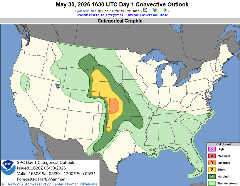
Published on
May 30, 2026 featured an Enhanced Risk across Central Kansas – mostly for a wind threat. The tornado threat was fairly minimal, with a 2% ‘hatched’ area draped across South Central Kansas.
We drove from Wichita, Kansas out to Pratt to see what the storms might look like. Honestly – they were very high-based all day, indicating more of a hail and wind threat versus the tornado threat.
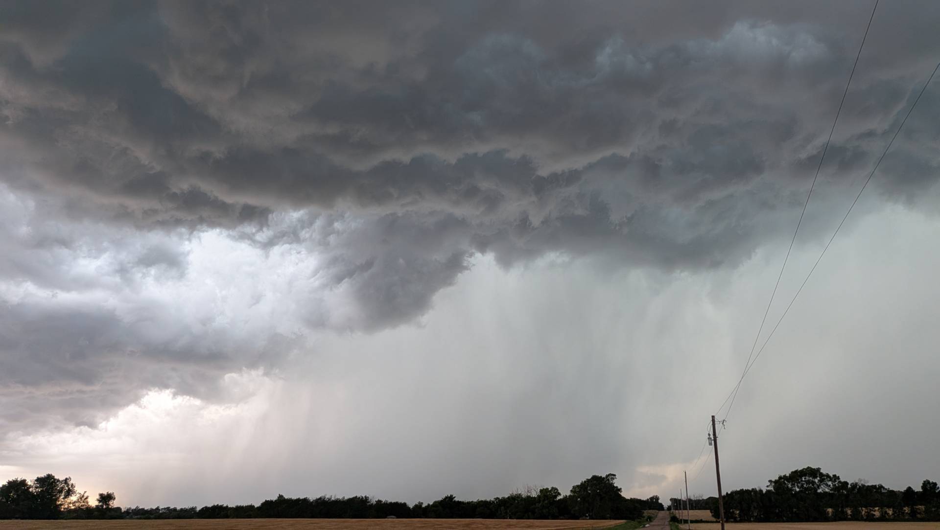
We jumped on a storm east of Pratt and it just featured a lot of heavy rain. Jumped on another storm near Kingman, which was producing ping pong ball sized hail with a lot of wind.
Severe storm 5 miles east of Kingman, Kansas. #kswx @NWSWichita
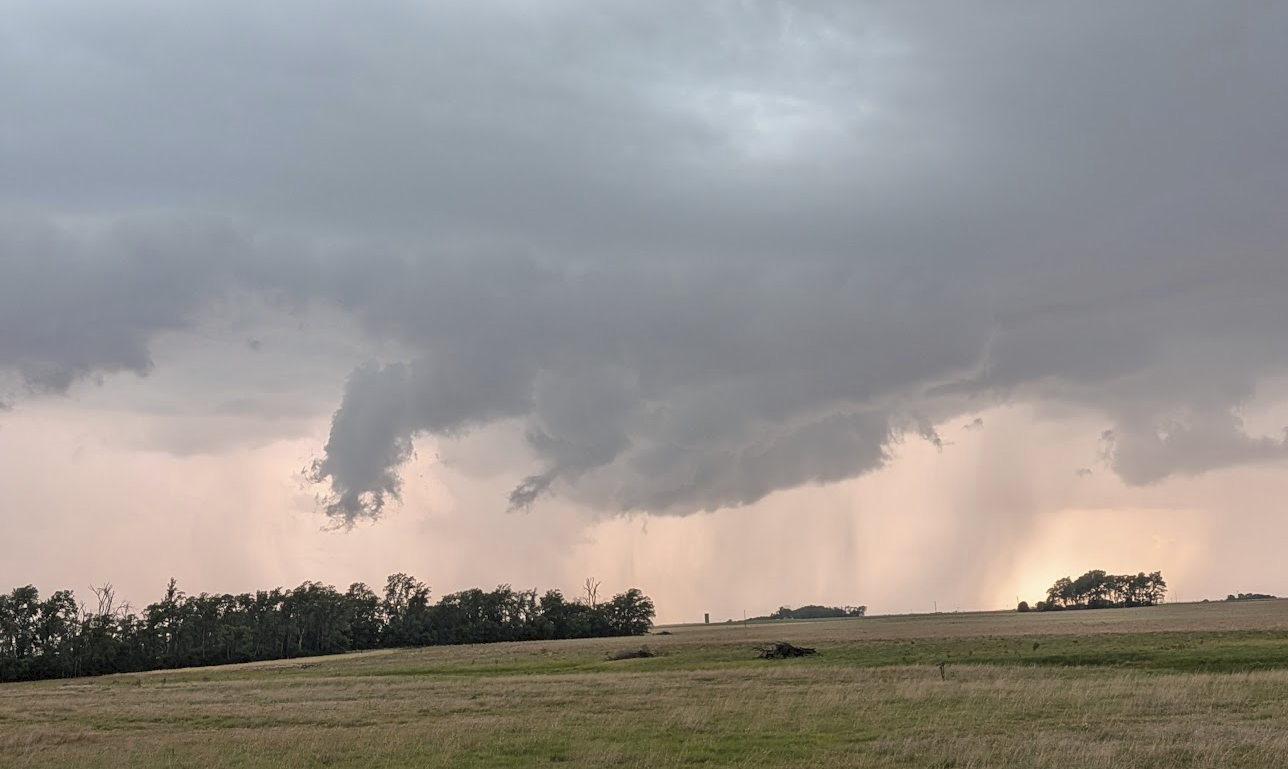
The storm east of Kingman exhibited some signs of rotation for a bit – but the rotational features were long sustained for long.
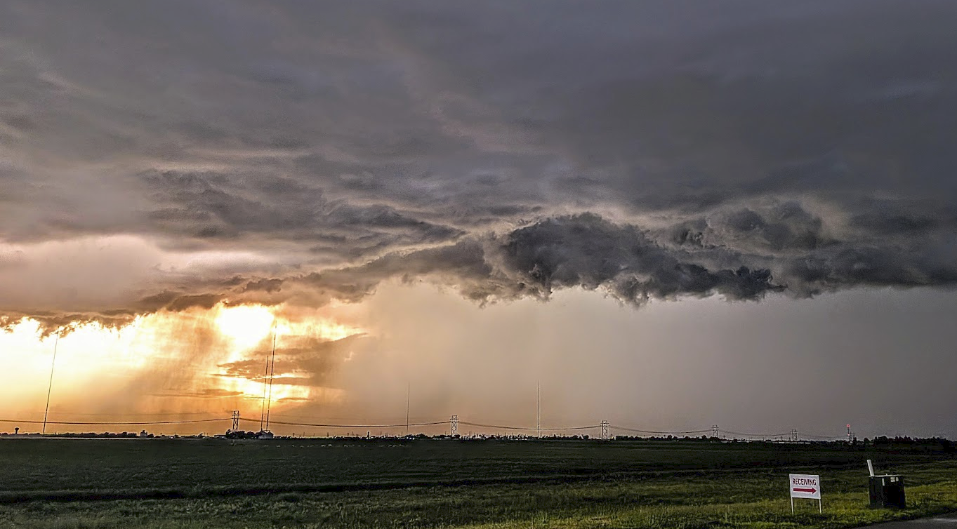
We busted back east again and positioned for a severe storm near Cheney, Kansas.
We watched the storm roll north from near the town of Cheney, until it was impacting Cheney Reservoir.
At this point, we decided to find shelter from hail in Andale – and let the storm pass over us.
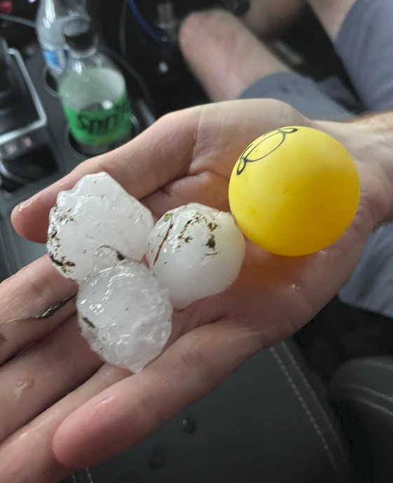
The hail came loud and fast, and with 70+ mph winds. We took shelter in a bank drive-thru, which protected us from damage. The minivan that pulled in next to us was not quite as lucky.
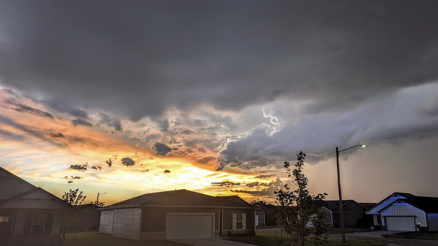
The sun quickly set as I was arriving back home at Chase Base – the following pictures were taken from my neighborhood as the sun set.
It was a fun, fairly local chase, considering some storms we find are 200+ miles from home. Back home before sunset is always an added bonus. Until next time
– Bryce
Community Comments
There are no comments on this post
Want to leave a comment? Join our community → OR Login →