

Published on
For once – a chase target seemed pretty evident for the Grand Island, Nebraska area on May 17, 2026.
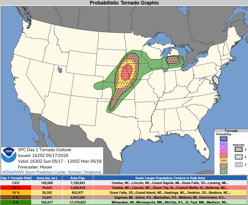
The Storm Prediction Center showed an Enhanced Risk over the Central Plains, stretching from Southwest Minnesota into North Central Kansas.
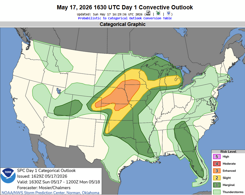
The best tornado potential appeared to be draped across Eastern Nebraska and adjacent regions.
We started off in Grand Island, and jumped on the first storm that popped about 14 miles west near Cairo.
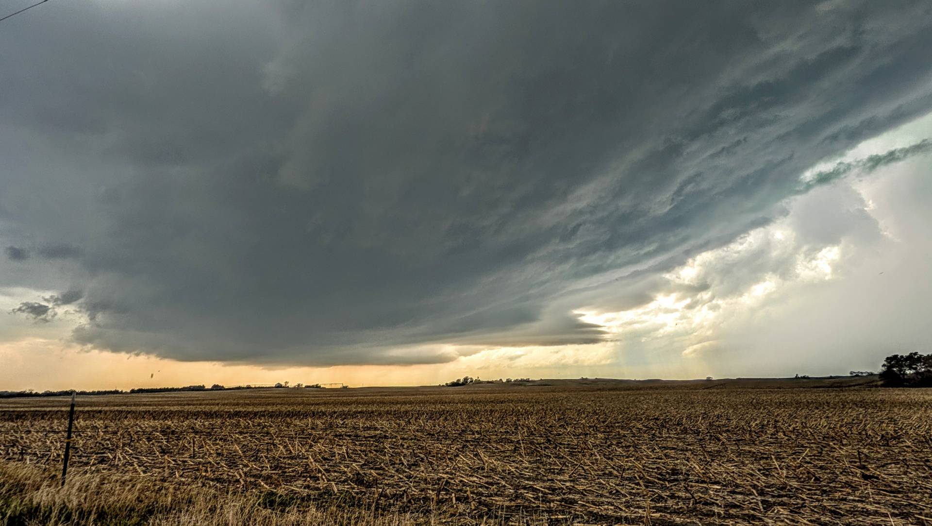
After getting east of Dannebrog and St. Libory, the supercell spit out a tornado – mostly rain wrapped from the southeast vantage point – but we were able to see a white elephant trunk turn into a white rope at dissipation.
The tornado didn’t last very long from this vantage point – and was much more visible in the damage path/to my northeast looking back to the southwest.
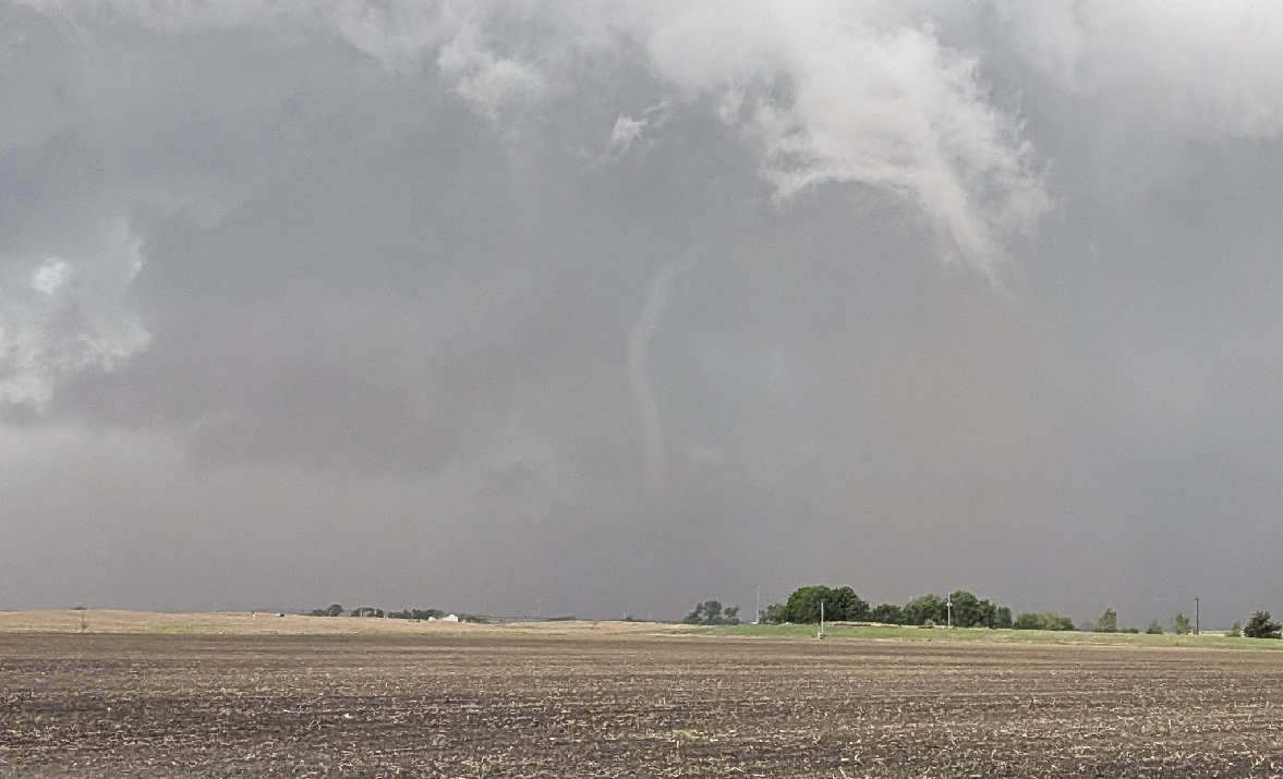
The tornado dissipating to the northwest of my location east of Saint Libory, Nebraska.
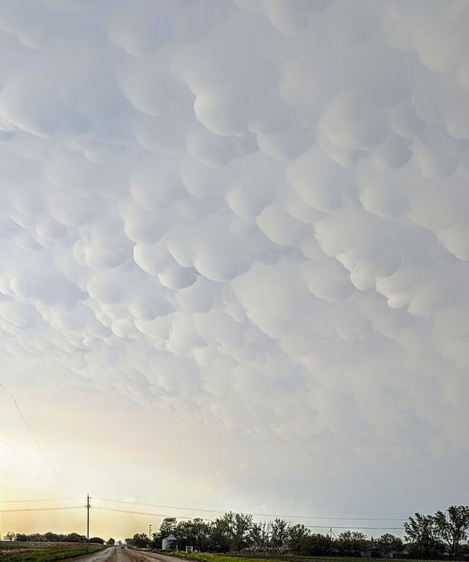
The supercell became outflow dominant – so we jumped down the line to check on some tornado damage in and near Hebron, Nebraska. The back side of the storm showed some amazing mammatus clouds.
Another chase in the books – and it was a fun one, minus the road network not being great early on (the Nebraska Sandhills!) and the amount of chaser traffic – but we enjoyed the trip all the same!
Community Comments
There are no comments on this post
Want to leave a comment? Join our community → OR Login →