

Published on
An active weekend of severe weather continued on Sunday, April 26, 2026. A little less clear than the day before as far as a target goes – but northern Oklahoma seemed plausible.
The Storm Prediction Center had a large Enhance Risk over the Central Plains. Being based in Wichita, Kansas – my team and I had the option to really go about anywhere for this setup. A conditional, but better setup seemed to be across the northern half of Oklahoma.
After some driving in circles, which is typical for my group, we settled on Perry, Oklahoma for the near-term. Storms fired around the 6 pm time frame, overhead of Perry. We scooted east and then north, eventually getting on the storm as it was east of Kaw Lake, east of Ponca City.
As is typical for me, I wanted to be ahead of the storm, so we blasted east to Pawhuska and then north. The supercell would produce a few tornadoes before we could see anything – if you don’t know this area, it isn’t known for a lot of roads or viewing spots.
The storm slowed considerably and would push toward our location about 6 miles north of Pawhuska.
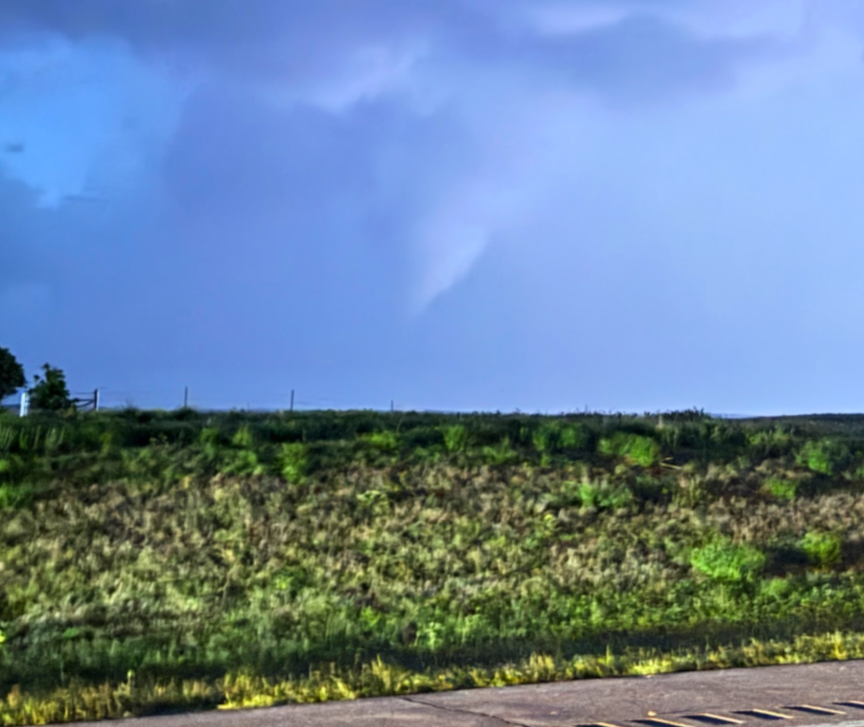
While not the prettiest tornado ever – the storm did produce a brief tornado north of our location after dark. A big thanks to Kirk & Alicia Short, and Beth Bowdoin for the photos – I was busy running the live stream and wasn’t on the right side of the car to take pictures!
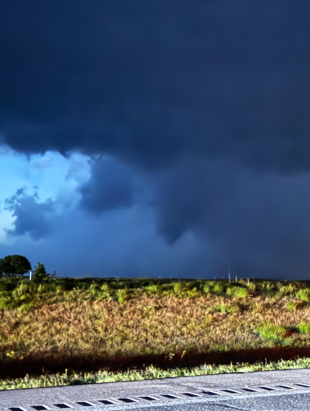
The tornado was likely an EF-0, but still provided some excitement from our group.
As soon as the storm passed the highway, we headed north to get back to Wichita for the evening.
Community Comments
There are no comments on this post
Want to leave a comment? Join our community → OR Login →