

Published on
Here we go again! Another potential big day across the Plains, in terms of tornado potential.
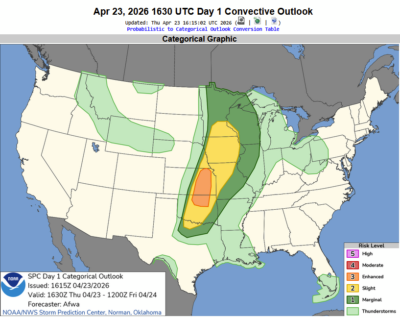
The Storm Prediction Center painted an Enhanced risk area from north of Topeka, Kansas south to Perry, Oklahoma. The early storms fired along an advancing cold front across the Upper Midwest, down to Central Kansas. These storms were a mixed mode of embedded Supercells and line segments.
Further south, the environment across Southern Kansas and Northern Oklahoma was quite volatile, if storms could stay isolated and thrive in the environment.
Storms did just that – fairly isolated storms fired near Wichita, but did not produce supercellular tornadoes – although many landspouts were common, with giant hail causing damage in Marion County, Kansas. The bigger story would be the tornadoes – a storm developed near Renfrow, Oklahoma and went on to produce twin tornadoes. While I was not in position to see those earlier tornadoes, I was on the storm as it passed Braman and moved toward Newkirk.
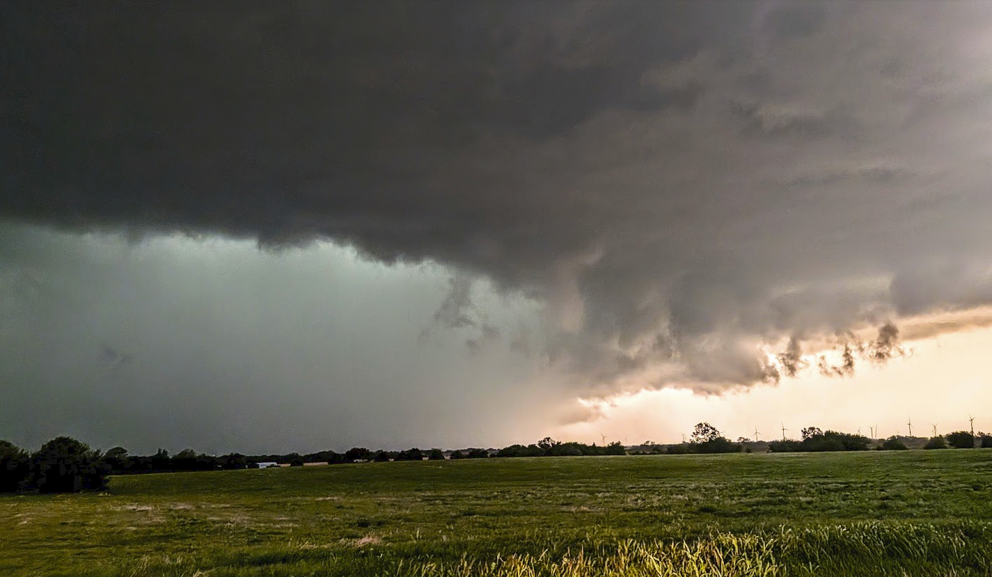
This tornadic supercell pressed east from Braman, Oklahoma and moved toward Newkirk. It did produce brief tornadoes while I was in position to watch – but would ultimately tease with the photogenic tornadogenesis before I was in position.
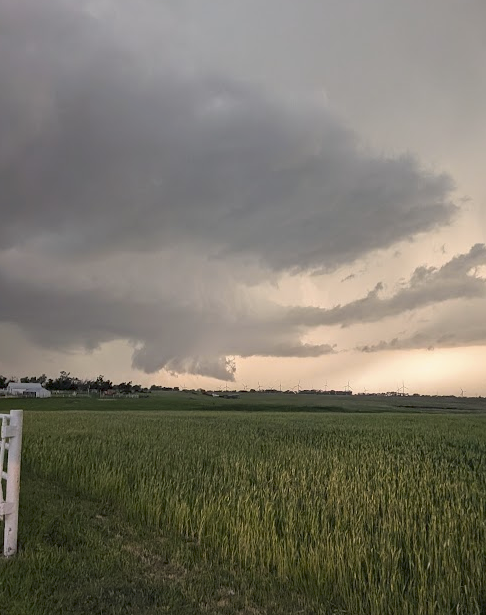
The supercell continued with strong rotation aloft and near the ground as it approached Newkirk, but couldn’t quite produce more than a few brief tornadoes that lasted less than 15 seconds.
Overall – it was a fun day. While my team and I missed out on the twin tornadoes near Braman, and a much larger, violent and highly documented tornado that tore through Vance Air force Base and Enid, we still provided more than 45 minutes of continuous TV coverage for those being impacted by this storm.
Community Comments
There are no comments on this post
Want to leave a comment? Join our community → OR Login →