

Published on
When it’s May, you chase – especially when it’s a weekend. There wasn’t much discussion within my team for May 9, 2026 – we opted to chase western Oklahoma.
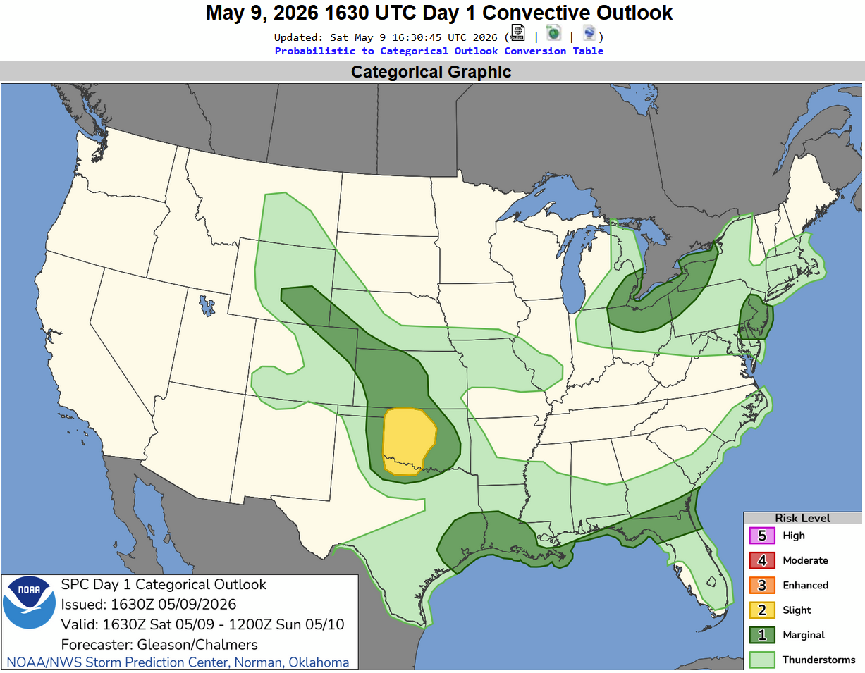
The Storm Prediction Center’s Outlook (below) indicated a Slight Risk across central and western Oklahoma.
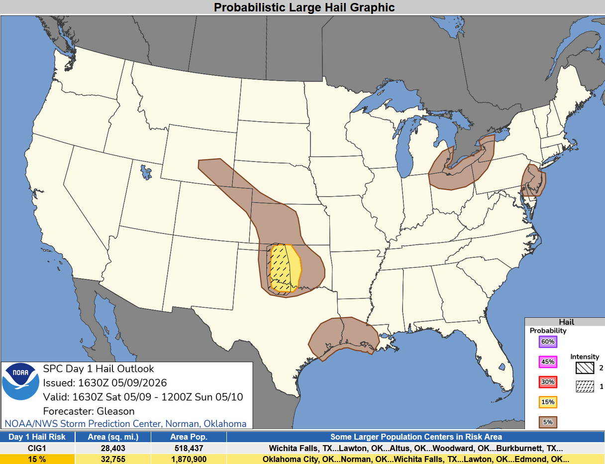
The biggest risk for this day is for hail, some of which was expected to be significant.
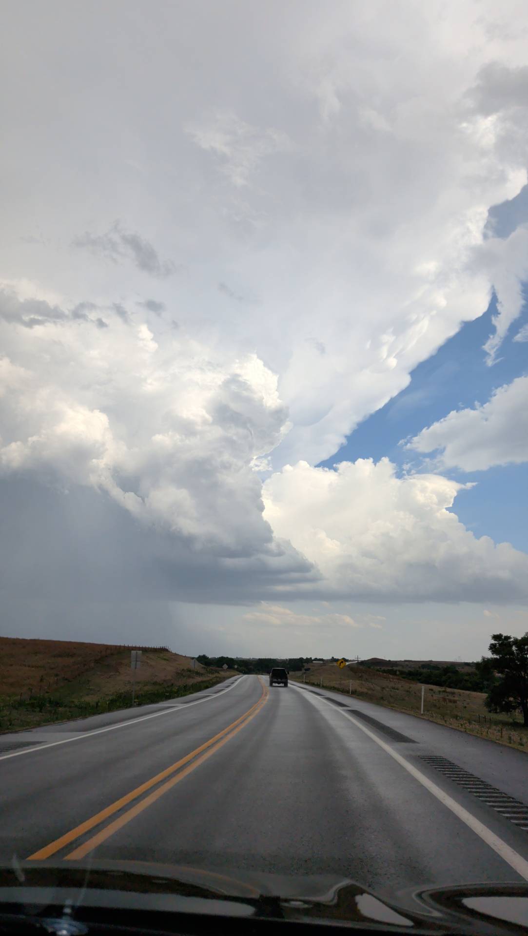
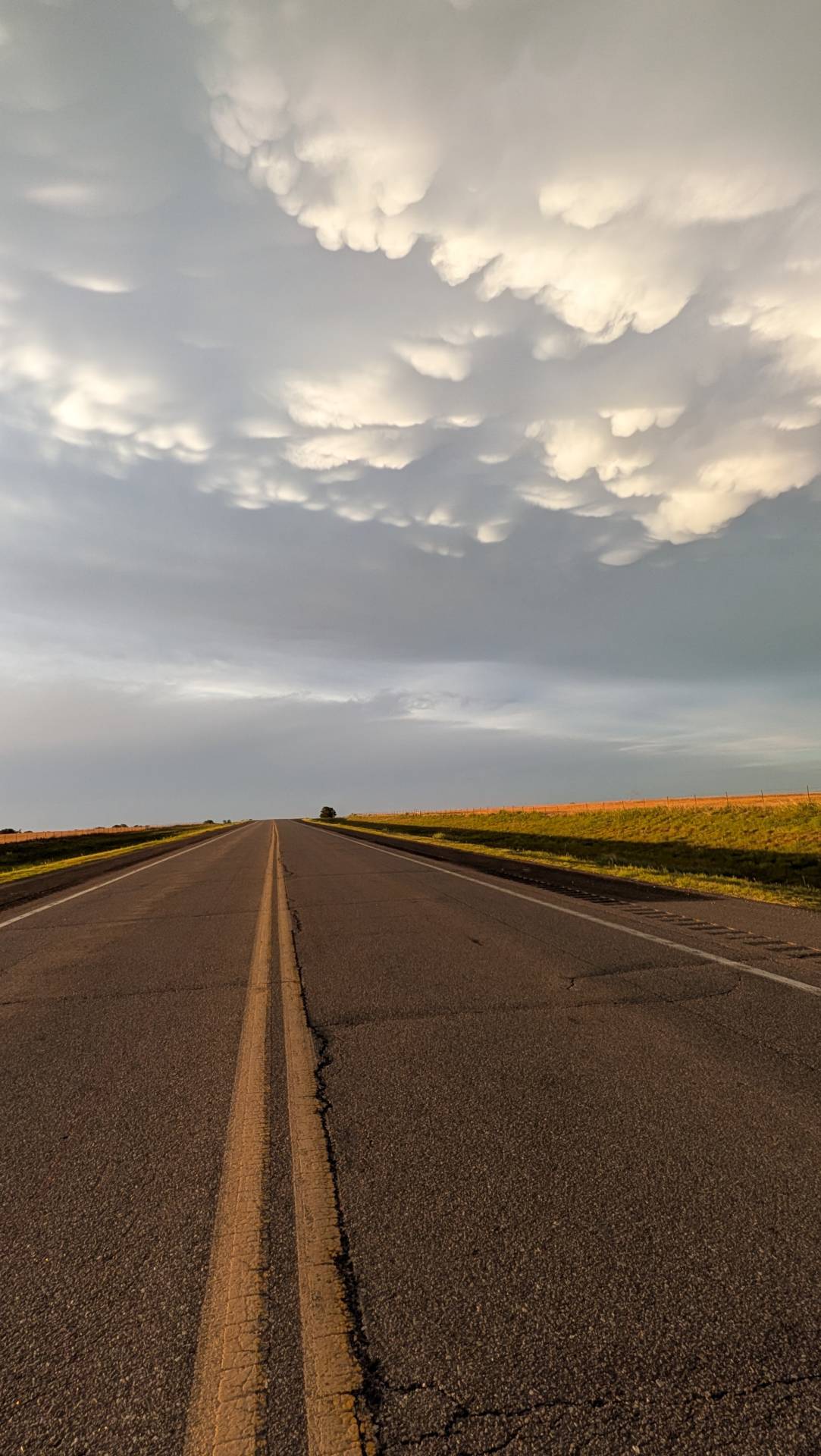
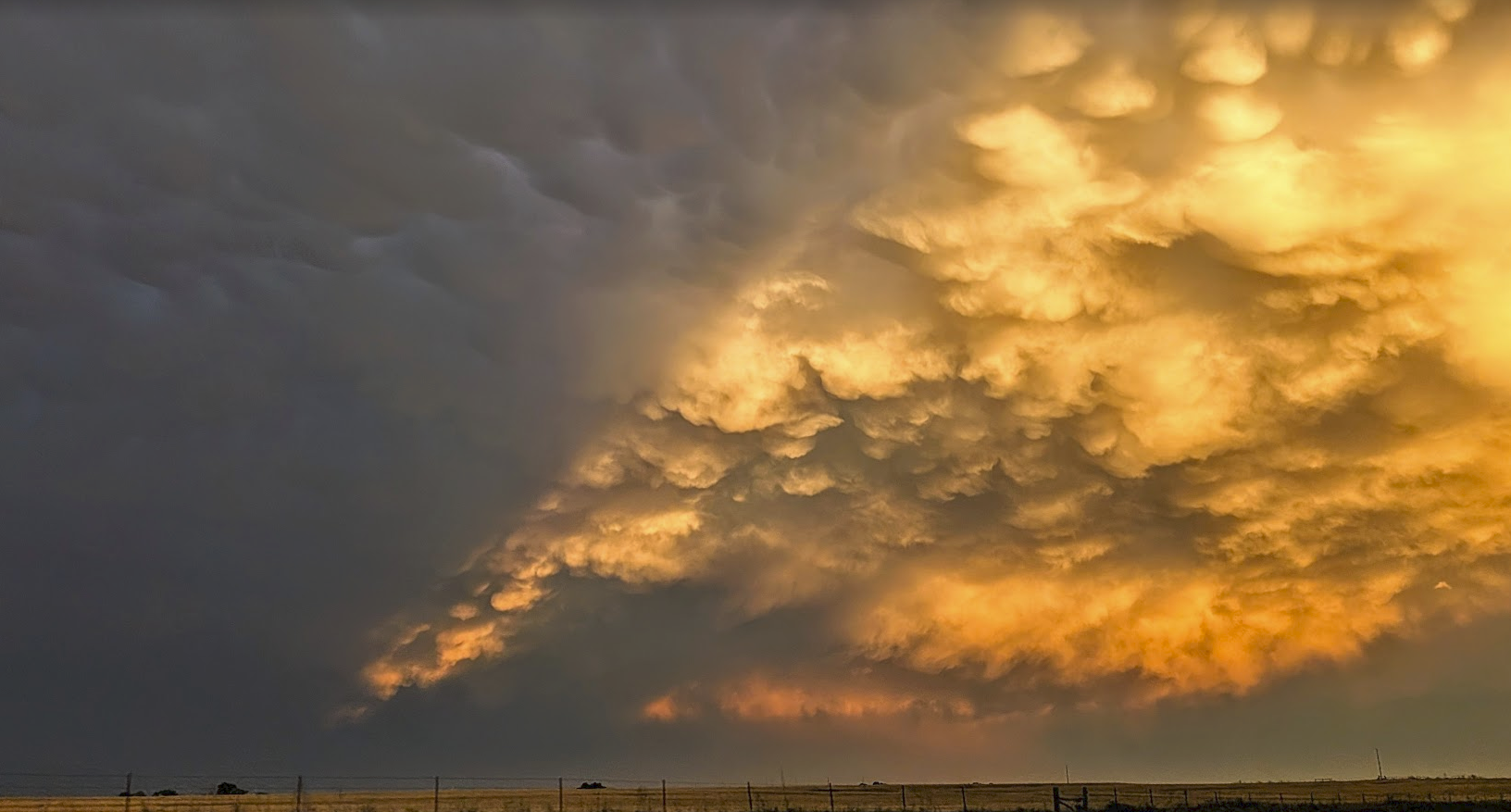
The sky continued to put on a show as sunset approached – taken approximately 10 miles north of Clinton, Oklahoma.
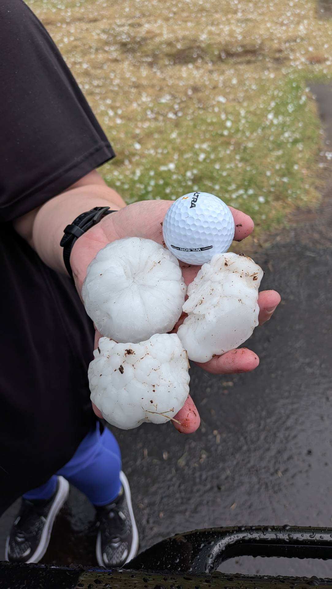
Storms moved in from the northwest right after sunset – and provided a shelf cloud – so I took my best attempt at a “shelfie”.

Overall it was a fun day – didn’t get into the storm structure quite as much as I would have liked since we came in behind the storms to sample the hail – but still had a blast. Bottom line is – it’s May, you chase.
Community Comments
There are no comments on this post
Want to leave a comment? Join our community → OR Login →