

Published on
With a Moderate Risk over much of the Kansas region, May 18, 2026 was a definite go, in terms of chasing.
The Outlook area, courtesy of the Storm Prediction Center, painted a rather scary view of how severe the storms might be.
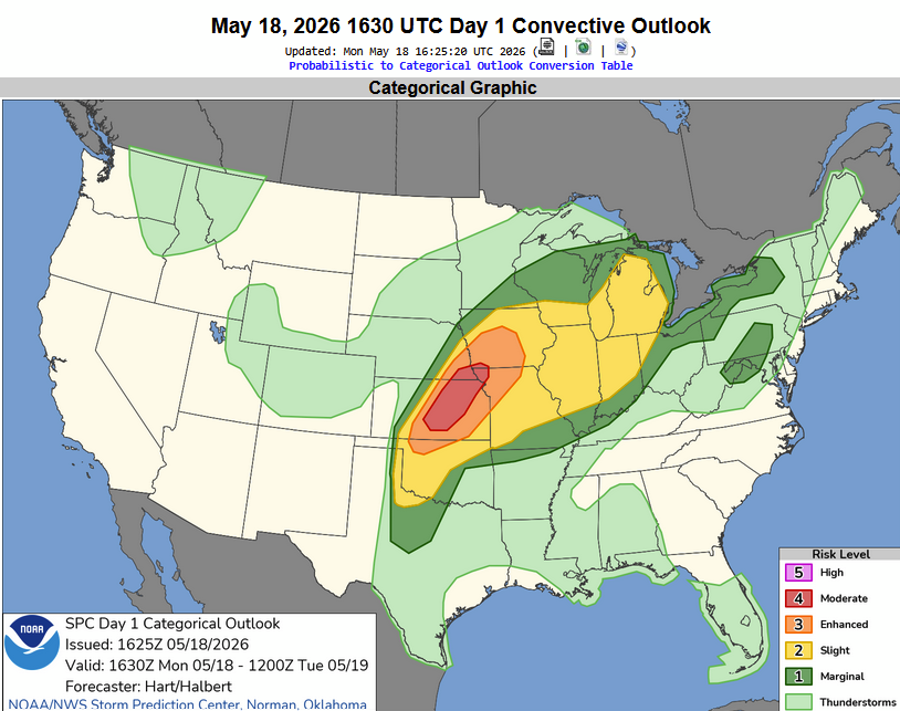
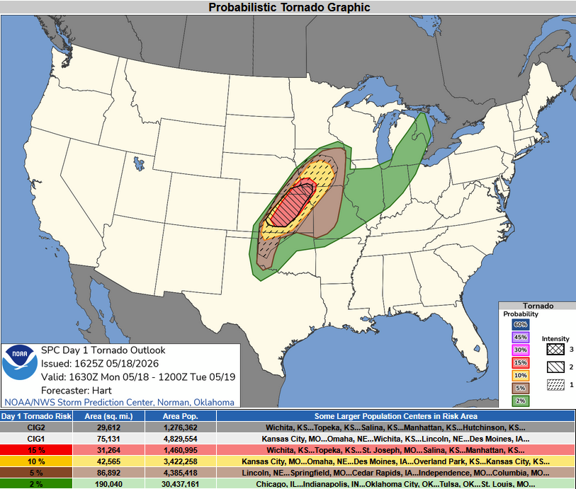
The Central Plains were categorized under a 15% hatched tornado probability area – generally from Nebraska City, Nebraska to the Wichita, Kansas area.
The first storm of the day tried its best to spit out a tornado near Lincoln, Kansas. This area of the state is known for the Smoky Hills, and such, isn’t great for chasing. The image below shows the one and only highway leading to this tornado-warned storm.
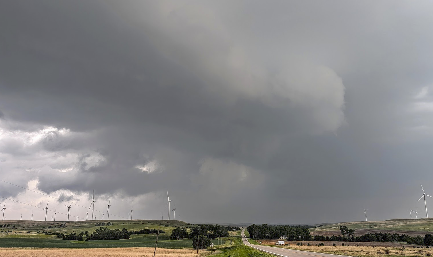
Looking north along Highway 14 in Lincoln, County, Kansas at a supercell that was tornado-warned.
The storm continued east to the Minneapolis, Kansas area. I was being silly as the tornado sirens were blaring and a wall cloud continued to march east.
Overall – it was more of a frustrating chase, as goes with many of the higher-end days. The amount of traffic on rural roads was absurd. The storms didn’t stay isolated long, but did produce tornadoes in the rain and hilly terrain on the Nebraska/Kansas border region. No tornadoes visible for this guy – but another chase is in the books all the same.
Until next time – Bryce
Community Comments
There are no comments on this post
Want to leave a comment? Join our community → OR Login →