

Published on
This day sort of snuck up on me – I was focused more on my work life than what Mother Nature could toss out on a very warm day.
Temperatures in Wichita found themselves in the mid-upper 90’s with heat indices topping out around 105. I figured it would be an uncomfortable day, but the storms would mostly roll across Northwest Kansas. Wrong Bryce, wrong!
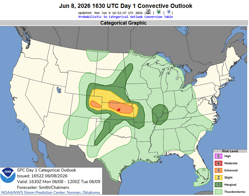
The Storm Prediction Center had an Enhanced Risk across a good portion of northern and central Kansas, depicting a high wind threat. The red X is Salina, where we targeted for the day.
Storms took their time to develop across Central Kansas – the thought was any supercells that could develop in front of the MCS line of storms pushing in from the northwest could yield at least some tornado threat.
We sat just west of the Salina airport for what seemed like hours – but finally around 7:30, a storm began to develop.
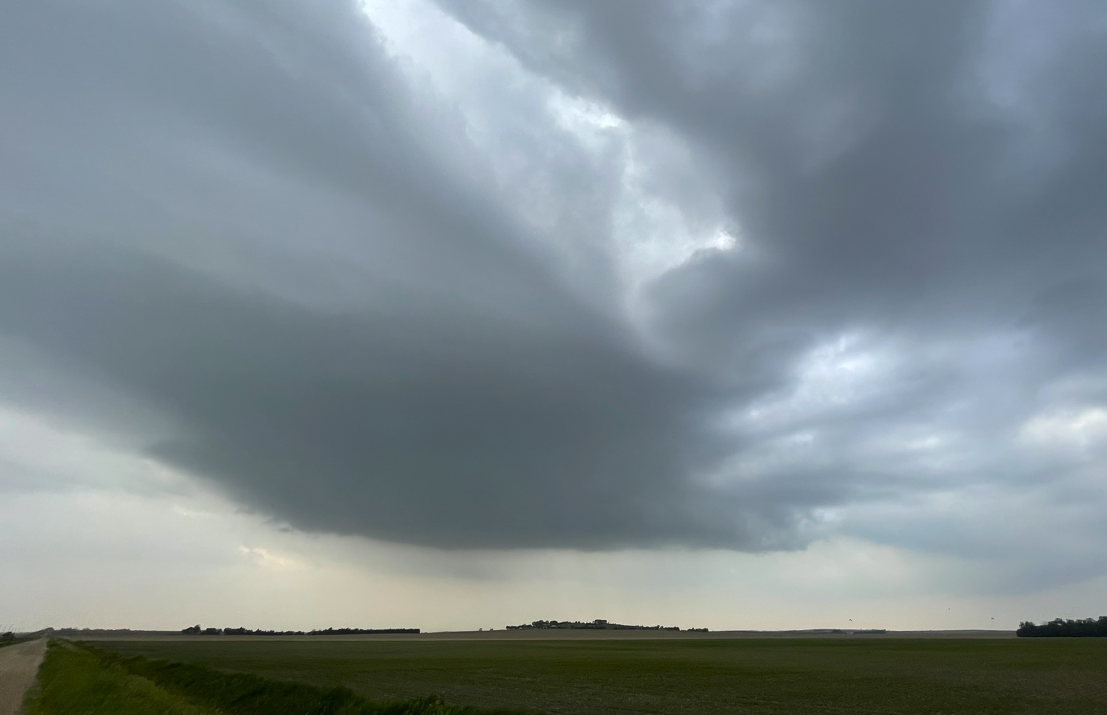
Storms developing near Salina, Kansas. @nwswichita #kswx
While the storm wasn’t all that pretty, it did develop quickly and produced some golfball sized hail near New Cambria, Kansas.
The storm did have a tornado warning on it for a bit while east of Salina, but it didn’t develop a significant tornado.
While waiting and waiting, I found myself bored – so my storm chase partner Beth created a video. It’s called The Bounce:
Honestly – sometimes you just have to entertain yourself while waiting on storms to get going.
Later in the evening as the storms gathered strength and bowed off to the southeast – the location we were at for several hours had a reported 113 mph wind gust – taken by the automated weather system at the Salina airport. We stayed ahead of the line as it moved southeast through McPherson and Newton.
Overall a fun chase – mild expectations were met when the whole weather system starting producing widespread 80-100 mph winds.
Community Comments
There are no comments on this post
Want to leave a comment? Join our community → OR Login →