

Published on
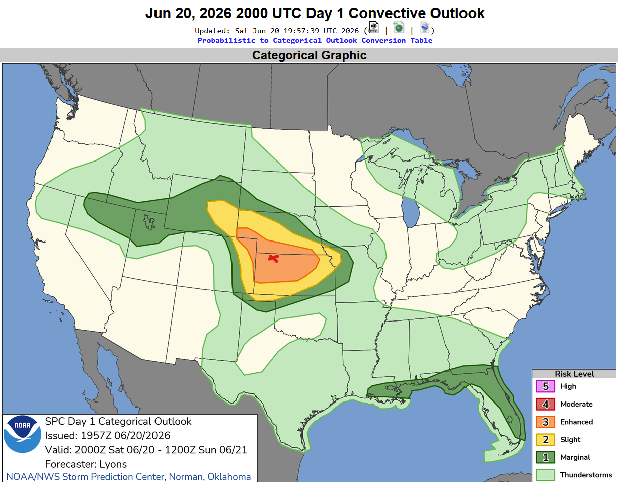
June 20, 2026 looked like a definite storm chase – with somewhere between North Central and Northwest Kansas being juiced for some hefty storms.
The Storm Prediction Center had a large Enhanced Risk across the area – with a 5% chance of a tornado – but a strong tornado could not be ruled out. The red X area indicates the target area – near Oberlin, Kansas.
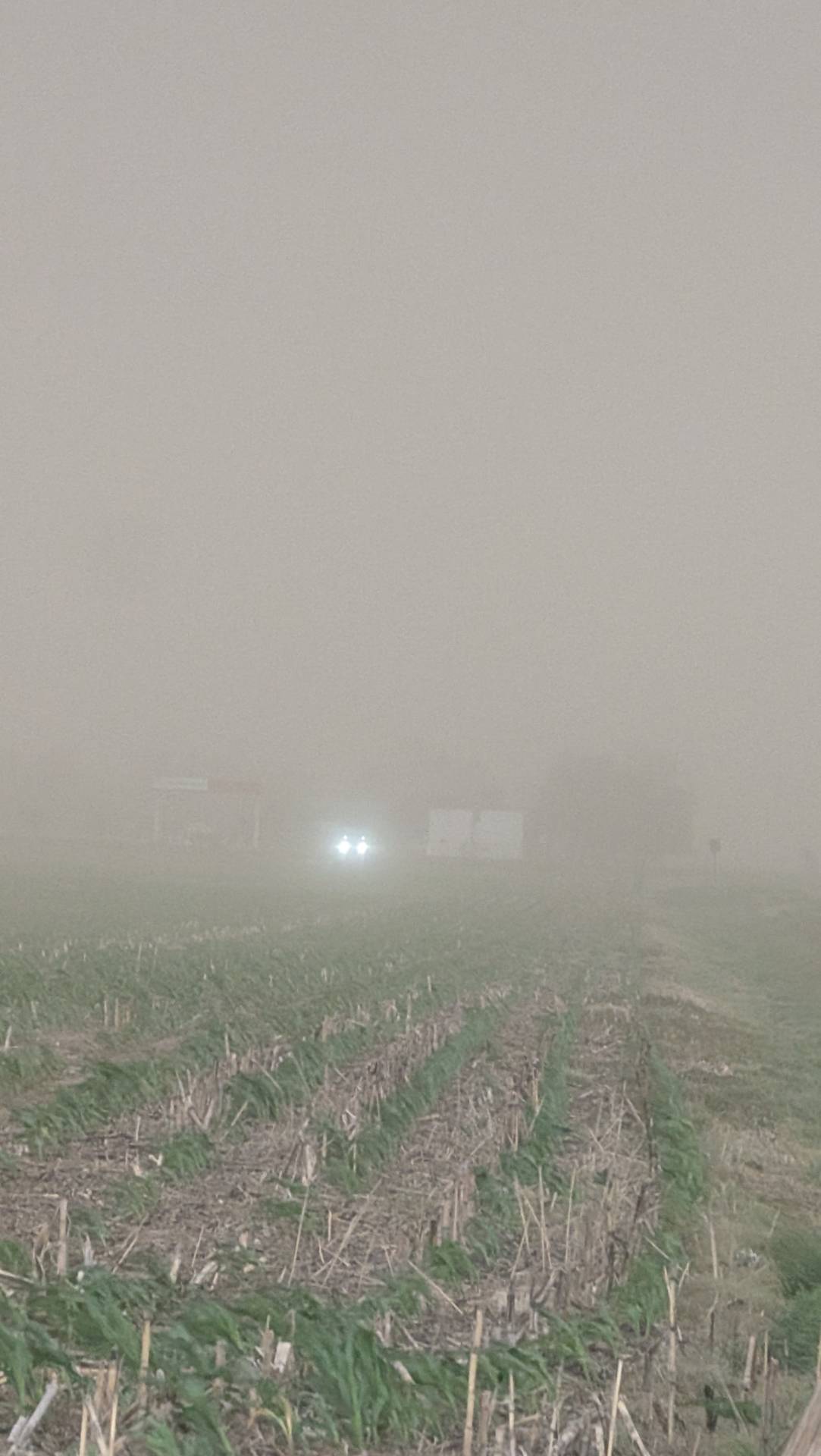
On storm approach – we found ourselves in a massive dust storm – with zero visibility at times. Blowing dust and dust getting sucked into the supercell was intense.
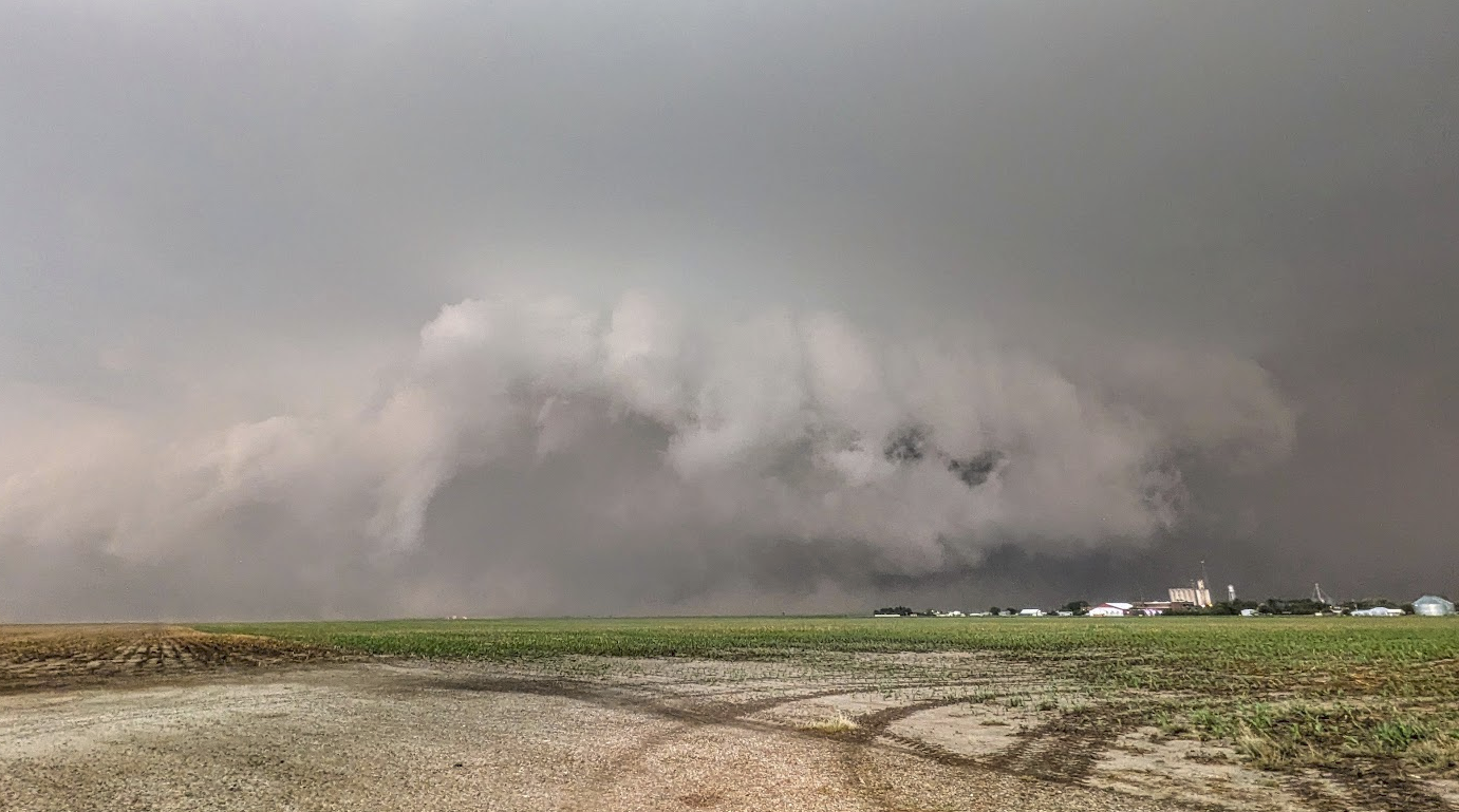
As the storm approached, we were able to finally see some structure through the thick dust. The image below was taken just south of Rexford, Kansas looking north.
North of Rexford, visibility was horrible.
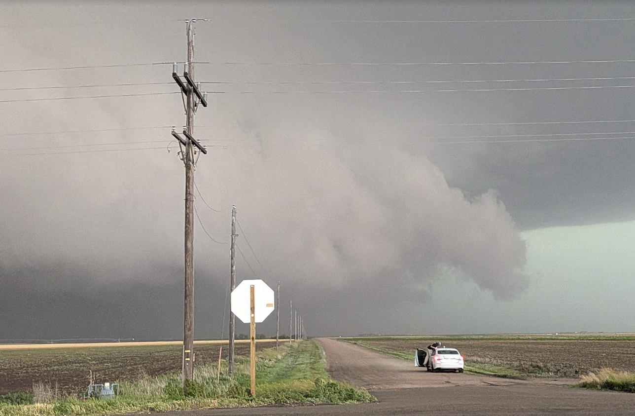
We were able to get some glimpses of structure at times – the image below taken near Seguin, Kansas.
While not the prettiest chase – it was still a fun day, and we were happy to be out enjoying the skies, although dirty at best. We made it back to Wichita around 11:30 pm, shortly before the line of storms pushed through. Unfortunately, a brief tornado spun up and caused a fatality about 10 miles north of Wichita.
Community Comments
There are no comments on this post
Want to leave a comment? Join our community → OR Login →