Published on
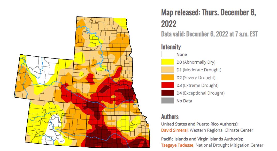
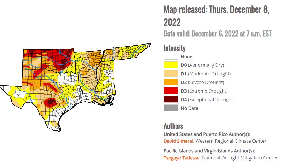
The Central Plains have been fighting intense drought conditions for the better part of 2022. The impact is widespread and devastating to both agriculture, cities that rely on reservoirs for drinking water, as well as local climate patterns.


With so much “Exceptional” drought – storm systems have less low-level moisture to work with, continuing the pattern of drought. Local geography can make a big impact on local weather – for example, a large body of water can be a source of evaporation, adding to the local moisture content of the local airmass. With less standing water in lakes, ponds and streams, the local atmosphere is drier.
Here in Kansas, we have had dry front after dry front move over – where typically the region would receive beneficial moisture from the passage of a cold front. In the Fall of 2022, that unfortunately has not been the case. Instead – Kansas has had the seamlessly never-ending threat of wildfires. With low relatively humidity due to exceptionally dry airmasses, the constant High Plains wind and very dry soils, Red Flag Warnings have been commonplace.

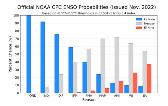
Unfortunately for those hoping for drought conditions to drastically improve – it doesn’t appear likely in the near term. La Nina is expected to continue strong through at least the first quarter of 2023 – with a possible pattern shift toward storm season ’23. If La Nina can slowly ease toward a neutral phase, drought conditions should improve somewhat – with the hope that Spring chase season has ample low-level moisture to work with.


Community Comments
There are no comments on this post
Want to leave a comment? Join our community → OR Login →