

Published on
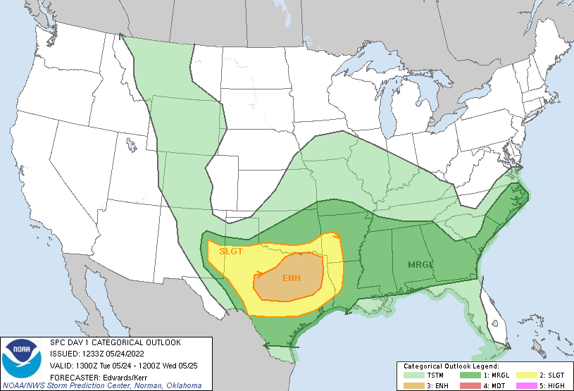
The Storm Prediction Center had an Enhanced Risk of severe weather near San Angelo, Texas on 5/24/2022.
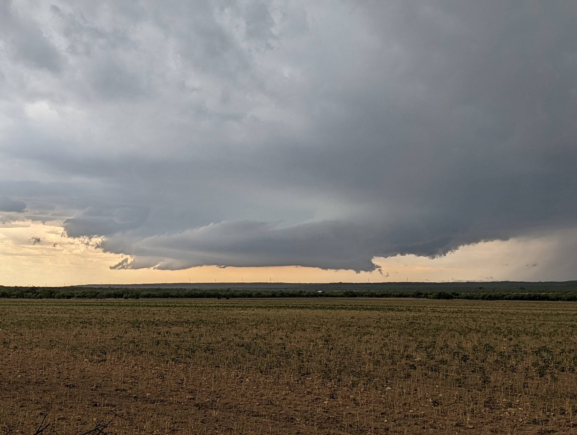
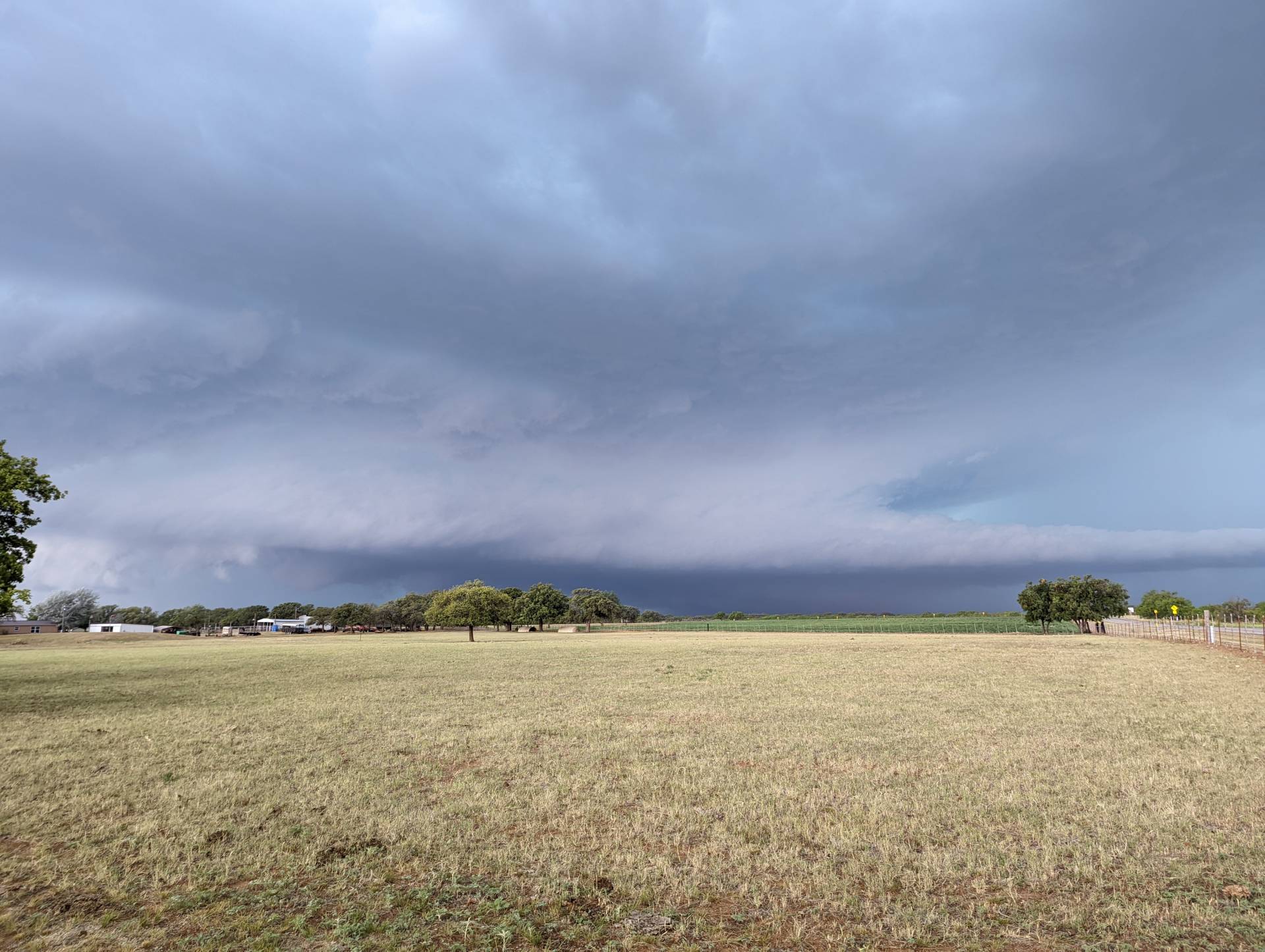
We positioned along an east/west oriented outflow boundary that was thought to give a little extra spin for any storm that could develop near it. This storm quickly went severe and exhibited mid-level storm rotation.
Community Comments
There are no comments on this post
Want to leave a comment? Join our community → OR Login →