

Published on
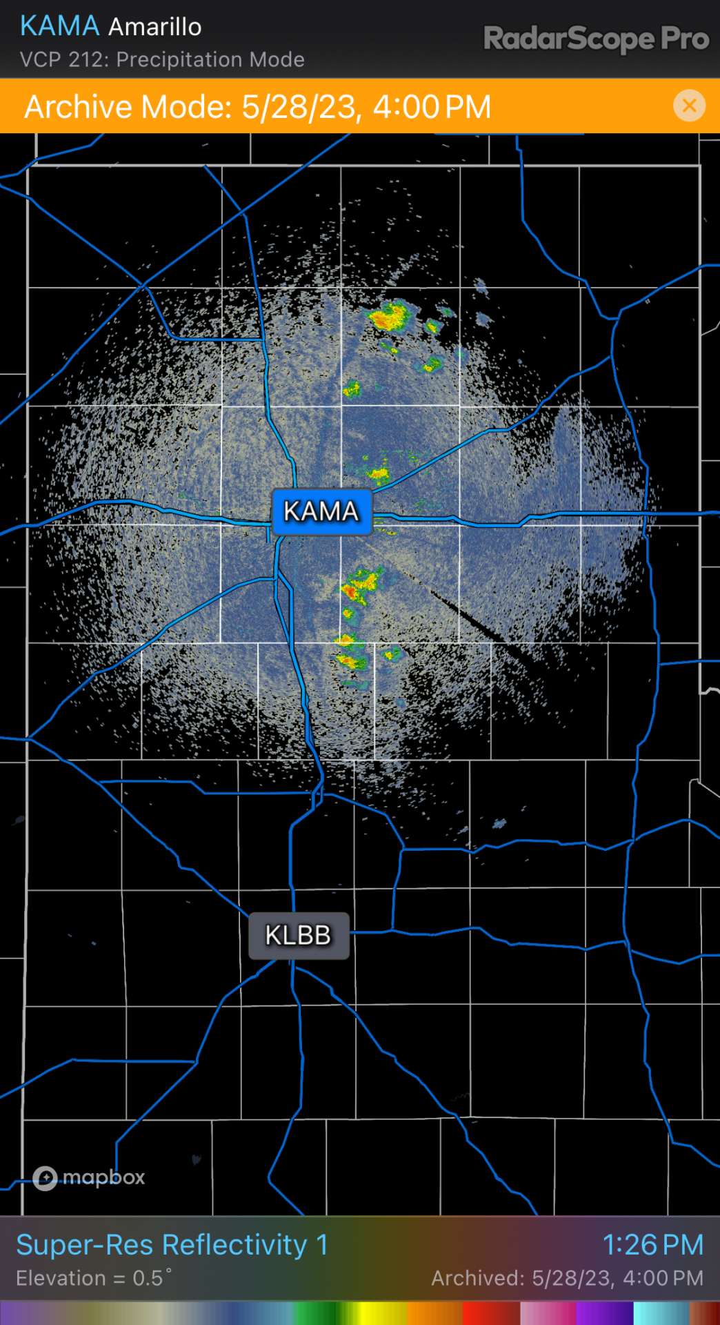
This day started out with the plan of being a low-key chase — I was thinking it would be an opportunity for some strong multicells and lightning. An early MCS left behind a west-moving outflow boundary that lit up cells on the north and south ends of the Panhandle. My initial idea was to catch storms firing along this boundary and then later on, go after what CAMs suggested would be a line of storms moving south out of southeast Colorado/southwest Kansas.
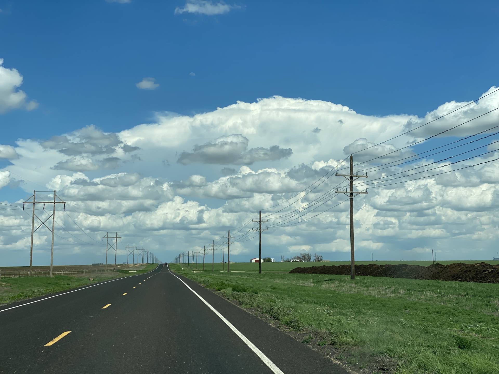
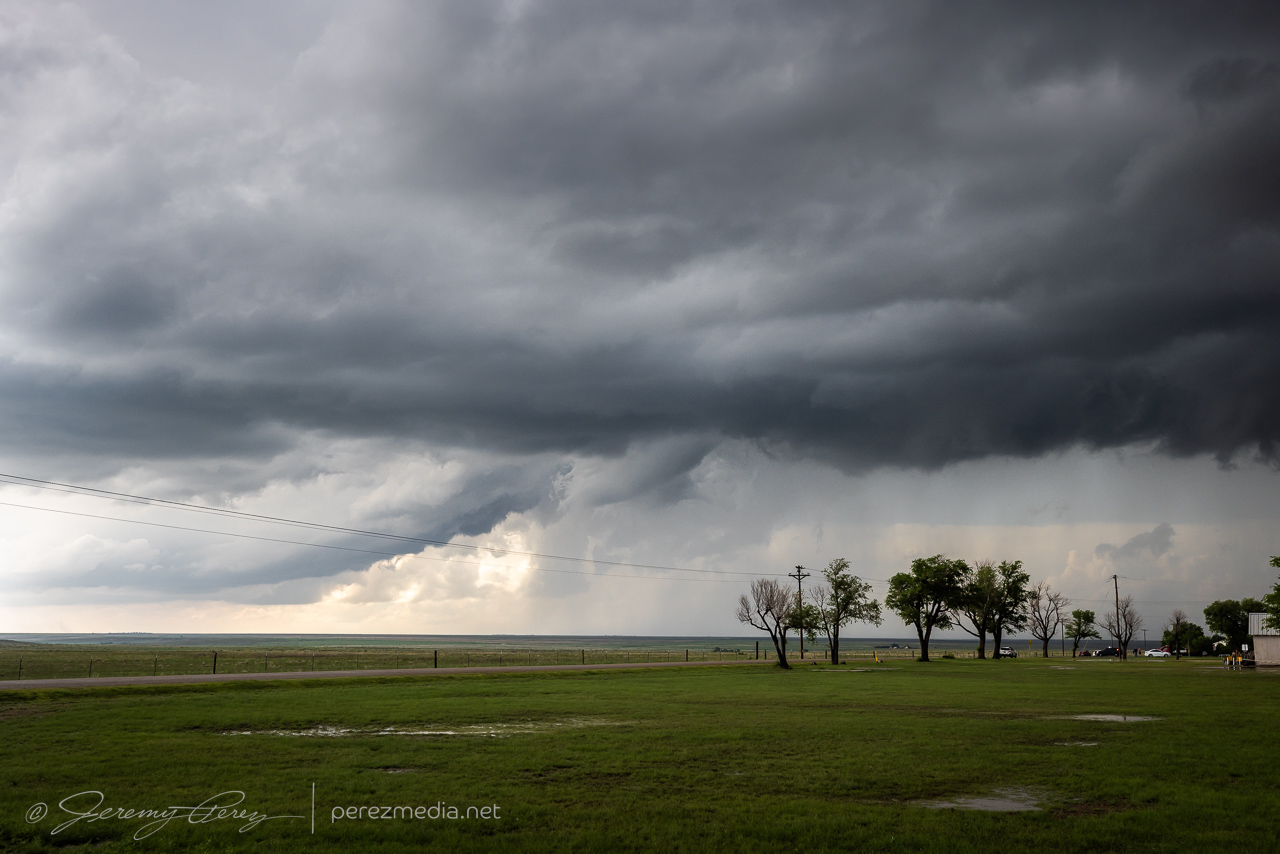
By mid afternoon, we were heading east toward an updraft lofting off the outflow boundary near Morse, Texas. As we got closer, the updraft looked strong and the base reasonably solid. The storm was moving slowly north and it was easy to keep pace and watch it develop. We had a chance to chat with a local contractor who repairs vehicle hail damage. He pulled up to talk about his own, recent harrowing hail encounter and discuss the storm we were watching.
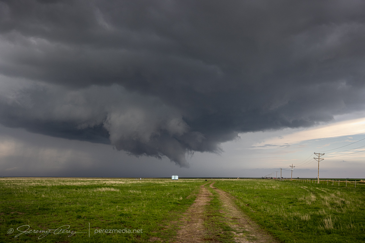
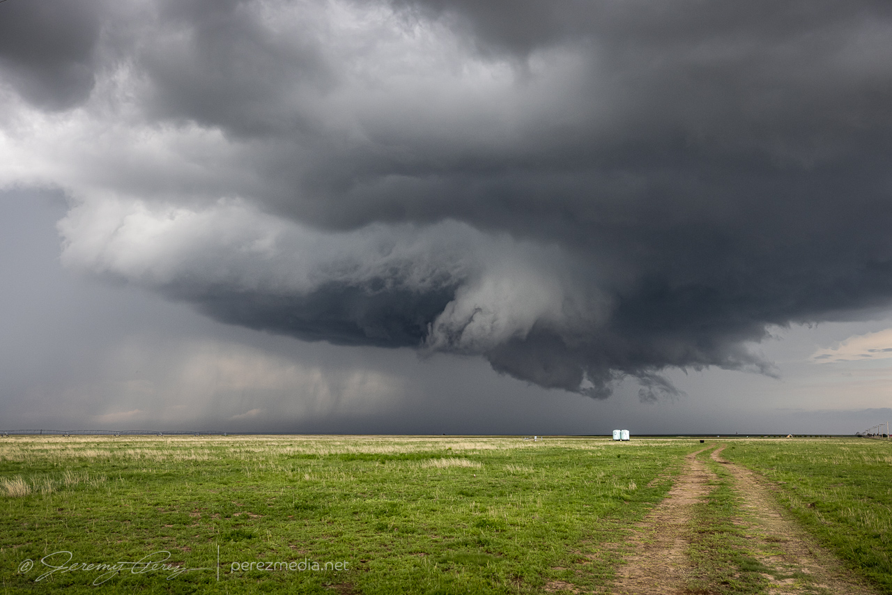
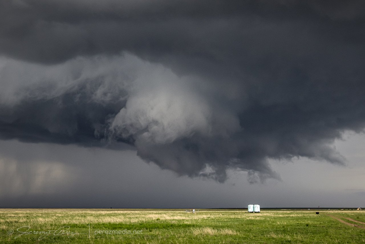
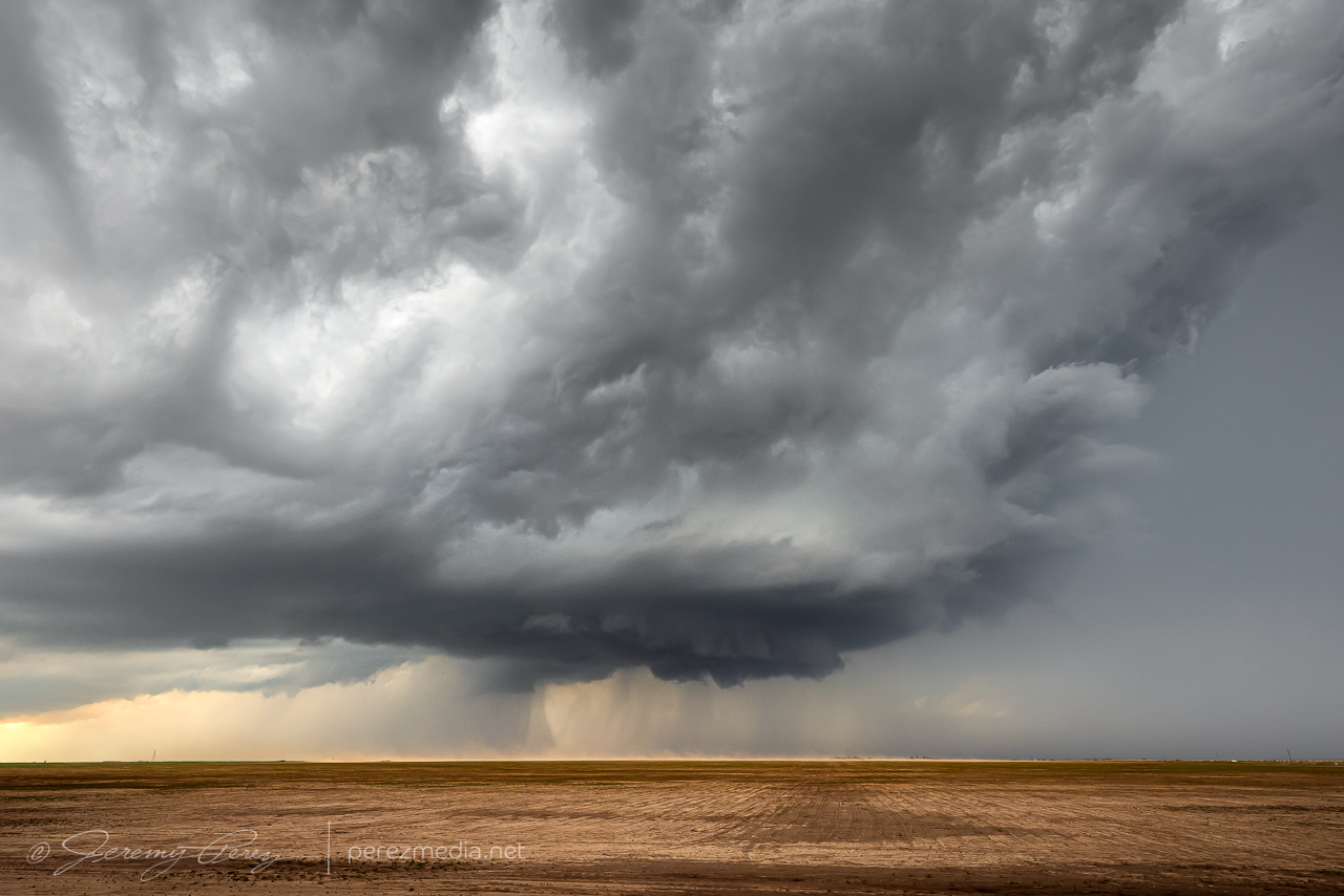
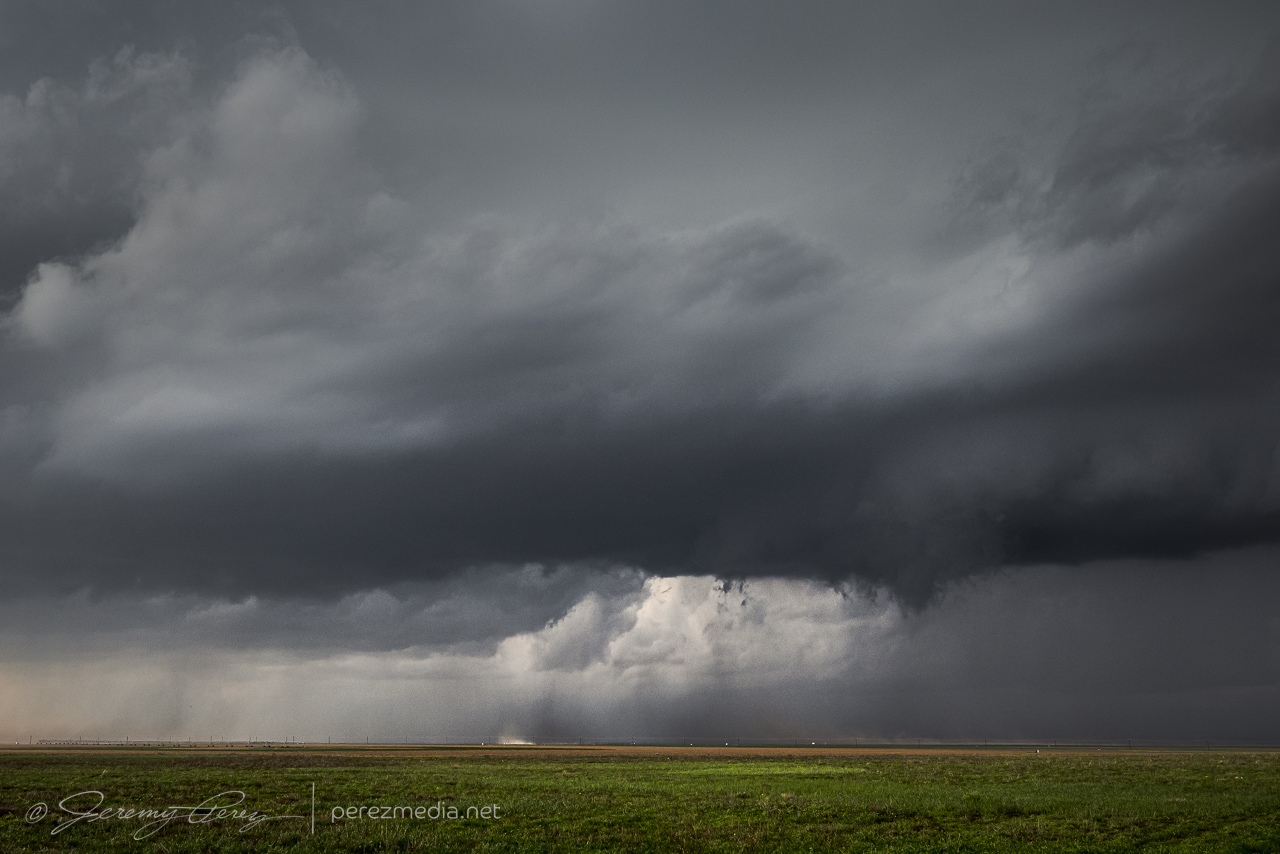
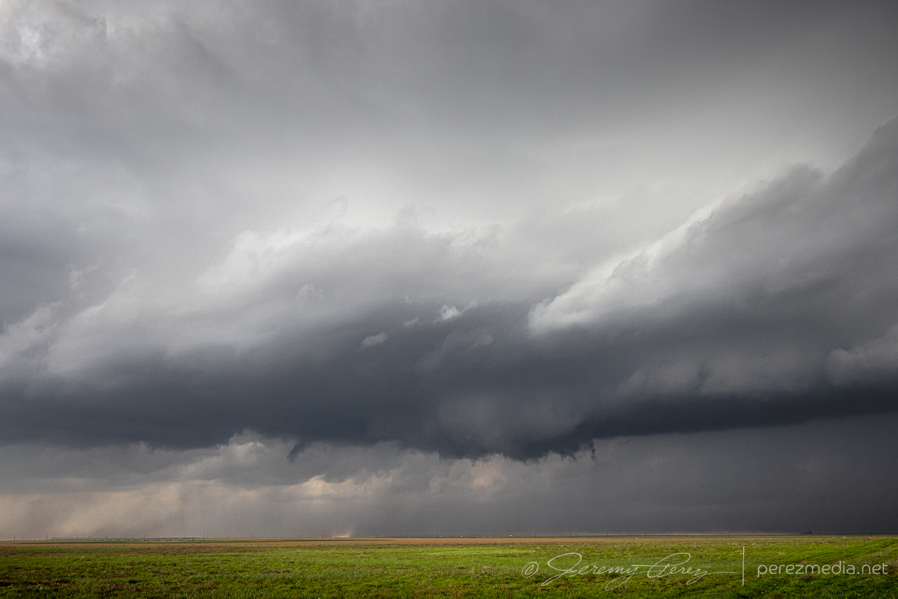
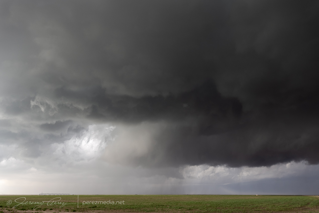
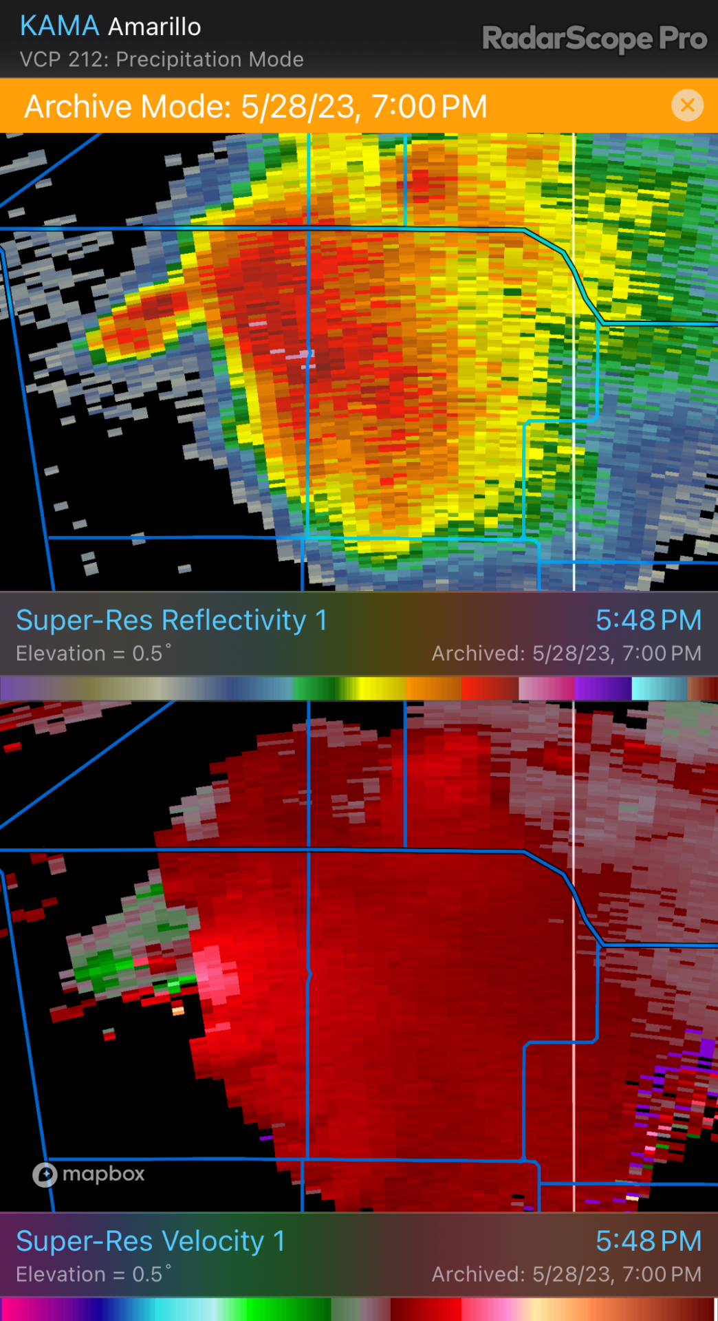
As quickly as the outflow boundary was hustling west while our storm drifted north, I initially thought the airmass behind the boundary would be more stable and would wither our storm as it fell behind. But that is definitely not what happened. The boundary had more than enough time to modify — I just had a predisposition to equating any fairly progressive boundary with cooler, stable air pushing in behind it. Our cell continued to strengthen and graduated to developing a mesocyclone and an absolutely perfect, rotating wall cloud. That was definitely not on the roster for the day and I was only to happy too switch modes and enjoy and capture every bit that I could.
We briefly made our way into Morse, maneuvering on paved roads after the storm had dumped rain and hail on everything. A local resident pulled up next to us to talk about the storm and to predict that even though it was moving away to the northwest, it would come back later. And his local gut feelings turned out to be totally right, with that forecast line of storms brewing up in Colorado/Kansas.
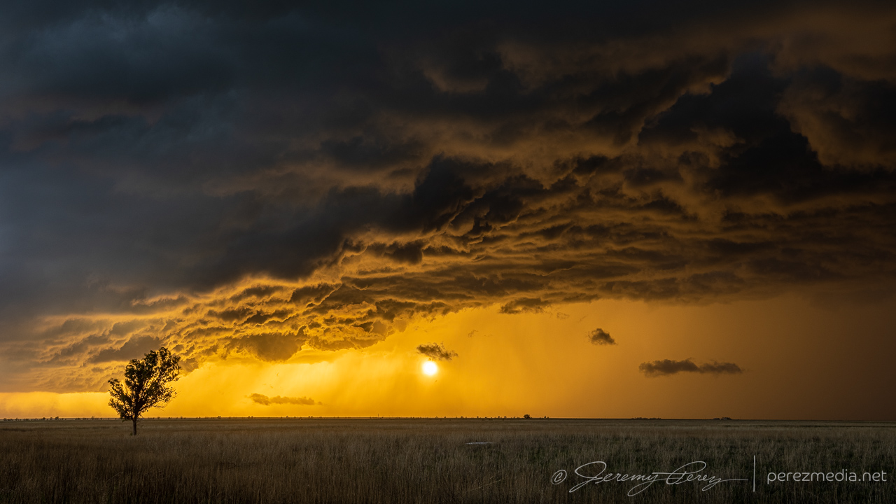
In other news, at this point, a new cell had formed northwest of our storm and was now going strong as it moved away to the northwest. But I wasn’t sure if ours was done yet, so we watched for a bit, spotting an arcus or funnel to the northwest of town.
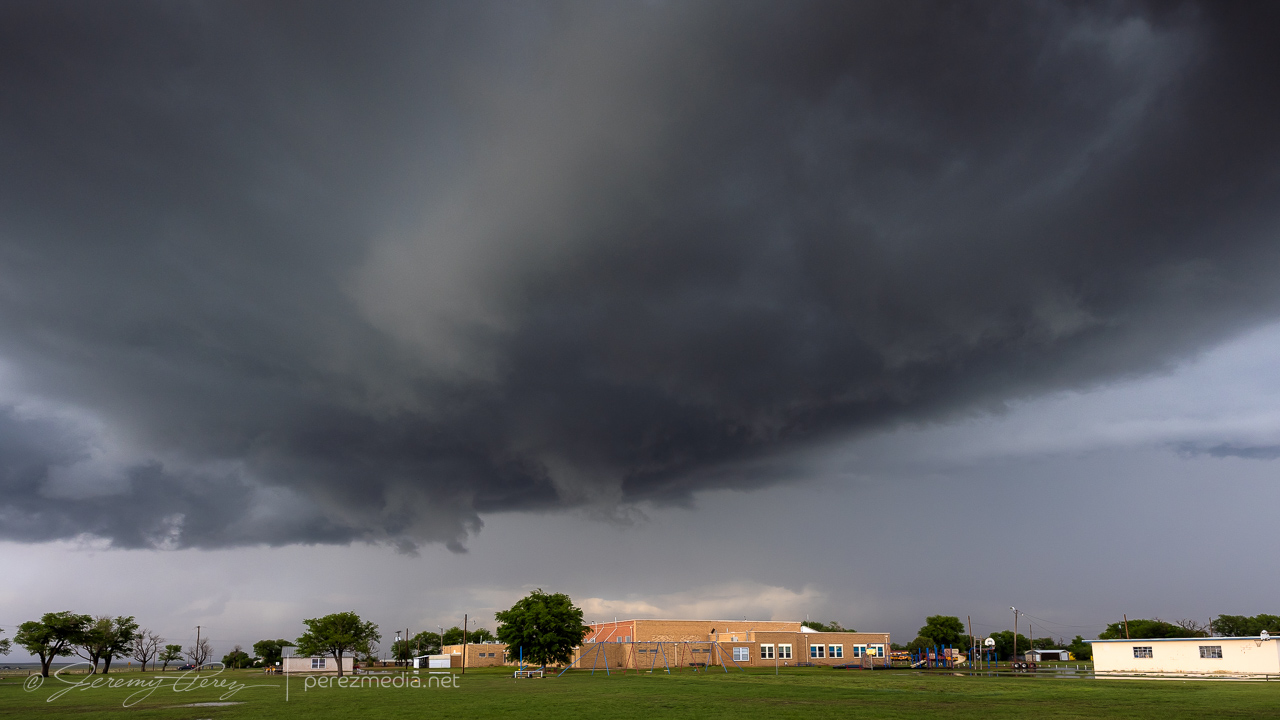
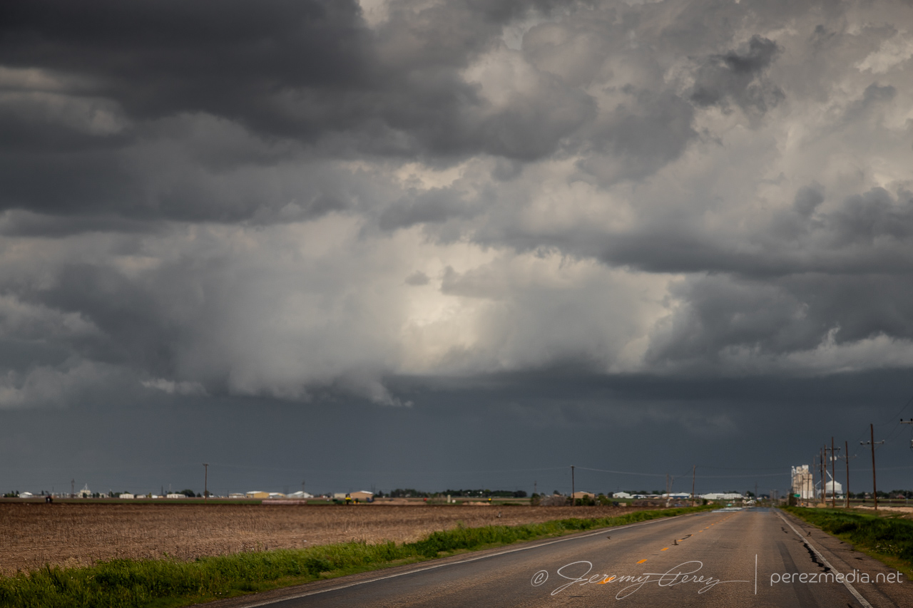
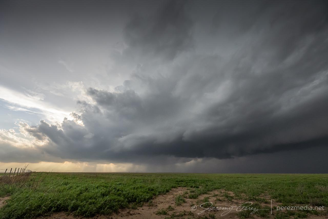
Finally it became clear that our storm was definitely withering and we hustled over to the next one. It was an interesting change to position on these clean, odd moving storms, Arizona-style, hanging out in clear air, not feeling compelled to snuggle up to the forward flank to see what’s going on. This next storm was a bit dustier and had collected a lot more chaser traffic at this point. But this area was great for roads, pull-offs and views. We did catch a gustnado puffing up under the RFD gust front at one point. There are always fangs of scud popping up above these dust ups and it all easily generates excitement, but I count myself dubious until proven otherwise.
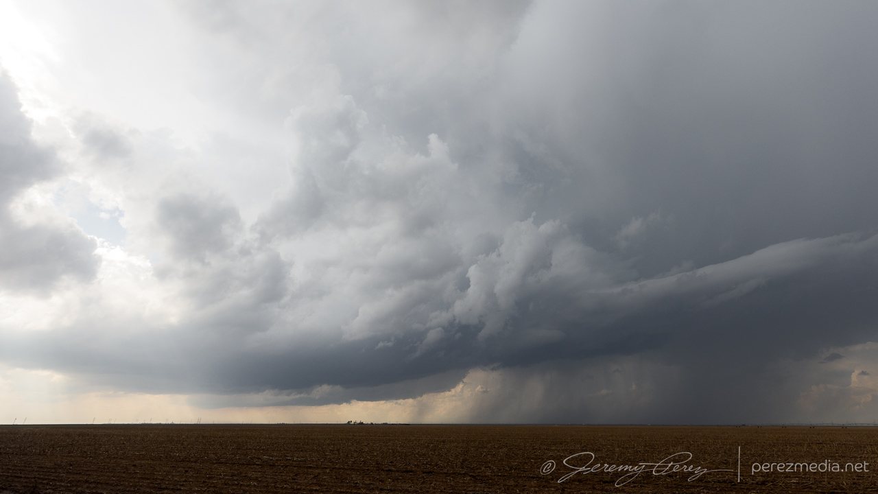
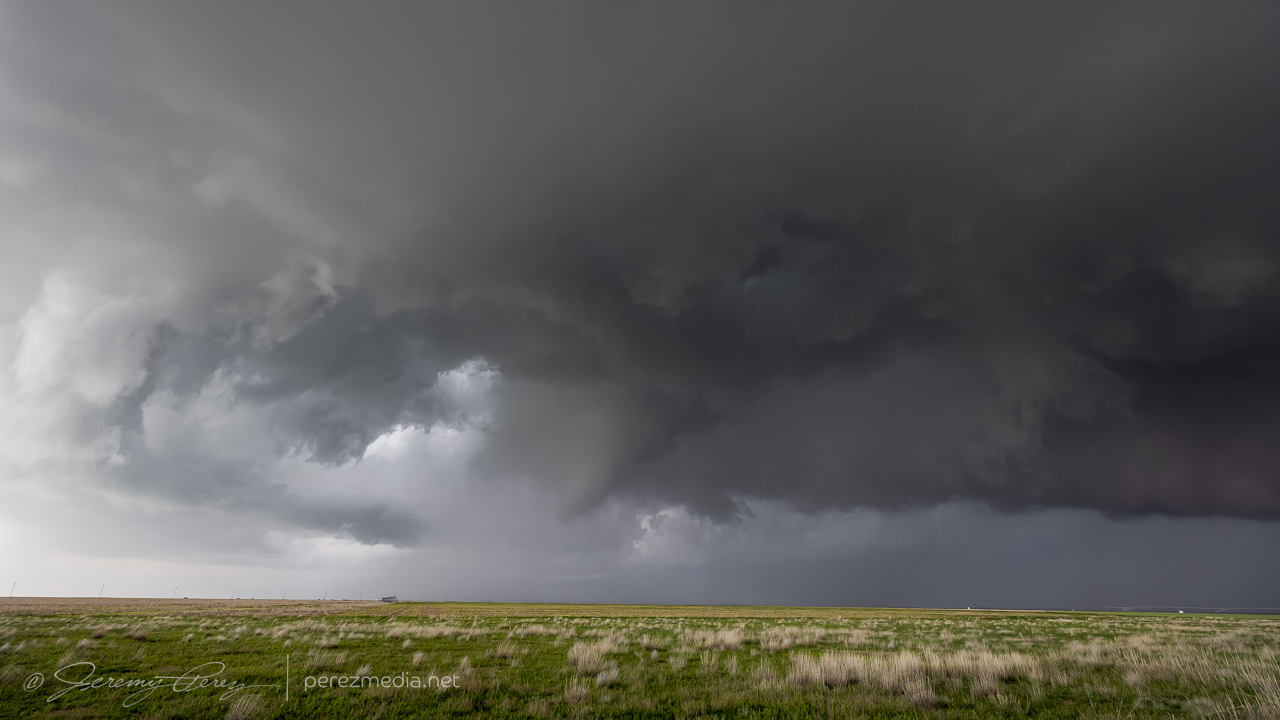
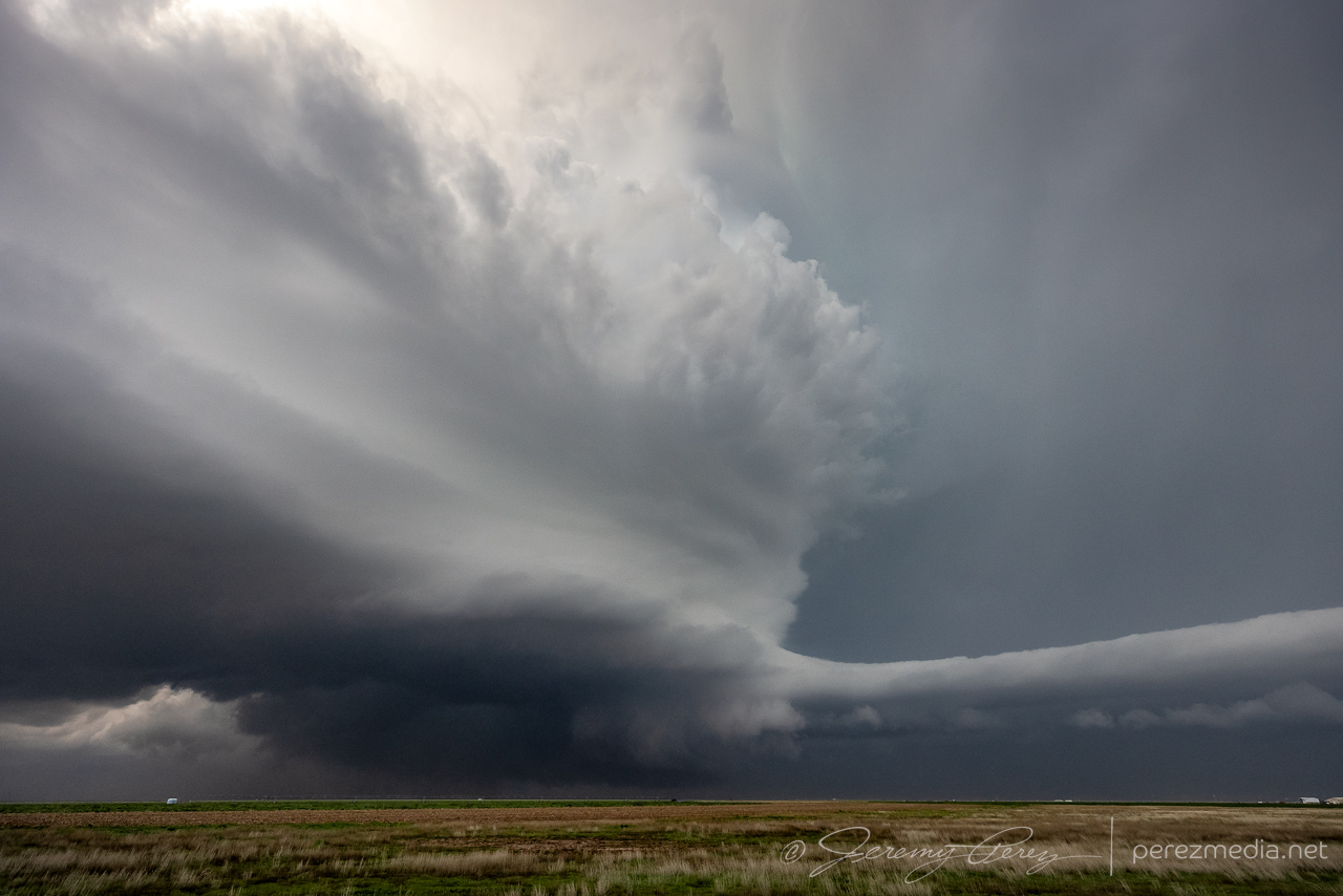
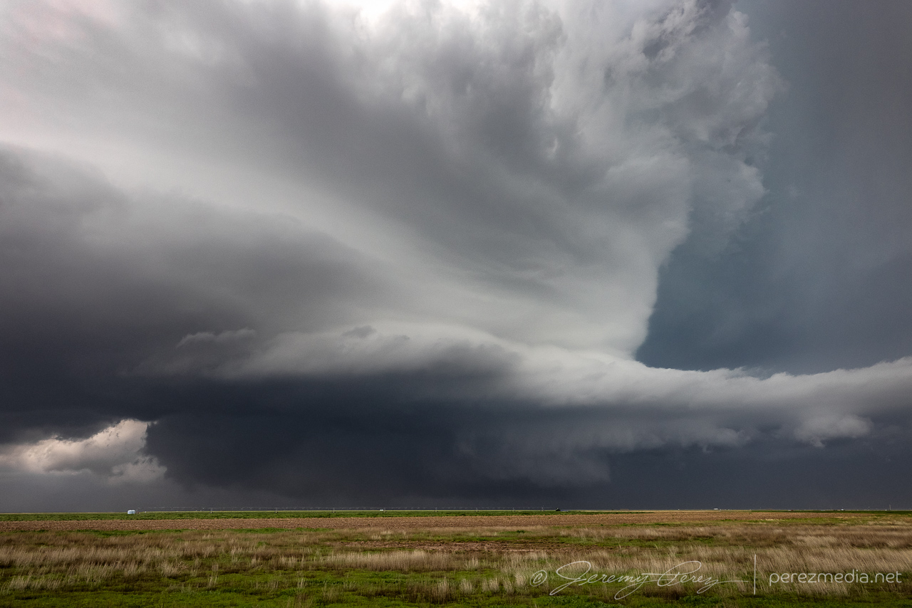
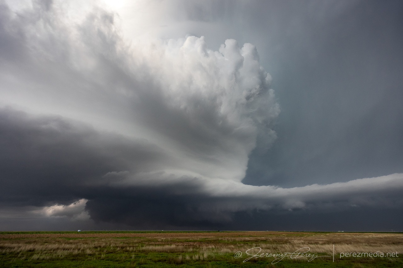
Around 00Z, a third cell to the west-northwest was rapidly strengthening and moving westward. It was starting to rain into our storm’s updraft and likely to become the main show next. So we cruised west and then north on CR119 to catch up. It was looking especially interesting with a lumpy inflow band running along the forward flank toward the updraft. Eventually, that inflow band stretched out and started showing streamwise vorticity current structures along the shelf.
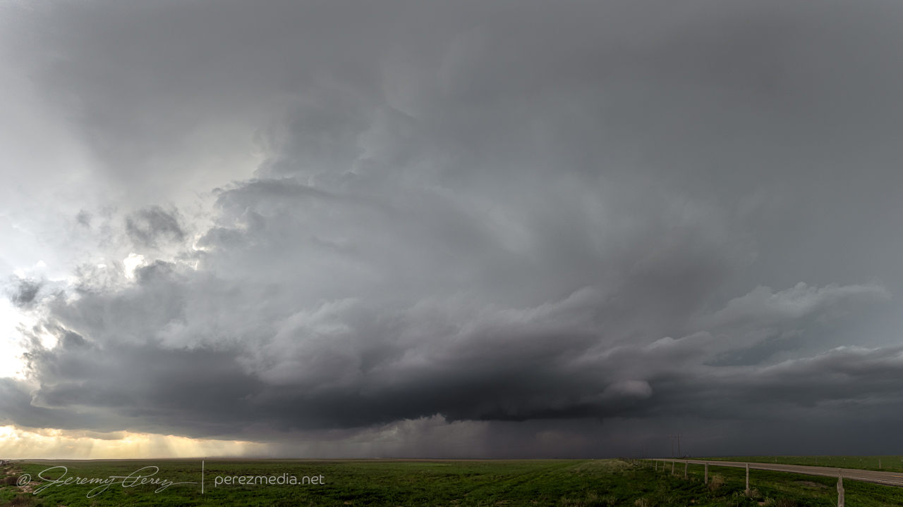
The storm was definitely looking like it had greater potential and I didn’t want to lose it due to paved road network issues. Unpaved County Road T, off of 119 looked like it had wet patches, but otherwise reasonably well maintained, so we headed west, mindfully maintaining momentum through the larger, inescapable ponds. We traded places with 2 or 3 other chasers along this road. Which is one of the great things about unpaved options—they’re a lot less hectic. As long as one doesn’t get stuck.
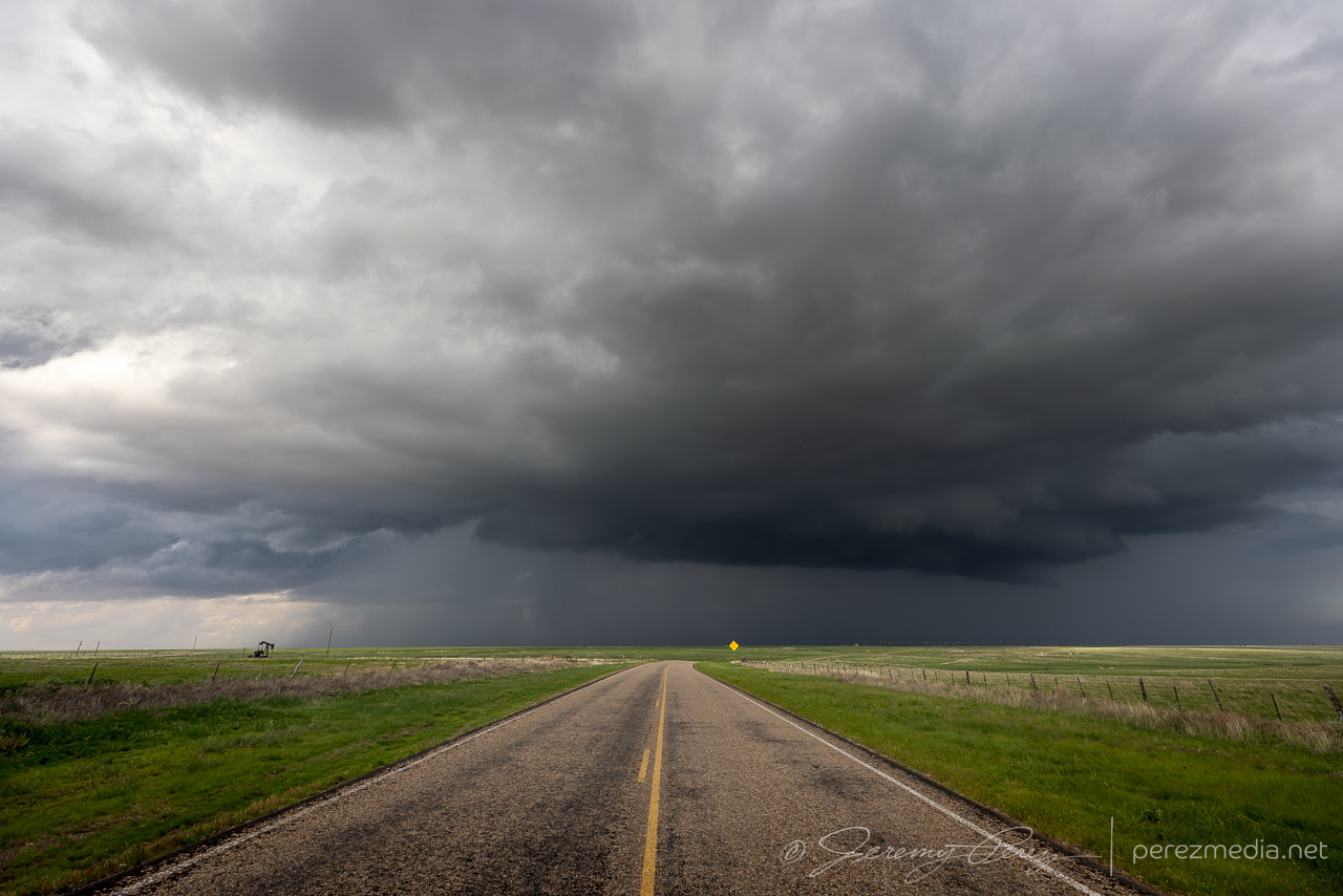
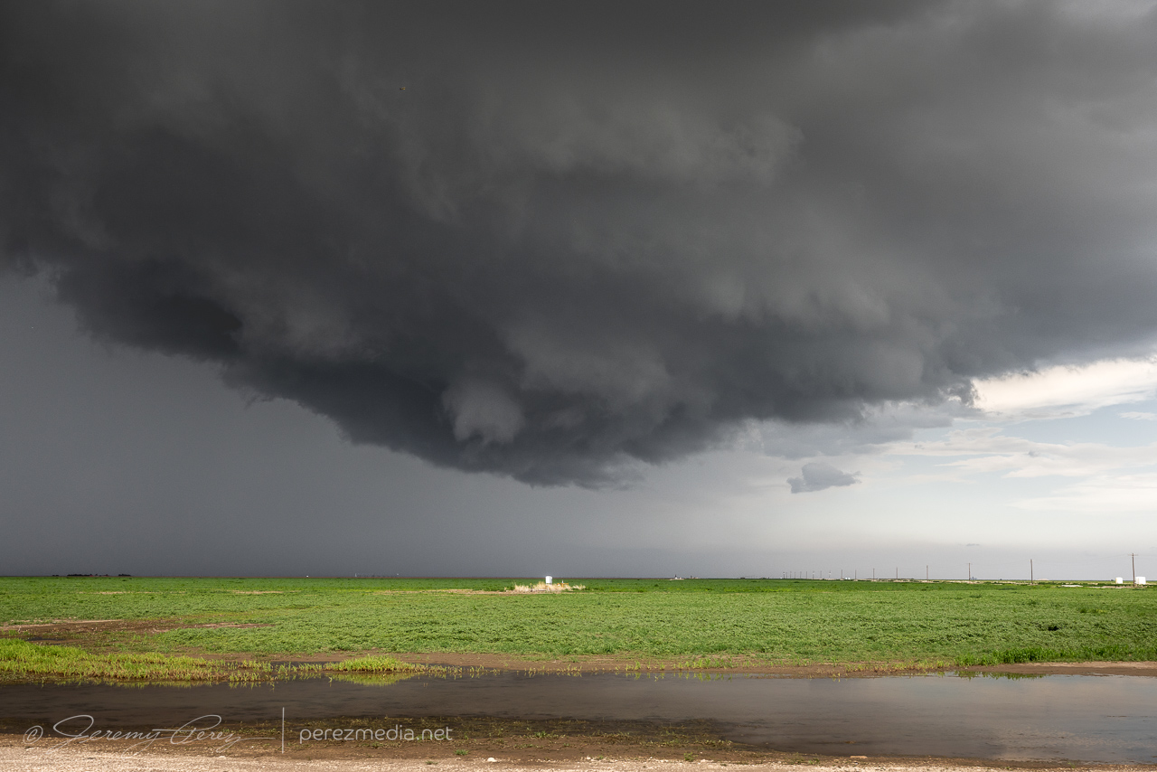
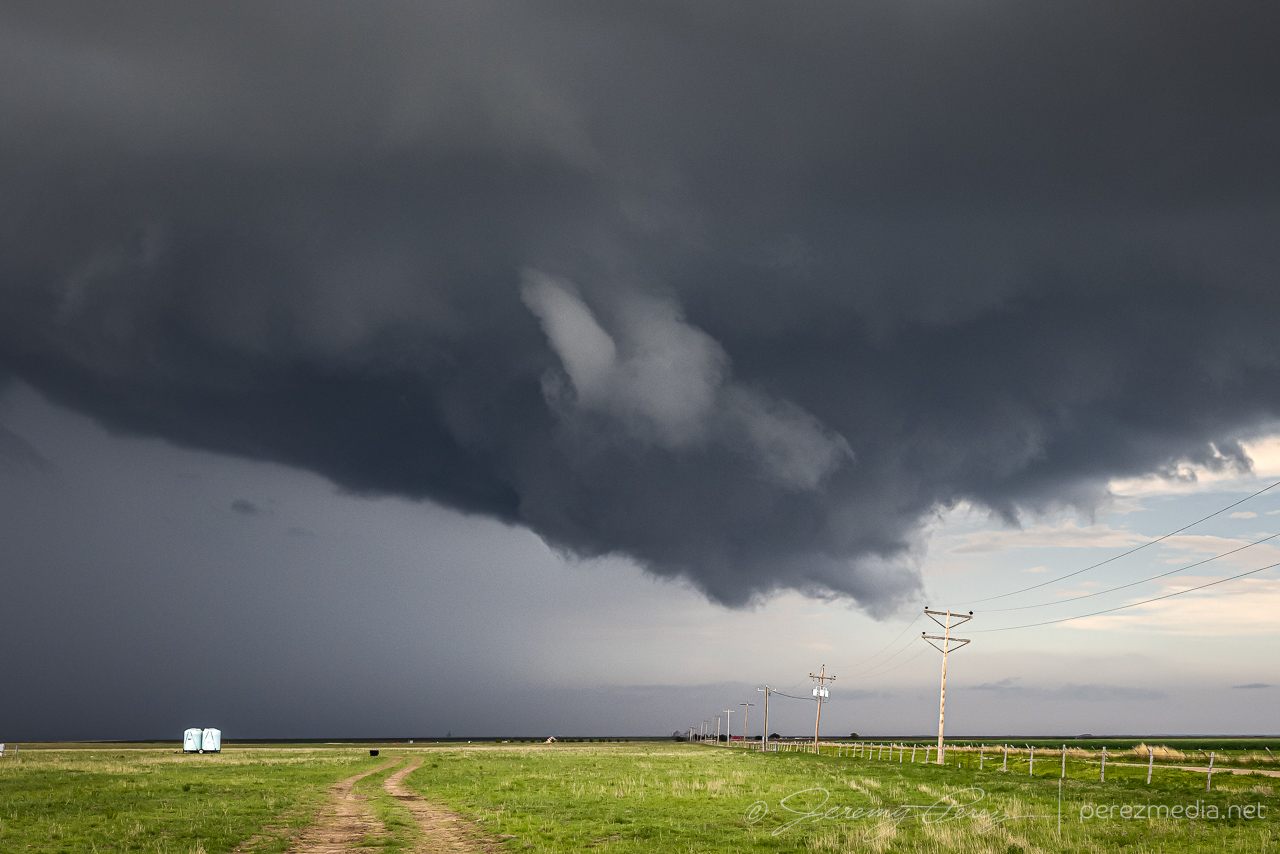
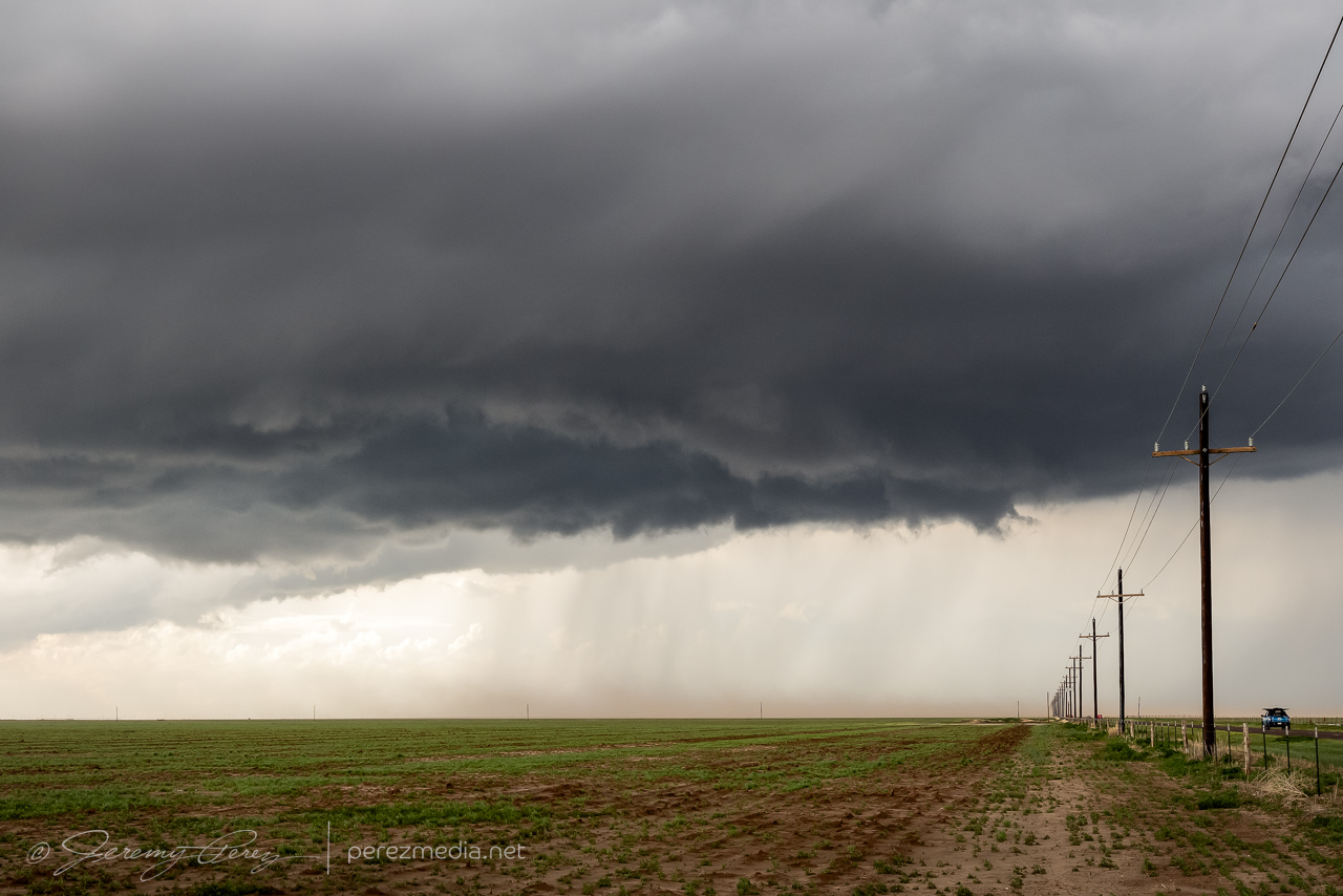
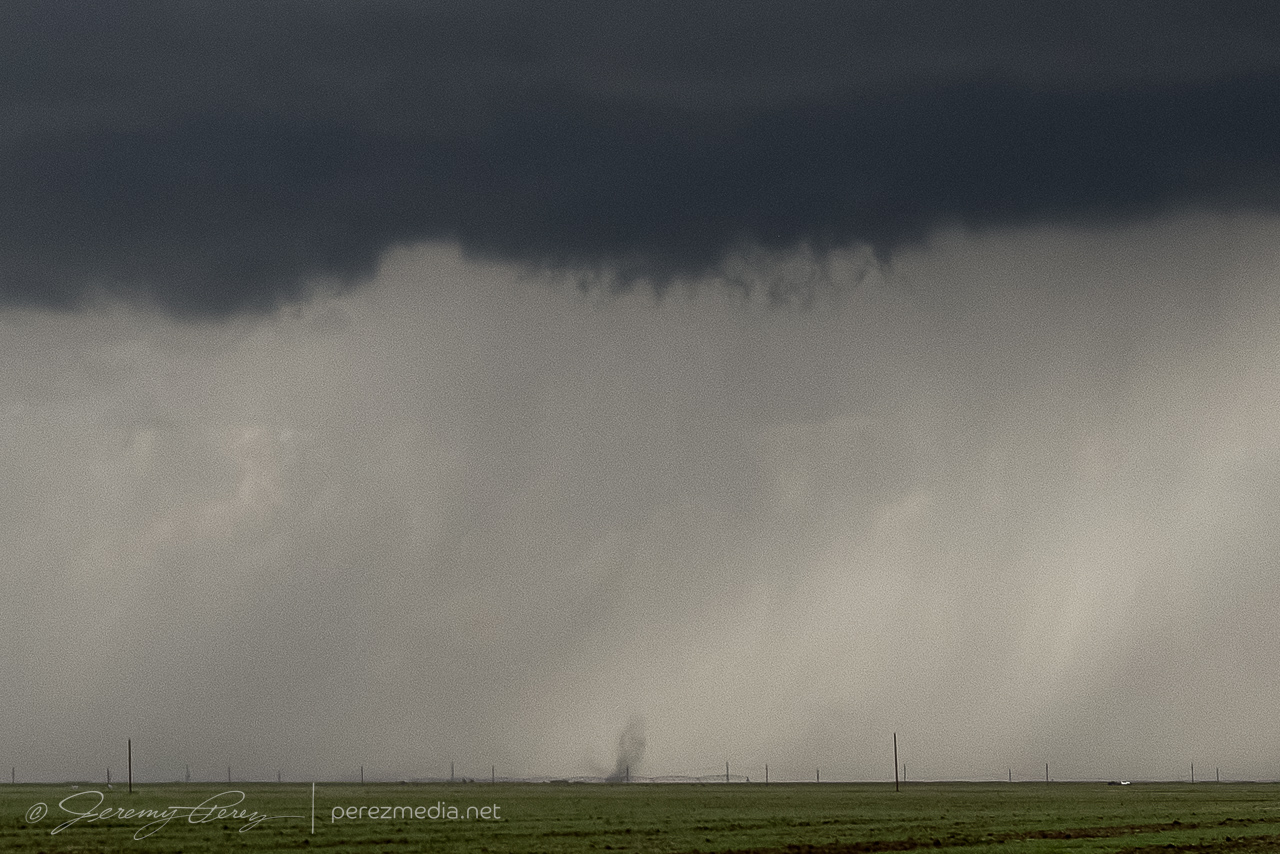
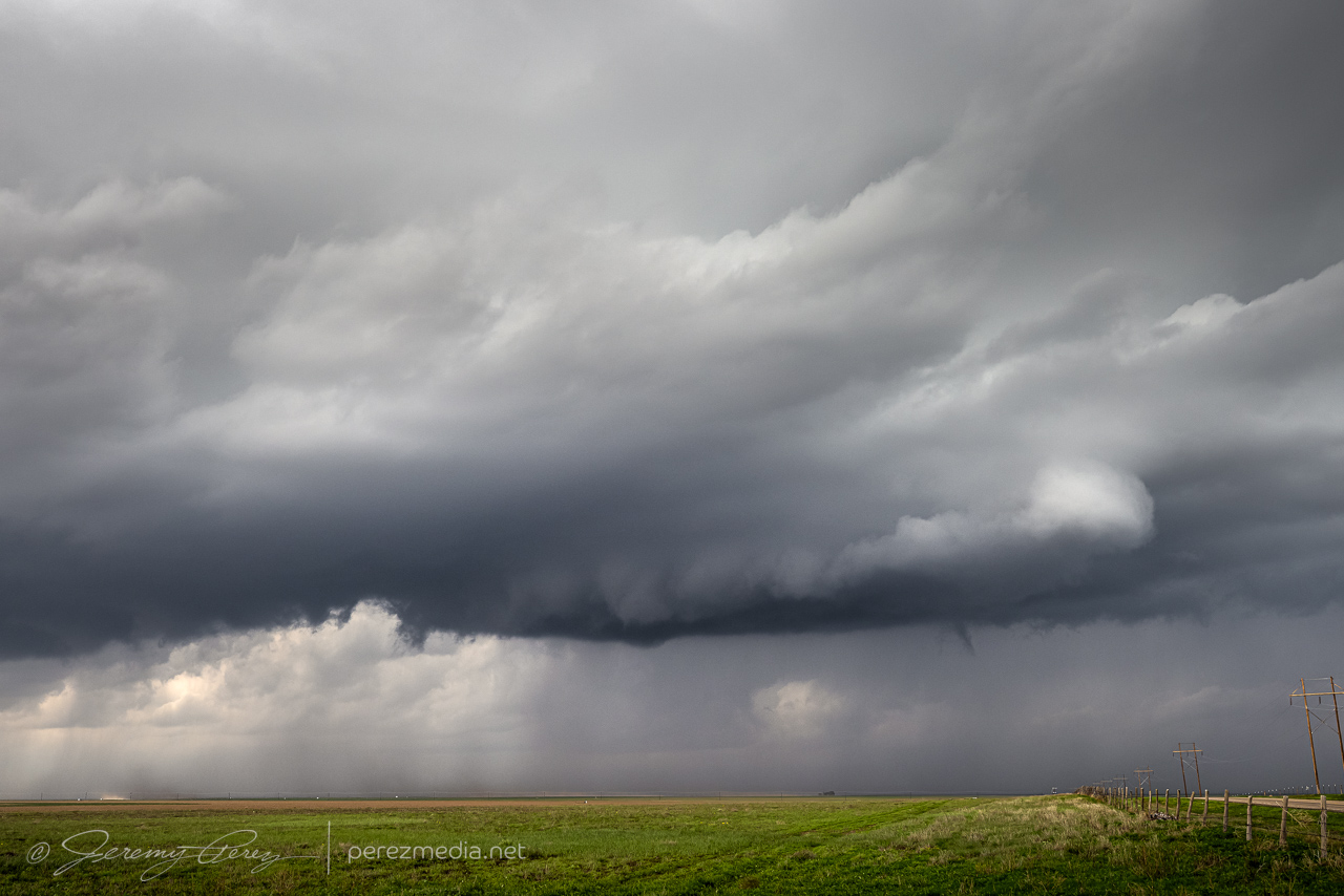
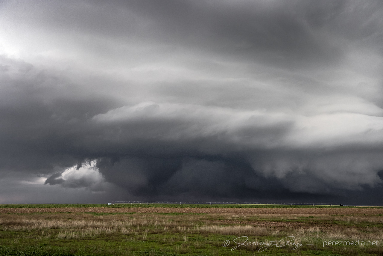
Over the next 10 minutes or so down as we hustled westward, RFD started stretching into the base, with enough precip to put a gauze across the lowering that was shaping up behind it.
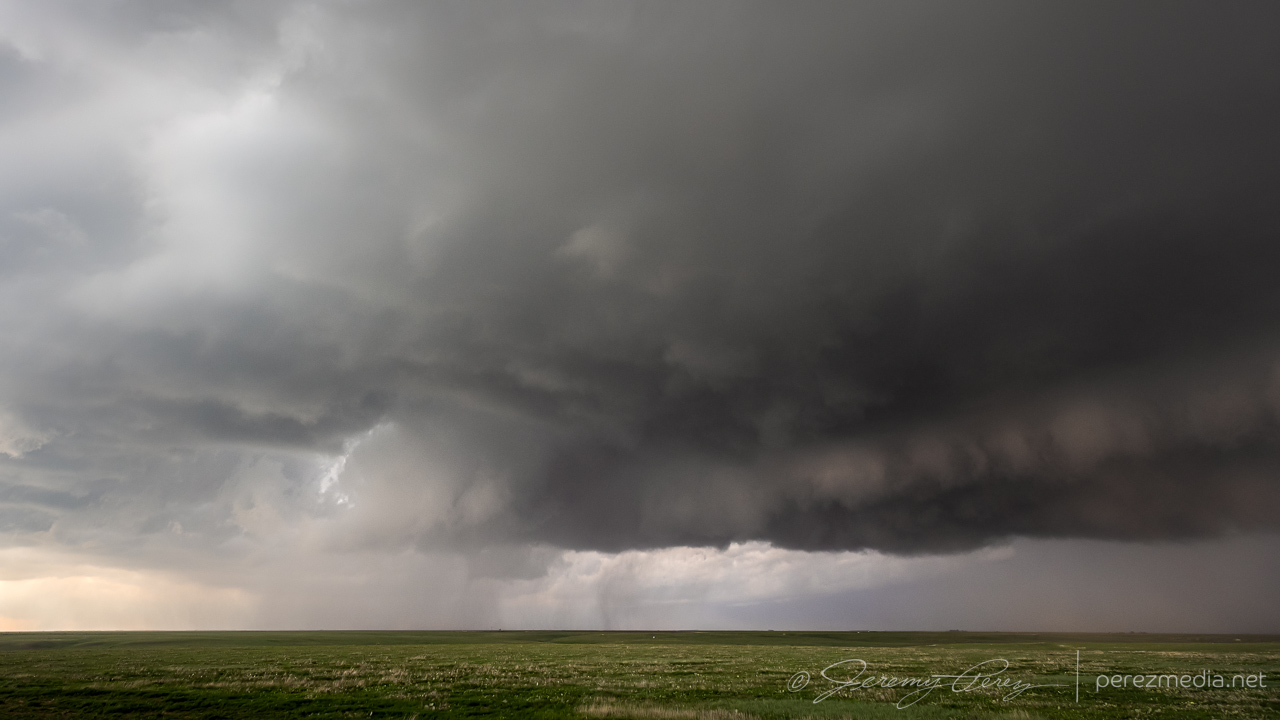
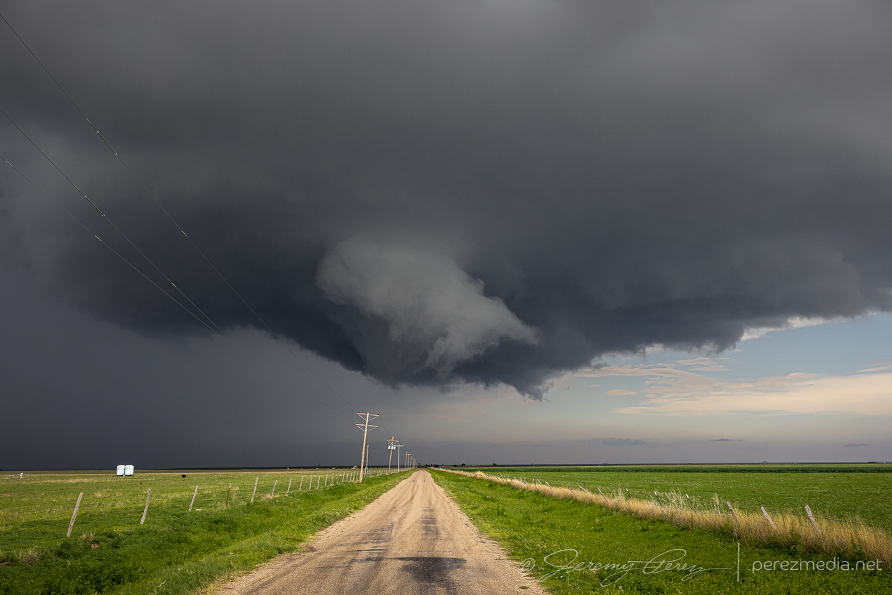
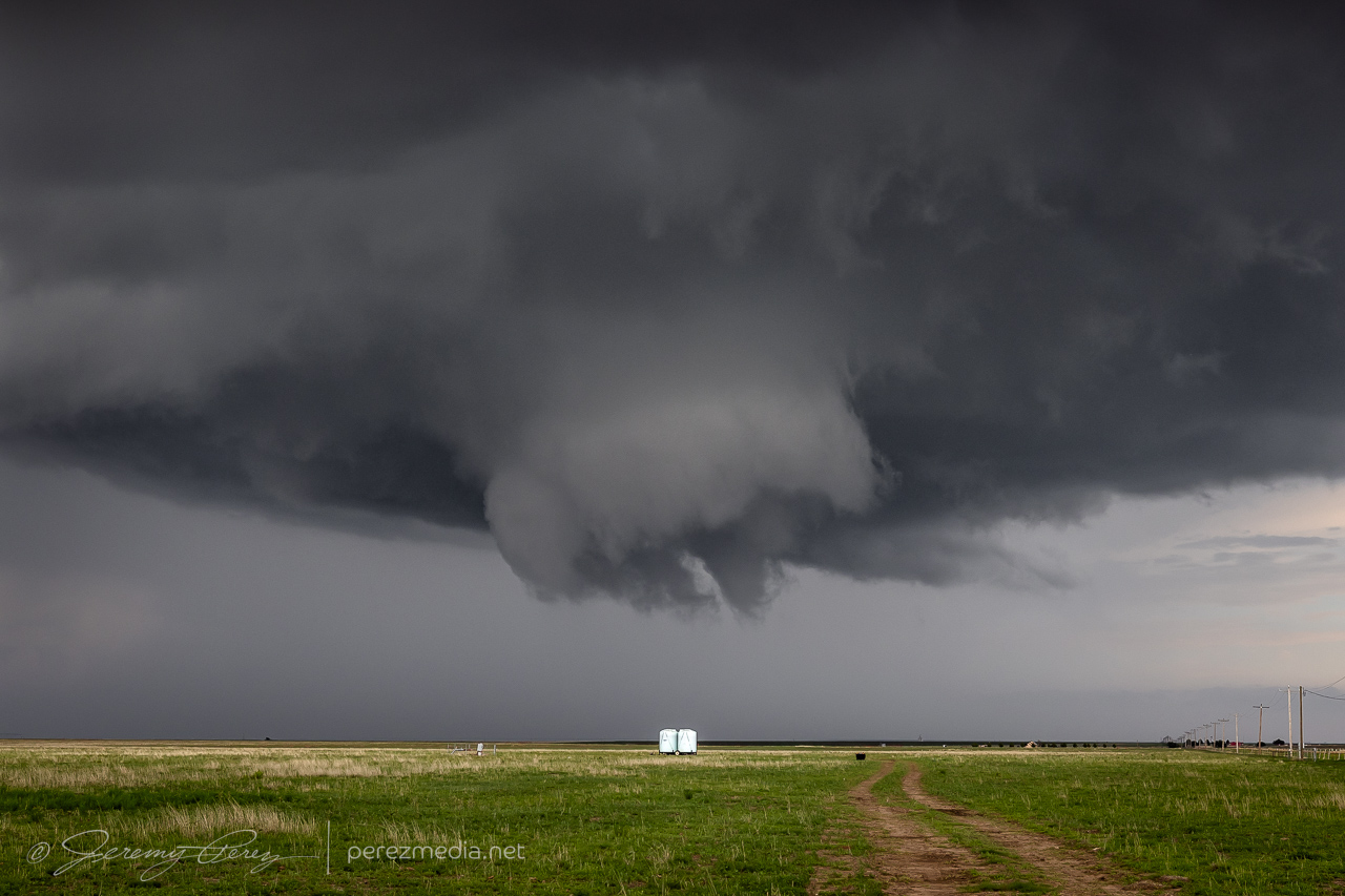
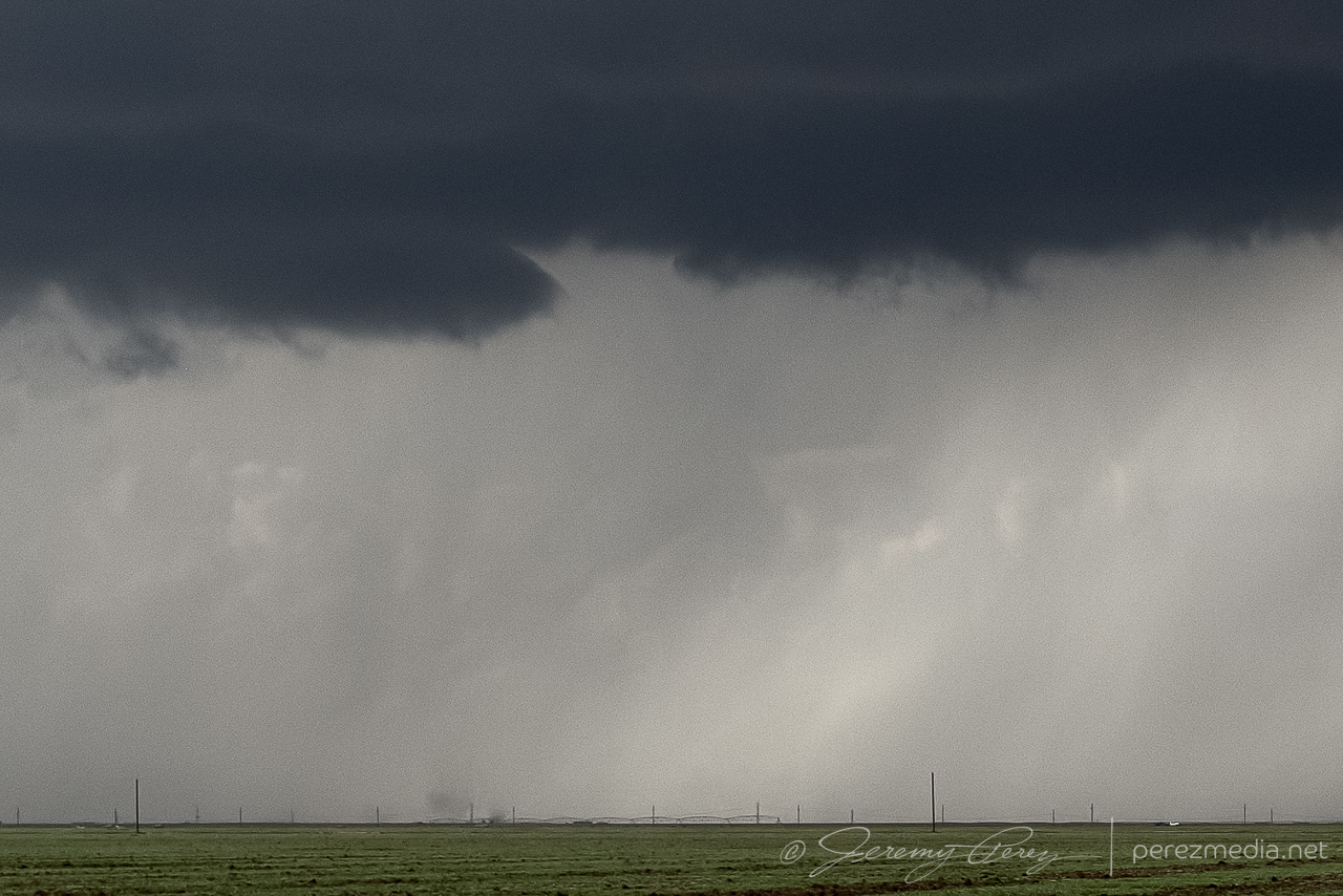
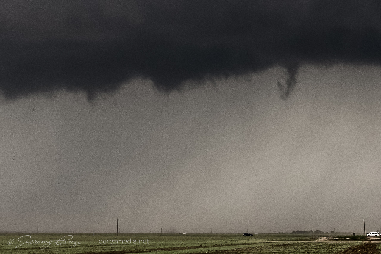
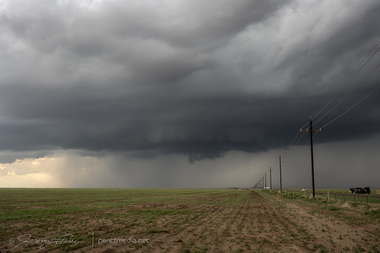
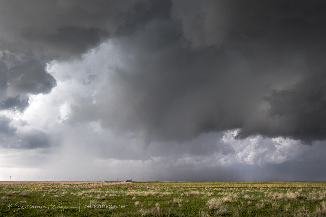
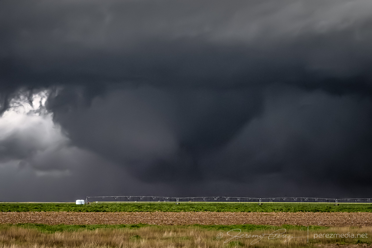
Gradually, the lowering grew more focused, and we took our stand about 8 miles down the road. Over the next 3-4 minutes, a funnel consolidated, lowered, and then the tornado fully condensed. This road turned out to be a great spot to watch tornadogenesis about 2 and a half miles northwest as the storm slowly grooved right to left. The tornado lasted around 7 minutes before fading out as a thin hazy rope inside the occluded precipitation.
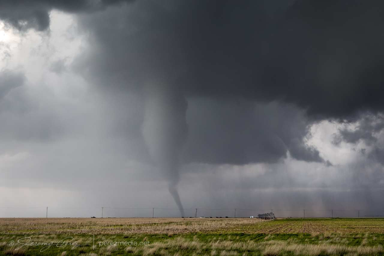
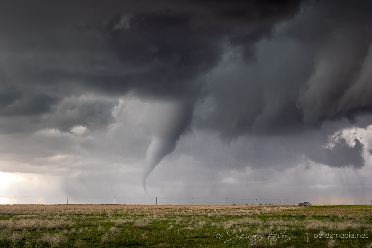
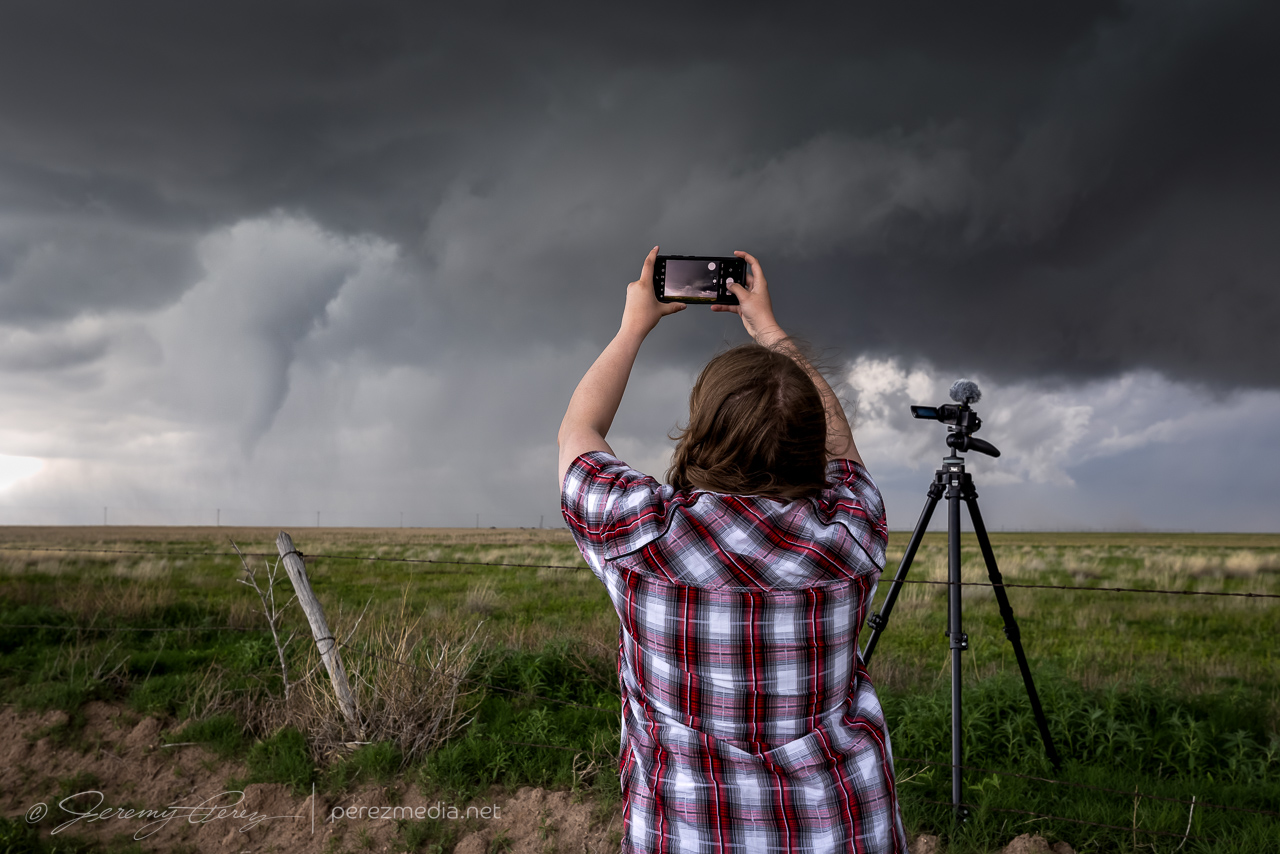
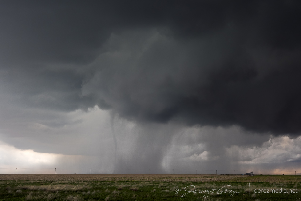
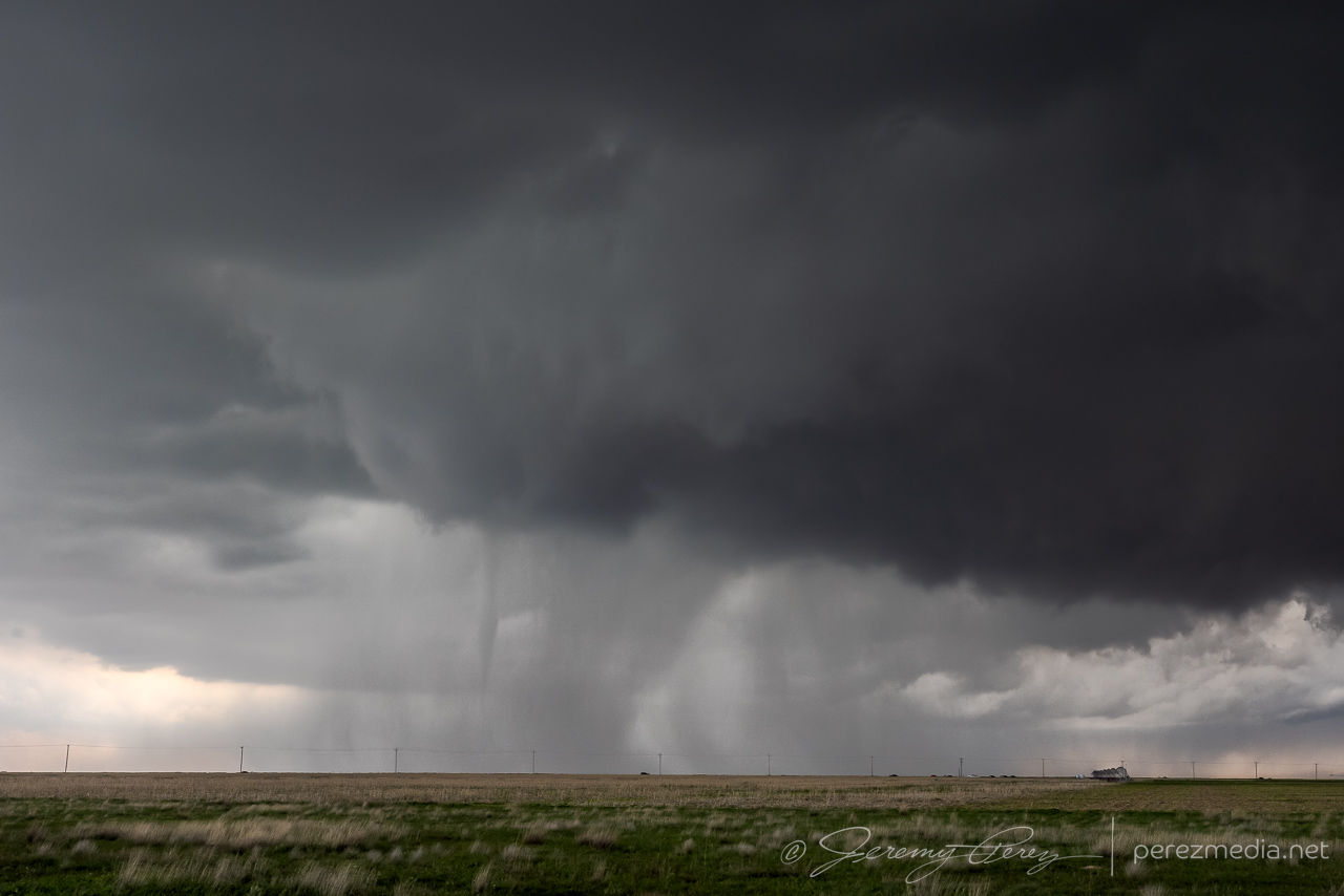
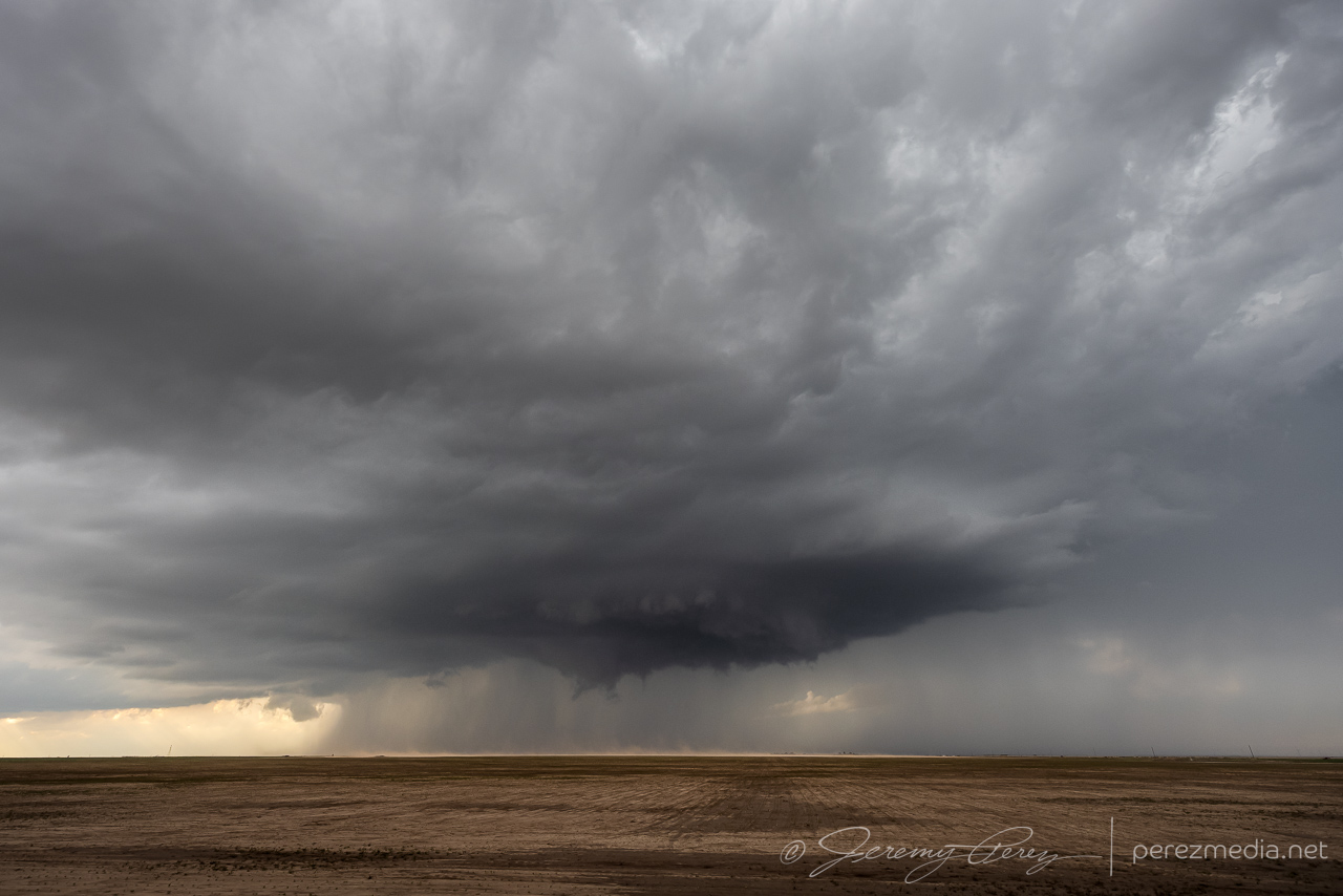
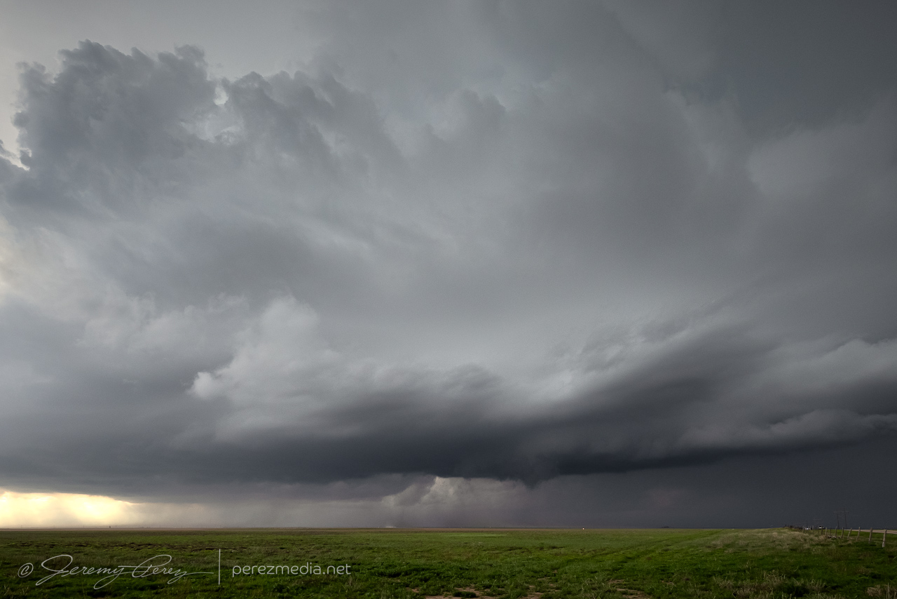
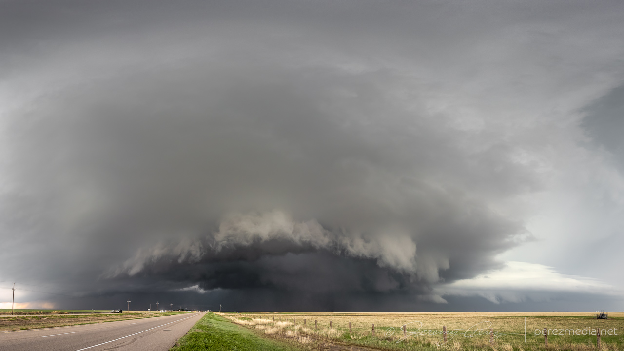
After a few maybe-nadoes on our chase trip, it was extremely cool to have a legit tornado drop after a trio of awesome storms, on a Less-than-2% tornado risk day. Once it had roped out, we dropped a couple miles south and then west on County Road V. This extra bit of distance gave a gorgeous view of what had been happening to this storm’s structure while we were closer in watching the tornado.
At this point, that other anticipated line of storms was now moving in from the north and I moved over to Hwy 287 south of Stratford so we could hustle south and stay ahead of it. As it rushed into our storm, it gusted out and everything started cascading southward. We cruised down Hwy 287 for a while, getting photos of the big gust front before calling the chase on a spectacular day.
Community Comments
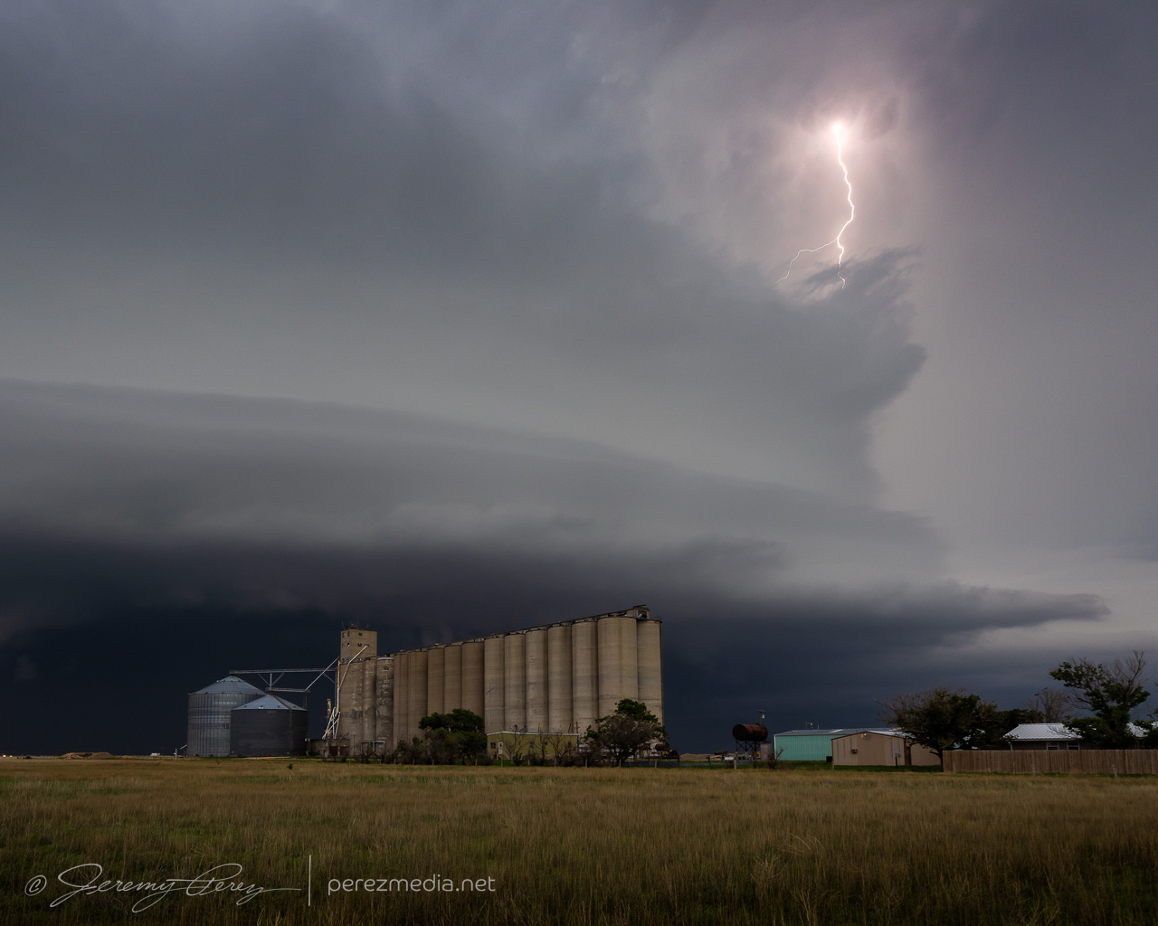
Beauty shots, Jeremy! What a chase! The tornado shots are incredible, but the one with the lightning + structure over the silo is 👌🏻
Thanks Travis! Man that was a fun day! Always on the lookout for a handy grain silo:)
Reply to Jeremy Perez
Reply to Travis Farncombe
Thanks Michael! Working on updating my chase reports from 2023 including better pics here...very late in doing so.
Reply to Jeremy Perez
Congrats on the tornado!! 🌪️
Reply to Michael Ulch
Want to leave a comment? Join our community → OR Login →