

Published on
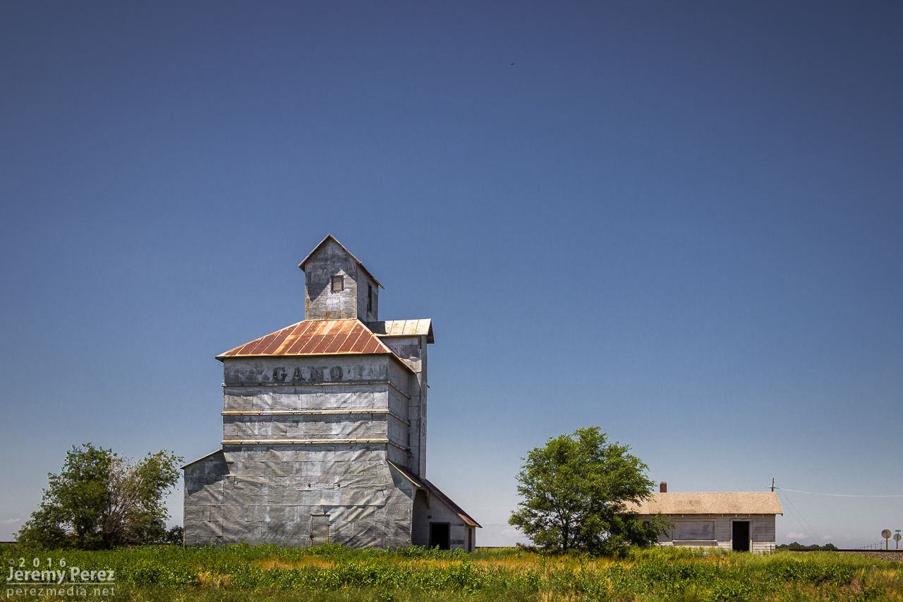
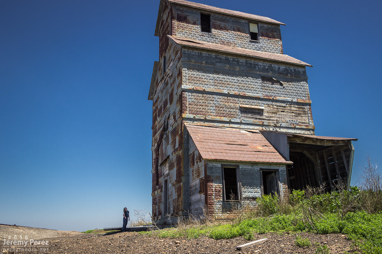
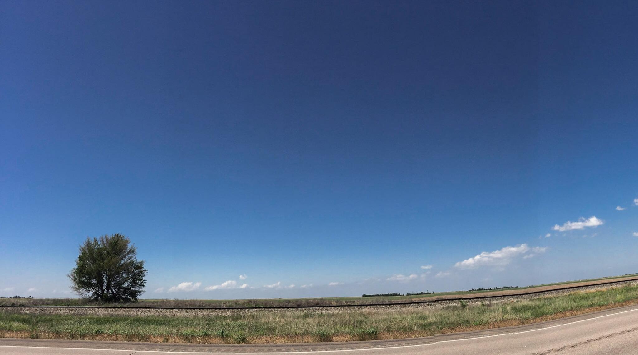
We started the day out in Dodge City where we had viewed several tornadoes the day before. This day’s chase took us further east into Kansas looking for convergence and backed winds along the dryline and other boundaries. As we made our way east on Hwy 50, we stopped at a couple abandoned buildings east of Spearville, at a spot on the map called Ardell. We had passed these the day before while shooting some sunset pics after the Dodge City storm. My daughter is a bit of an explorer and spent a lot of time checking things out, including peeking into a window where she was hissed at by a huge, cranky gopher snake that had wound itself around some pipes dangling over an inky abyss.

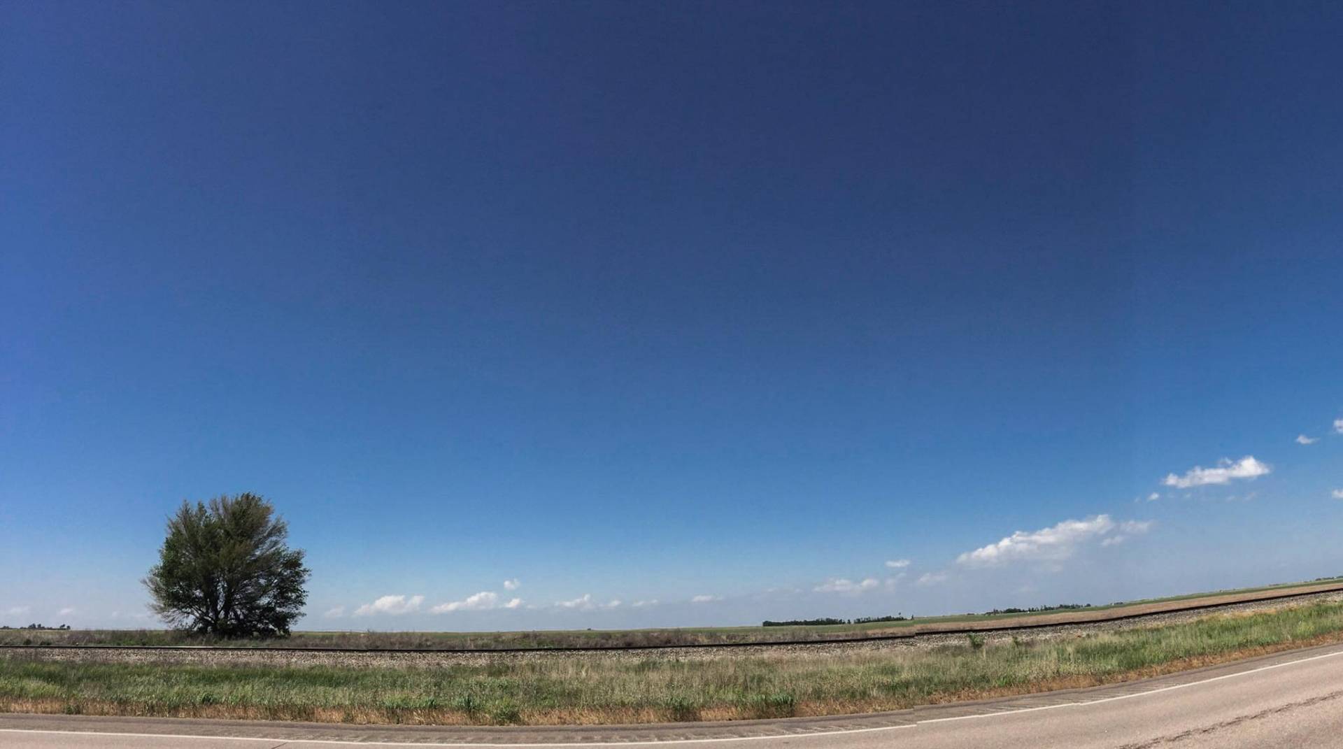
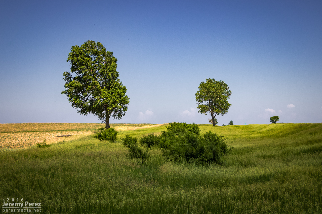
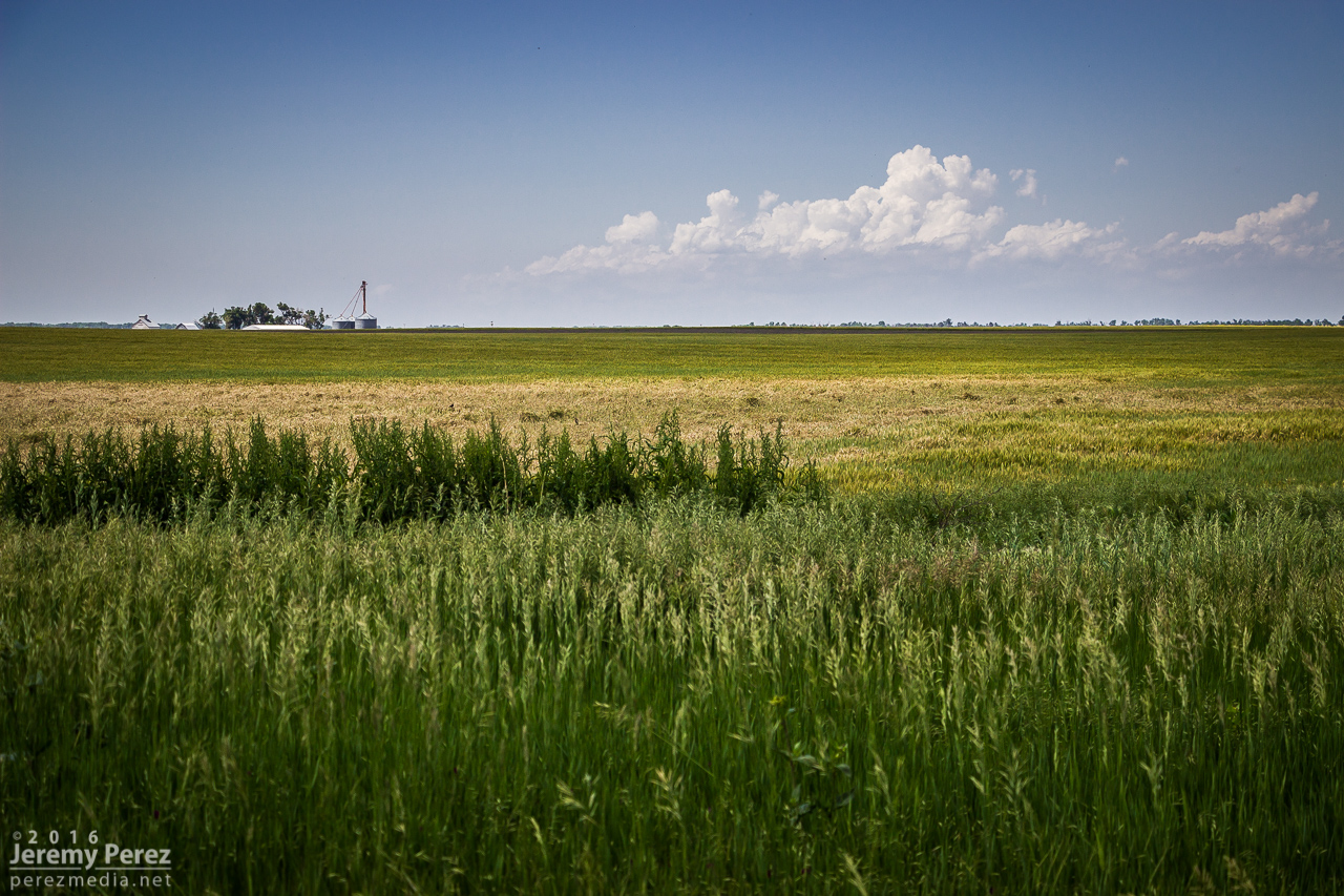
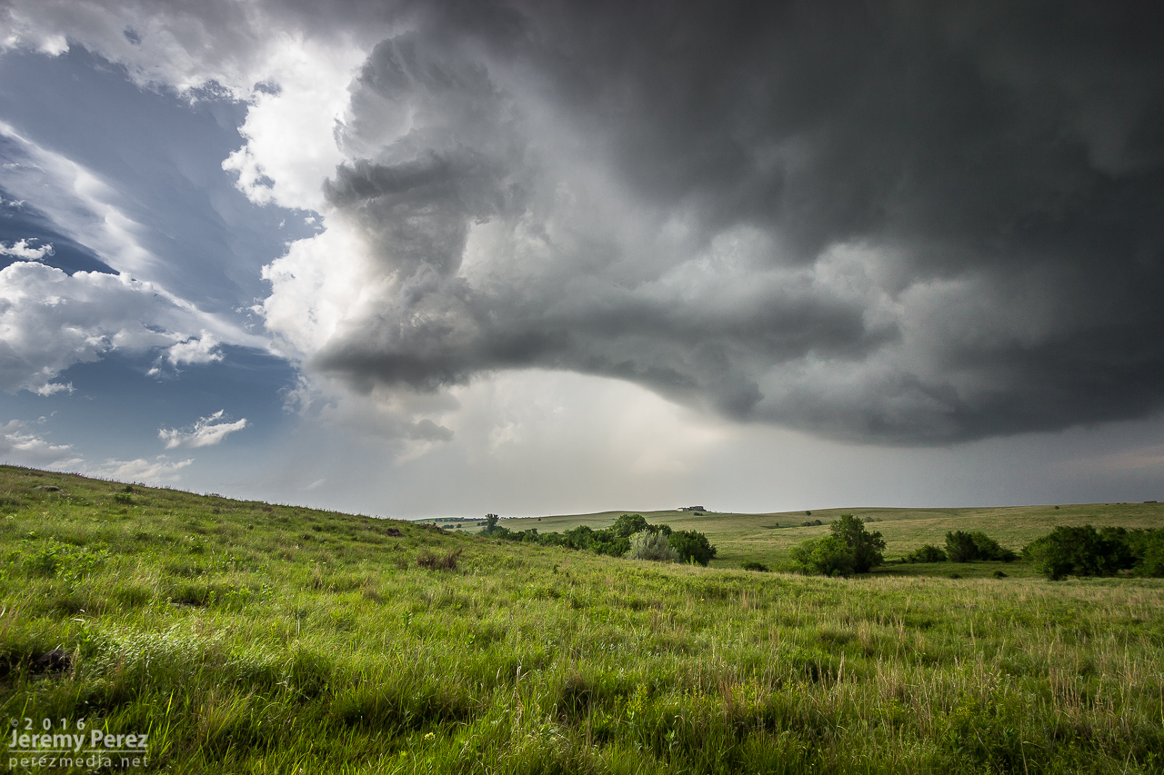
As we got further east, a long arc of clouds bordering hazy skies announced the dryline bulge. It was extremely cool to see it stretched out like that visually without even needing satellite. Although the satellite view was pretty impressive too, showing both the arc of the dryline and a boundary further east. Towers were trying to build on this eastern boundary, while others were brewing to our north near the triple (quadruple?) point. We gradually made our way eastward shooting landscapes along the way, watching the boundaries percolate, trying to decide between east or north.
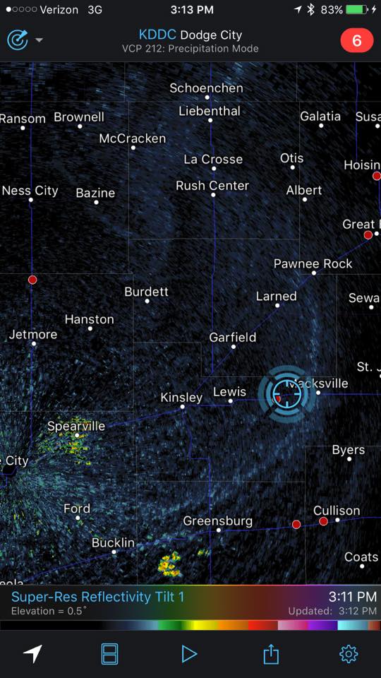
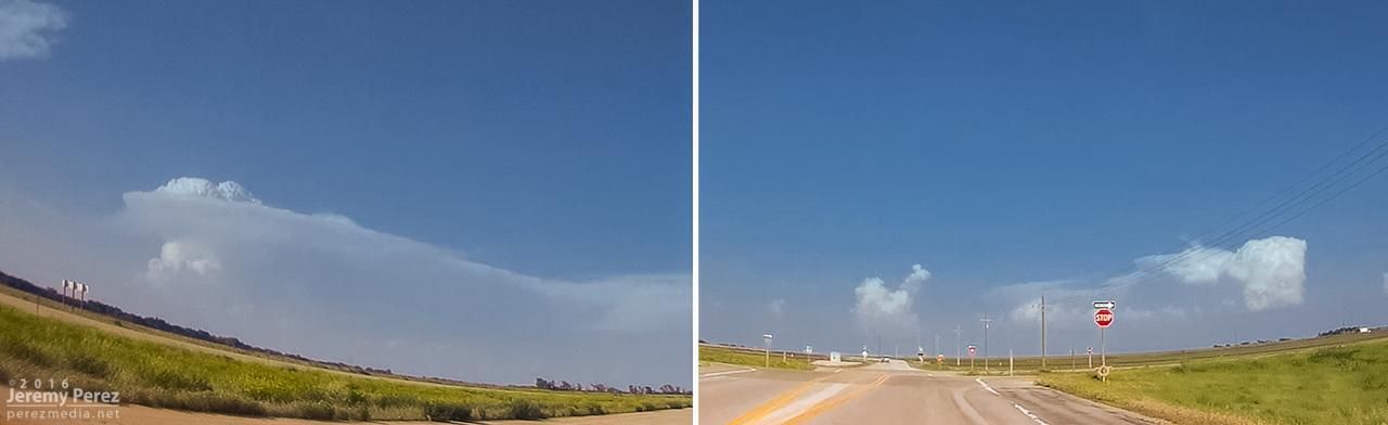
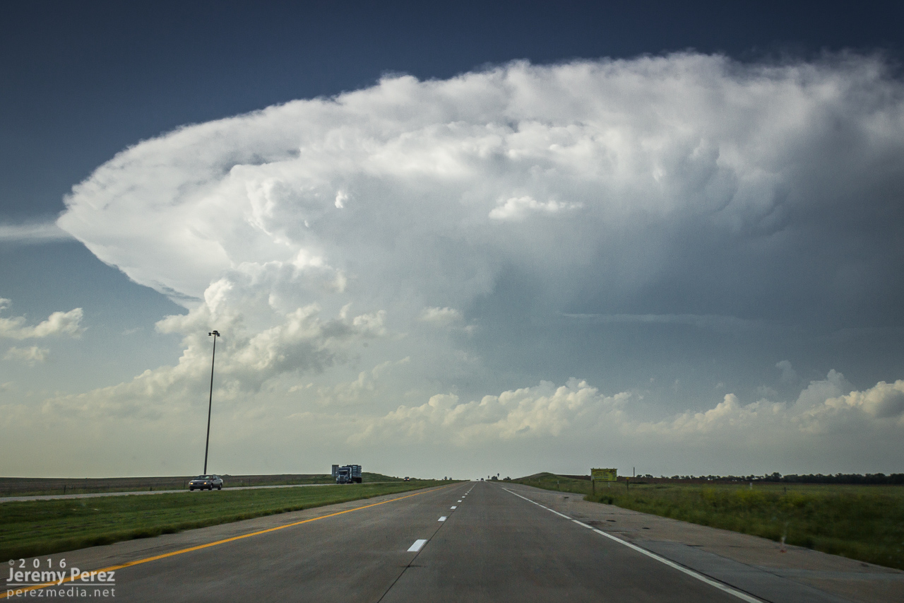
By the time we reached Hutchinson around 2145Z, convection was gushing anvils to our north near Claflin while the Wichita towers appeared to still be working on the cap, so we headed northwest to head for the northern target. When we got to a few miles southeast of Lyons by 2215Z, those anvils had gone orphan while a Wichita storm was finally taking off and looked like it had a nice, muscular updraft going. More self doubt followed as we drifted eastward and a new growing tower between Minneapolis and Lincoln to our north got going. I watched these two towers compete for attention north and southeast until Rt 61 a few miles southwest of McPherson when a final decision had to be made. I opted north, thinking that storm’s convection looked sturdier, had a backsheared anvil, overshooting top, hopefully the benefit of a boundary and better backed inflow to work with, and an easier intercept by this point.
As we got further north on I-135, the storm was looking pretty impressive as it approached the north side of Salina. I wondered if Bennington would see a repeat 2013 performance—and apparently a tornado did briefly touch down there while we were still making our way north.
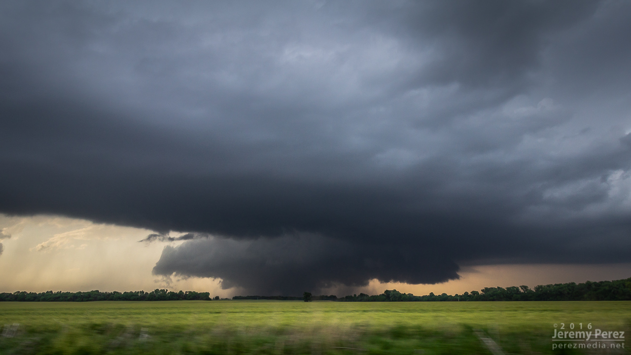
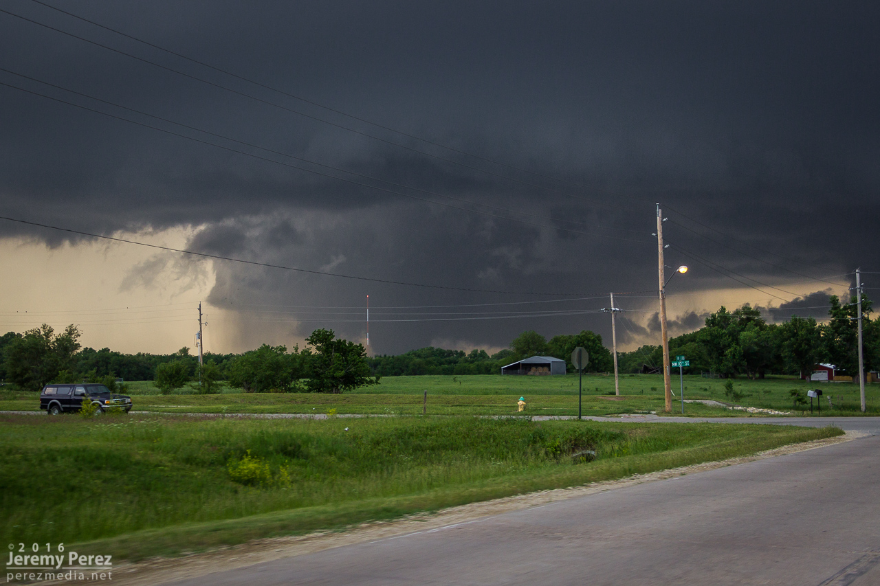
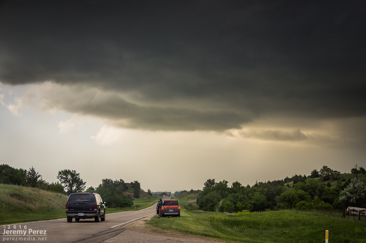
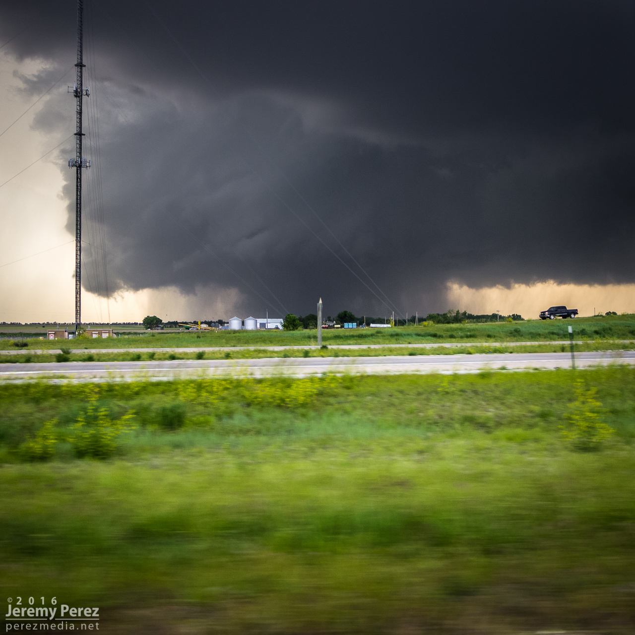
We headed off onto the grid about 4 miles north of I-70 and had our first look at the base. It was working on an RFD notch, but didn’t look too impressive at the moment.

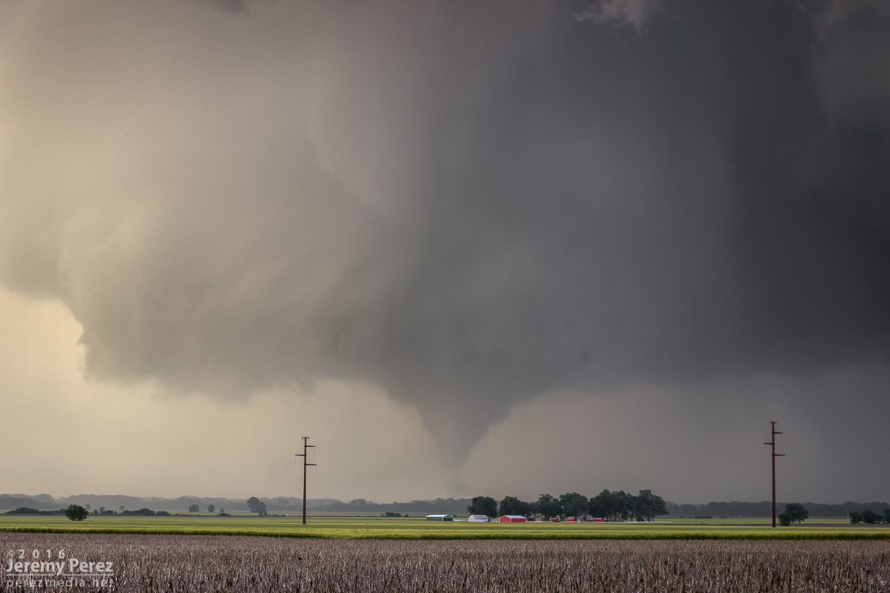
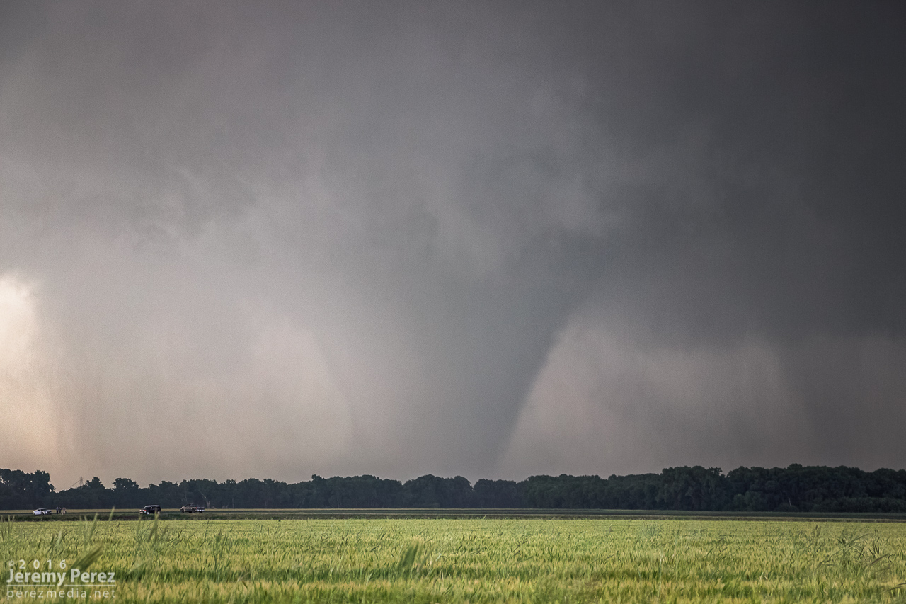
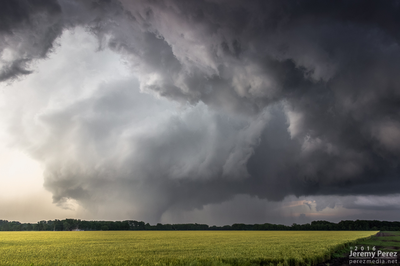
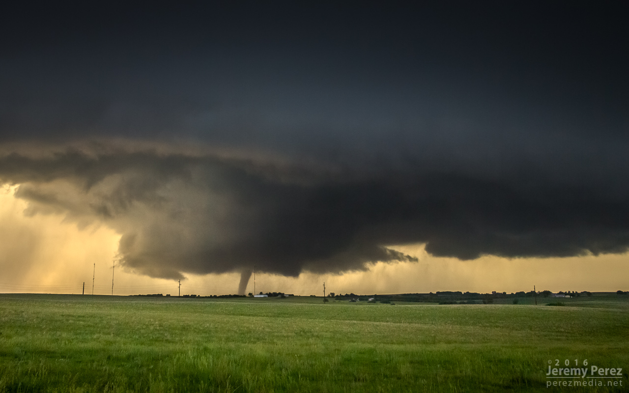
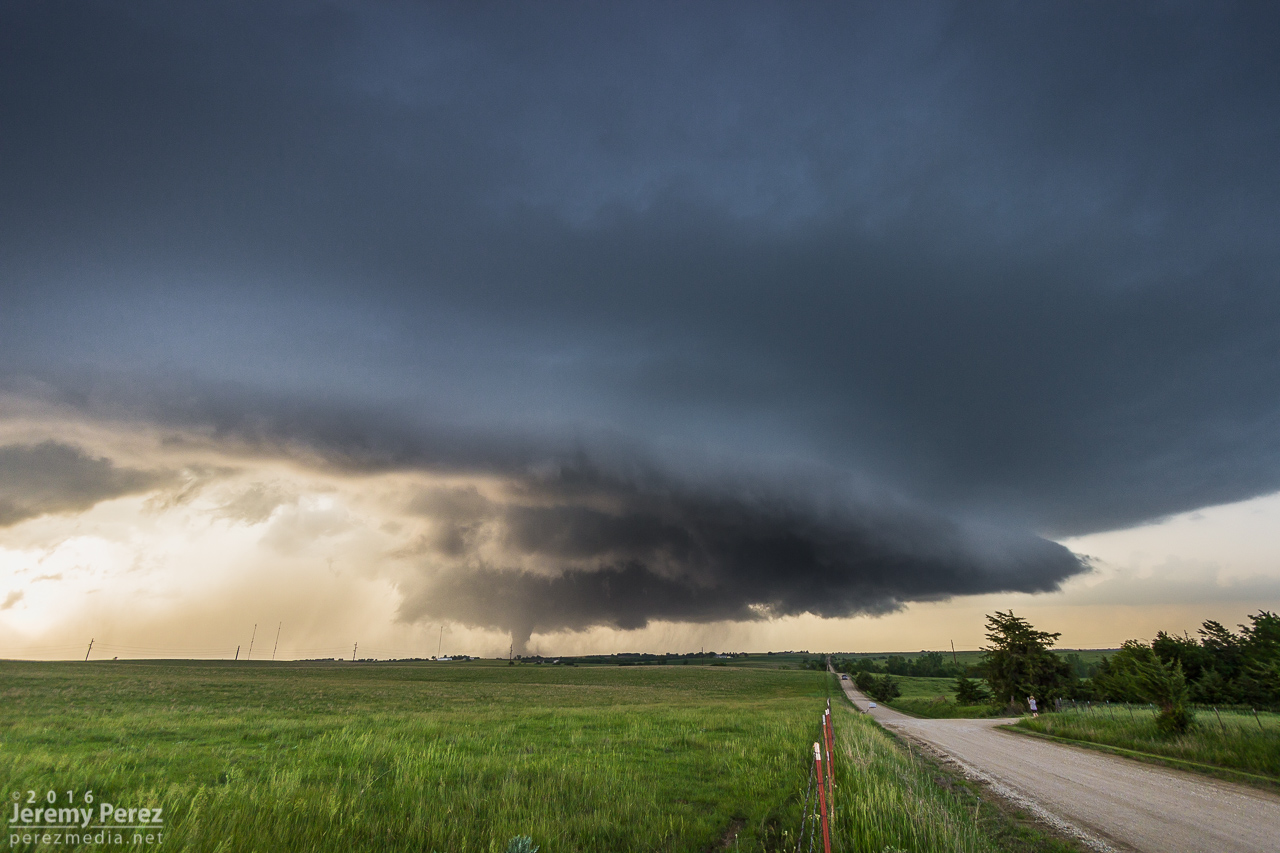
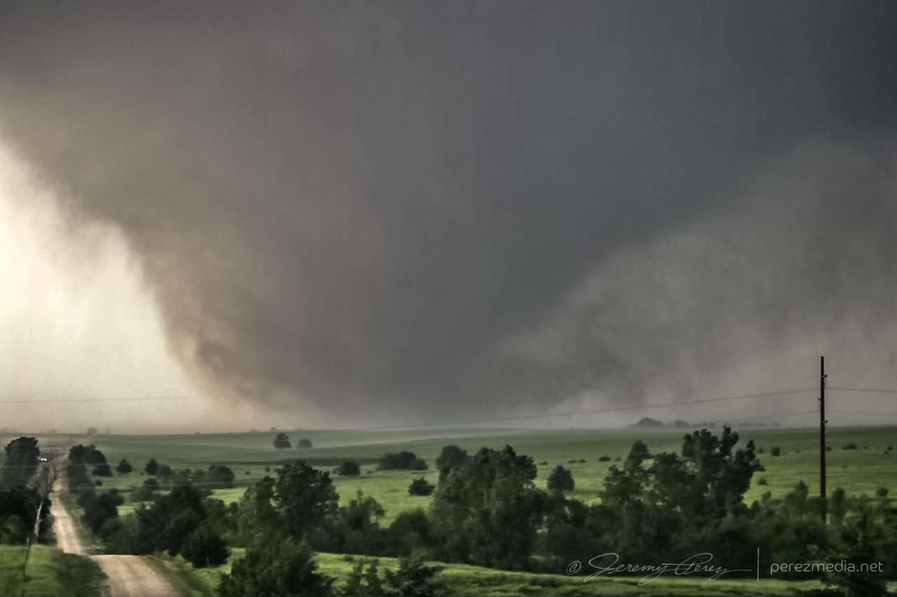
We got a little behind for a few minutes, but worked some very nice dirt road grid to catch up. After heading west another 5 miles, the storm really pulled together and we caught sight of a hazy, dark, cone tornado behind a thin veil of RFD precipitation. The pace of the chase really picked up after that. As we paced and worked to gain ground on the storm, the tornado grew in size while the choppy barrel meso above it took on Bowdle stylings.
At 240th road, I headed south and got onto I-70 to try and gain some ground on it, snagging blind photos out the window along the way. Just a bit before the Solomon exit, we encountered a sheriff hollering at a tour van operator who was parked on the side of the interstate while his tour group was loping across the median. Yikes.
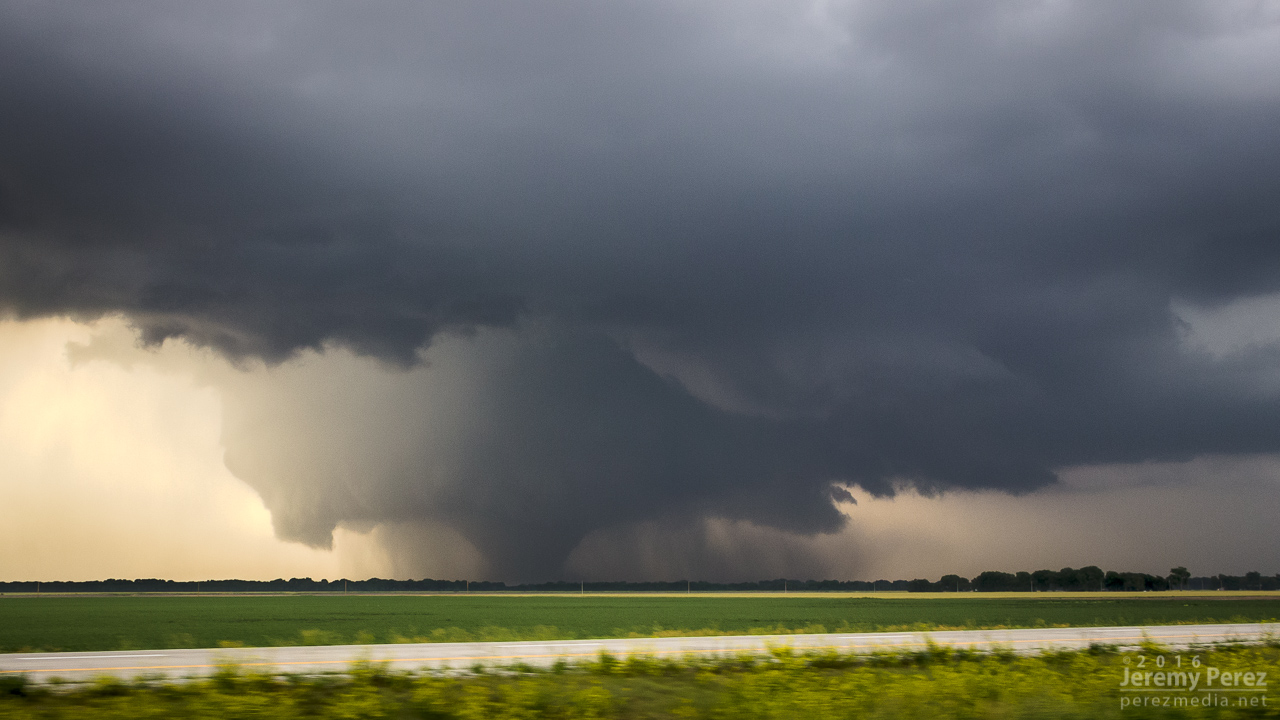


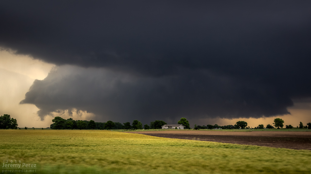
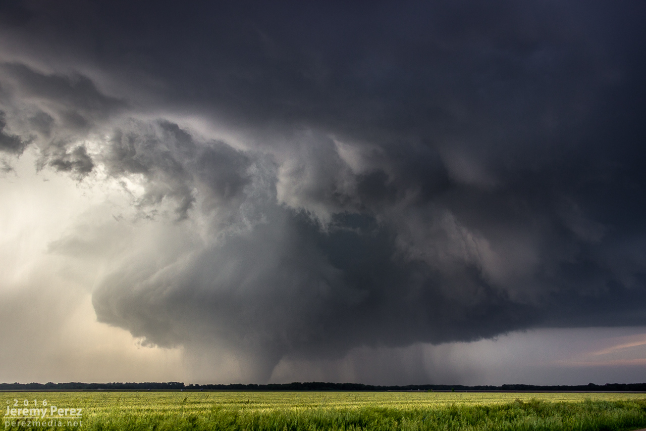
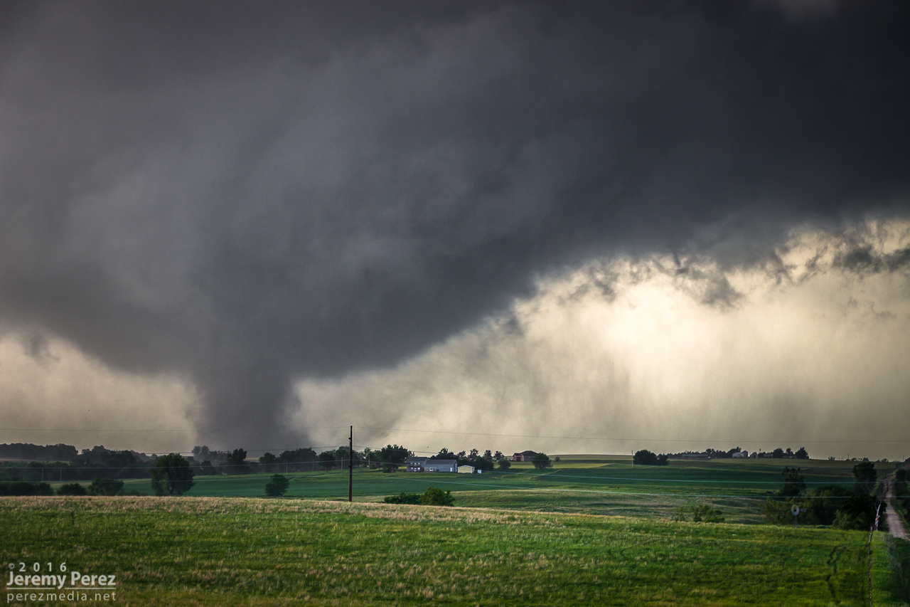
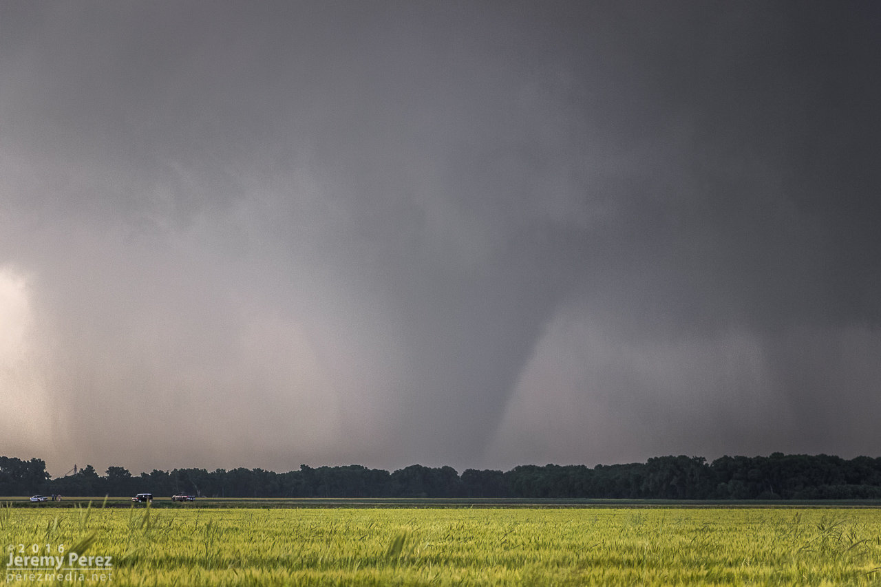
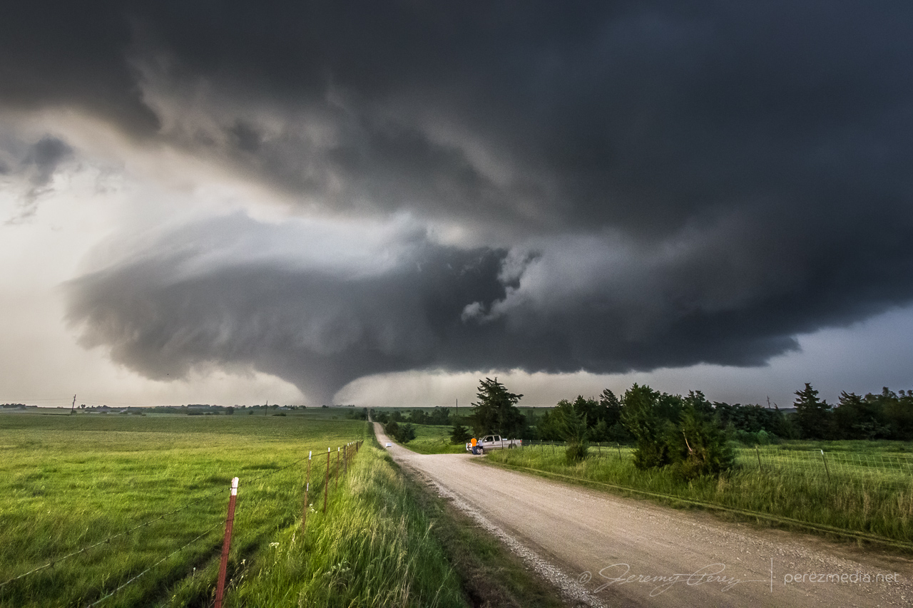
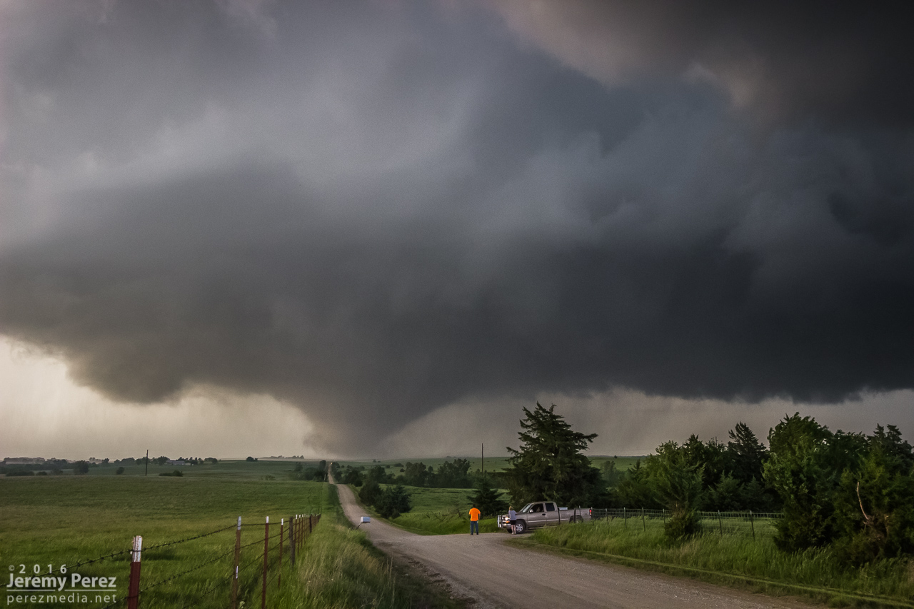
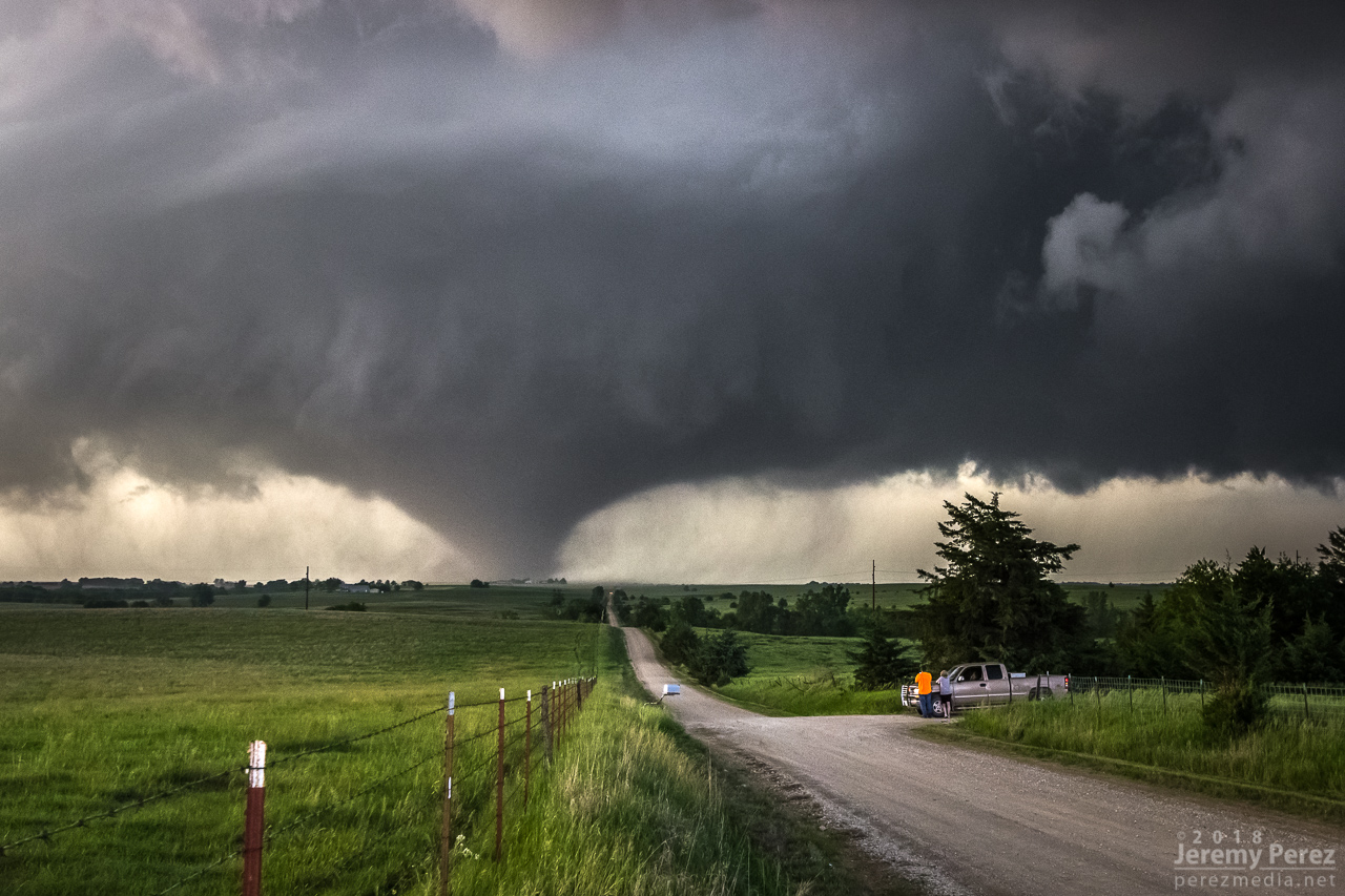
We made our way to the east side of Abilene and Indy Road just north of I-70. It was a perfectly elevated spot to watch the dusty, stovepipe tornado approach and widen into a large cone as it crossed our road a little over 2 miles to the north. It served up the best set of photos and video I’ve ever gotten of a tornado. A couple of locals, a father and I think his teenage daughter pulled up and talked about this being the first they’d seen even though he’d lived in Abilene his entire life.


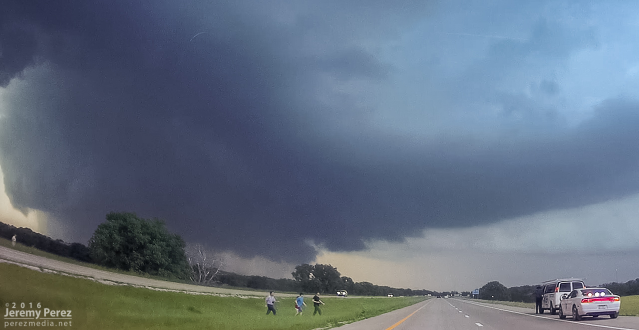
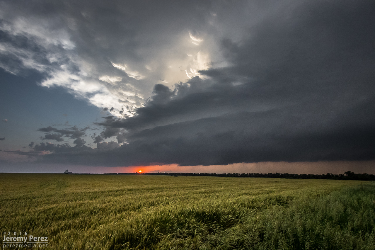
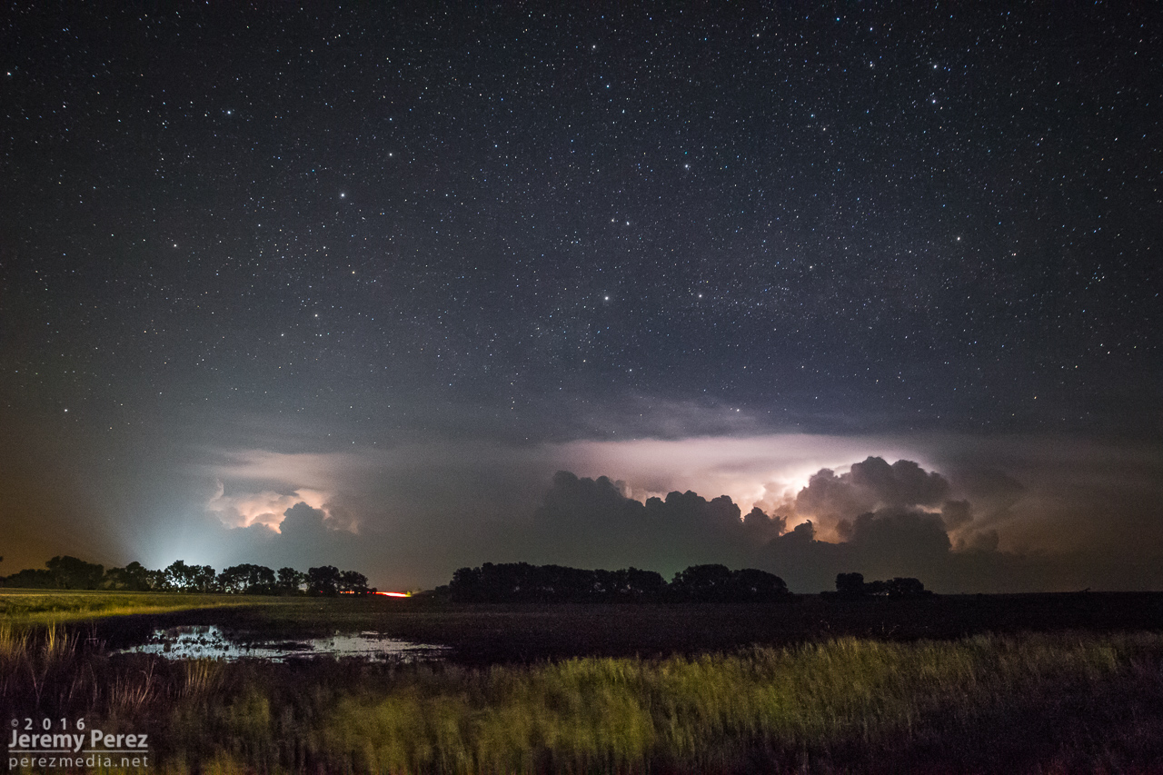
As it passed to the east, RFD shrouded the view and was pretty intent on knocking my tripods over, so we packed up and pulled back east onto Old US 40. Because the storm was nudging increasingly south and we didn’t want to play tag with the approaching tornado, we turned south on Rt 43 at Detroit to get some distance from it. I was concerned that by the time we found a good east-west road we might not catch back up until the river infested, choppy road network south of Junction City. So we lost it at that point and snagged sunset photos of a beautiful trailing cell before heading further south and shooting some nightscape shots with fireflies, stars and receding lightning near Antelope.


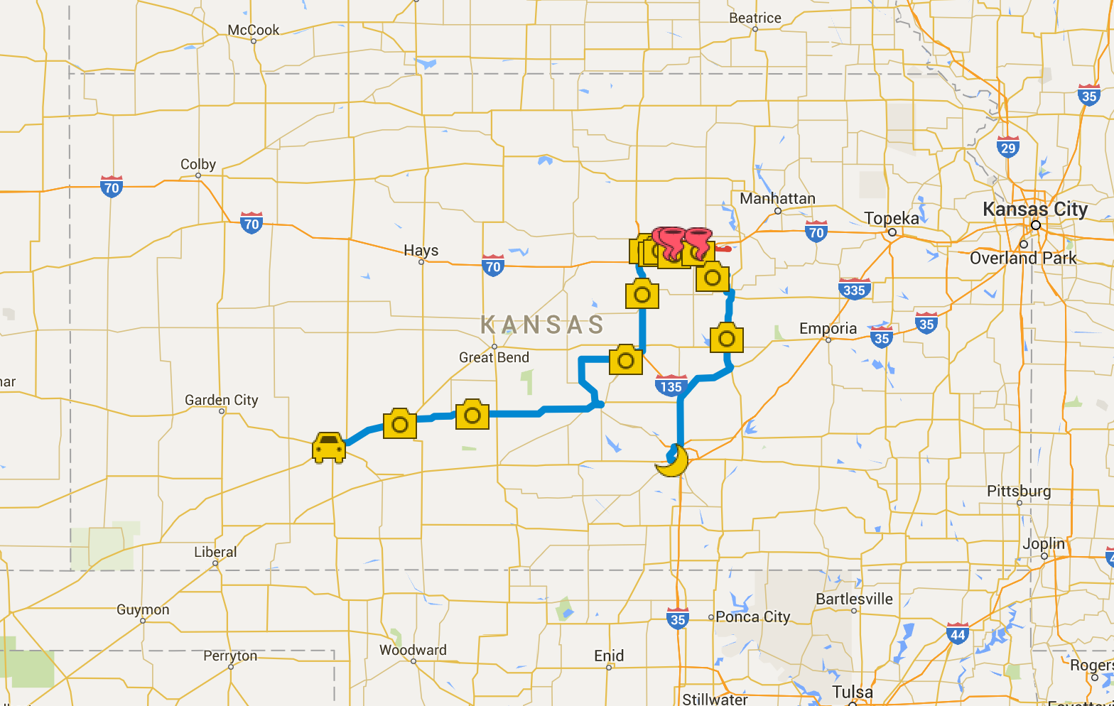
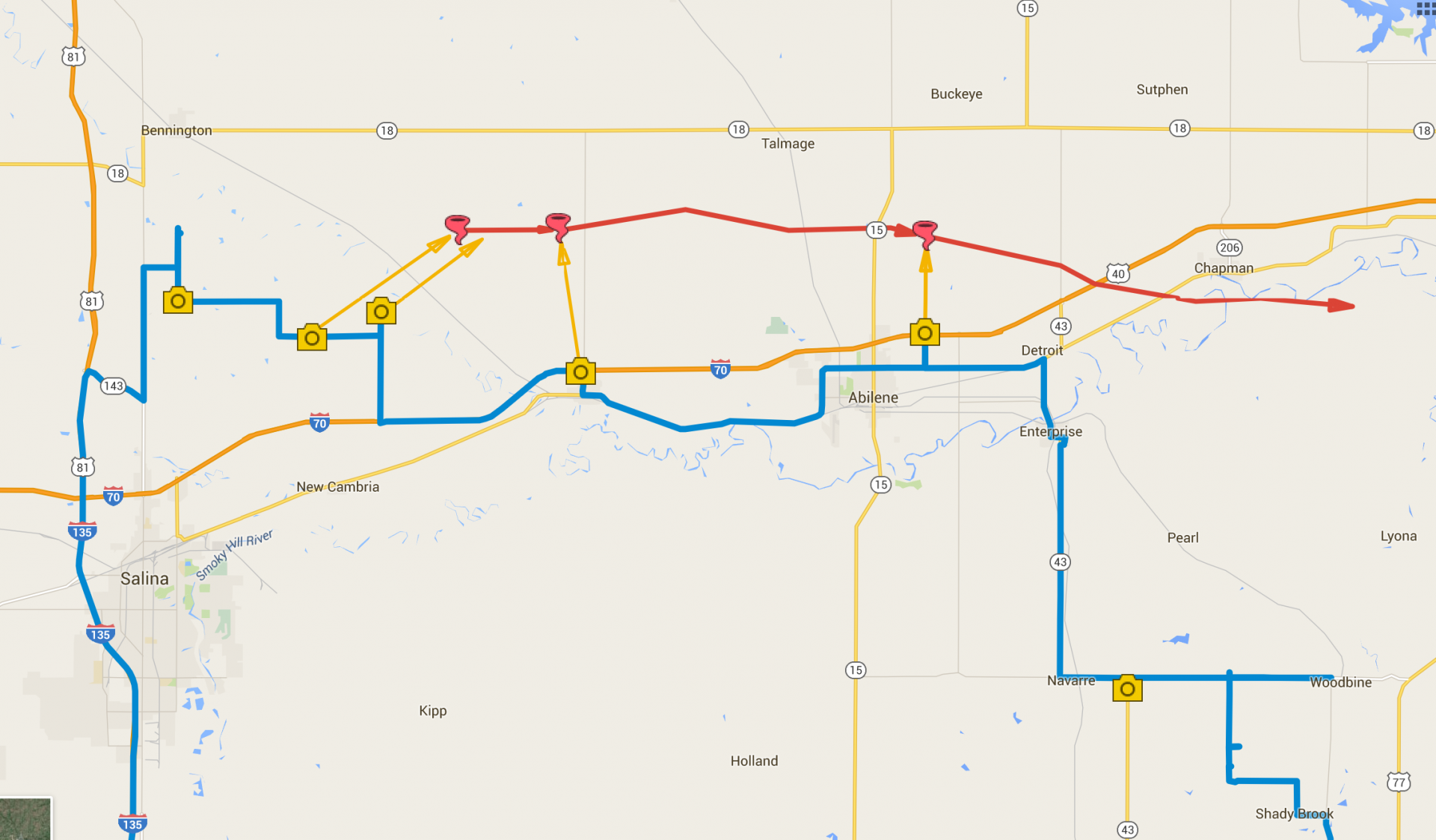
Zoomable/interactive chase map
Video highlights from the chase:
Community Comments
There are no comments on this post
Want to leave a comment? Join our community → OR Login →