

Published on
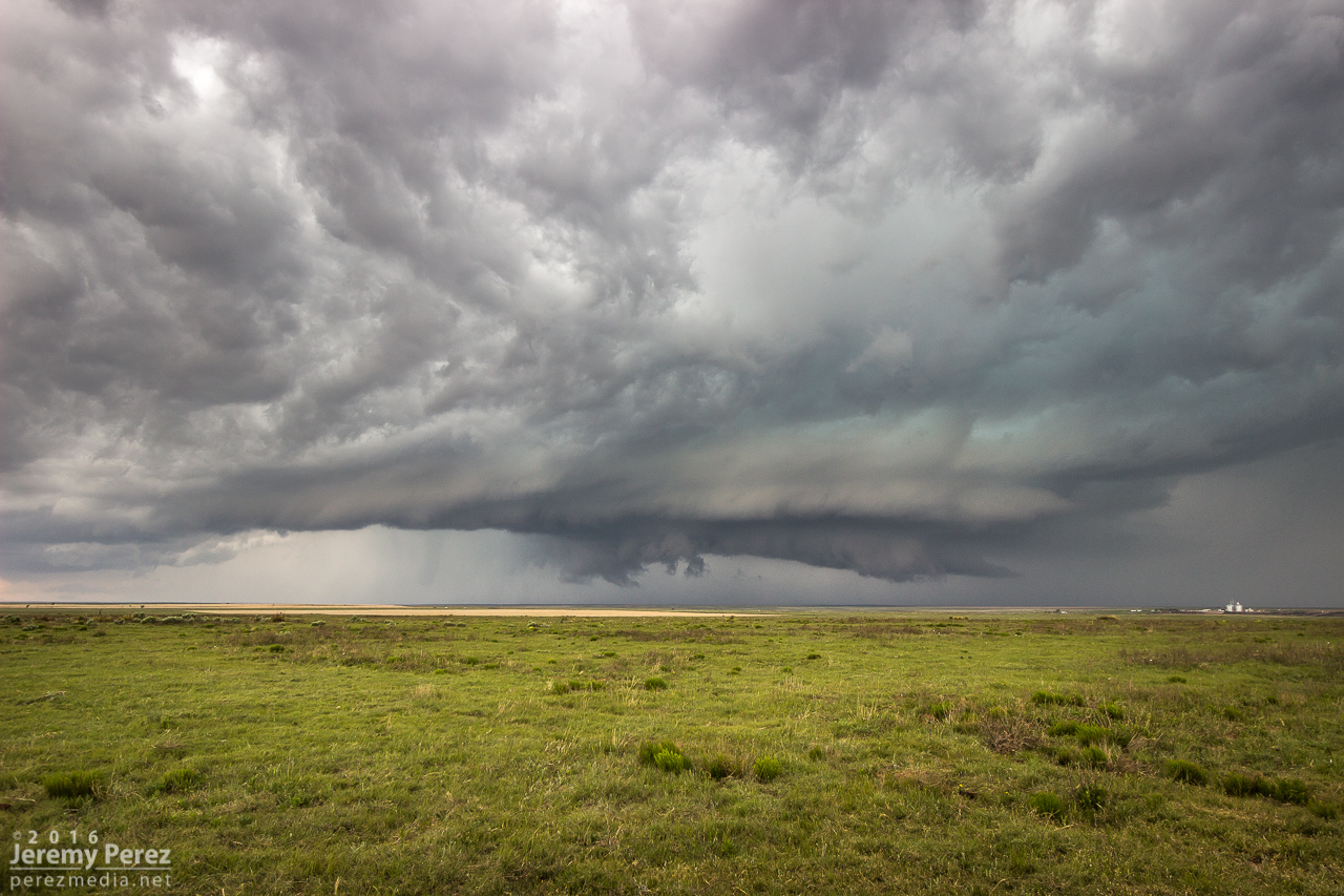
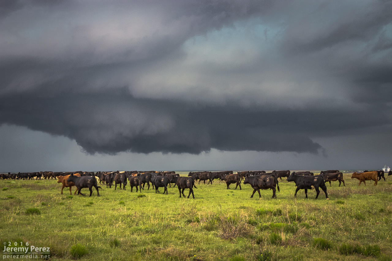
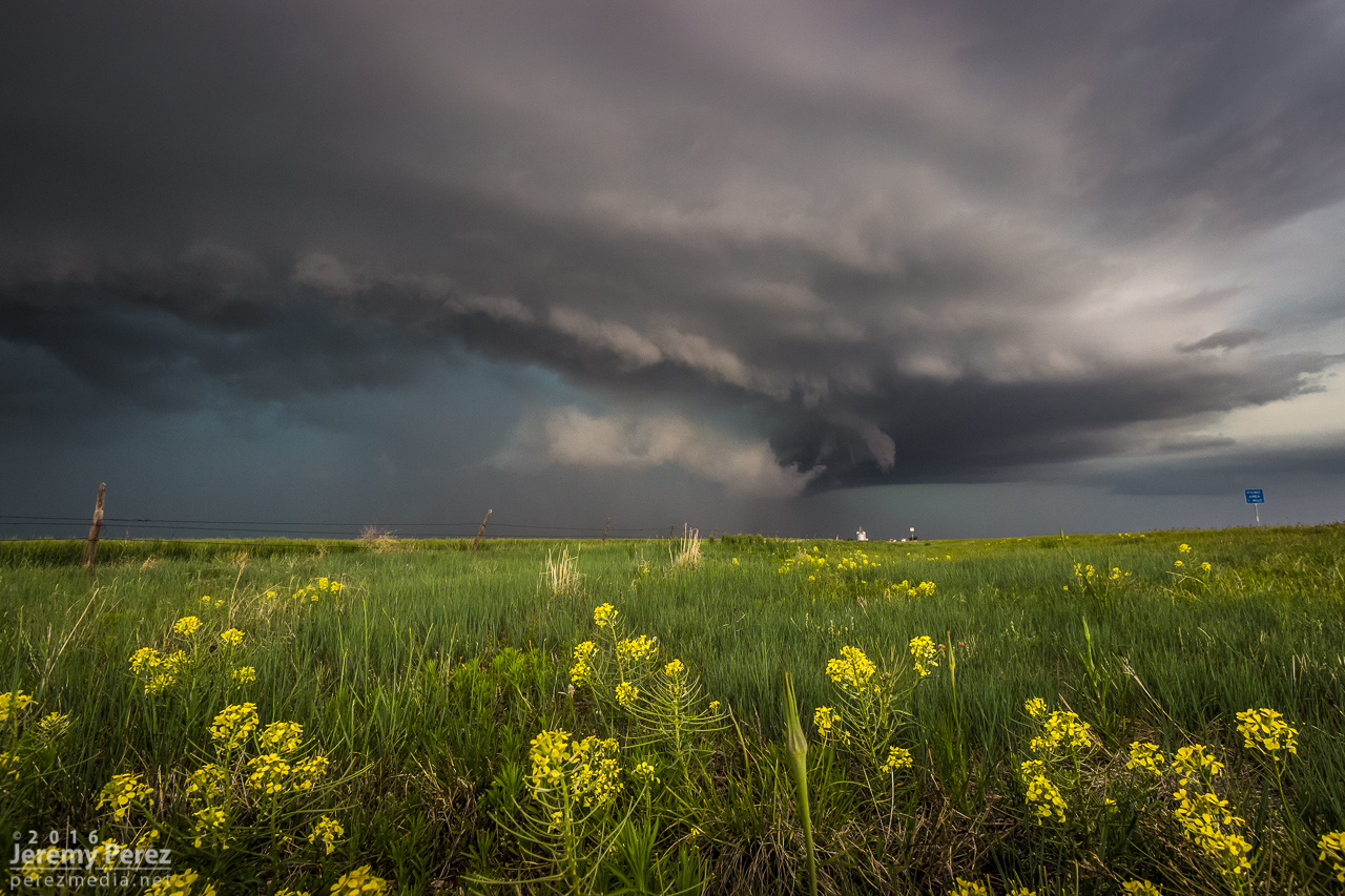
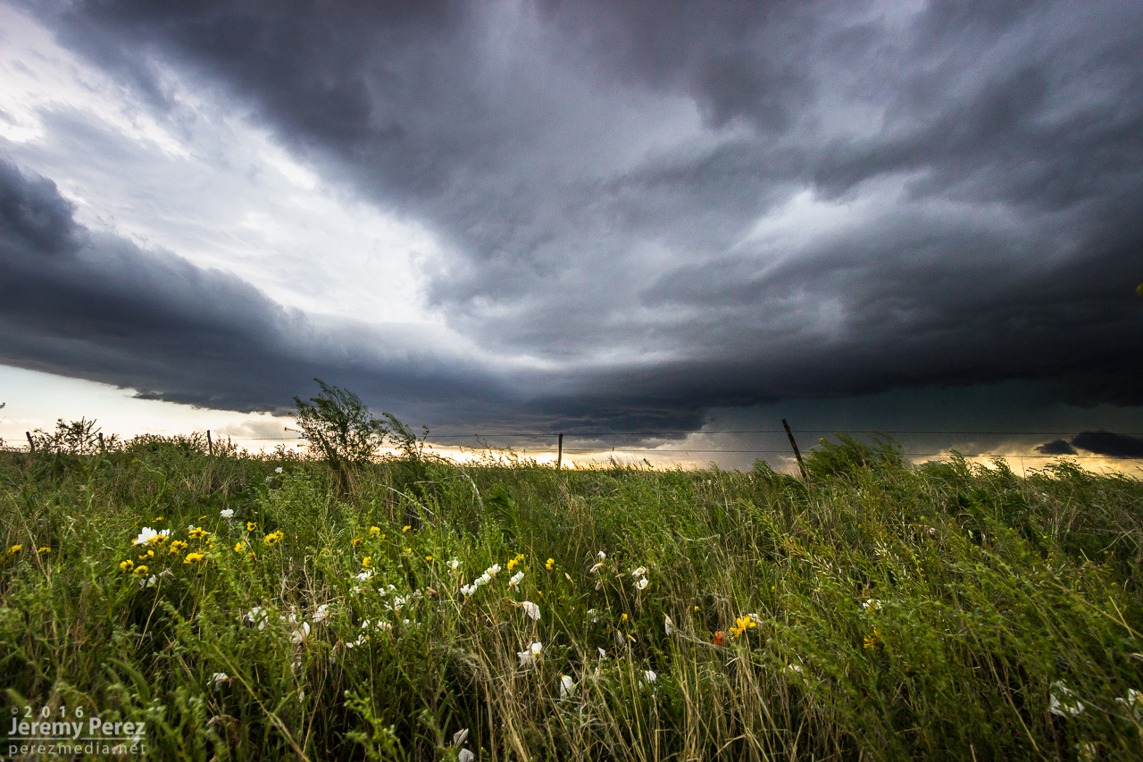
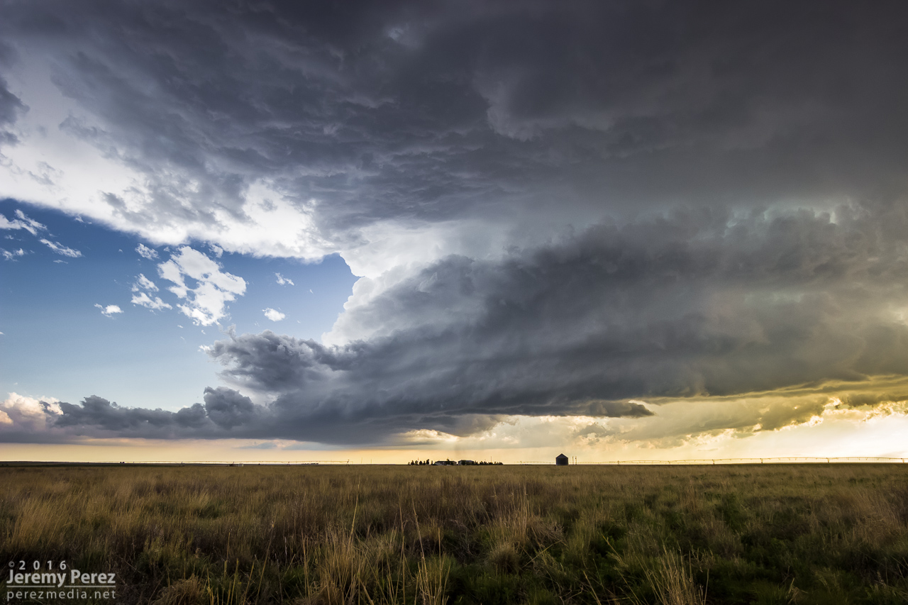
This day came on the heels of chasing linear storms and shelf clouds way south near Marathon, Texas. My daughter and I made the long journey up the Texas Panhandle and on to the western end of the Oklahoma Panhandle. By 21Z, we were driving beneath the mammatus filled anvil of a strengthening storm west of Boise City. We were barely in time to catch the action as it unfolded. We made it to an unpaved crossroads about a mile east of Felt by 2127Z and had a good vantage of the supercell to our northwest.
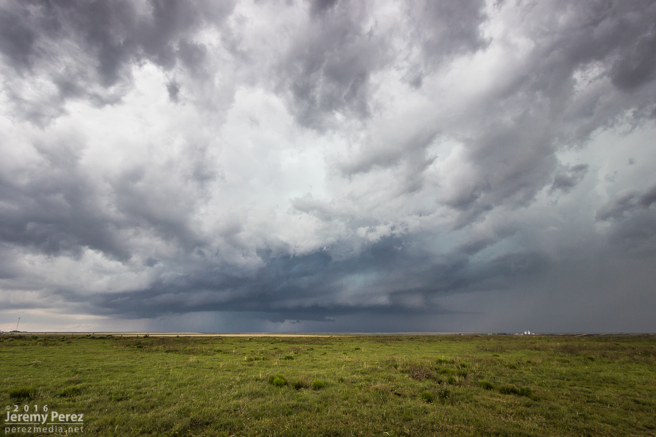
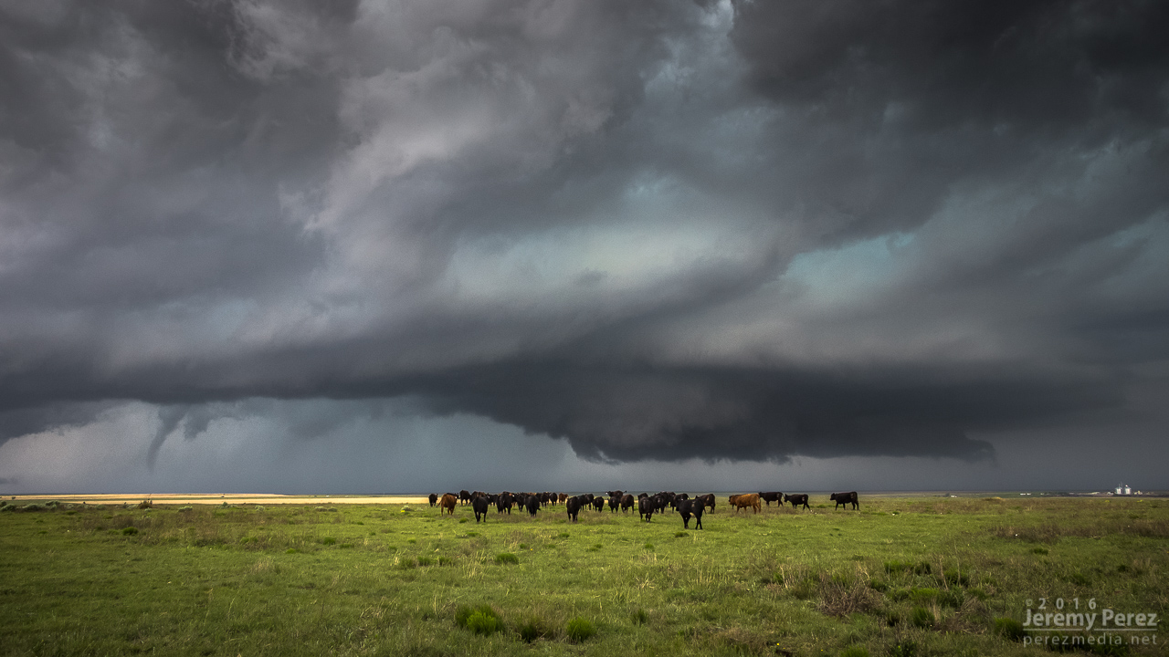
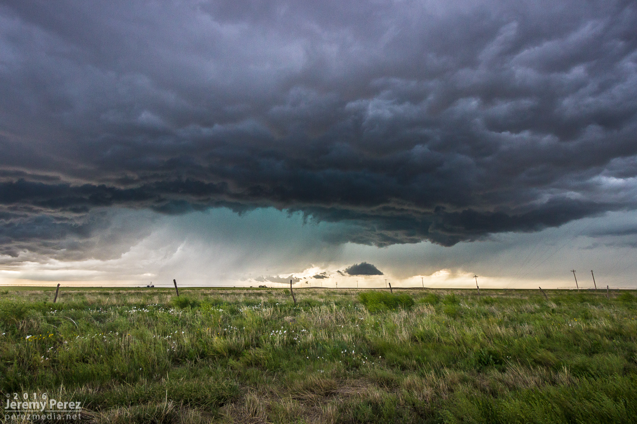
Within just a couple minutes of getting my video camera tripoded and rolling, a low contrast funnel emerged within the shroud of RFD precipitation.
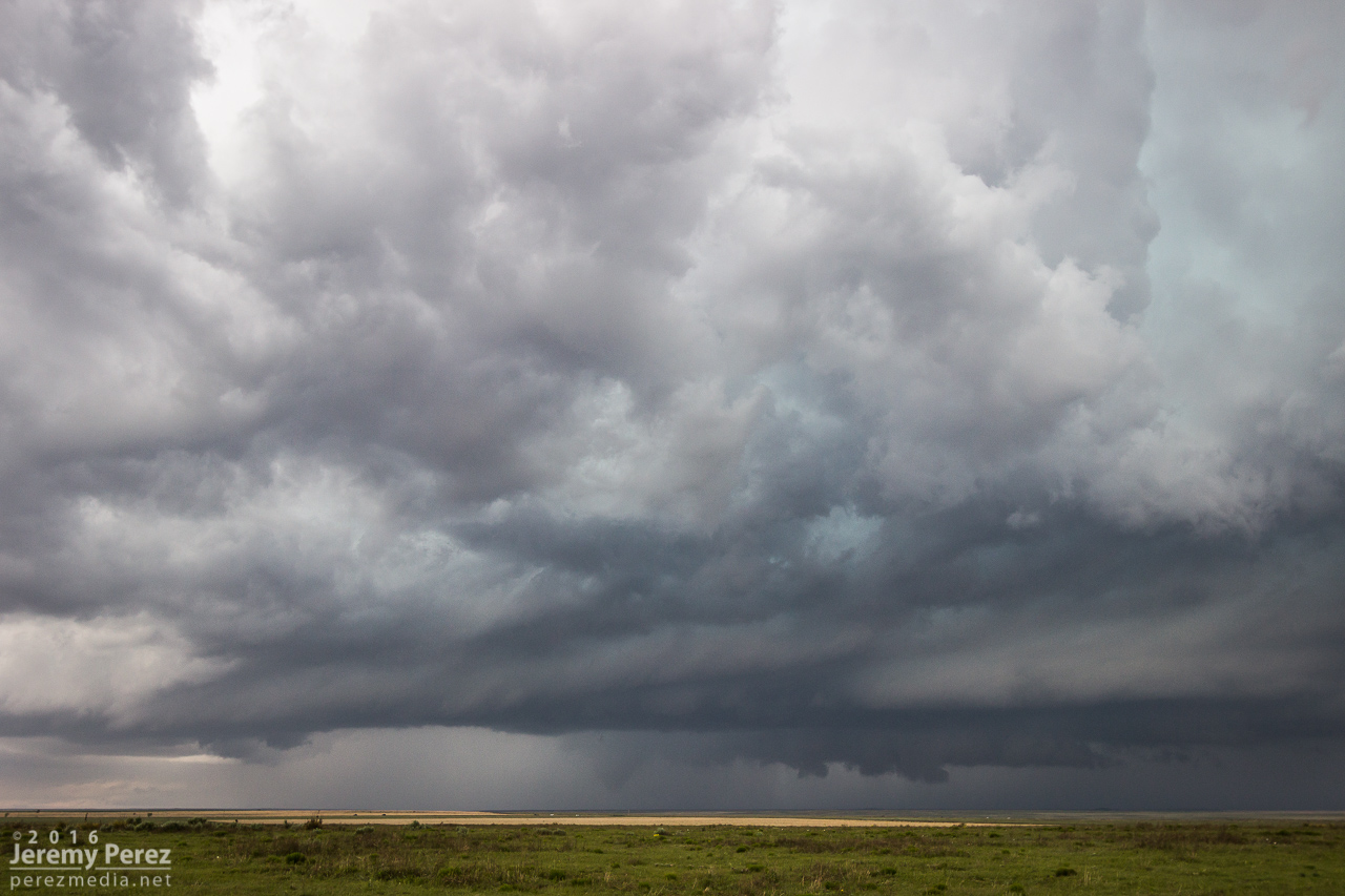
As it drifted southward, it became easier to discern and began to elongate.
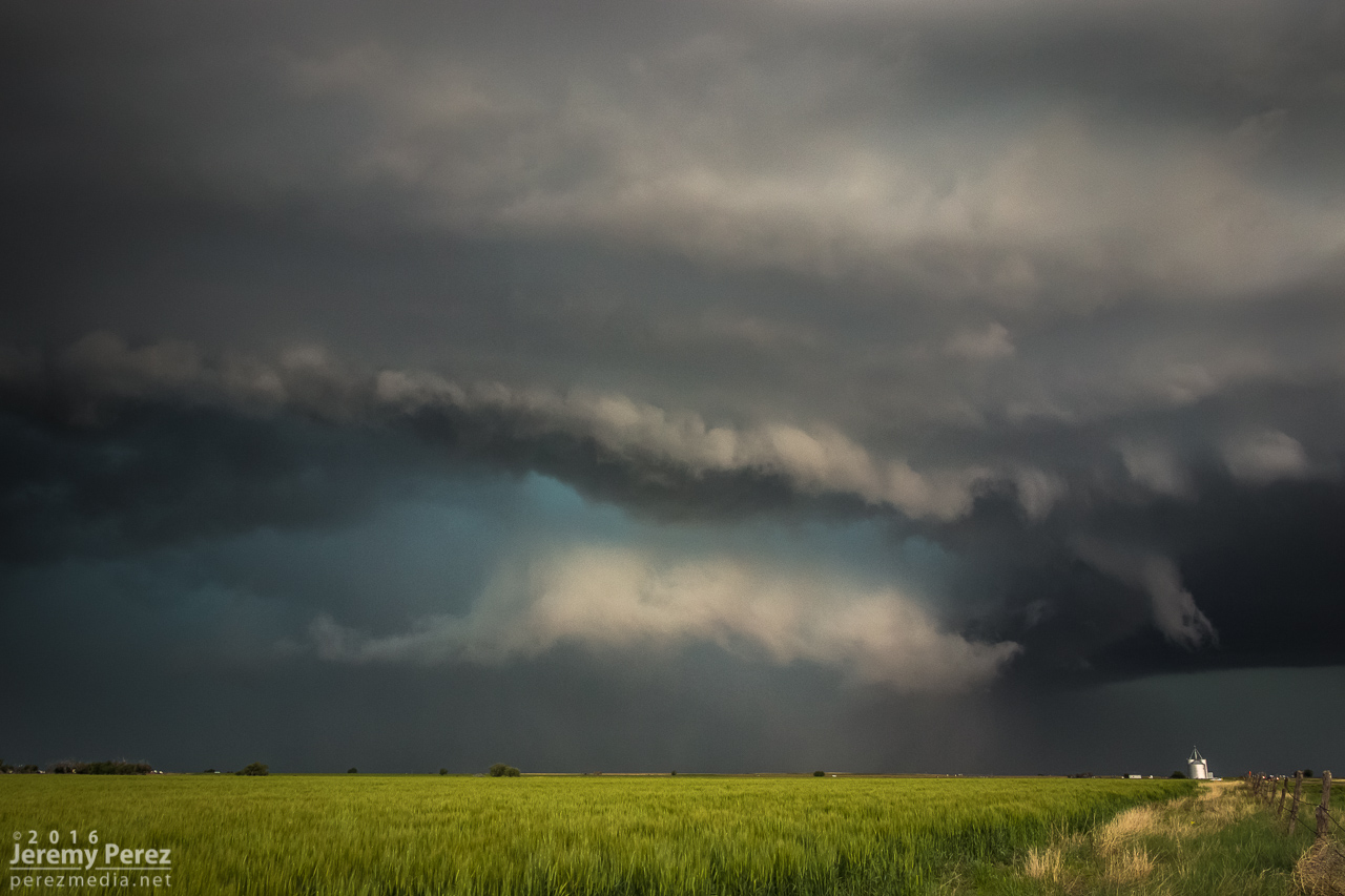
Chasers closer to the storm documented ground circulation, so this was tornadic. About this time, the herd of cattle whose fence we were peering through, had noticed us and came over to see if we had acceptable offerings. We did not. But I still took the opportunity to document their coexistence with tornadic supercells.
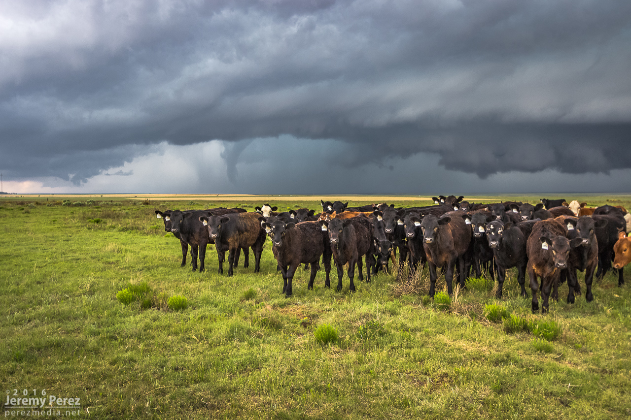
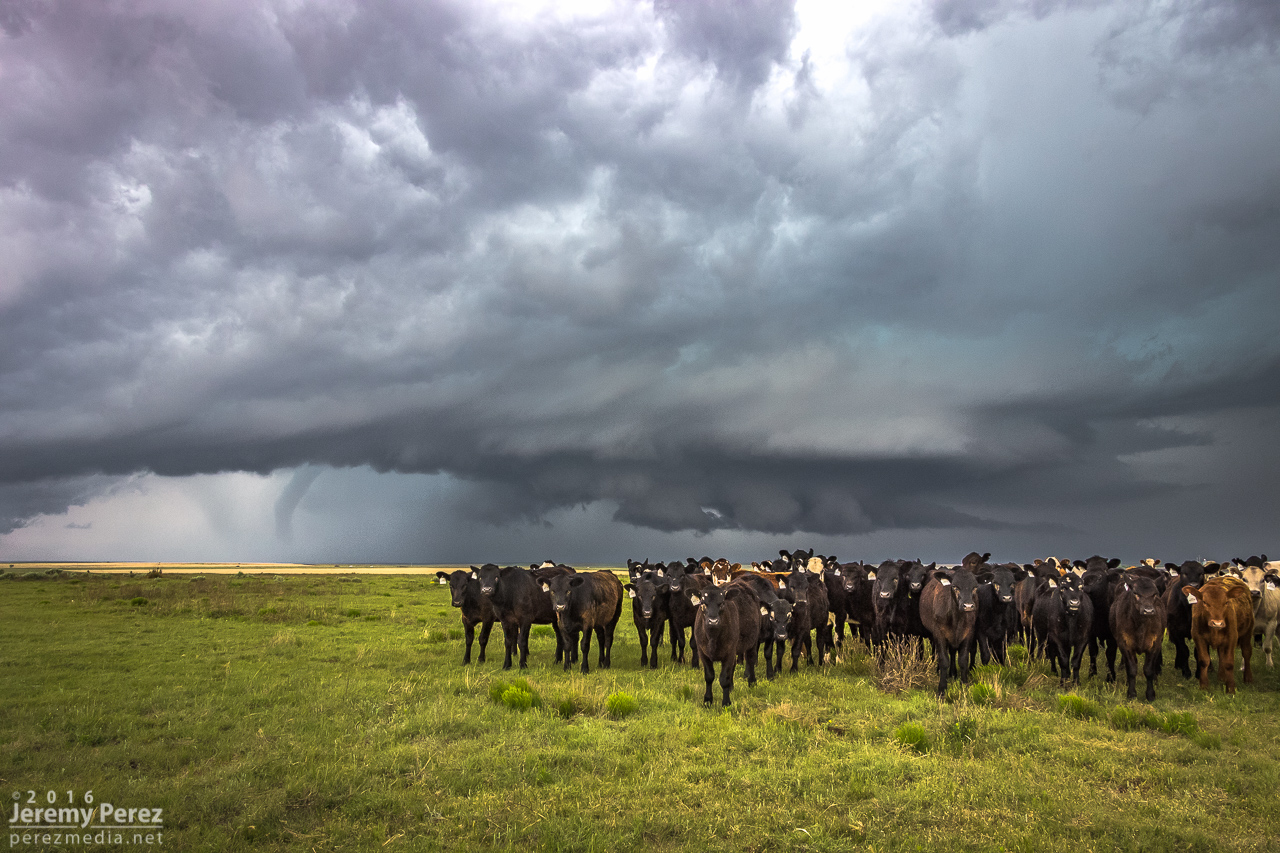
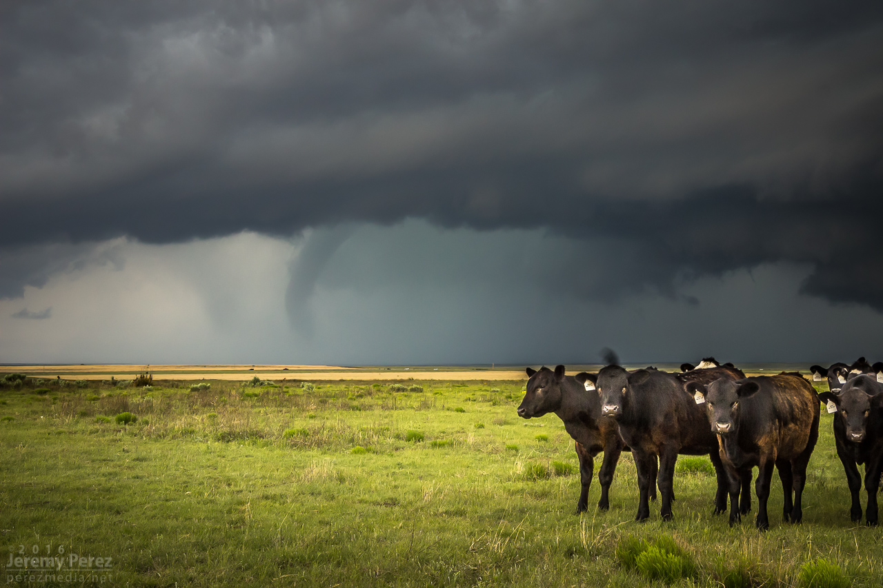
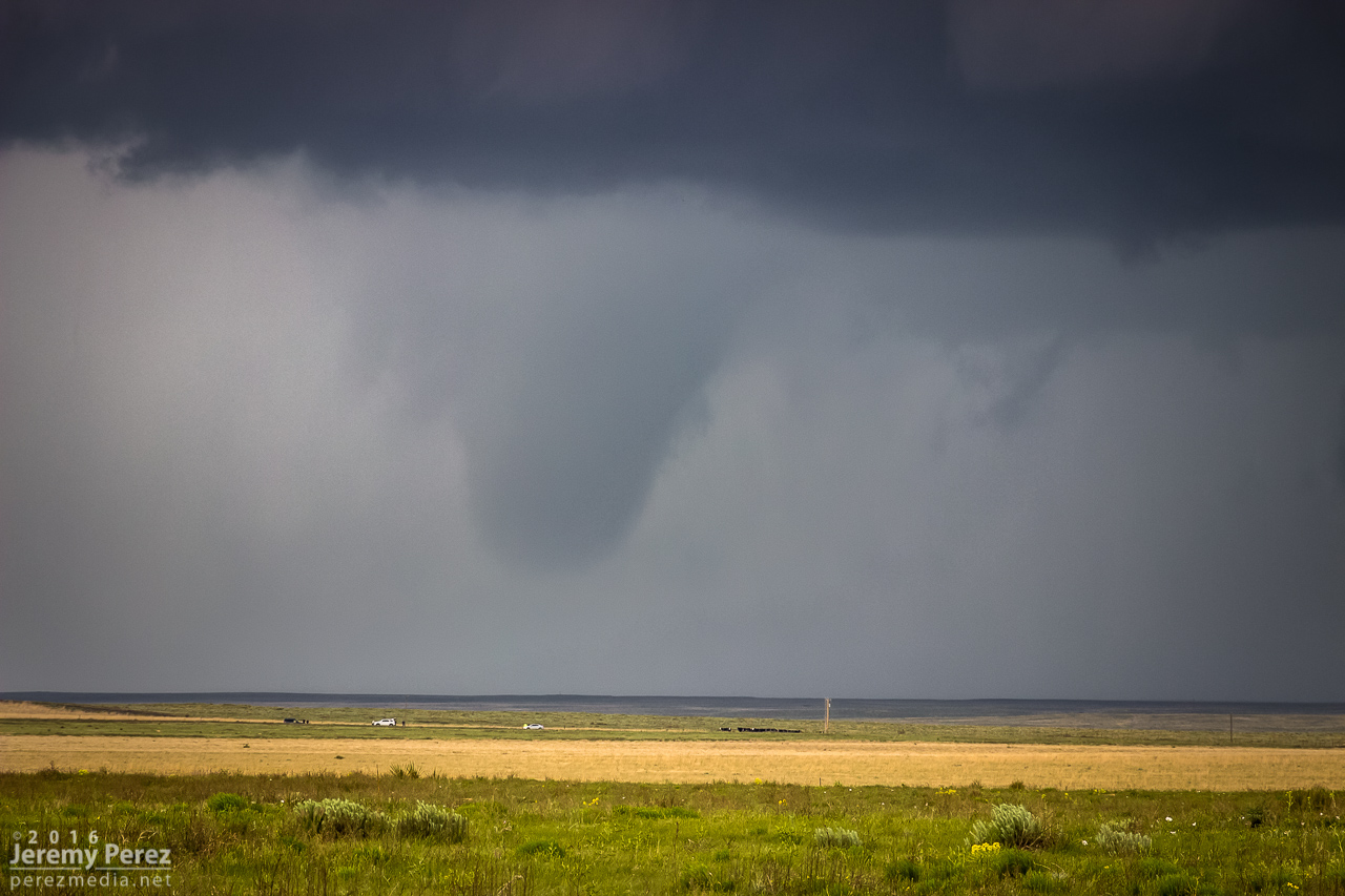
The herd eventually realized we had nothing worthy to offer and began a more active milling about as I think they realized that the storms were moving closer and something had to be done, even if that meant roaming in circles. The rotating wall cloud beneath the new base was beginning to tighten up and was headed straight for our location. A family exiting the road to the north let us know we were welcome to use their storm shelter if we needed. Which was very cool, but we assured them we were about to bail out of the way ourselves. Sure hope those cows didn’t sustain too much hail damage or otherwise.
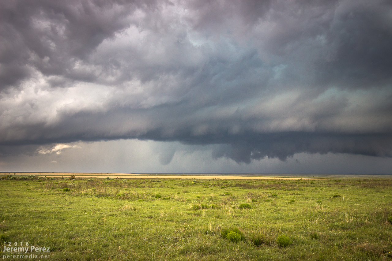
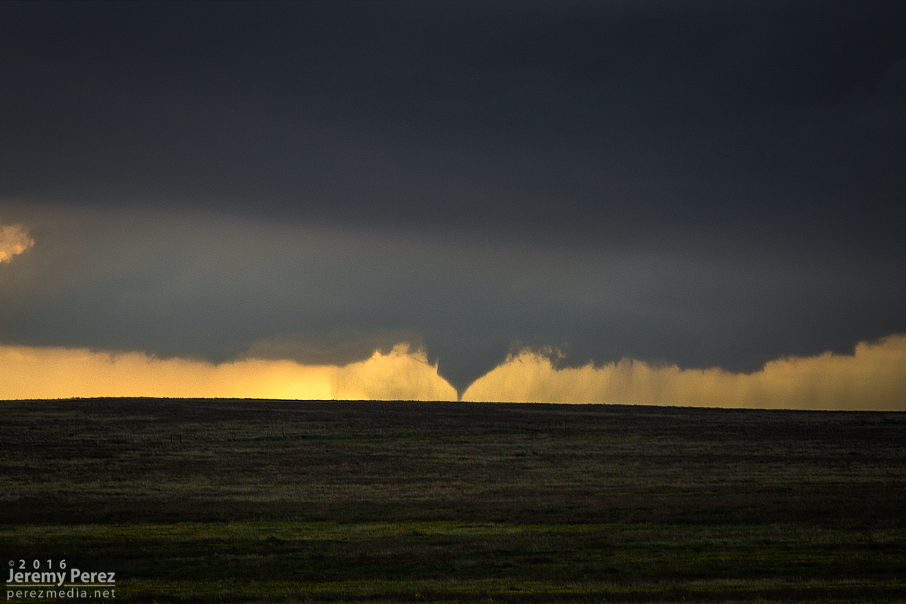
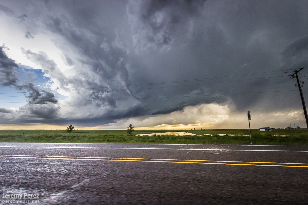
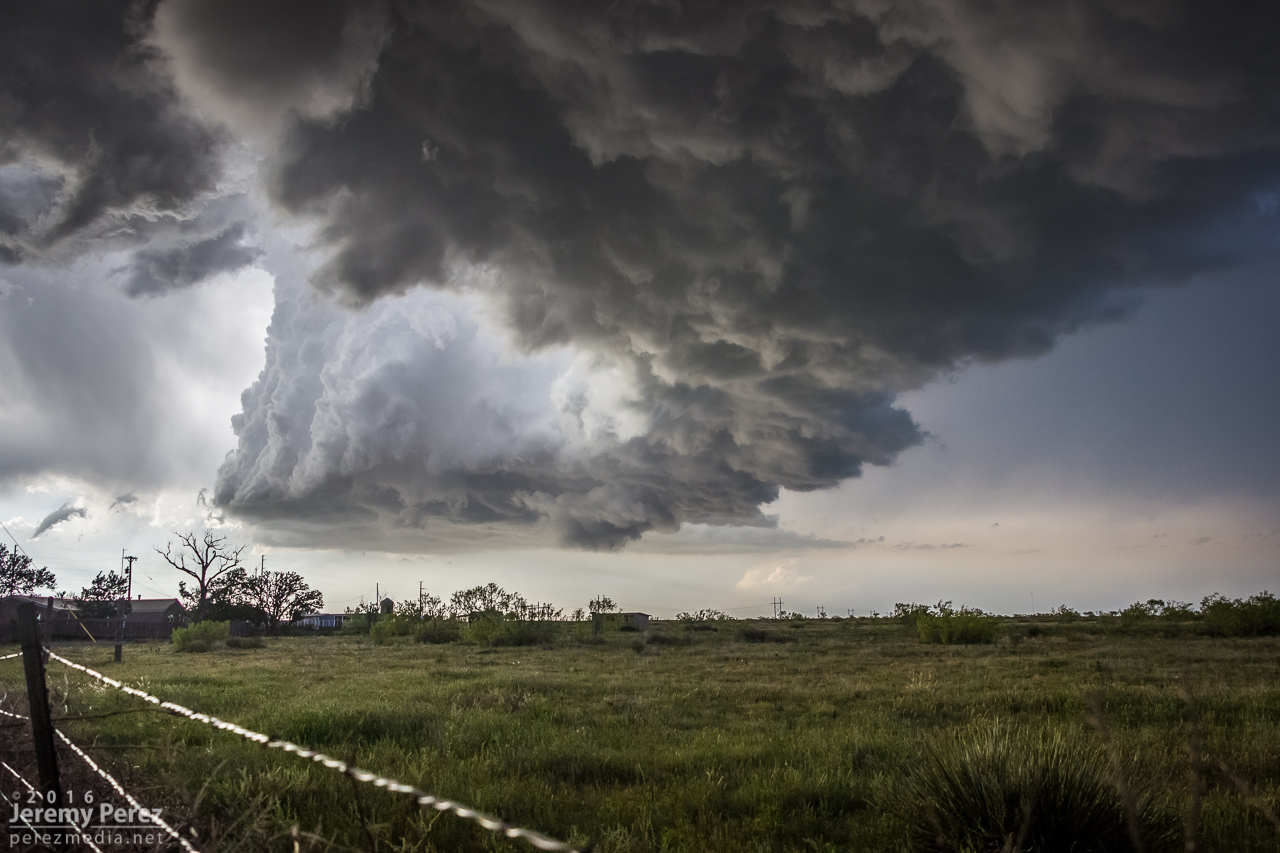
We packed up and quickly made our way about five miles further east to watch the new circulation cross the road. There was a distinctly tornadic looking shadow behind the RFD as it crossed, and I felt sure it must be a tornado. But reviewing video, the edges were rough and motion along its profile was not particularly fast. So I haven’t counted it as a tornado. The NOAA Storm Event Record for that moment in time plots a touchdown a couple miles further north than that structure. In my photos that plotted area is beneath a new area of circulation with no visible funnel, just a broad wall cloud/lowering. In any case, it was an impressive sight.
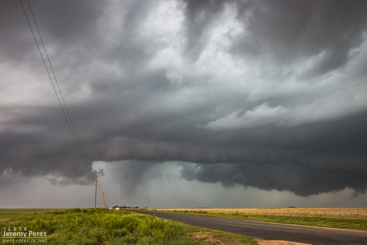
2157Z 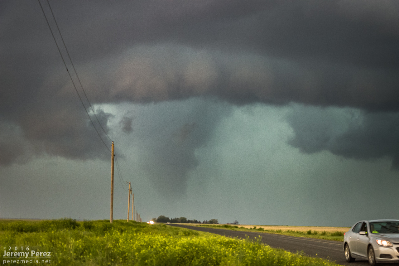
2159Z
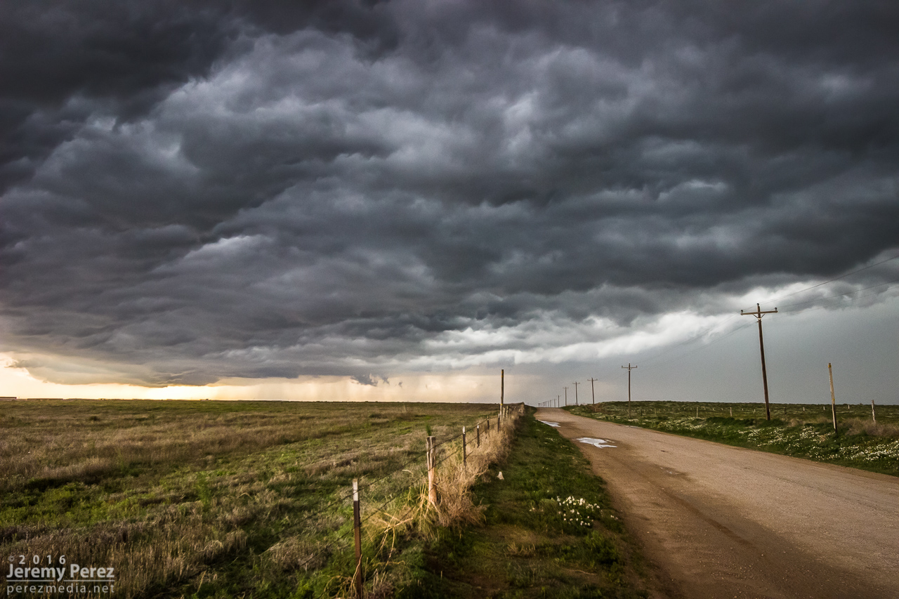
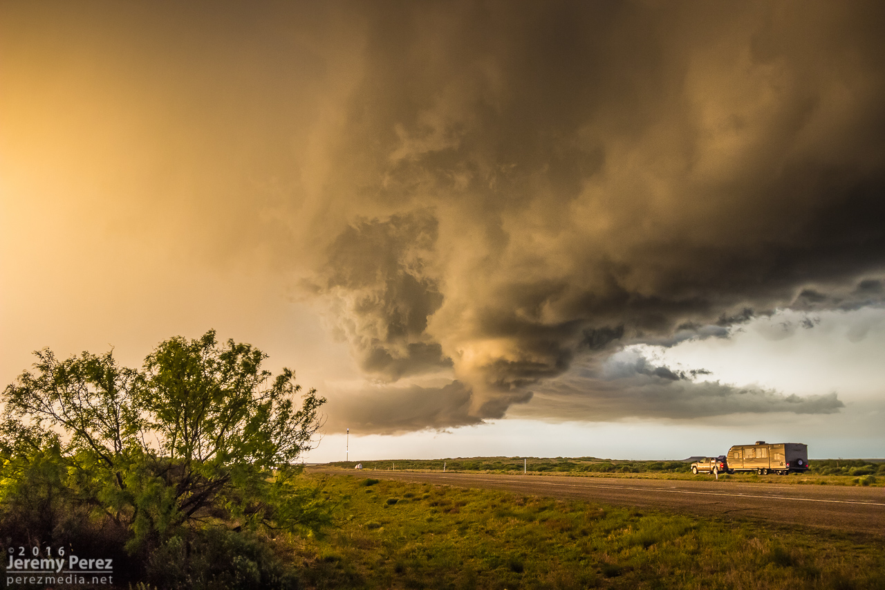
After that, we made our way east and south to get out of the way of the southeastward mesocyclone handoffs. The storm was becoming more HP at this point.
We kept moving south to flank new development to the west and suddenly noticed a sharp lowering on a distant updraft to our west. I pulled over barely in time to squeeze off a few shots and get some terrible video of another possible tornado. There was an intervening hill, so there was no way to tell from our location if it had ground contact. Damage was documented with this one though, about 16 miles south of Texline, and there is a NOAA Storm Events Database report for it.
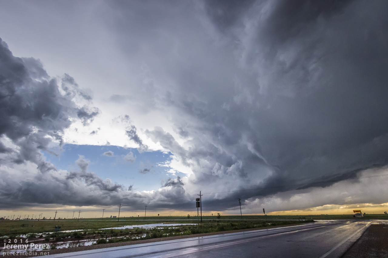
After that, we kept moving south, documenting moody landscapes along the way.
When we got to Dalhart, stopped trains and road construction led to a bit of a fluster trying to get through & out of town before an inbound storm accosted us with a barrage of hail. We finally threaded around that mess and found a way to Highway 87 to keep making our way south-southeast ahead of the storms.
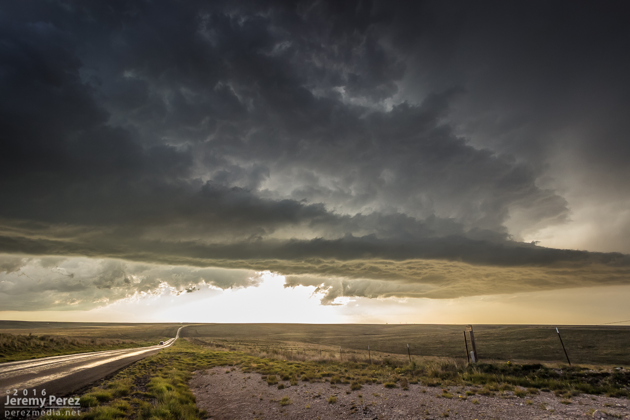
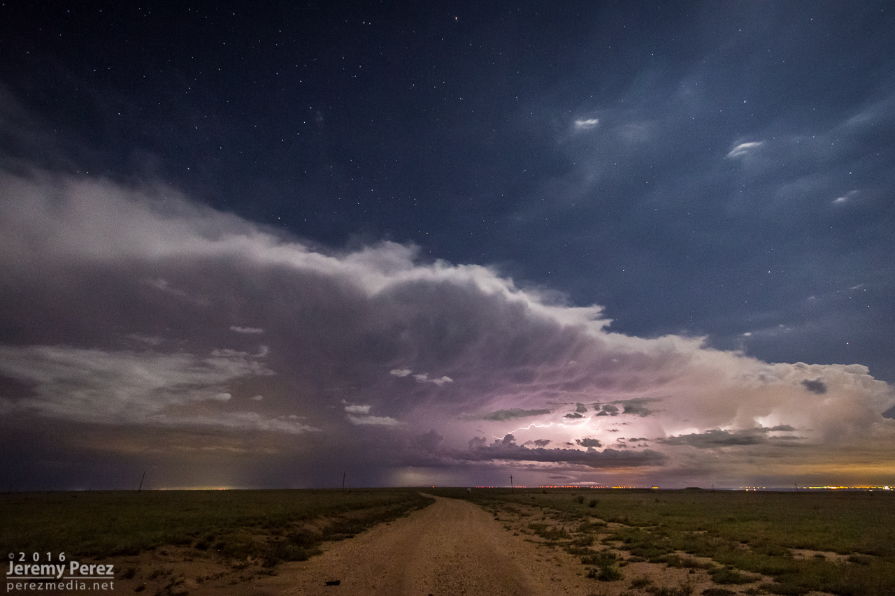
Further southeast, the supercell structure, and eventual outflow structure, were becoming awesome. There were some good times surfing that and grabbing shots along the way as the sun worked on peaking down below it.
0059Z 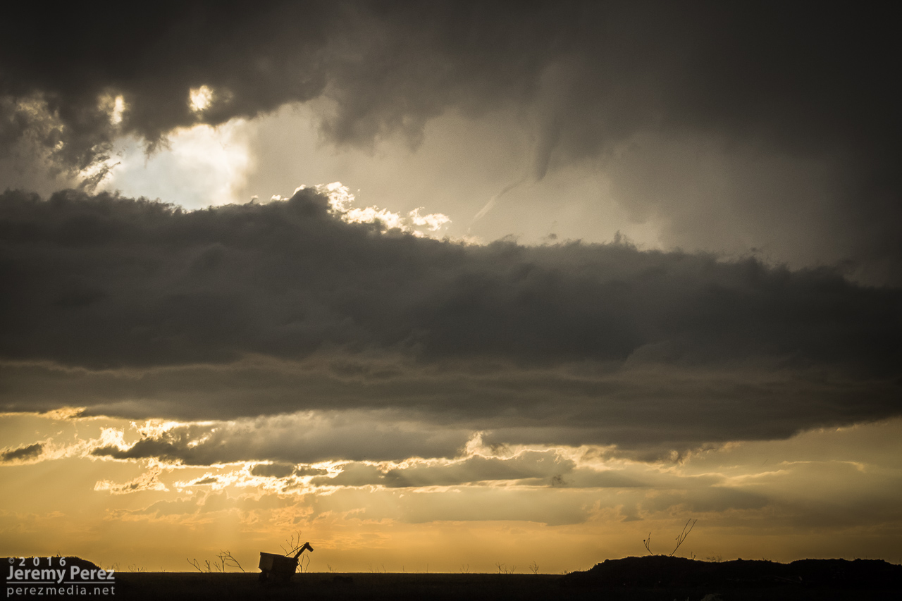
0113Z 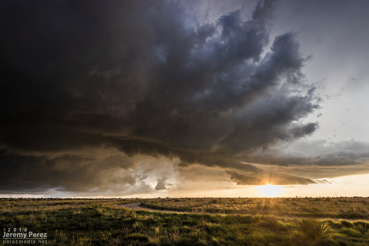
0123Z
About eight miles south of Masterson, I stopped to watch the cell pass by to our north. On radar, and visually, it looked like we had room to spare to stay out of the RFD, but a golf ball pinging off the hubcap sent me racing back into the car. Radar loop later showed that RFD stringing out and yo-yo-ing it’s way further south than I thought it would. As I backed us out of our parking spot, I could see what must’ve been baseballs bouncing up out of the grass. I can’t stand being in big hail, so stress levels skyrocketed as I hustled at enough speed to get out of it but without so much velocity as to make any big hail hits especially disastrous. We nabbed a few dimples out of that, but no broken glass thankfully.
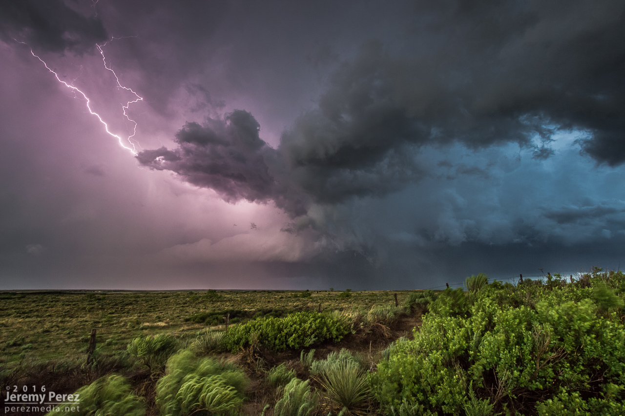
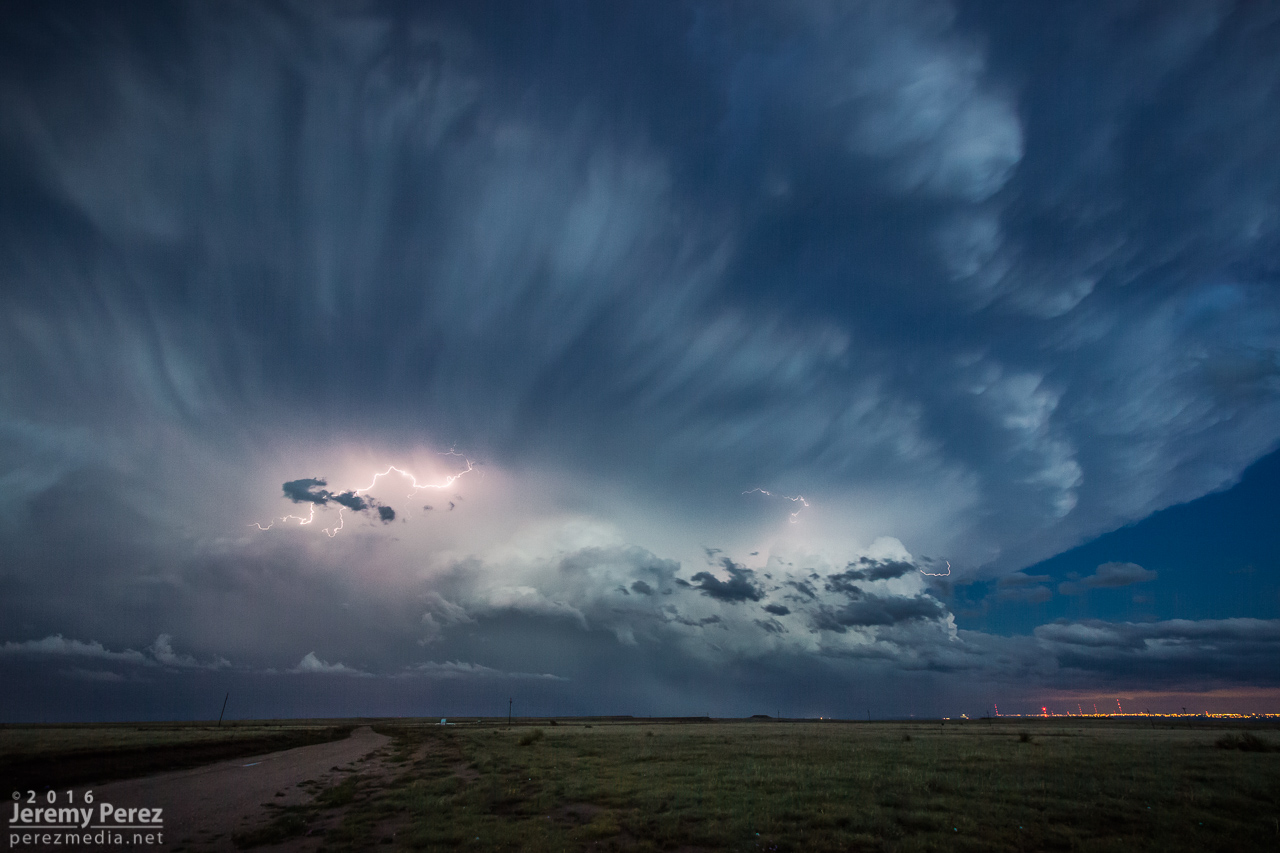
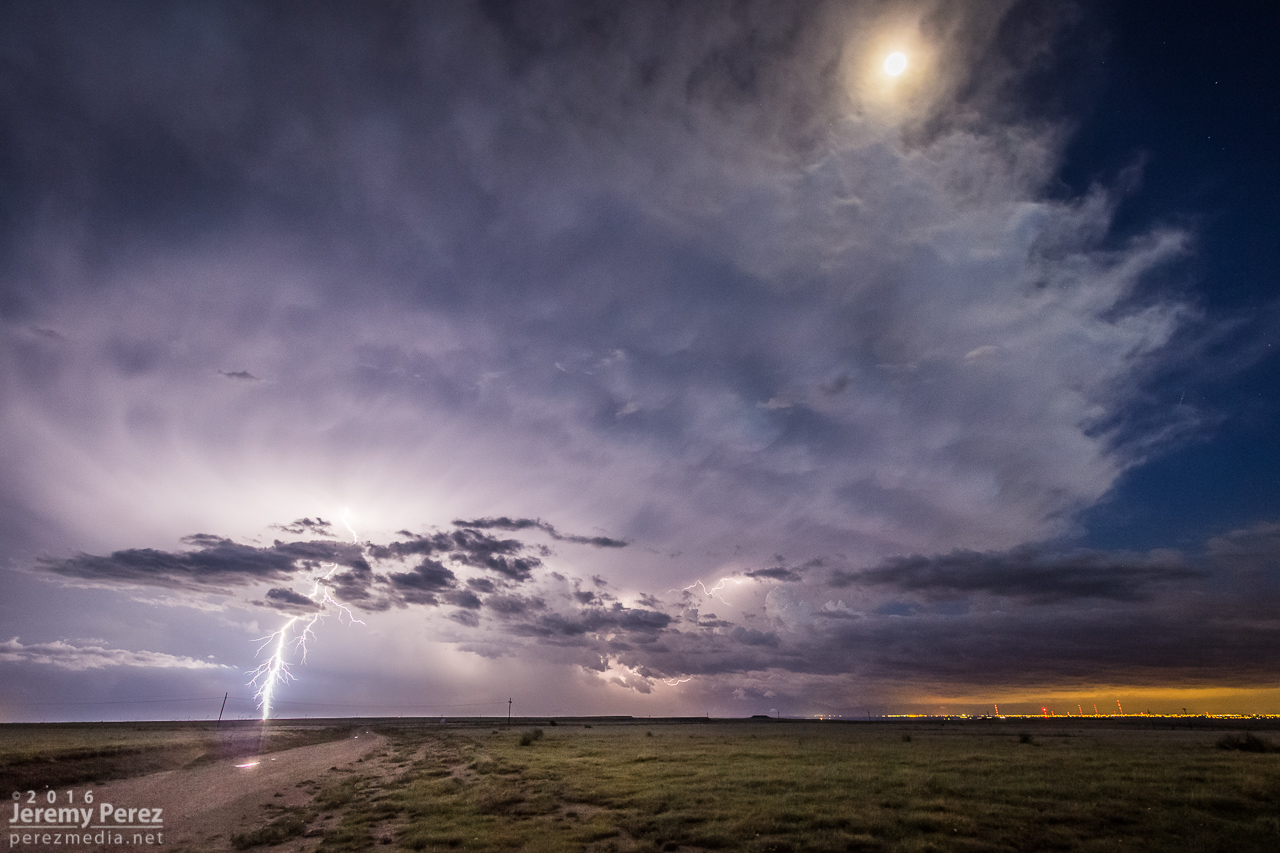
After that little run for cover, we found a couple good spots to watch it move off in the twilight as lightning colored the sky. This was definitely a fun chase with at least two tornadoes on two different storms to cap it off.
Community Comments
There are no comments on this post
Want to leave a comment? Join our community → OR Login →