

This tornado touched down at approximately 8:30 pm and tore a path through the wilderness southwest of the town of Kapuskasing. Along the tornado’s track, a massive swath of mature forest was decimated, however so remote was the touchdown that the damage did not come to the attention of Environment Canada officials until the following year. It was not until July of 2016 that the tornado was officially confirmed and given its EF2 rating.
The tornado tracked for 7.5 km to the northeast and, at its largest, was up to 300 metres wide. Thankfully it did not remain on the ground for longer, as it was on course that would have taken it directly through town.
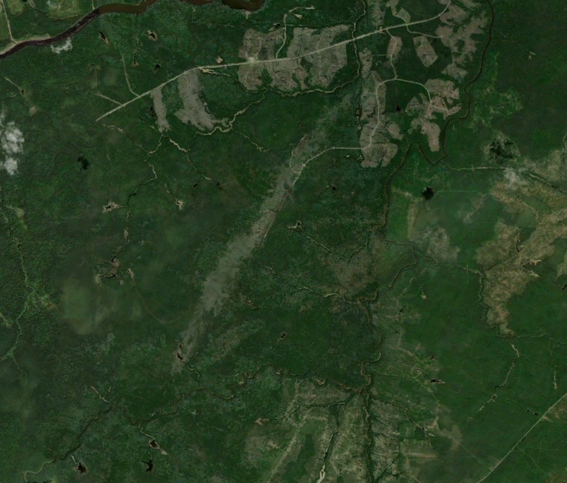
Figure 1 depicts the clearly visible scare left by this EF2 tornado southwest of Kapuskasing. The latitude/longitude data was extracted to create the path of this tornado.
This was one of two damaging tornadoes that touched down in the forest of Northern Ontario in the Kapuskasing area on August 19. The other:
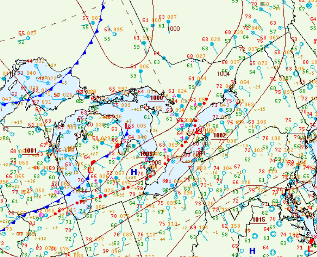
Figure 2 depicts the surface observations at 2:00 pm EDT, which shows a low pressure system over Lake Superior, a cold front extending over Lake Michigan and a warm front extending into northern Ontario. The warm front became the focus for intense thunderstorm activity in the afternoon/evening hours of August 19th, which ultimately led to two strong tornadoes.
Sources
NWS Weather Prediction Center Surface Analysis Archive. (2017). Surface analysis 18Z Wed Aug 19 2015. Retrieved from: https://www.wpc.ncep.noaa.gov/archives/web_pages/sfc/sfc_archive.php