

On its 3.5 kilometre long, 50 metre wide path, the tornado snapped and uprooted trees which caused subsequent damage to vehicles and cottages. The supercell storm and the tornado itself were exceptionally photogenic for Ontario; eyewitness photos show a classic cone tornado with a large debris cloud at the base of a large, bowled wall cloud and a well structured mesocyclone.
This was one of two tornadoes to touch down on July 28, 2002. The other was a powerful F2 tornado that caused extensive damage at Halfway Lake Provincial Park, injuring campers.
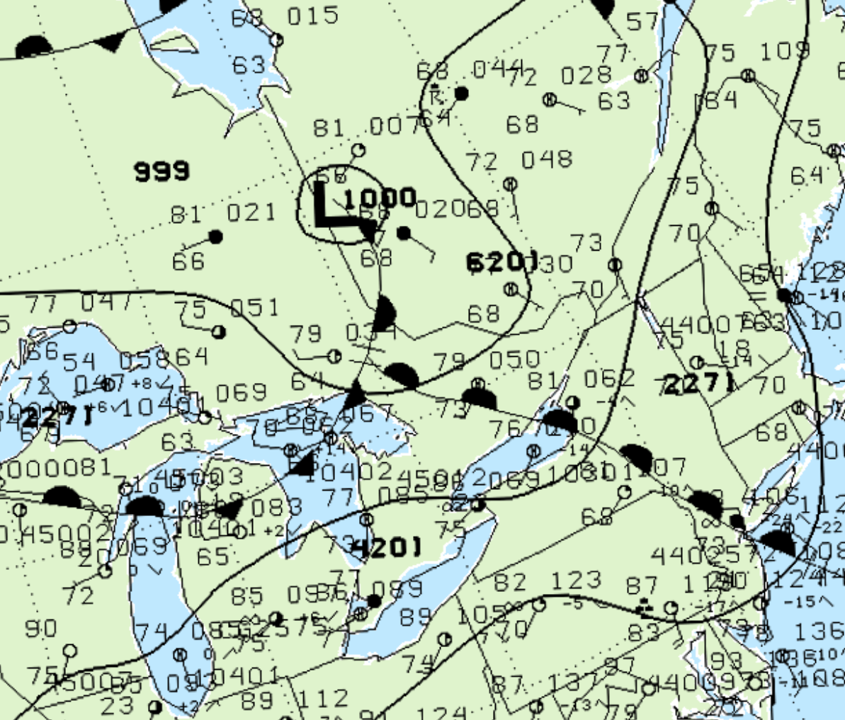
Figure 1 depicts the surface observations at 5:00 pm EDT, which shows a stationary front near North Bay and a warm front moving north into eastern Ontario. This warm front became the focus for intense thunderstorms in the afternoon hours of July 28th, which ultimately led to this F0 tornado.
According to Environment and Climate Change Canada (2018), an F0 tornado touched down at 4:30 pm EDT near Kasshabog Lake in Ontario. The path of the tornado was not documented by ECCC, but it had a maximum width of 50 metres. The tornado caused no fatalities or property damage, but injured six people.
Sources
NWS Weather Prediction Center Surface Analysis Archive. (2017). Surface analysis 21Z Sun Jul 28 2002. Retrieved from: https://www.wpc.ncep.noaa.gov/archives/web_pages/sfc/sfc_archive.php
Environment and Climate Change Canada Data. (2018). Canadian National Tornado Database: Verified Events (1980-2009) – Public. Retrieved from: http://donnees.ec.gc.ca/data/weather/products/canadian-national-tornado-database-verified-events-1980-2009-public/