

Published on
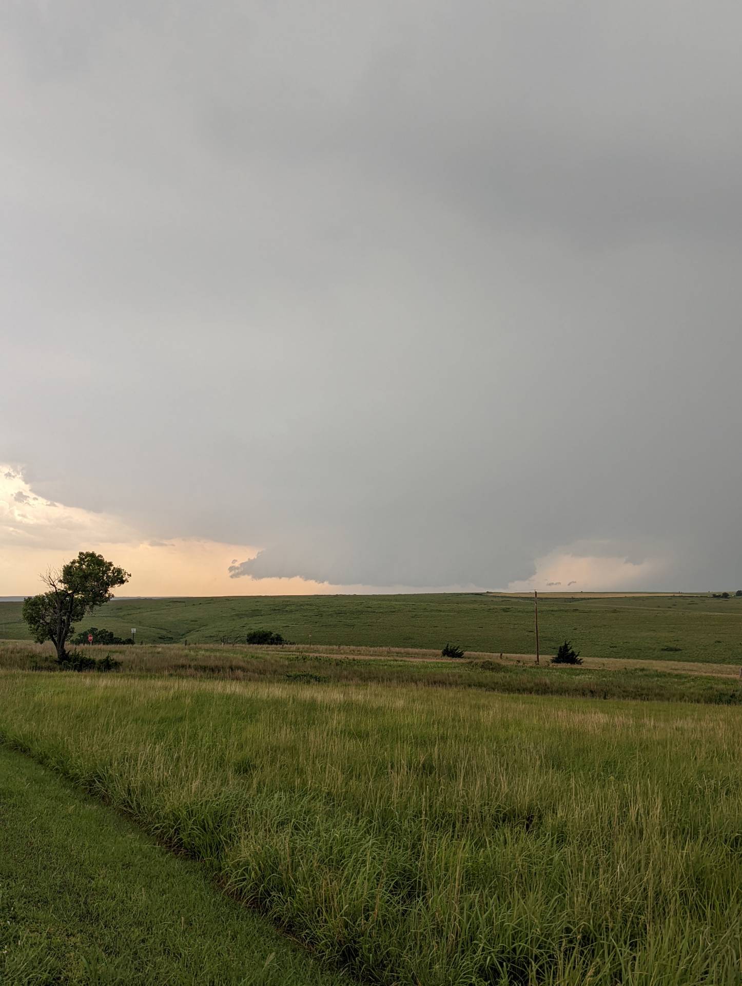
The day started off with an isolated supercell thunderstorm developing near Russell, Kansas. It was fairly classic looking initially, but became a high-precipitation supercell with time.
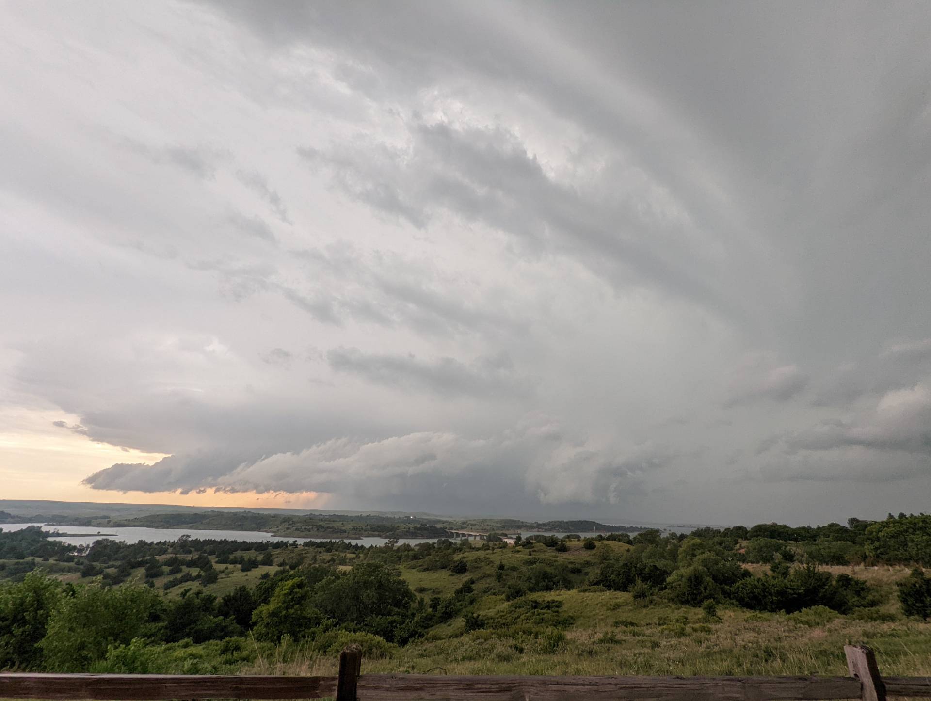
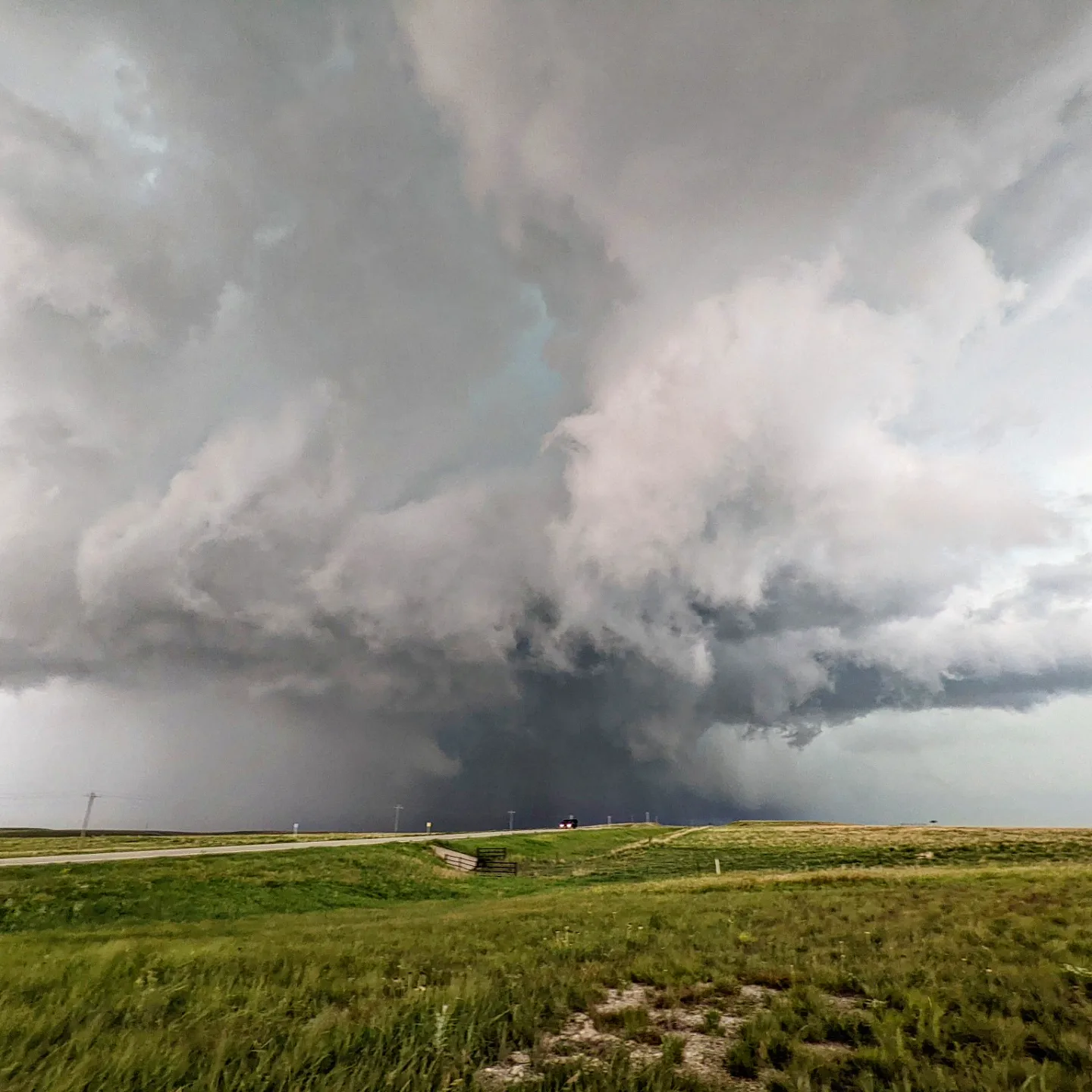
The storm slowly moved northeast, crossing over Wilson Lake. The photo below shows the view from atop a hill near the Wilson Lake dam as the storm approached.
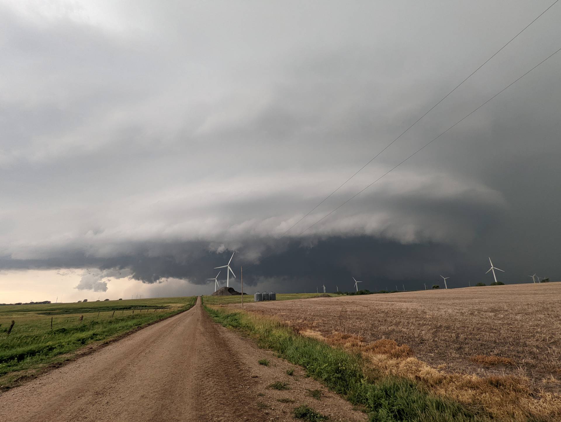
We positioned further east along I-70 about 6 miles east of Wilson. The storm had fantastic structure as it moved over the wind farm.
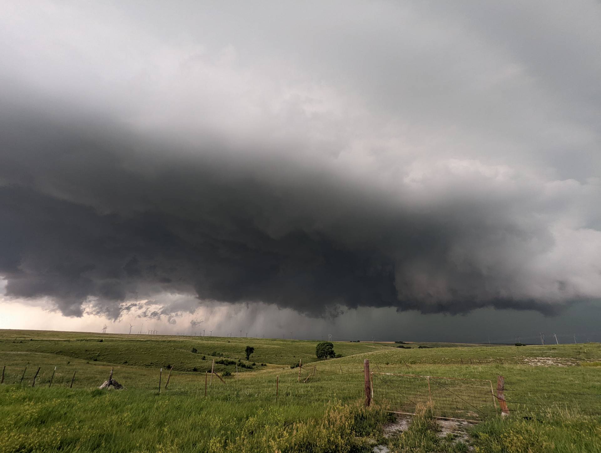
As it moved east, the views continued to amaze. Low hanging clouds, rotation, and stacked plates galore.
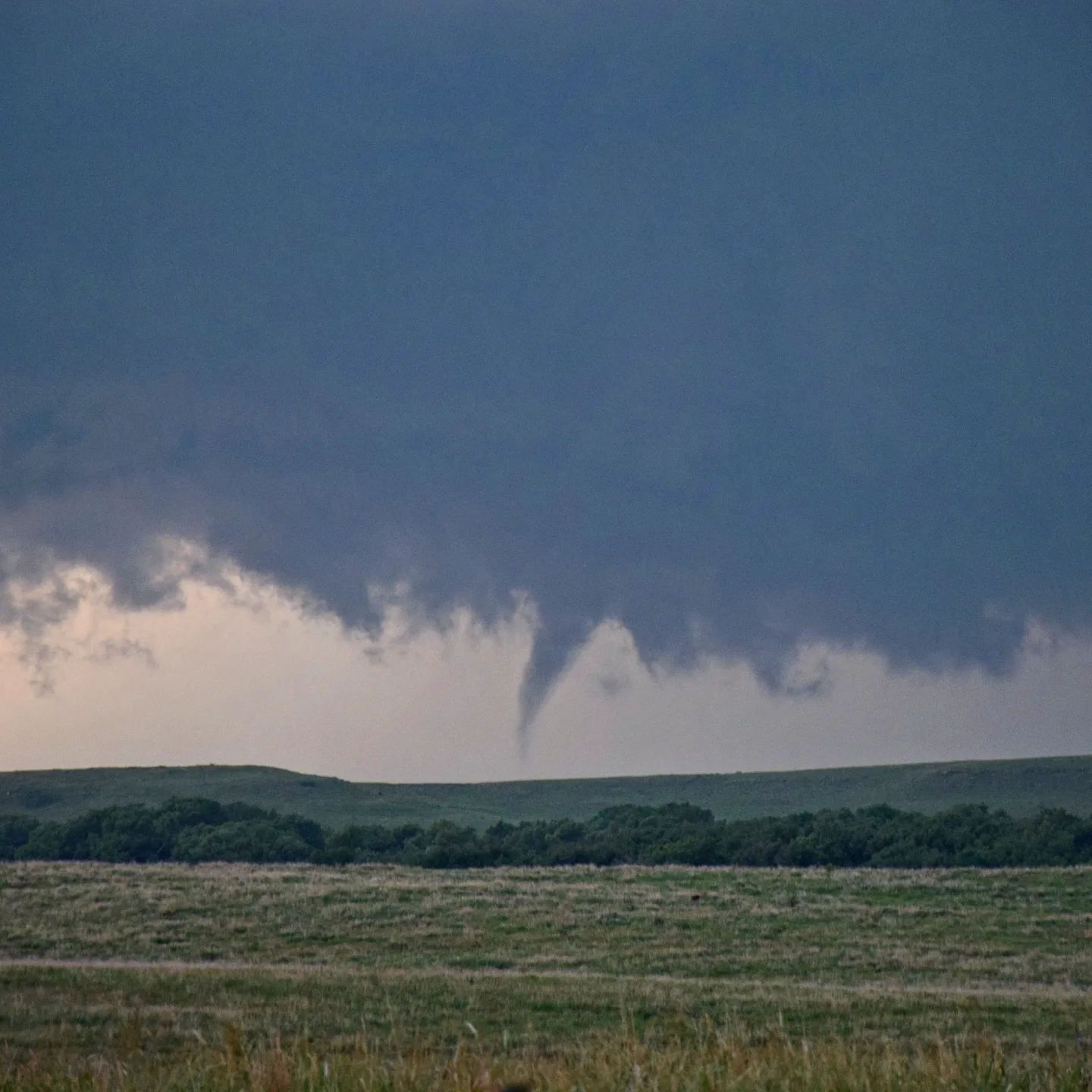
Finally, the elusive tornado developed. Closer to sunset, and further to the east near Glendale, a brief rope developed and lowered, spinning up a brief debris cloud over an open field.
Community Comments
There are no comments on this post
Want to leave a comment? Join our community → OR Login →