Hitting the road for today’s severe thunderstorm threat, follow along live at live.highwaysandhailstones.com #mbstorm
Just waiting to meet up with our Under The Meso Videographer, then heading south!
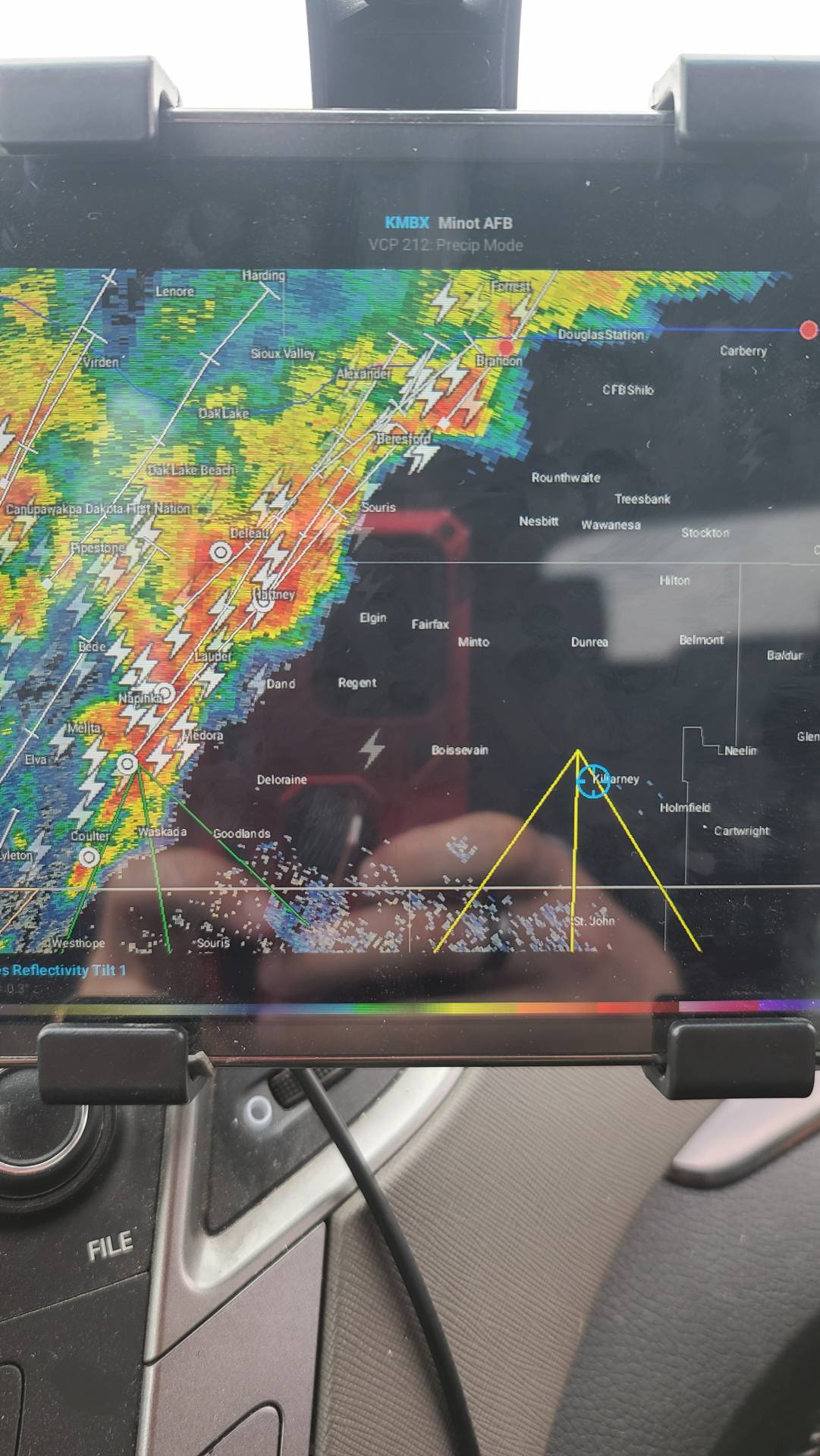
Currently sitting near Killarney, there is a line of sub severe thunderstorms to our west stretching from waskada up to Brandon, we are expecting this line to keep moving NE with hopefully some new development on the SE end #MBStorm 3:40 PM CDT Monday 09 August 2021
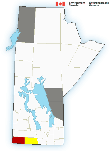
Severe thunderstorm warning in effect for:
Mun. of Brenda-Waskada incl. Medora and Goodlands
Mun. of Grassland incl. Hartney and Minto
Mun. of Two Borders incl. Melita Coulter and Tilston
Environment Canada meteorologists are tracking a severe thunderstorm capable of producing quarter-sized hail and wind gusts in excess of 90 km/h.
At 2:39 PM CDT Doppler RADAR indicated that this severe thunderstorm was located near Coulter and was moving toward the northeast at 60 km/h.
Large hail can damage property and cause injury. Strong wind gusts can toss loose objects, damage weak buildings, break branches off trees and overturn large vehicles. Lightning kills and injures Canadians every year. Remember, when thunder roars, go indoors!
Please continue to monitor alerts and forecasts issued by Environment Canada. To report severe weather, send an email to MBstorm@canada.ca or tweet reports using #MBStorm.
3:42 PM CDT Monday 09 August 2021
Severe thunderstorm watch in effect for:
Mun. of Boissevain-Morton incl. Turtle Mtn Prov. Park
Mun. of Brenda-Waskada incl. Medora and Goodlands
Mun. of Deloraine-Winchester
Mun. of Grassland incl. Hartney and Minto
Mun. of Two Borders incl. Melita Coulter and Tilston
Cartwright-Roblin Mun. incl. Mather
Mun. of Killarney-Turtle Mountain
Mun. of Lorne incl. Notre Dame and Swan Lake
Mun. of Louise incl. Pilot Mound and Crystal City
Mun. of Pembina incl. Manitou La Rivière and Snowflake
R.M. of Argyle incl. Baldur Glenora and Greenway
R.M. of Prairie Lakes incl. Margaret Ninette and Belmont
Persons in or near this area should be on the lookout for adverse weather conditions and take necessary safety precautions. Watch for updated statements.
Please refer to the latest public forecasts for further details and continue to monitor the situation through your local radio and television stations or Weatheradio
Looks like I got #2021’d again, calling it a night
Above is our live chase log from this chase, This day was looking very good for Manitoba, The models had been agreeing for days, And I was actually very confident we would find ourselves under a severe thunderstorm. However, some early morning convection that moved through the province stabilized the atmosphere a bit and left behind overcast skies, which prevented daytime heating, Not allowing us to get up to the convective temperatures that were forecast, However, Northern North Dakota did not experience this early morning convection, allowing them to reach convective temperatures, and develop some severe thunderstorms, We sat near Crystal City as these storms developed south of the border, Hoping and Praying that they would move up into Canada, Unfortunately, they began moving east instead of Northeast, Quickly becoming Tornado Warned, We were a mere 50 miles North of one of the tornado warnings, the only thing stopping us from being there was that darn International Border being closed! Leaving us hopeless, under overcast skies with a few lightning strikes and rain…. 2021 Strikes yet again!


Community Comments
There are no comments on this post
Want to leave a comment? Join our community → OR Login →