

Touching down just north of Orillia near Highway 11, this EF0 tornado was witnessed by many and was thoroughly documented in photos and on video. It is often referred to as The Target Tornado since many photos and videos show it passing just behind that store in town.
As its parent supercell approached the highway from the west, a funnel cloud developed at the base of a large, bowl-shaped wall cloud. Motorists watched and filmed as vortices began spinning below, then condensed into a single column and became a cone tornado. It was on the ground for several minutes and caused minor damage to trees along its path.
This was one of five tornadoes that touched down on August 7, 2013. The others:
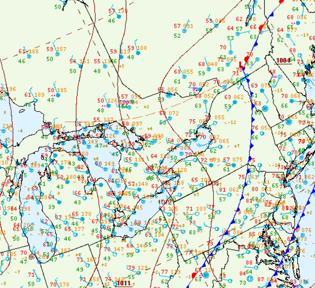
Figure 1 depicts the surface observations at 5:00 pm EDT, which shows a trough of low pressure in central Ontario behind a cold from over the northeastern United States. This trough promoted convergence and thunderstorm development in the afternoon and evening hours of August 7th, which led to a tornado outbreak across central Ontario.
Sources
NWS Weather Prediction Center Surface Analysis Archive. (2017). Surface analysis 21Z Tue Aug 13 2013. Retrieved from: https://www.wpc.ncep.noaa.gov/archives/web_pages/sfc/sfc_archive.php