

Published on
The setup for May 28th looked to offer a two part show. First would be some early terrain driven storms lofting off the Davis Mountains, south of Fort Stockton, and then storms firing off the dryline and interacting with an outflow boundary north of Fort Stockton. Not wanting to miss a thing, I decided to play for both.
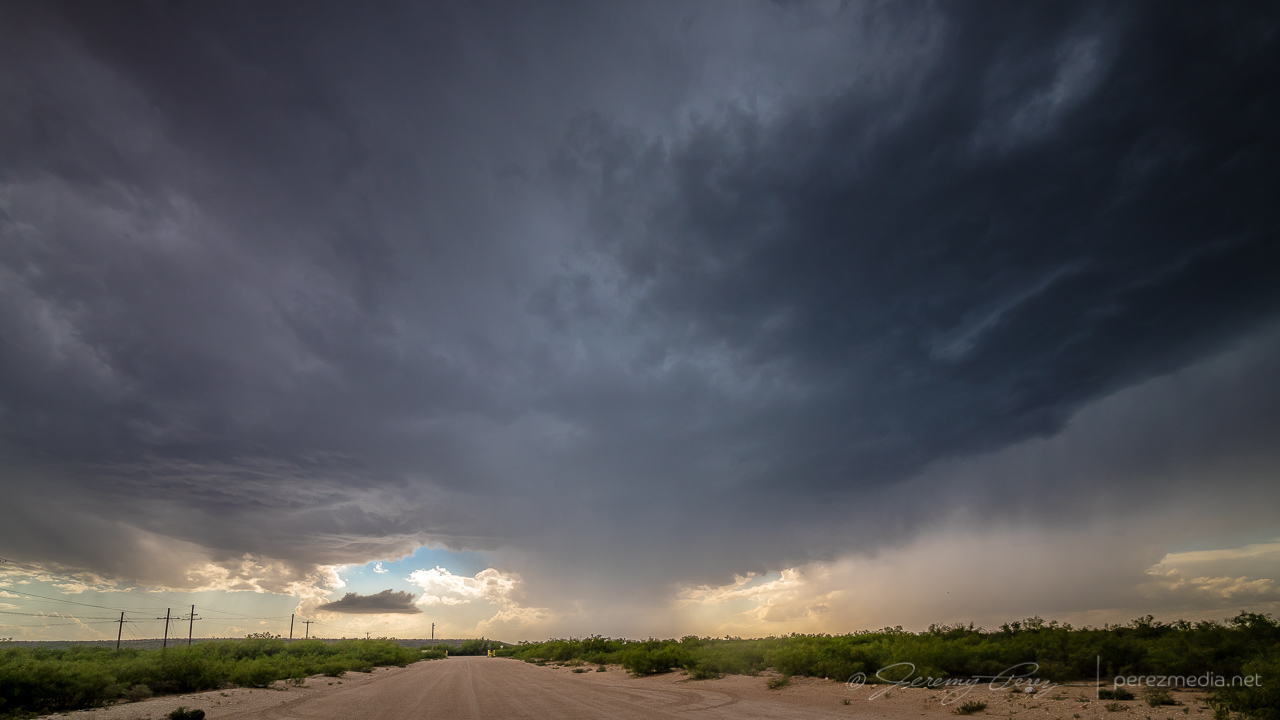
I headed southeast of Fort Stockton on Highway 285. However, I got too late of a start to catch the one semi decent storm in that target area. By the time I got down to Highway 90 between Sanderson and Marathon, that storm had passed its peak and was headed south and out of reach. Realizing the sadness of that intercept and seeing convection starting to fire to my north, I started my defeat retreat, back north on Highway 385. It was extremely frustrating to realize I had gone roughly 120 miles out of my way for the following shot:
Not that I dislike that shot. But 120 miles? Yikes. There was still the second play to go for, and I worked my way north of Fort Stockton to find a likely cell and see if it would interact in meaningful ways with the outflow boundary to the north. The storm that I started tracking was simultaneously spitting out left splits and making a mess of the surrounding environment.
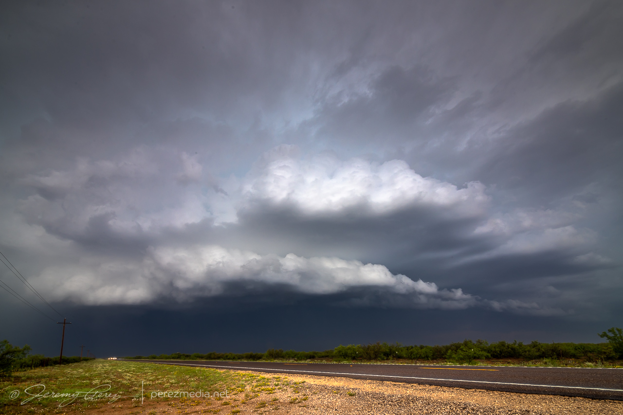
About this time, I finally decided to attach and secure my moon roof hail shield. Things were looking messy and I figured I might wind up in a core, so on it went. After that, I worked northeast to see what this thing would do when it hit the boundary. Just before hitting it, it cast off another left split that collided with another cell moving southeast along the boundary and then all of them tangled up and lodged on the boundary. And it was a mess — couplets sprouting up all over in inside. I saw a bit of shelfy structure from my vantage on the south end.
Other chasers wound up reporting a landspout up along the northern part of that mess, which by that point was the stronger area anyway. Road angles were no good for taking the short path to that other end without core adventures, so I backed off to the west and found another way north, just in case I could get some sort of clear view of things. That view never materialized and outflow from the mass of convection was pretty intense as I made my way further north.
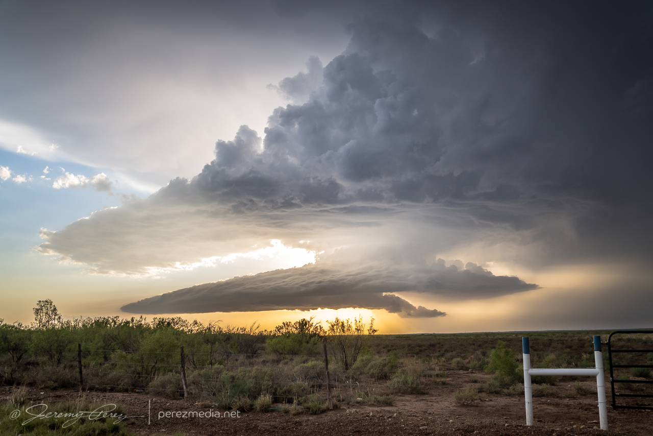
Fortunately, by the time I was near Monahans and Interstate 20, another cell that had formed on the northwest end of the outflow boundary in New Mexico had now strengthened significantly and was meshing gears southeast along the boundary. I hopped on I-20 and headed west as the storm’s base began to materialize on the horizon. It looked great from a distance: dark and heavy and uncluttered by precipitation. By the time I exited at Pyote, it was an awesome sight to behold, lofting unspoiled air out of the boundary layer in ruffled, spiraling swoops. I started looking for a vantage amid the sulfurous, garlicky odors permeating the entire area, and finally found a spot a couple miles south.
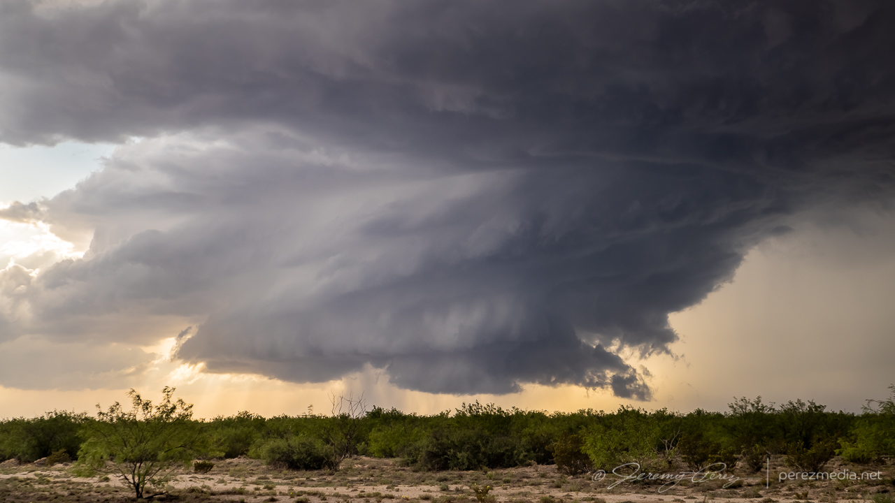
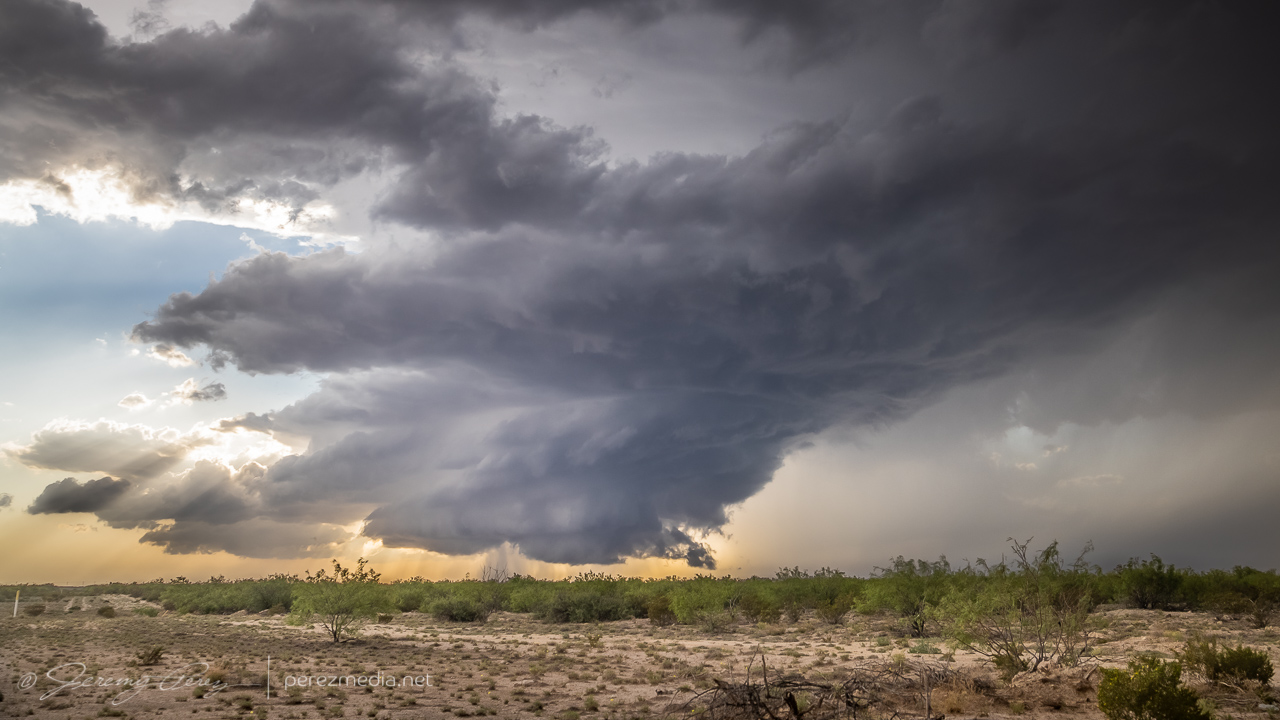
Strong, frequent bolts from the anvil kept me inside the car the entire time, so I couldn’t work out more interesting compositions. It seemed a wonder that all those strikes weren’t igniting the heavy fumes in the air into an Independence Day alien annihilator beam scene. But we avoided that crisis somehow. Meanwhile, the updraft continued moving straight for me and was a majestic thing to behold as it spiraled and churned nearer.
0044Z 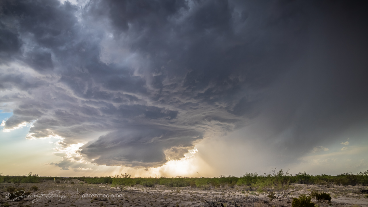
0046Z
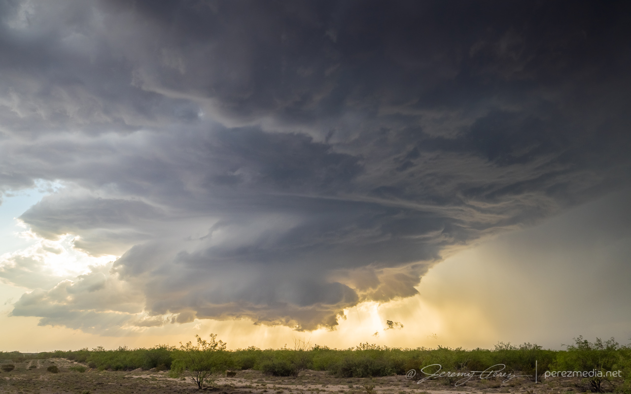
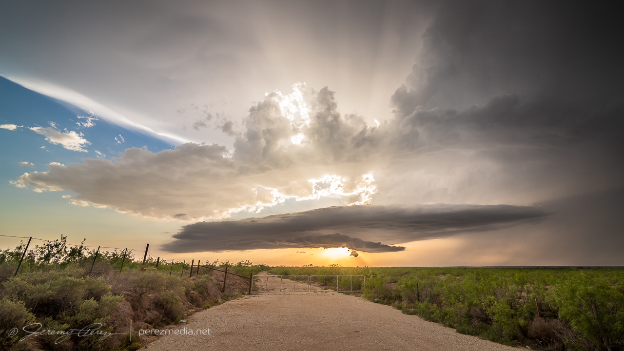
Gradually, it started to encounter overturned air from the left splits that earlier cell had been tossing into the area. The base started to lift and smooth out as stable intrusions began peeling it open.
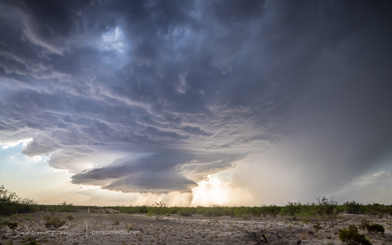
The elevated and rooted bases finally separated into Cylon Base Ship formation as the storm entered the vanishing phase.
0122Z 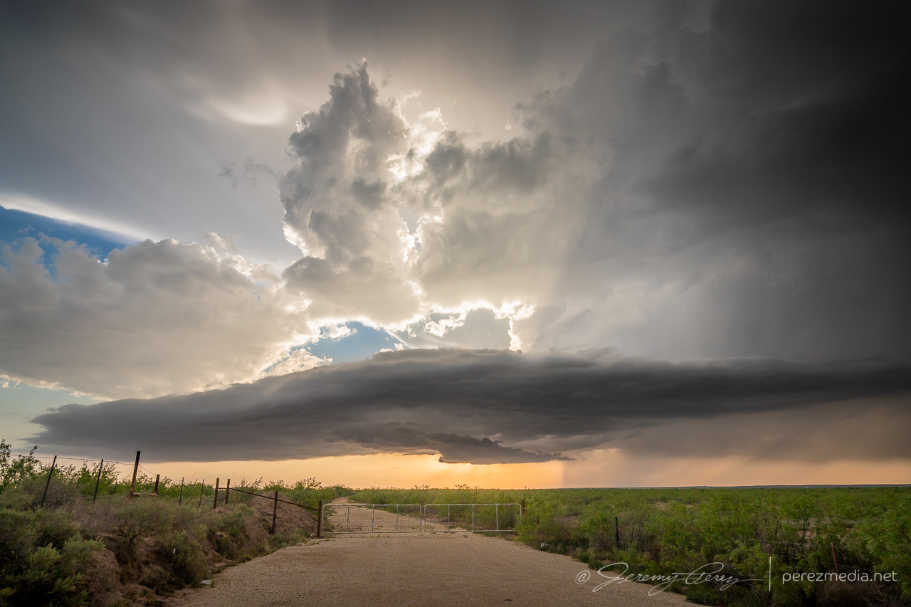
0125Z
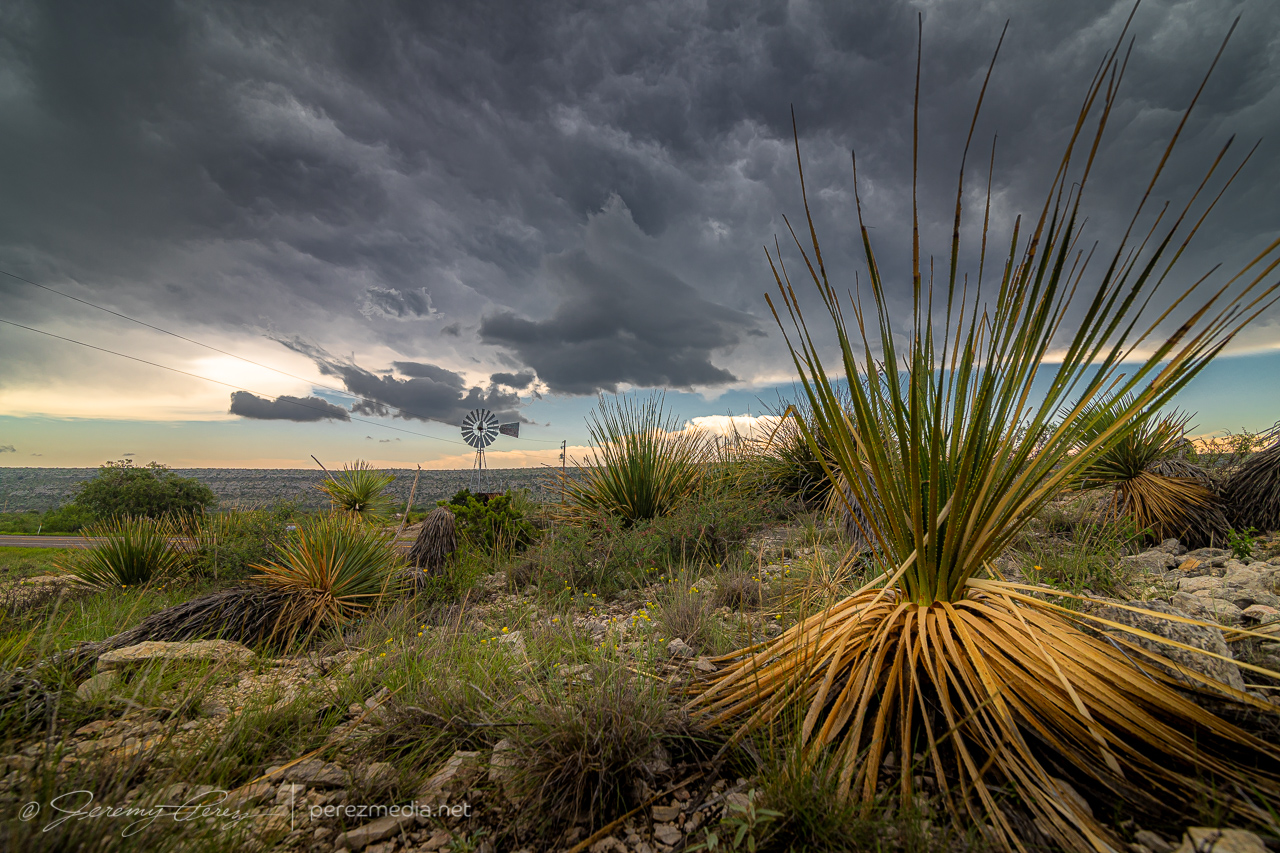
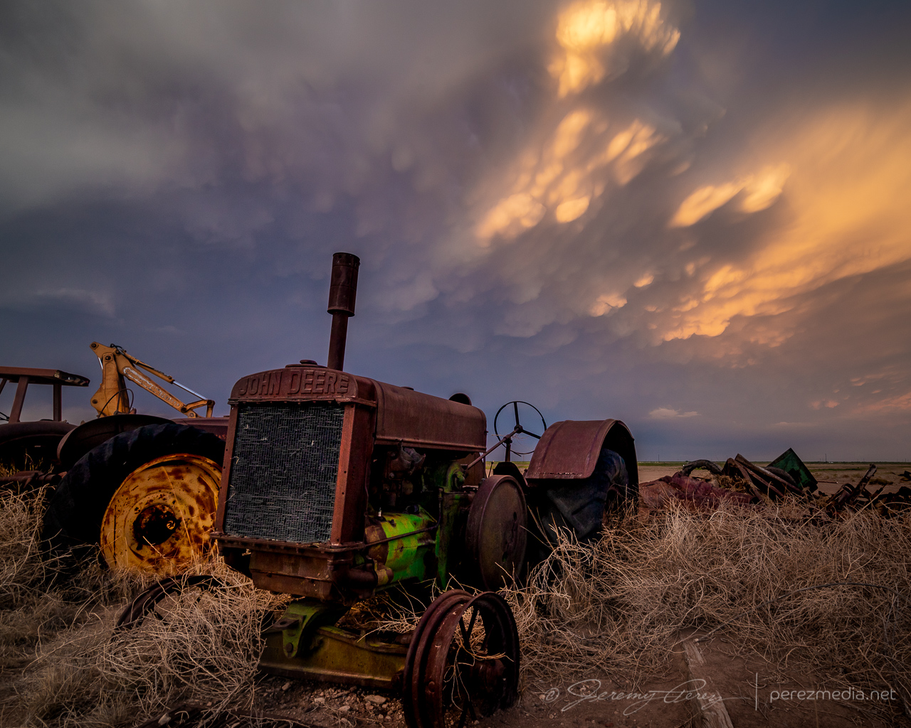
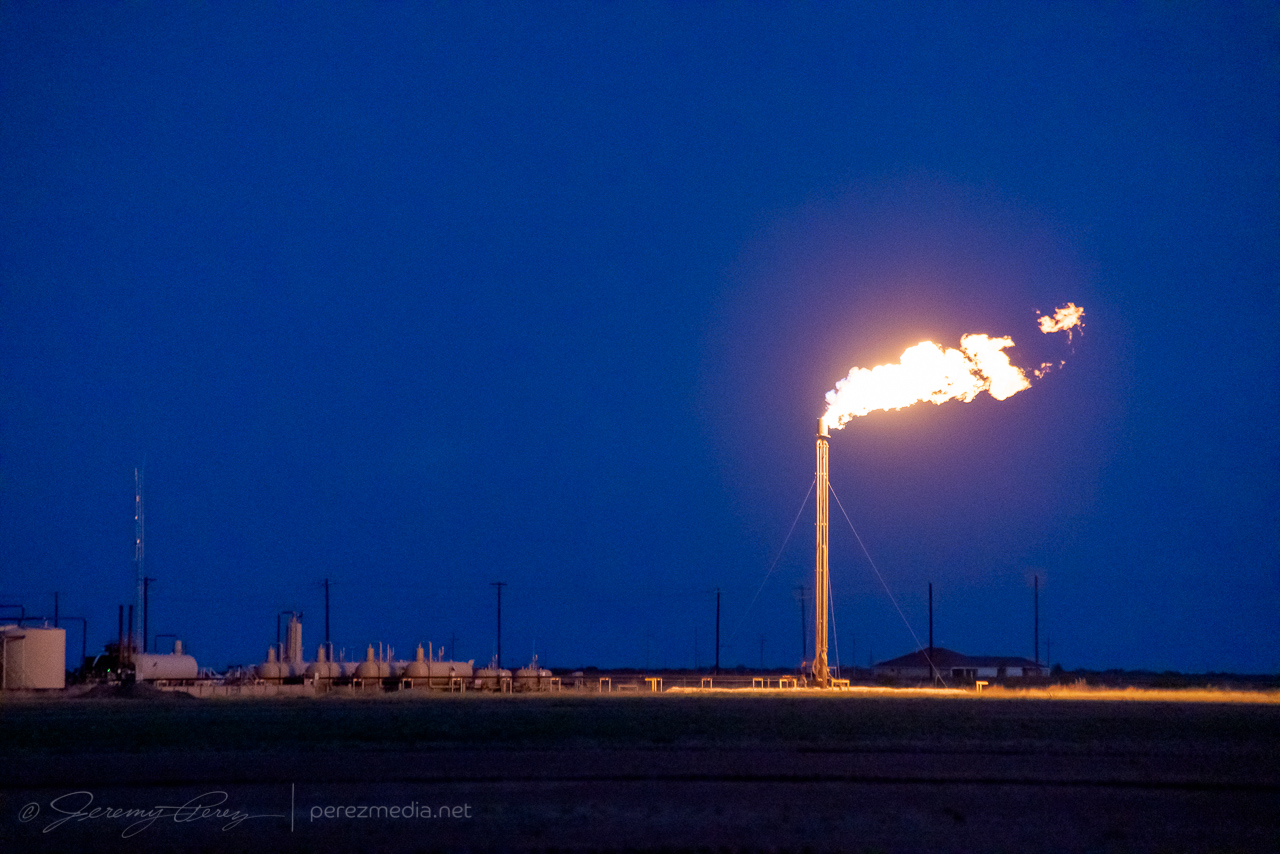
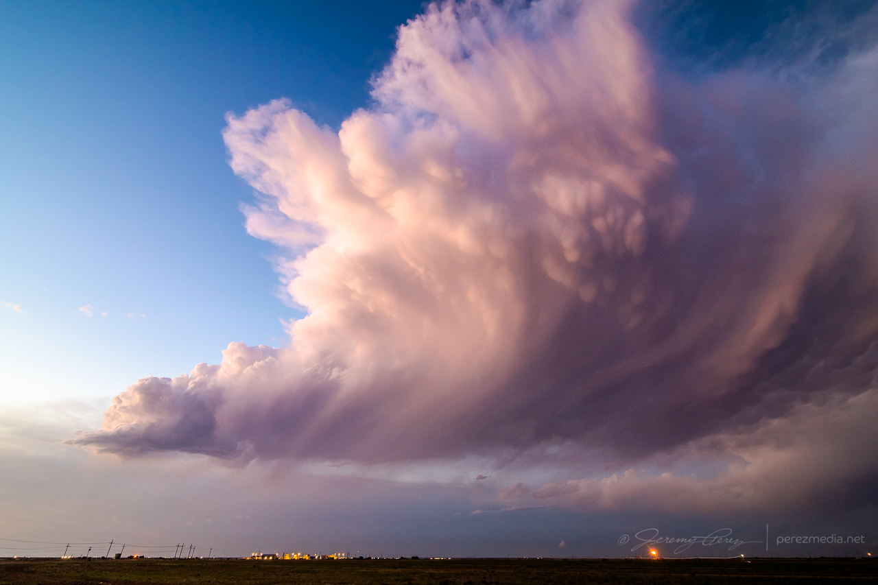
I was very happy with how that turned out, but now it was time for a possible sunset play. I headed further south looking for some sort of scenery to pair with the approaching mammatus display. But mile after mile of paved and unpaved road yielded nothing but ugly infrastructure — masses of power lines, gas pipes, pump jacks, trashy sheds and so on. And none of it was inspiring me, it just looked all ugly. Finally, somehow, I wound into an area that wasn’t infested with power lines and saw a dirt field with some old, rusted farm equipment gathered into a John Deer colony. There weren’t any dwellings or outbuildings nearby, so I hoped my presence wouldn’t cause aggravation. I drove down the access road and started snagging images as the sun clipped the anvil and mammatus bulbs.
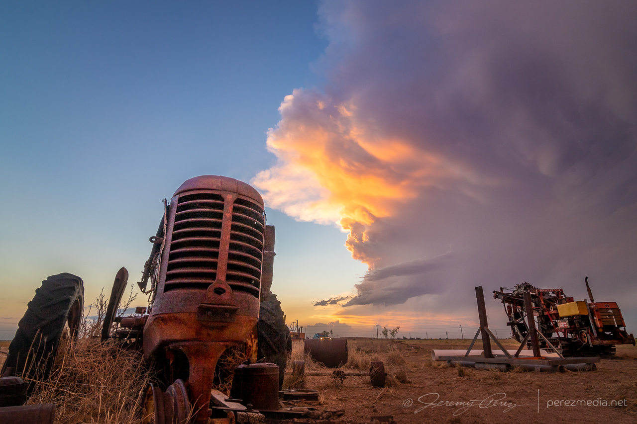
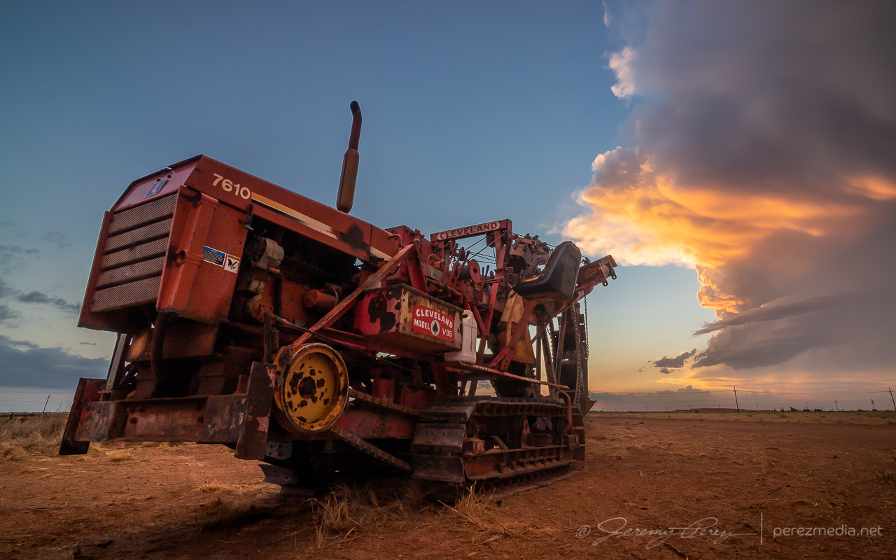
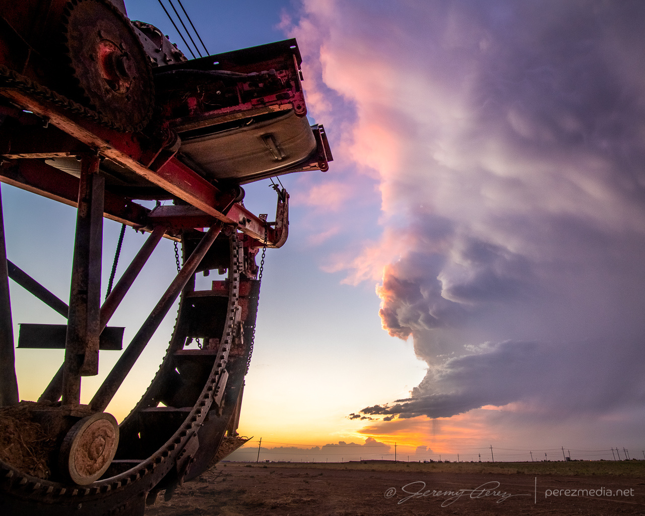
By the time I was done, my withered storm was just a feathery mass drifting off to the east. I called the chase at that point and looked forward to a long drive and some more fun in Colorado the next day.
Community Comments
There are no comments on this post
Want to leave a comment? Join our community → OR Login →