

Published on
The target for the 29th was very singular — looking for a storm of the day to develop off the higher terrain of southeast Colorado as it feeds off upslope flow, strengthening as it moves southward. I made the 400 mile trip up the Texas Panhandle after a much needed hotel stay in Seminole. By the time I reached Kim, Colorado, the storm was gathering strength, but still had a long way to go.
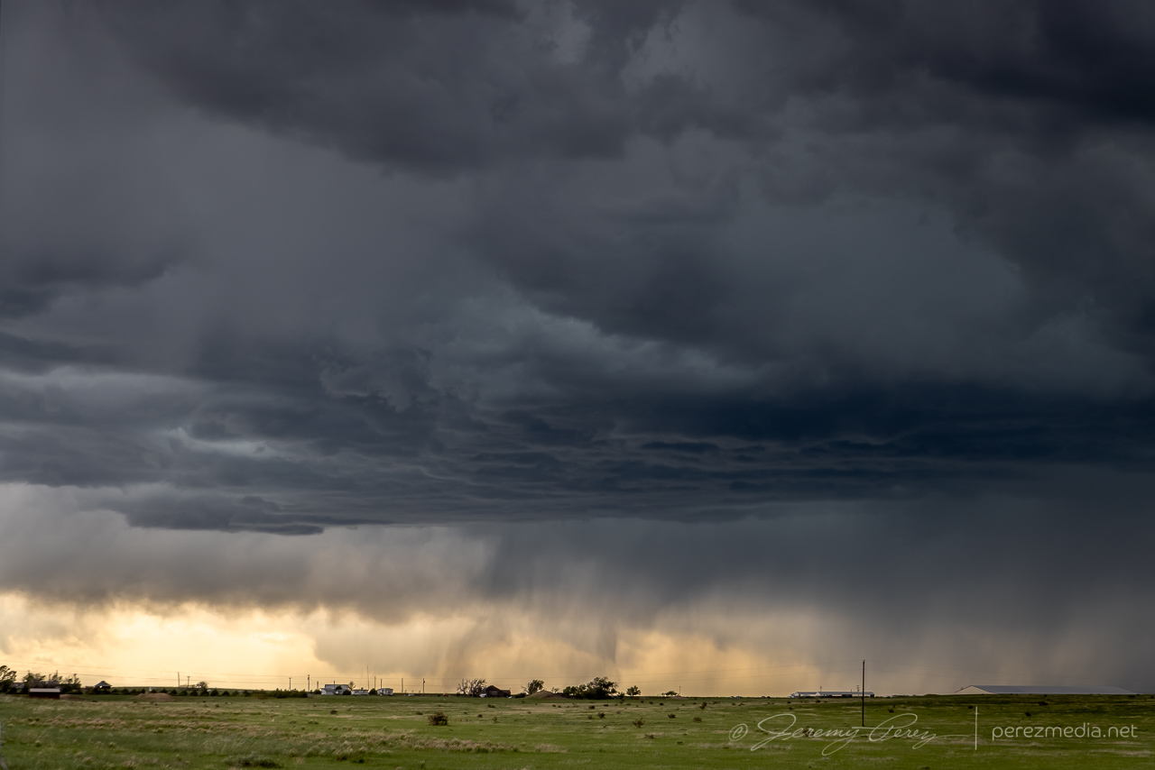
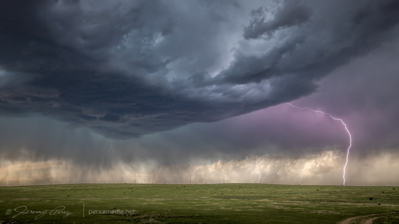
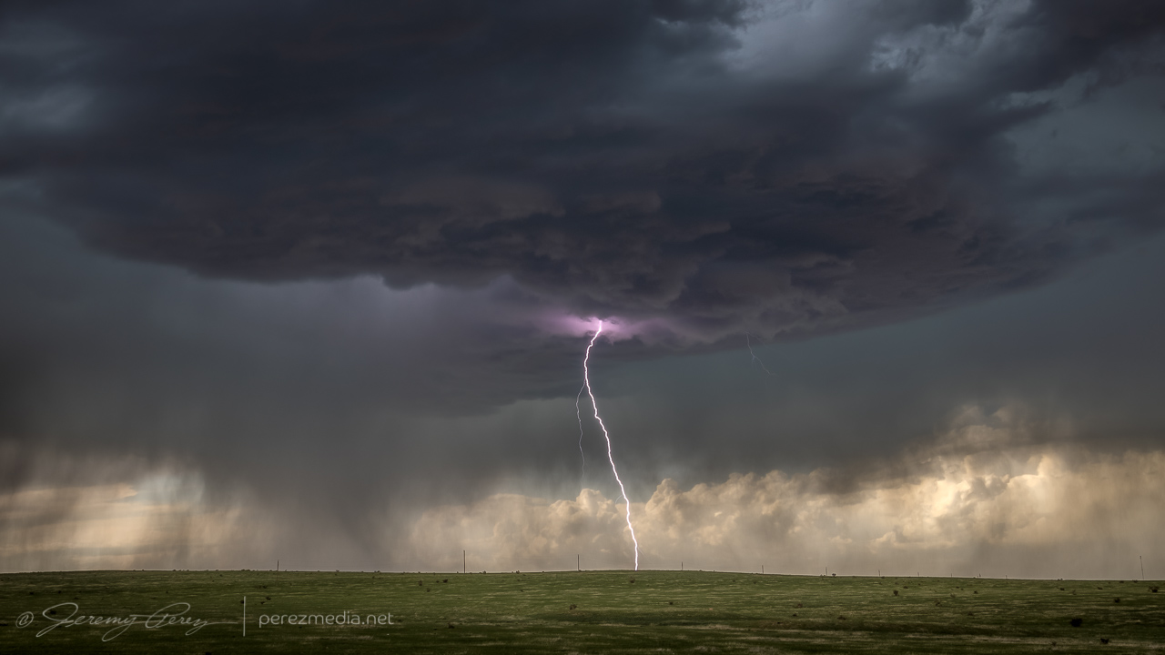
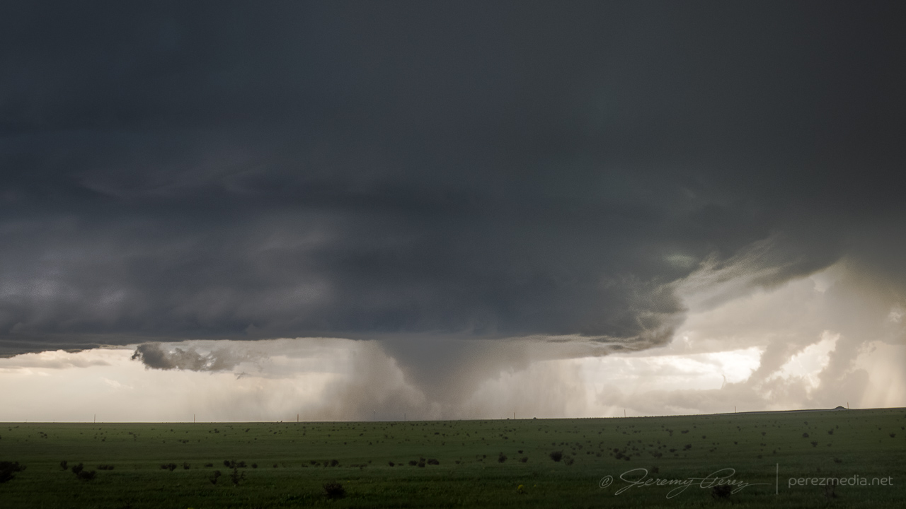
The base was broadening and getting sculpted as it started to spit out purple flares of lightning. The lightning trigger did a great job with that phase.
2226Z 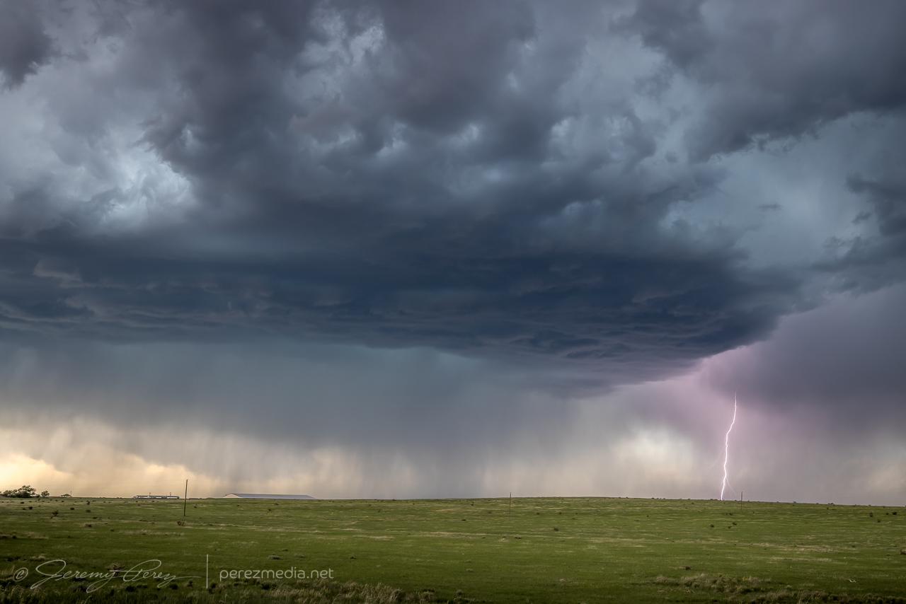
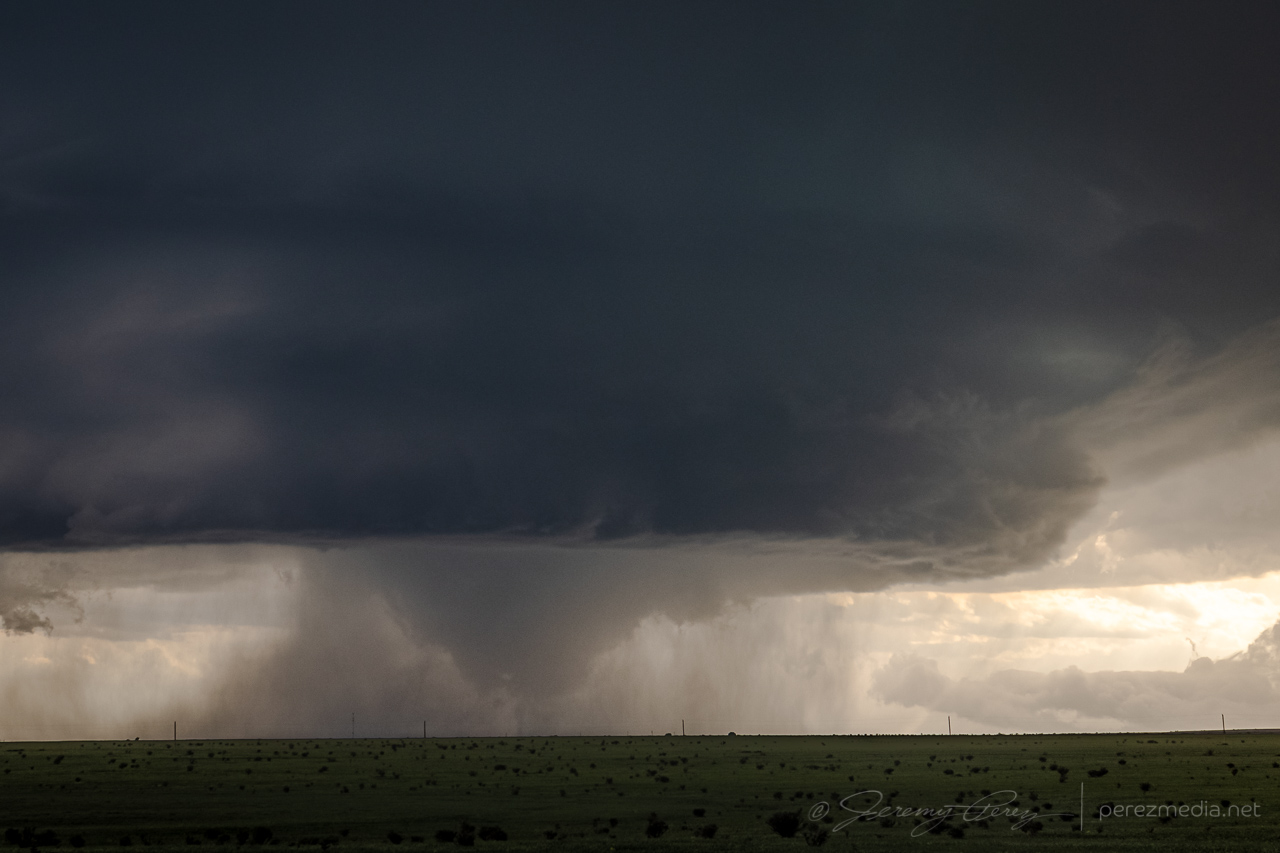
2236Z 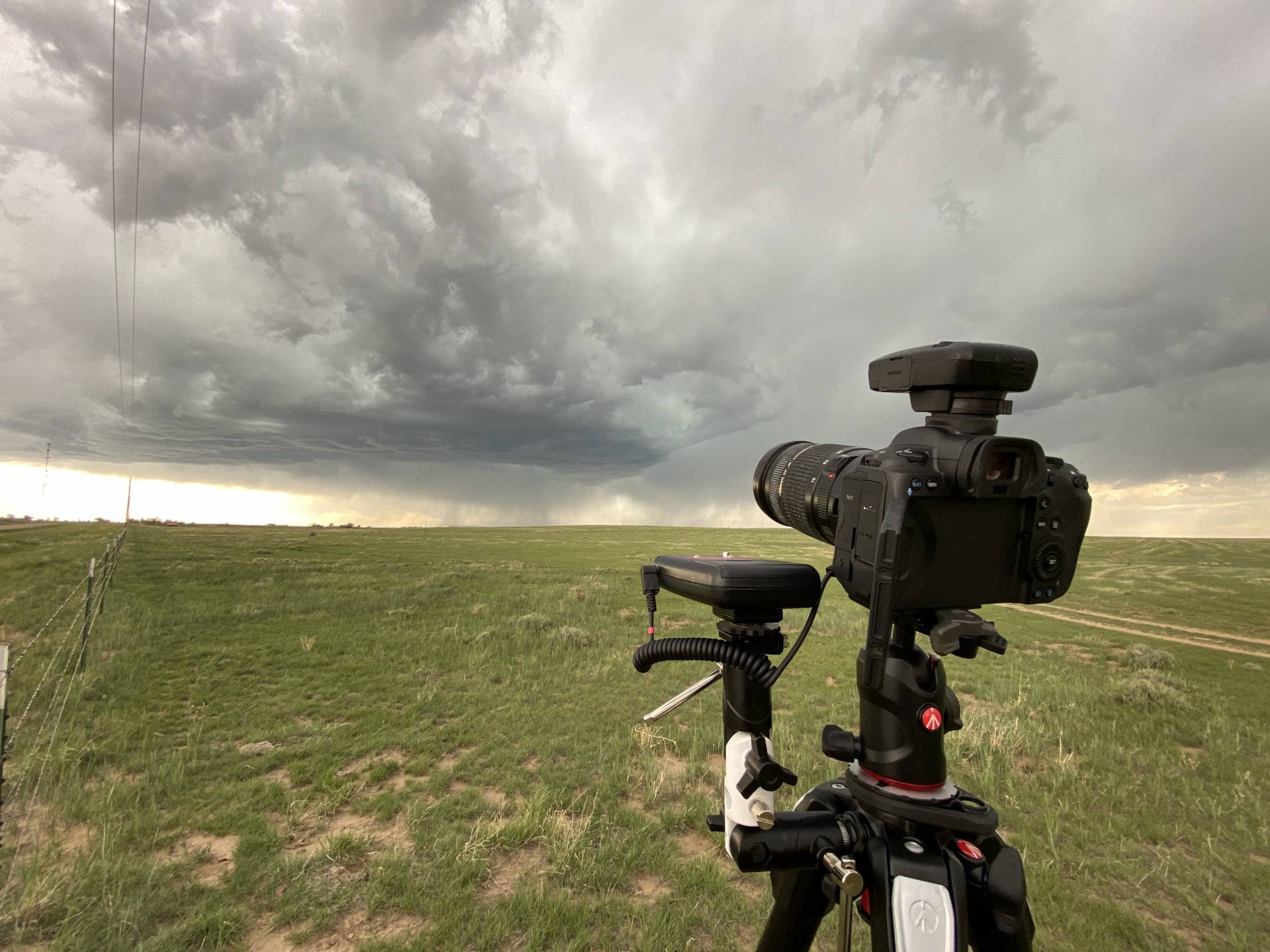
Running the LT-IV trigger and a GPS receiver
As the storm started to approach and get better organized, I repositioned east-southeast. I made a stop to get a couple shots and noticed a concentrated dust plume at the downdraft interface. I took it for a gustnado, but seems like it got reported as a landspout. The rear dashcam showed it lasting about 30 seconds but I couldn’t see any clear indication that it was connected to anything in the storm base.
Gustnado — 2301Z 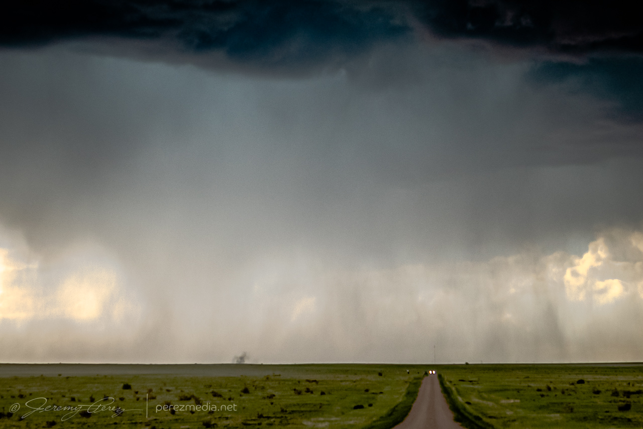
Close-up
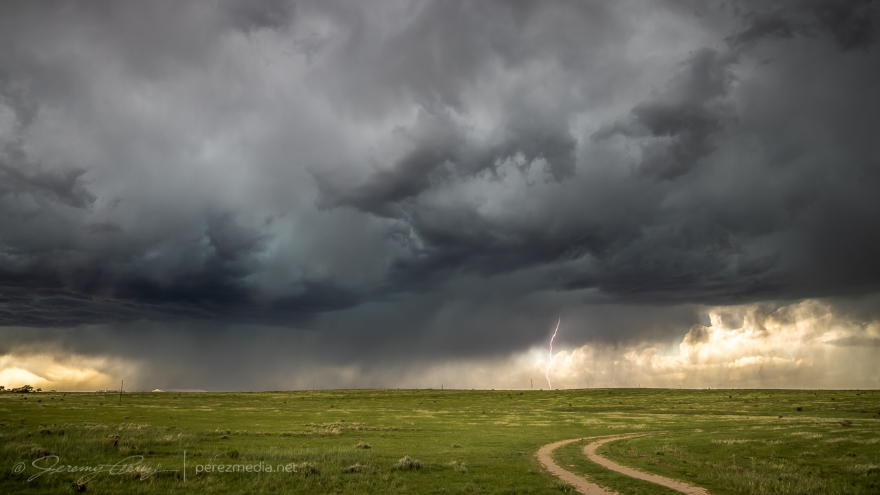
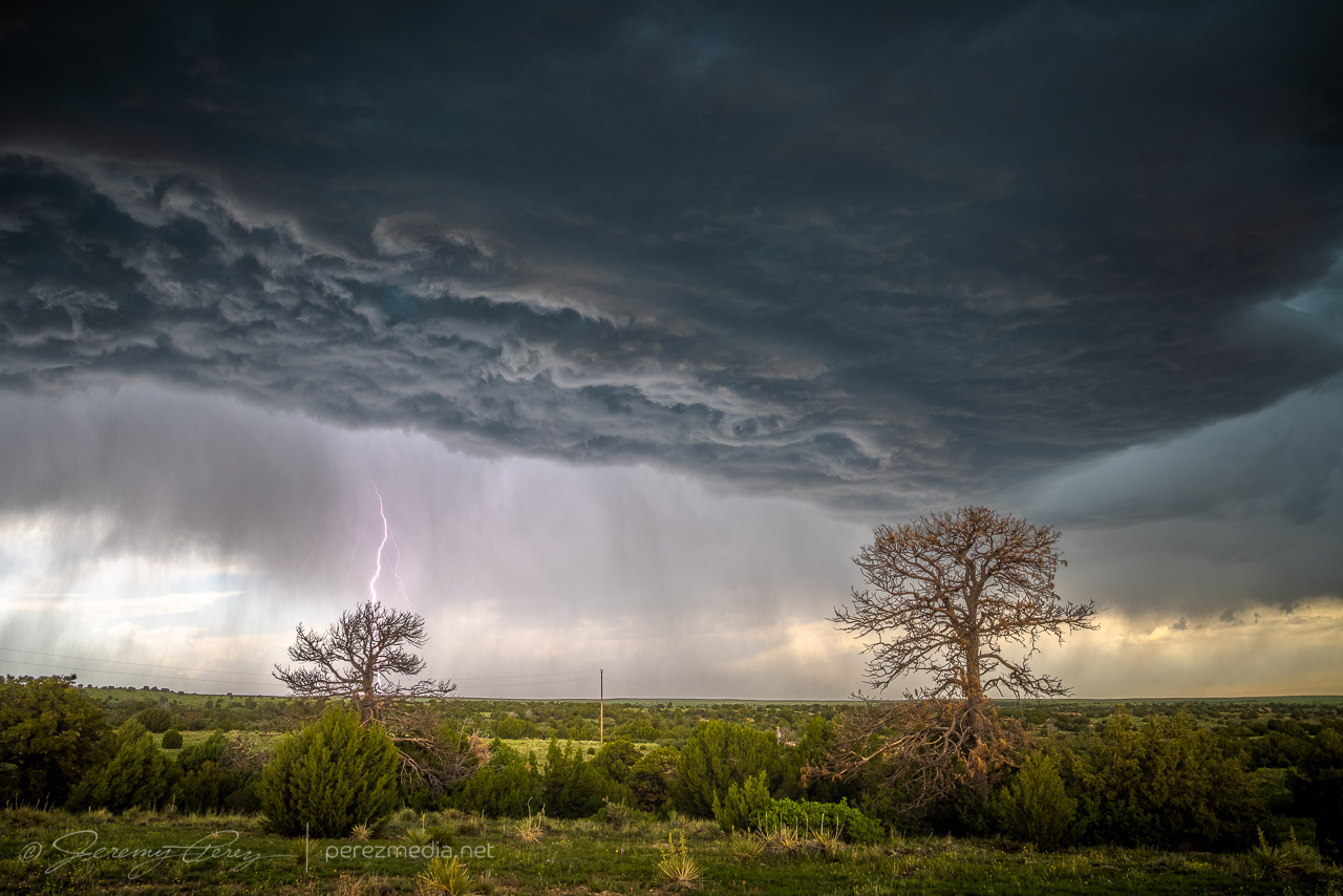
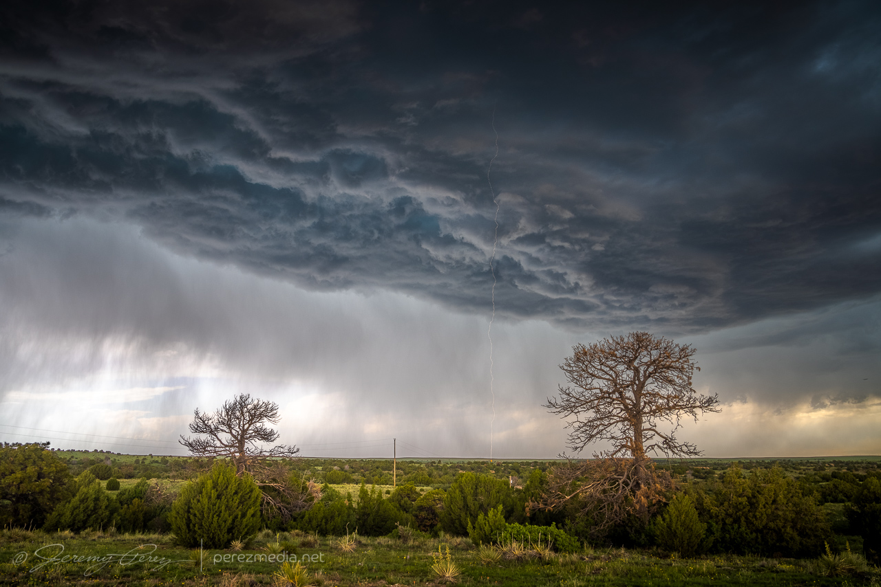
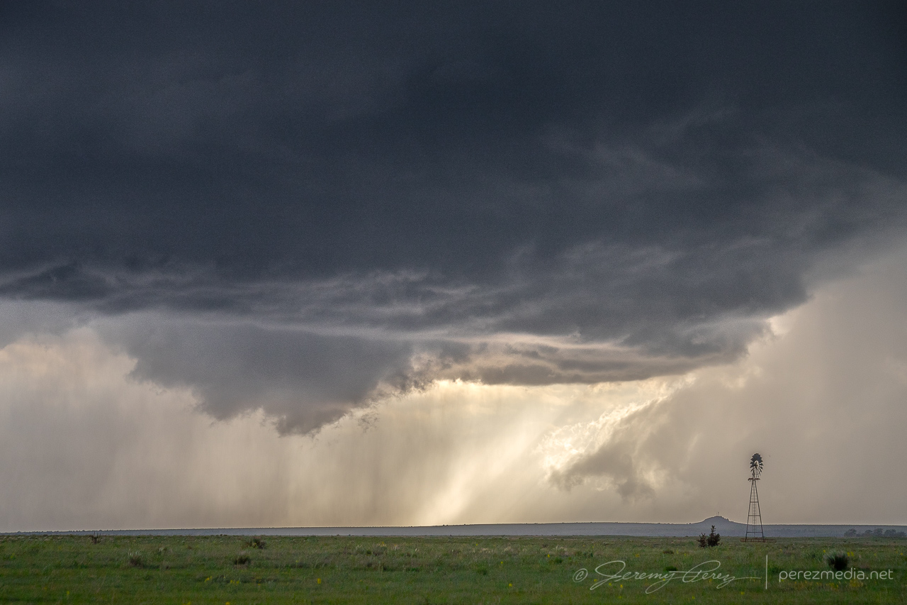
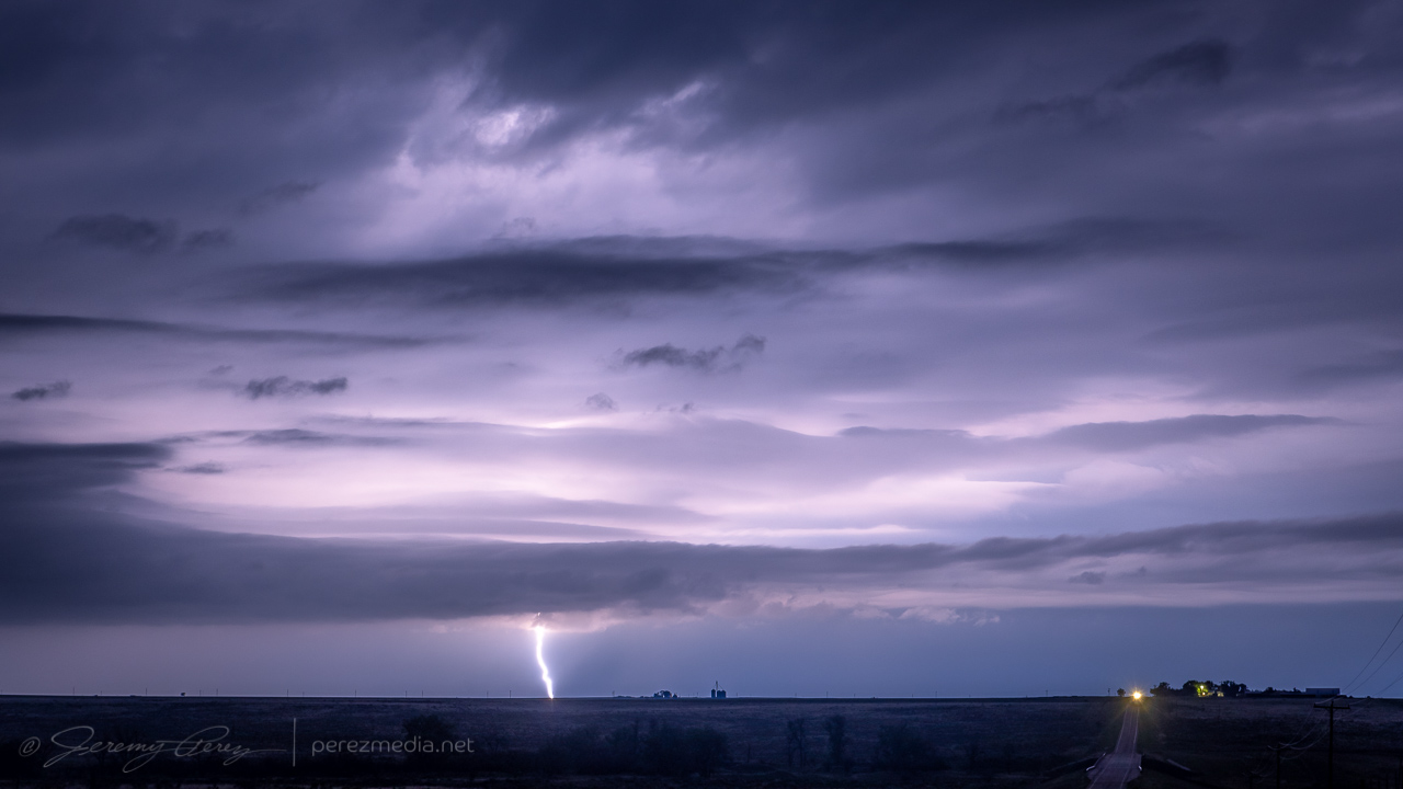
From there, I repositioned further to the east southeast. About 6 miles from Kim, I stopped at a beatiful overlook near a homestead that featured a couple old pine tree snags. The storm was dropping lightning bolts just to the north and kept me seated in the car except to drop and retrieve the camera. It was fascinating and fearsome to listen as each CG caused the barbed wire fence to hiss with induced current.
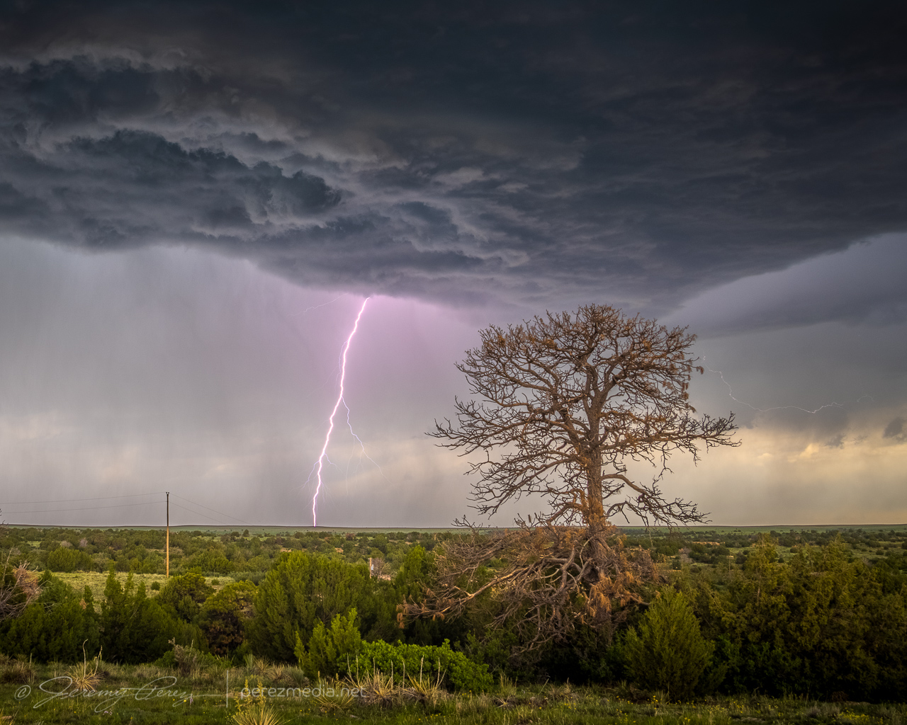
I later found that one of the strikes showed a landing point. The bolt itself is very faint, which makes me think the exposure just caught the dwindling portion of the strike. Looking closer shows an orange plasma plume at the point where it hit the hillside.
2322Z 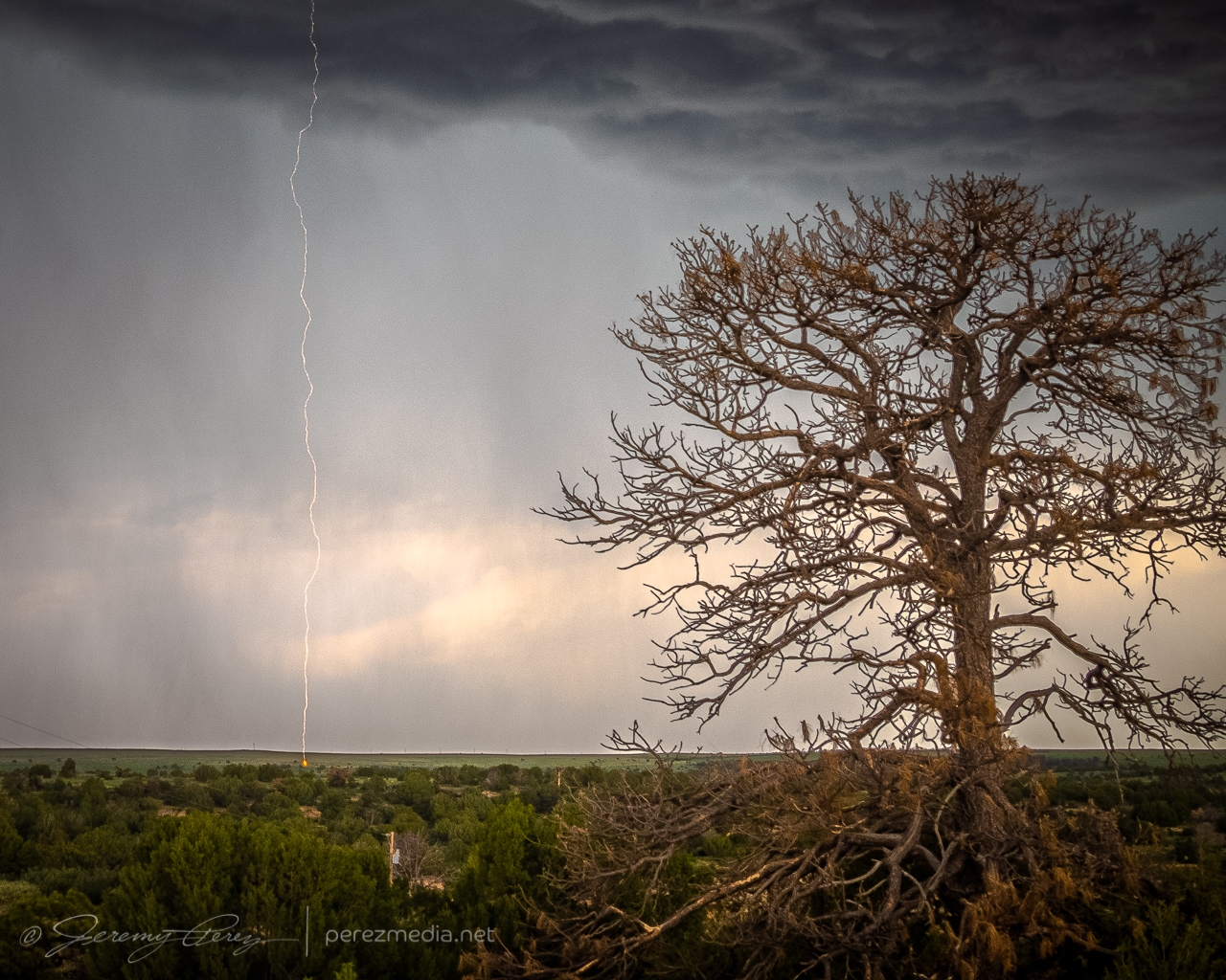
Closer view 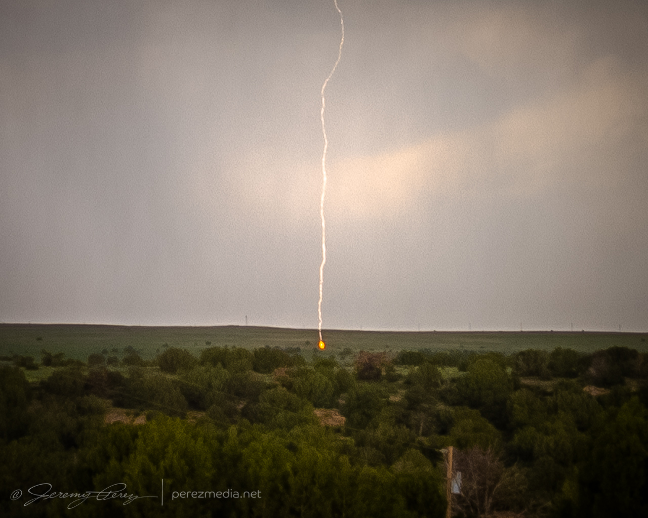
Tight view of landing point
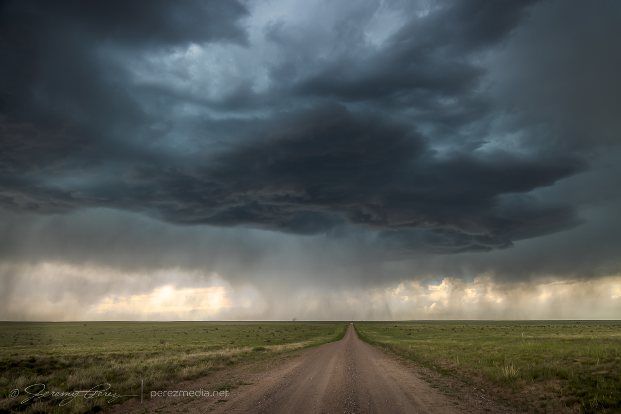
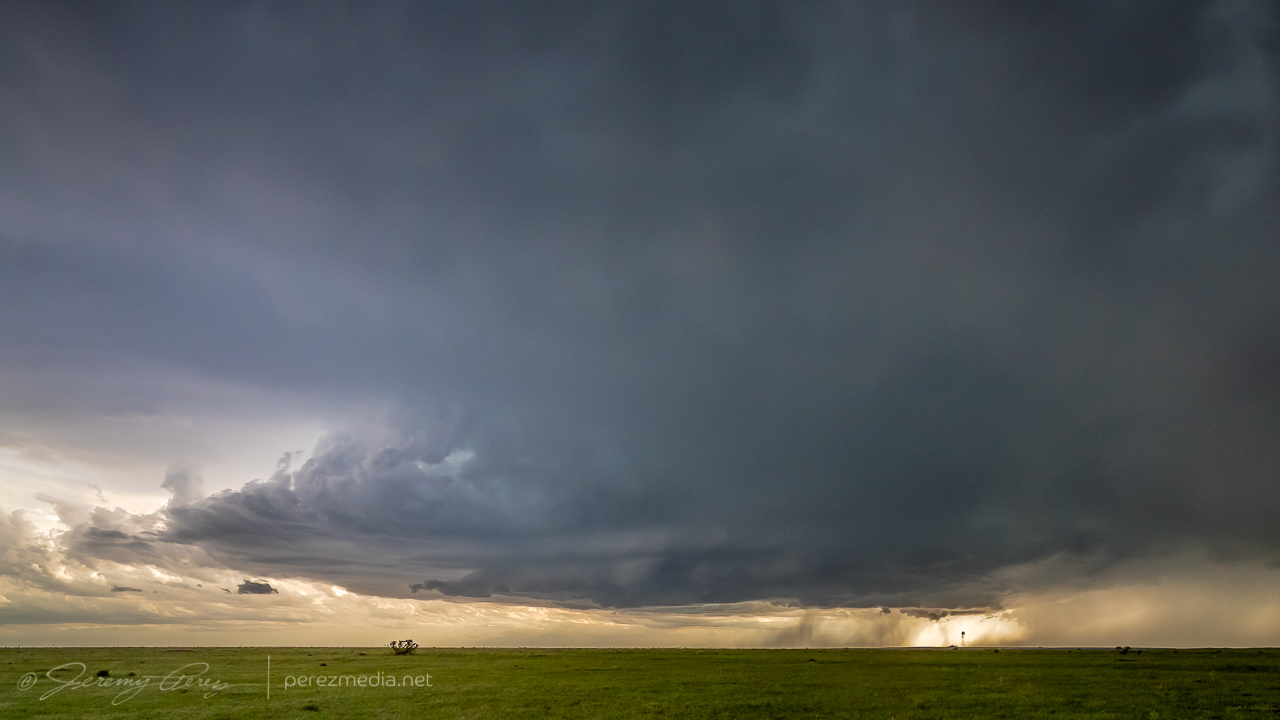
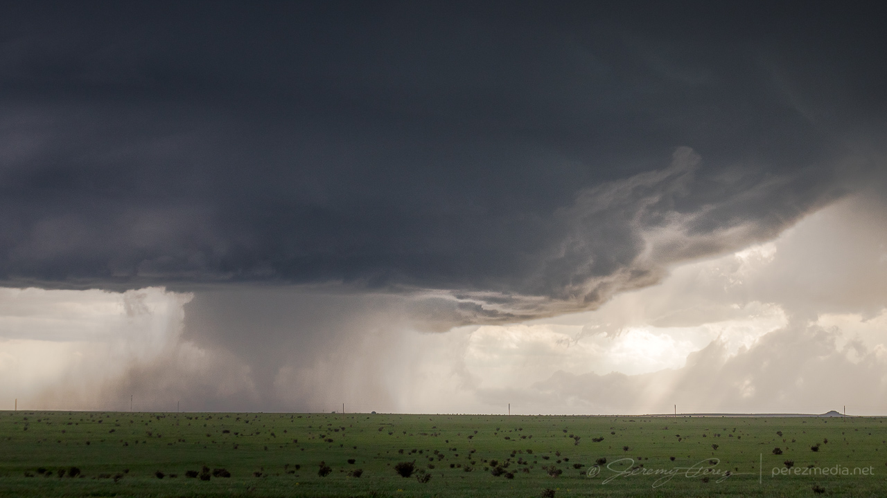
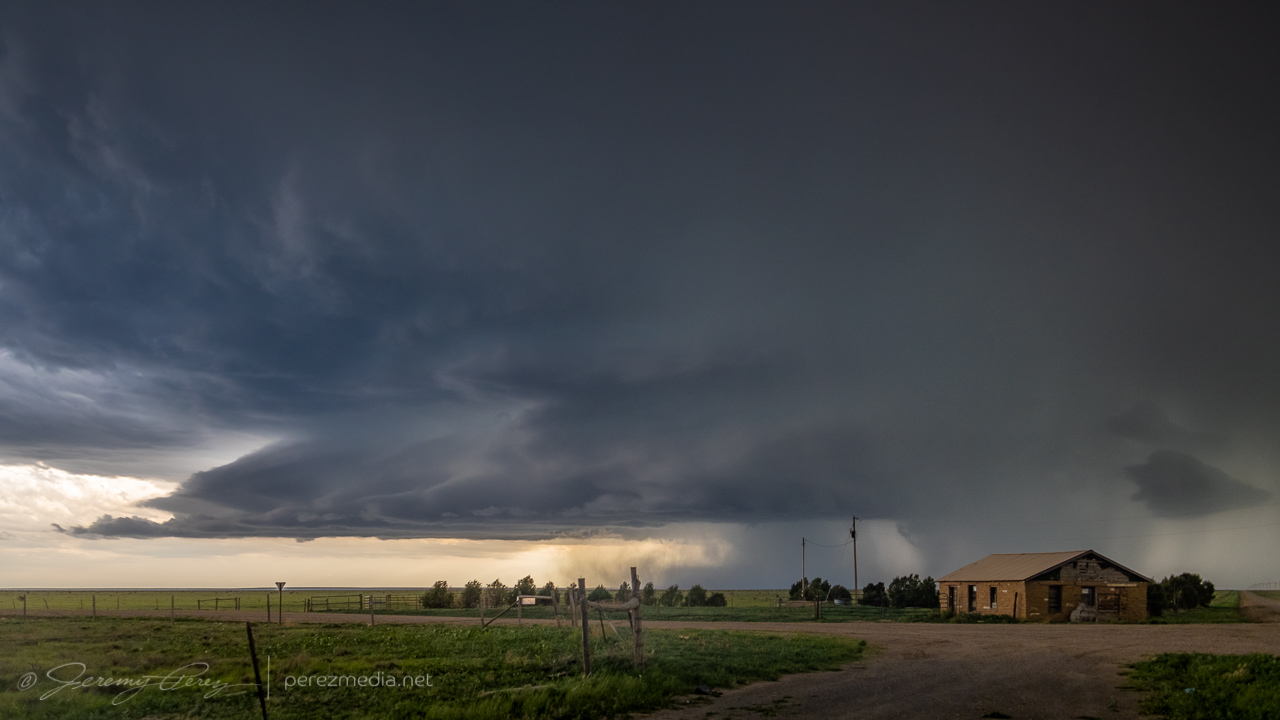
As I moved further east, the base kept trying stay tight as eddies of vorticity rippled along the downdraft interface, but it wasn’t quite ready yet.
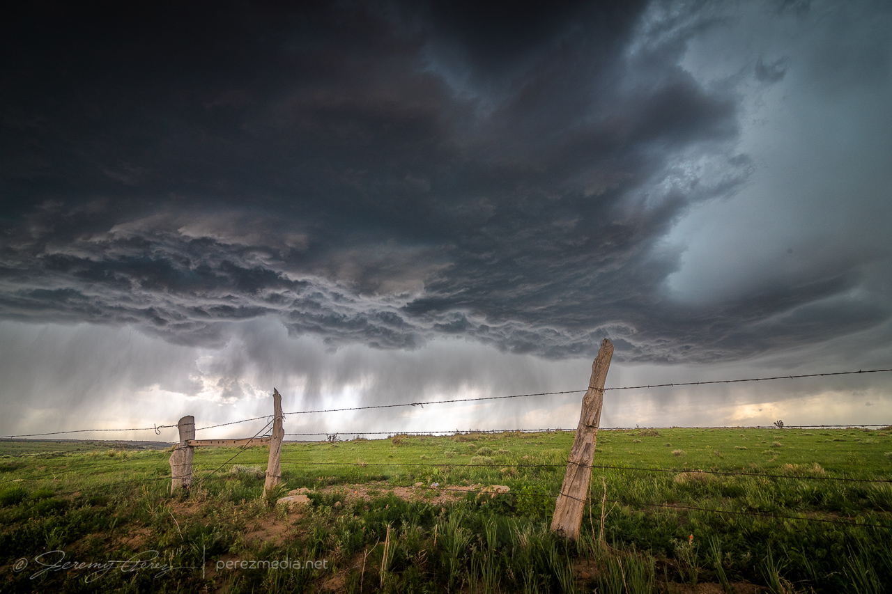
2330Z
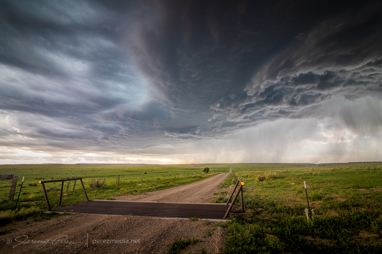
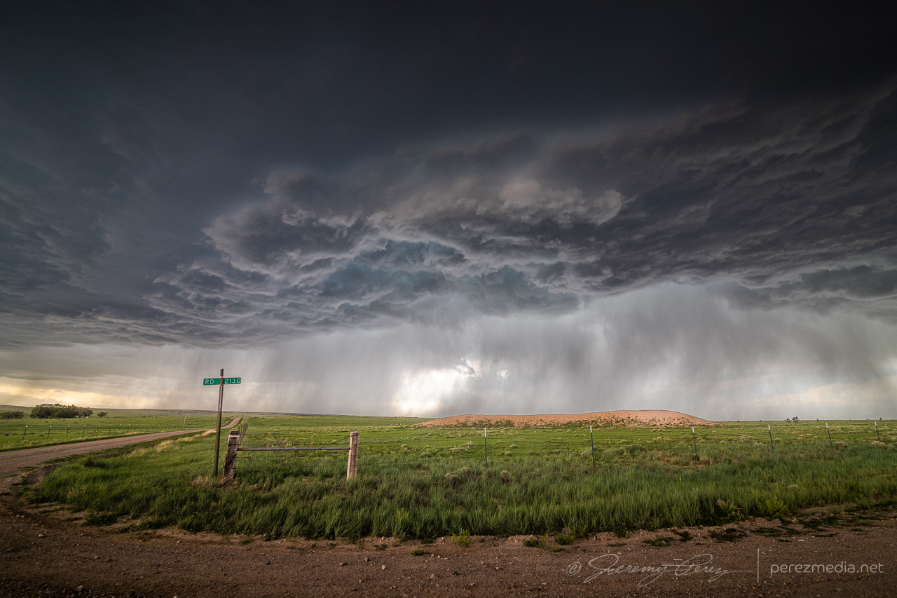
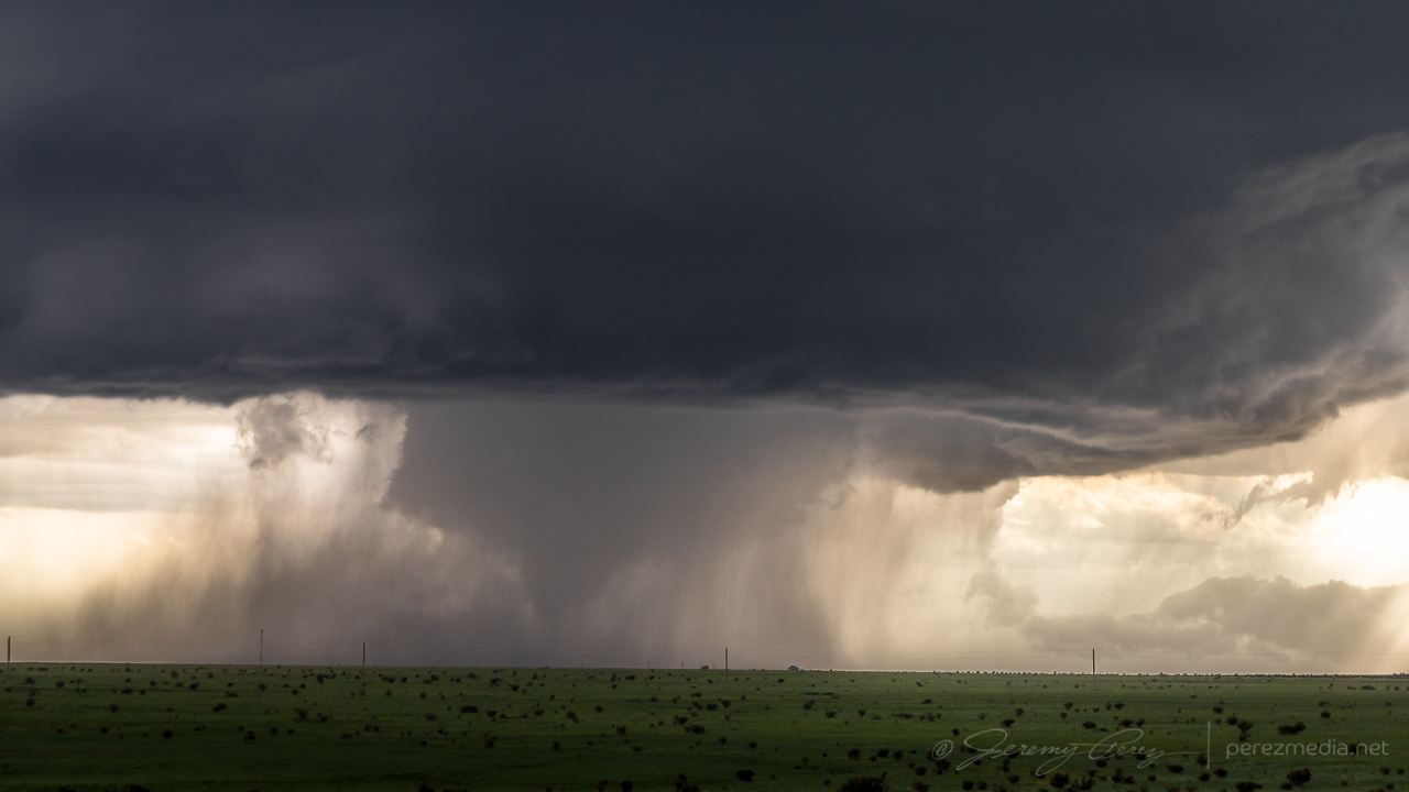
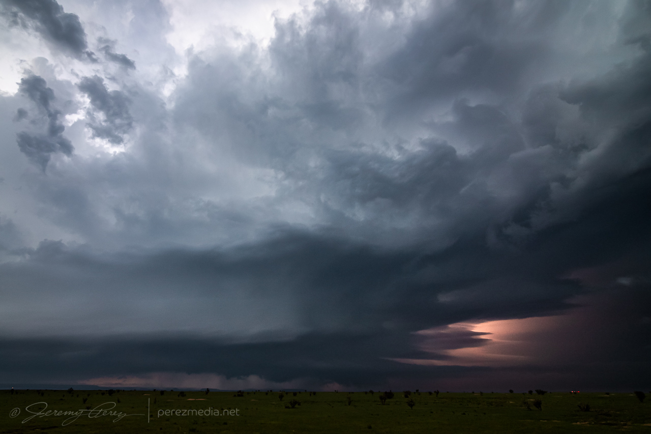
The forward flank wanted to nudge me further south at this point, but there were no reliable road options down into the Carrizo and Tecolate Creek drainages and surrounding mesas. So I hustled an unfortunately long 15 miles further east so I could keep flanking the storm southward. By the time I was back on track, heading southward with it, the storm was much better organized, but my crisp, clear views had grown mushy.
Fortunately, back lighting from the sinking sun helped with some silhouetted contrast. By 0014Z, a wall cloud was taking shape beneath the updraft. As RFD precipitation encircled it, the wall cloud dissipated. I took that opportunity to nudge a little further south.
After a couple minutes of driving, the wall cloud reappeared behind the curtain of RFD and took on a tight cone shape. I quickly stopped and started snagging photos and video. It certainly looked tornadic, but as far aways as I was, I couldn’t be positive. It was quickly reported as a tornado by several chasers who apparently had better vantages.
As the RFD precipitation grew heavier and contrast more difficult, I moved further south to see if the storm would cycle in the clear again. It lost some organization so I started leading it further, trying to figure out whether I wanted to chance the unpaved road through the Cimmaron River valley, or take the long way around through Campo and Boise City. I opted for the paved route, so I left it earlier than I wanted so I would have a chance to catch it on the other side.
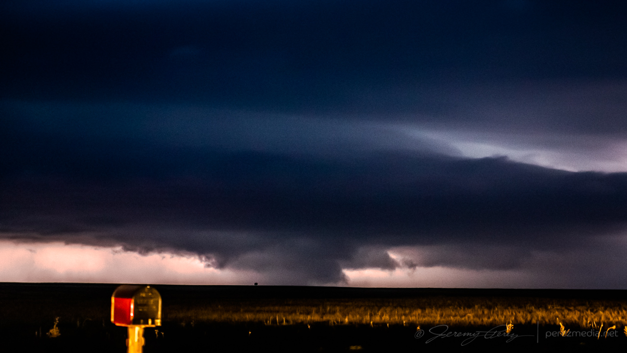
With an abandoned homestead 20 miles west of Campo — 0031Z 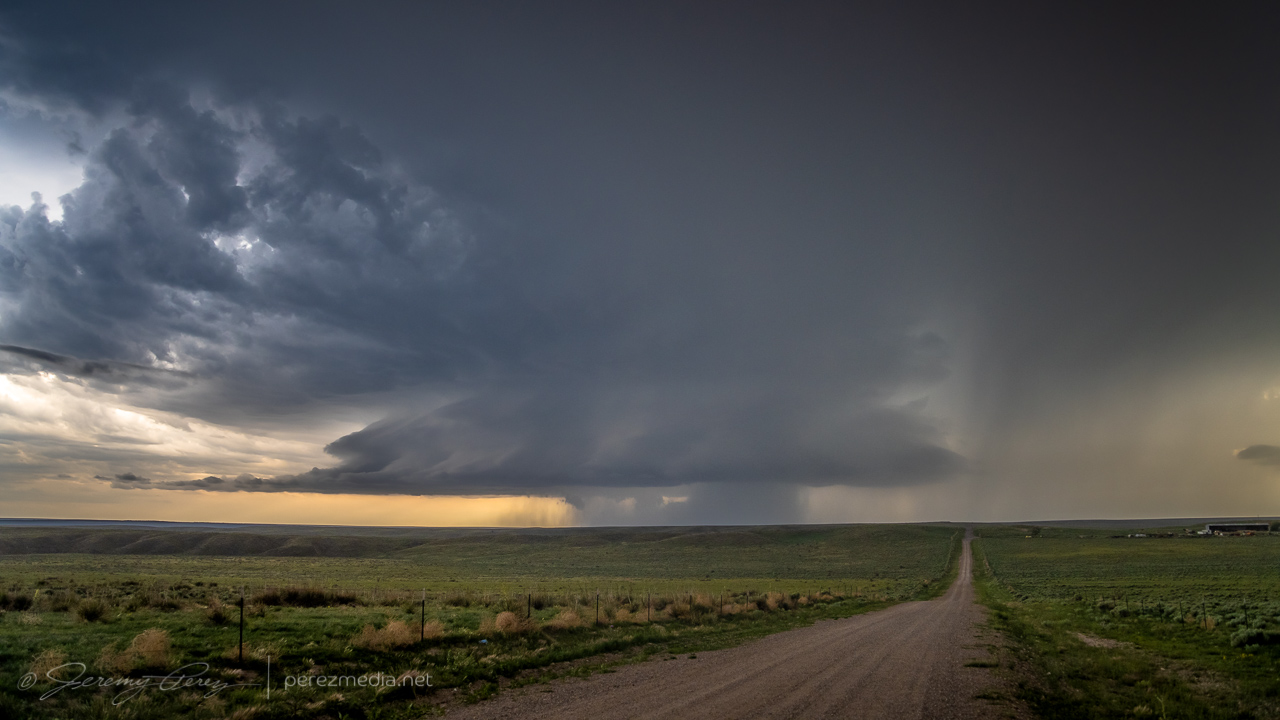
Dwindling as I take the long way around the Cimmaron River valley, 15 miles west of Campo — 0043Z
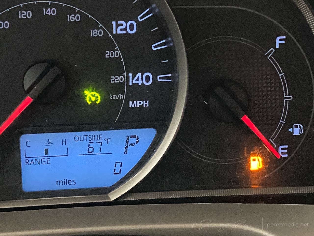
After passing through Campo and heading south, I realized my gas tank was on empty and estimated range falling about 12 miles shy of the next fuel stop in Boise City. What a dumb move. I had completely forgotten to fill up in Campo before heading out to intercept the storm. I slowed to 55 mph to get the best fuel economy possible, occasionally pulling off for others to pass in the double-yellow areas. I managed to pad a few miles into the estimated range as I drew closer, but it hit zero miles about 6 miles outside town. I hoped the computer was being more alarmist than reality. Fortunately, I made it to the gas station without needing to hike to it with my spare gas container.
Once that stressful deal was taken care of, I headed back west to catch the storm as it continued dropping south. Twilight had deepened and it was difficult to get visuals of what was beneath the base by this point.
As it approached, I backed off to a spot about 15 miles west of Boise City and grabbed time lapse shots, trying to see what was happening beneath the base by way of flickering lightning. Several times, the core thickened up and looked pretty ominous. About that time, spotter reports showed up reporting a tornado. I couldn’t tell if they were from chasers close enough to know for sure, or if it was from overenthusiastic reporting. I figured I’d either wait for a survey, or see what my time lapses picked up.
The time lapse footage didn’t show anything convincing. It was too dark, too far away with too much intervening terrain to have a clue from my vantage. Other chasers later challenged the tornado reports as inaccurate, which is unsurprising. Which helps demonstrate how difficult it is to make a positive tornado ID on a messy storm after dark.
0253Z 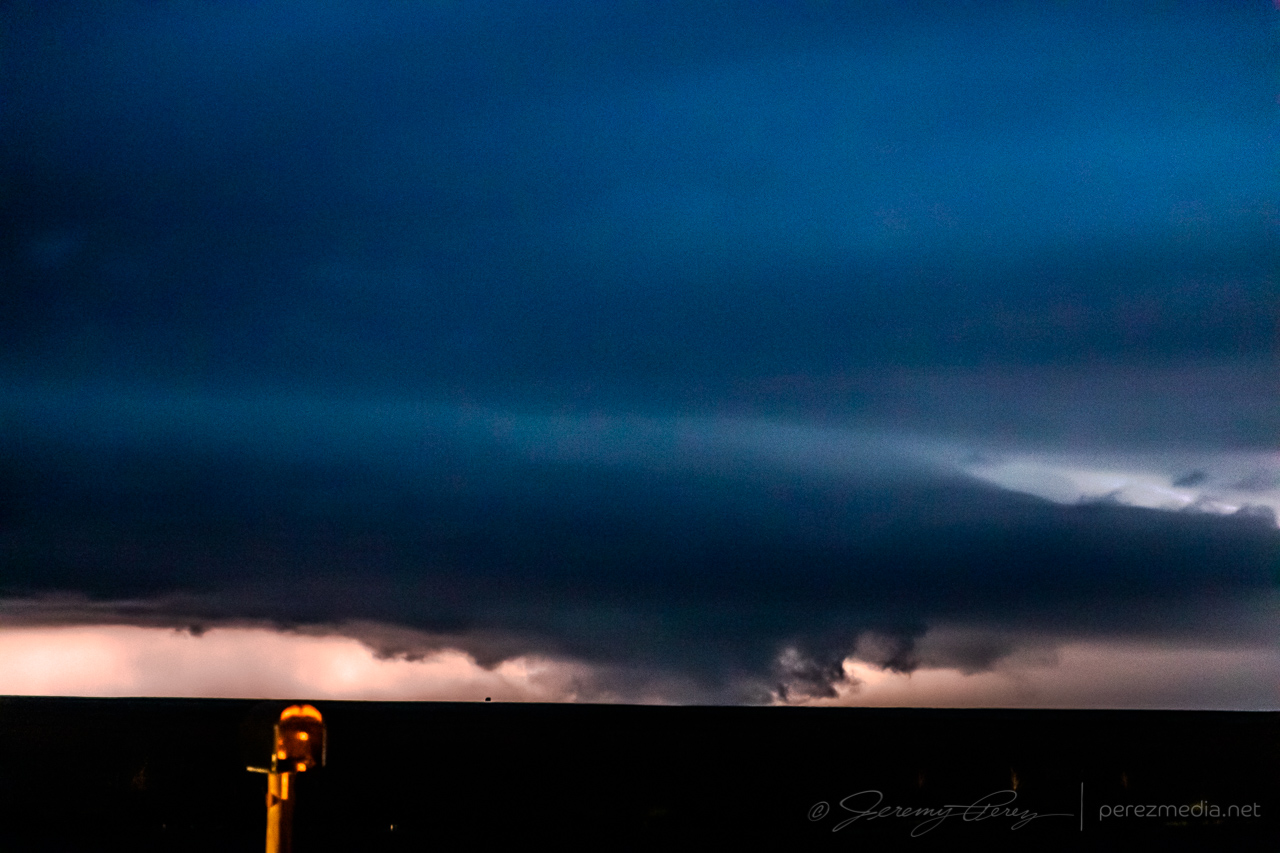
0256Z 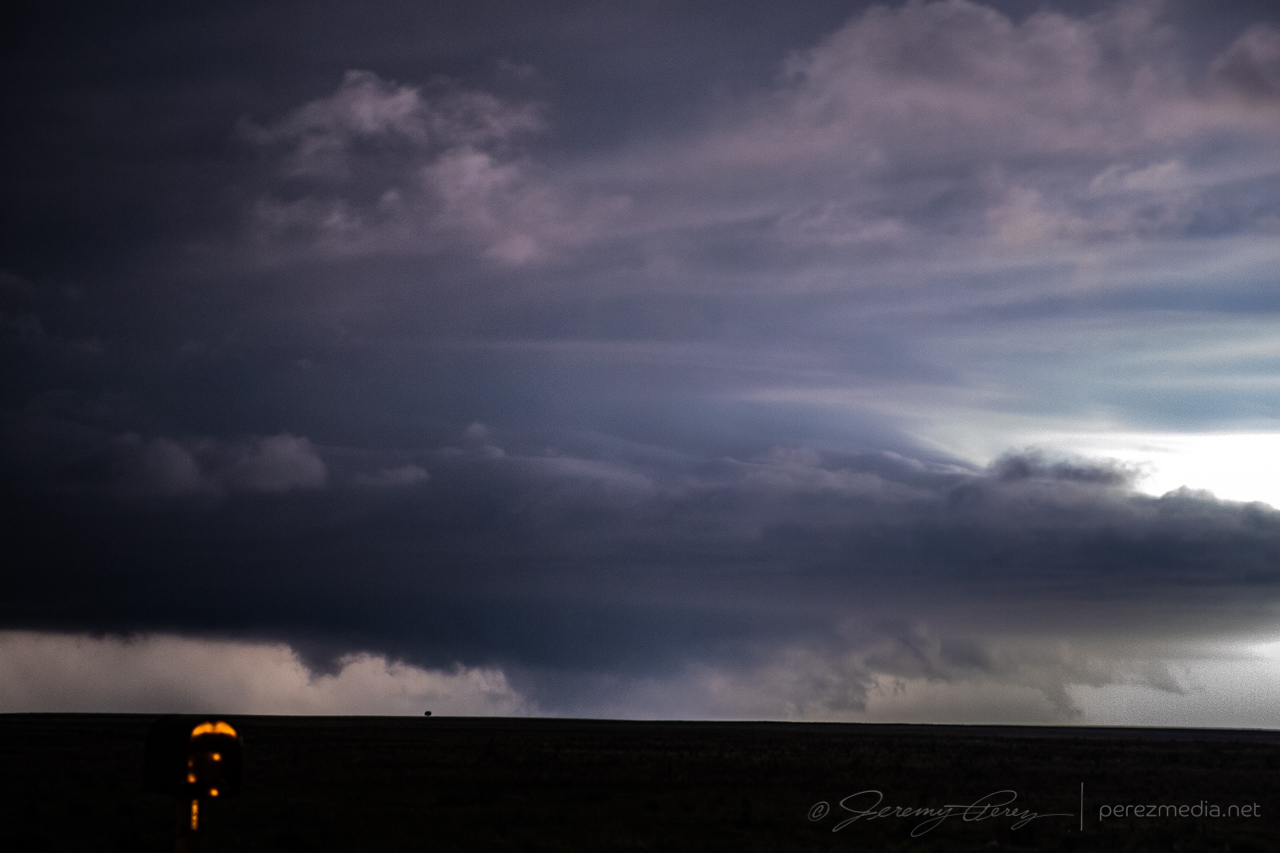
0256Z
After hanging out with that for a while, I drifted southeast to a point about 6 miles southwest of Boise City, and tried to snag some parting lightning shots before calling of the chase for the night, with learned lessons about checking fuel levels before launching into the heat of the chase.
0247Z 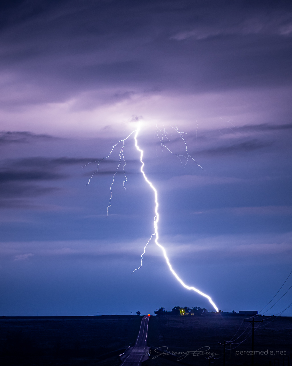
0429Z
This tornado has now been documented in the NOAA Storm Events Database:
EF-U | Las Animas County, Colorado | 29 May 2021 | 0024–0029Z (30 May)
Community Comments
There are no comments on this post
Want to leave a comment? Join our community → OR Login →