

Published on
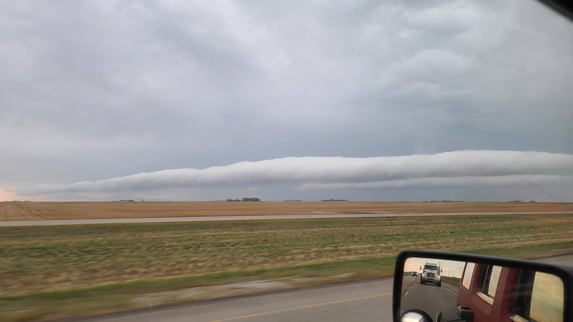
The final day of Meteorological summer decided to go out with a BANG in Saskatchewan. After a season full of disappointment and busts I decided to give it one last shot for this setup, The day started early with me leaving home around 7 am to make the drive to Moose Jaw, As I was passing Regina, a dying thunderstorm to the south pushed out a beautiful big roll cloud as seen below, This was already a good start to the chase and it wasn’t even really starting yet!
While sitting in Moose Jaw, We had very strong Southeast surface winds ripping through, which was a great sign for what was yet to come, Weather soundings were suggesting today’s storms would likely be high based, but these surface winds might have just been enough to make up for that and produce a tornado or two.
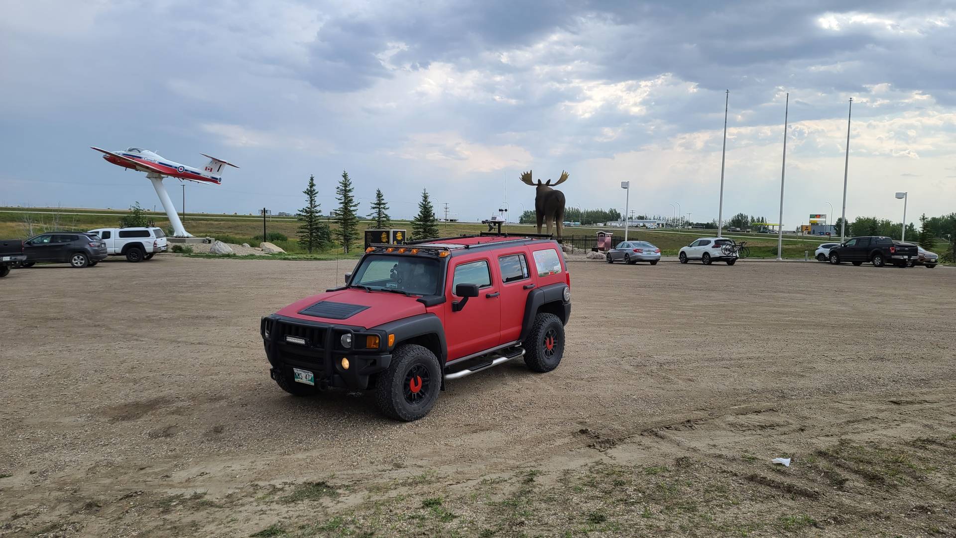
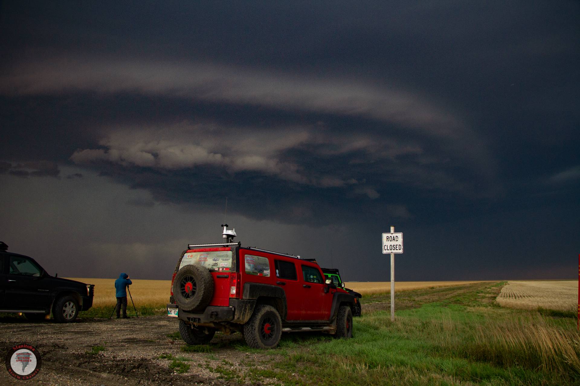
Around 4:30 pm we started getting some thunderstorm development to the Southwest, We stood tight in Moose Jaw for a little longer to watch how they were developing from a distance before eventually deciding to hop in H3LICITY and start making our way towards them.
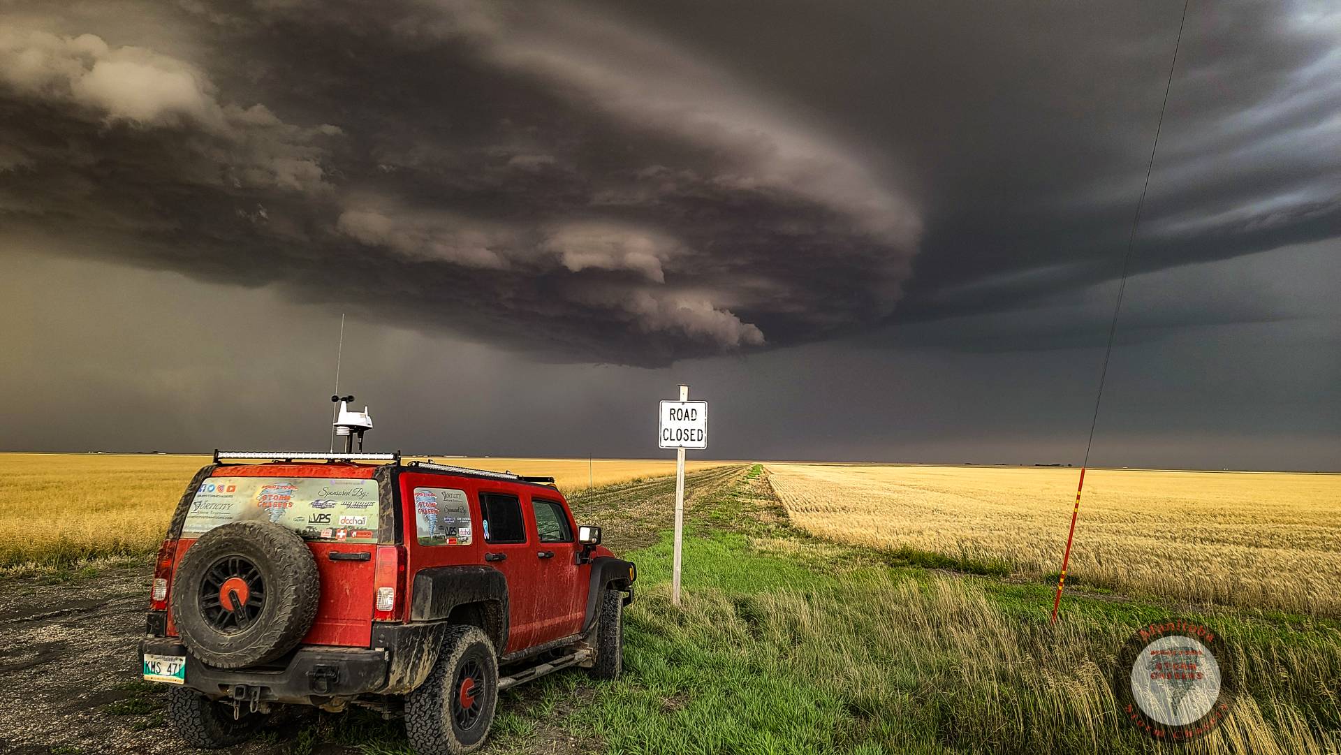
The most southern cell looked very intense with large hail apparent on radar, however, upon arriving in a spot where we could watch it, we were fairly disappointed, It wasn’t just high based, it had almost No base! and was very boring to look at..
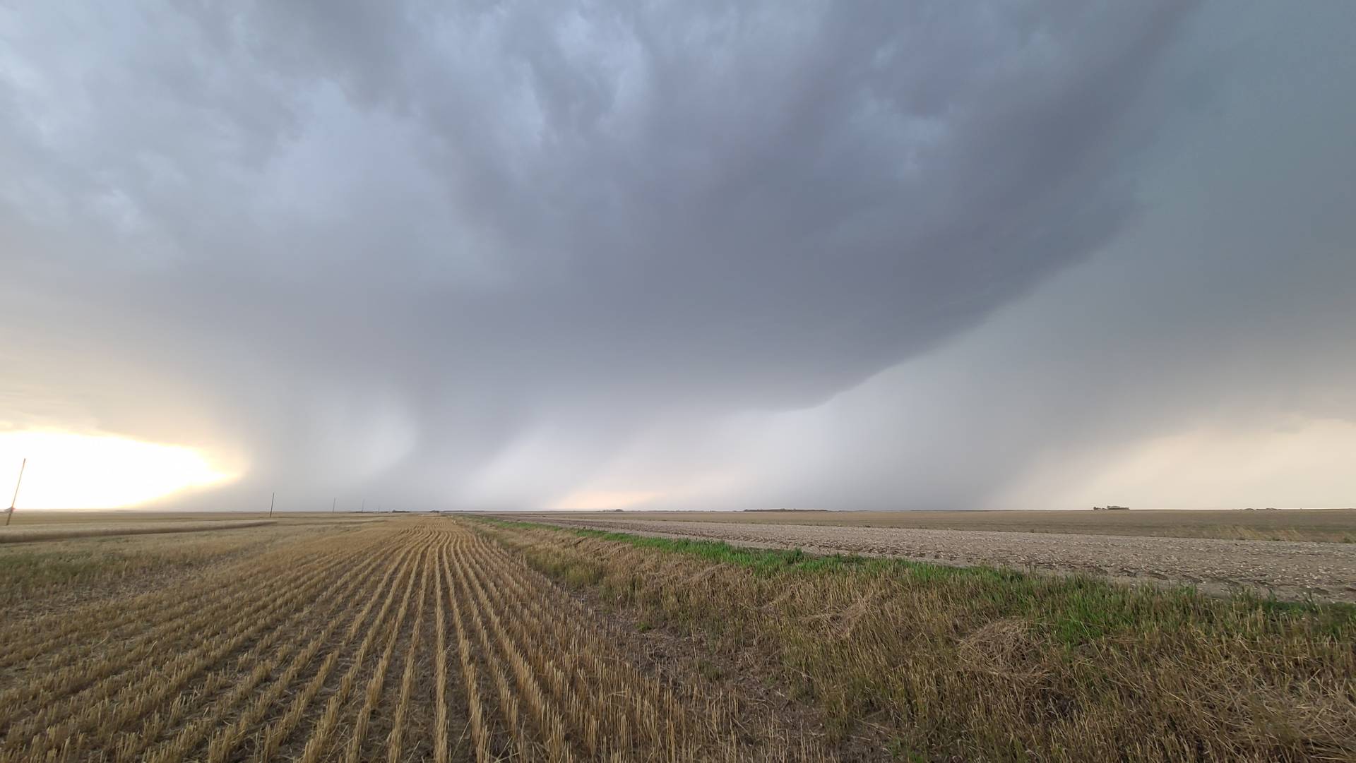
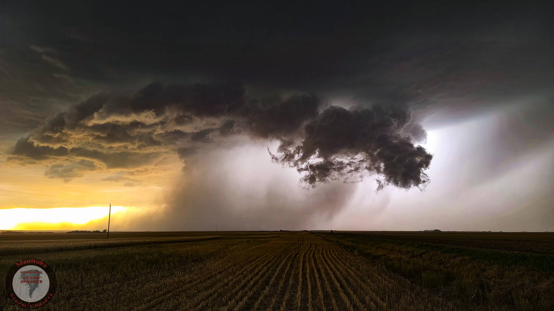
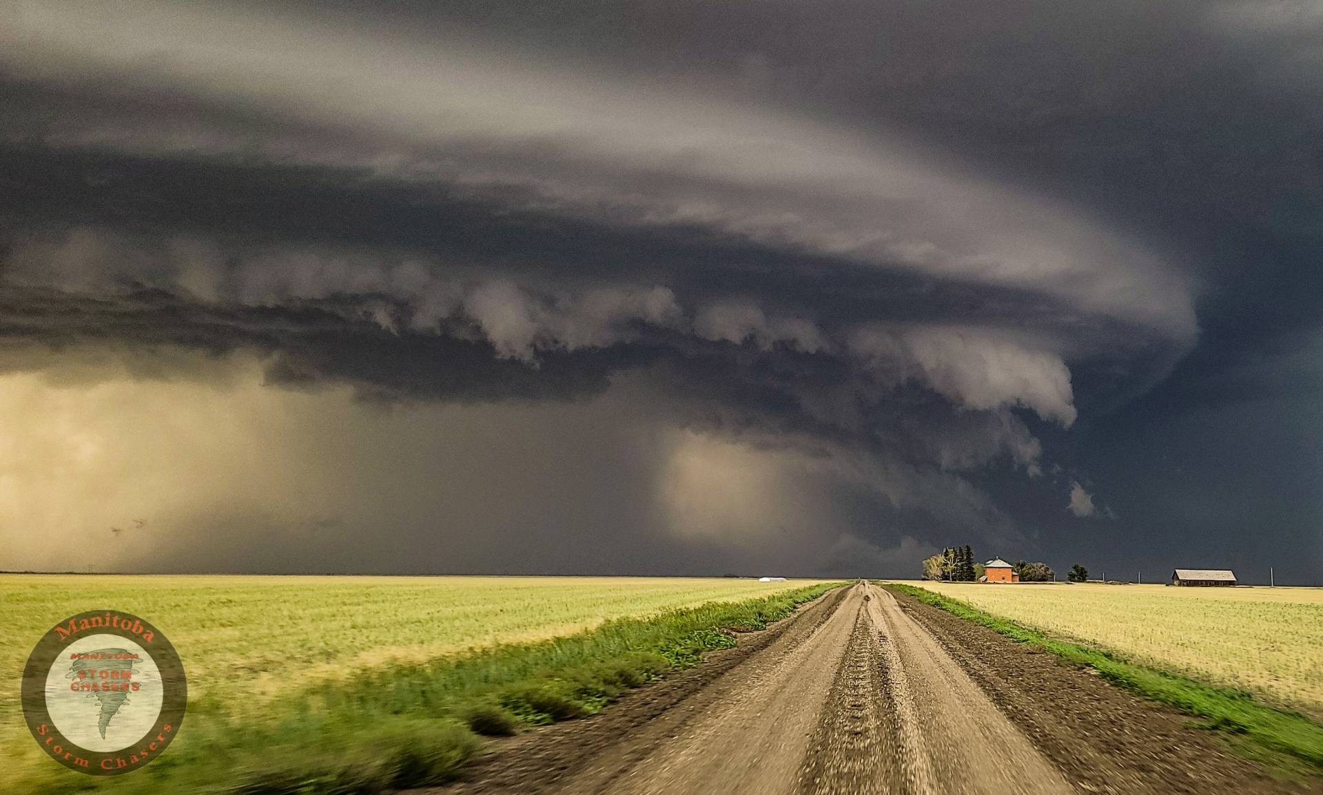
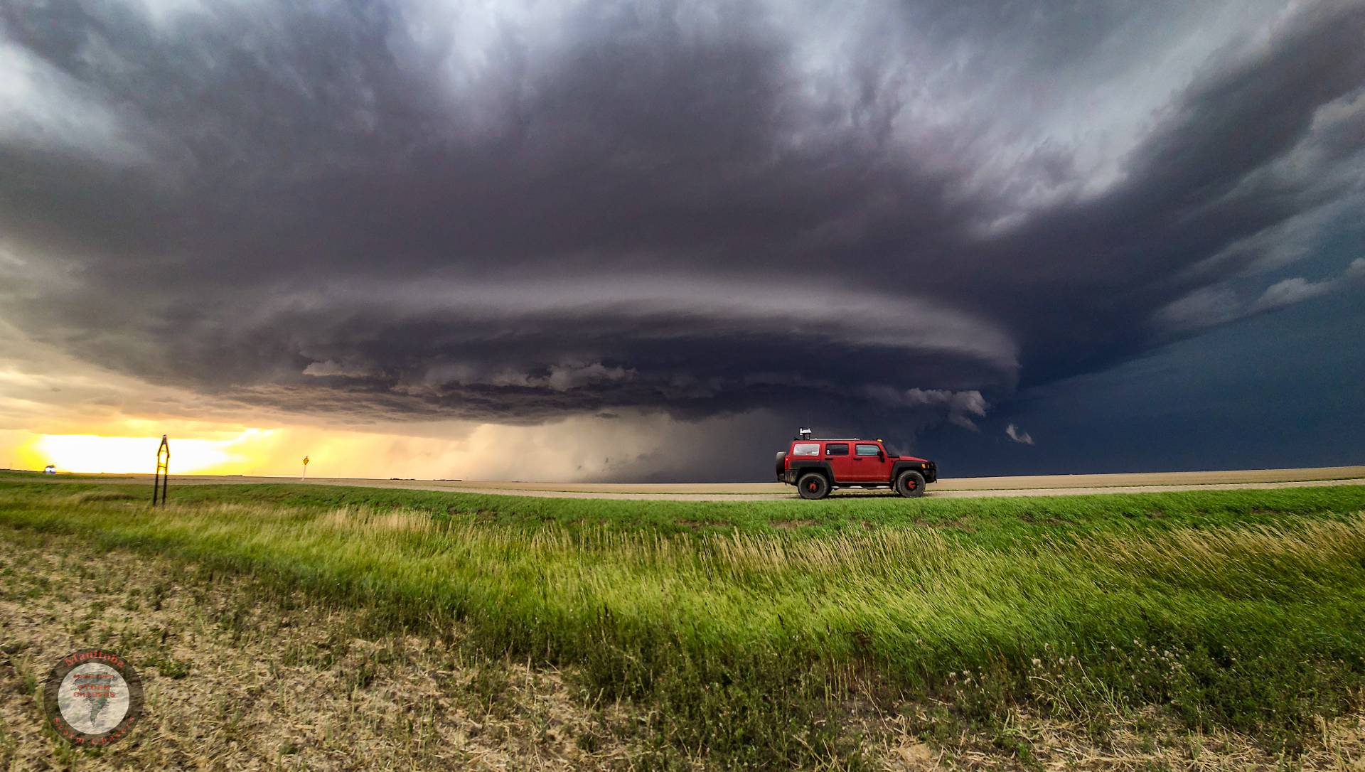
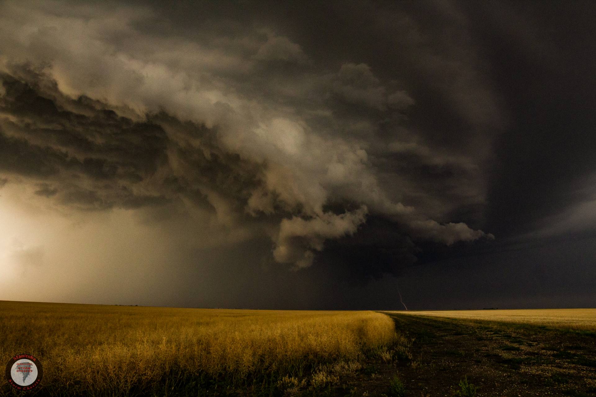
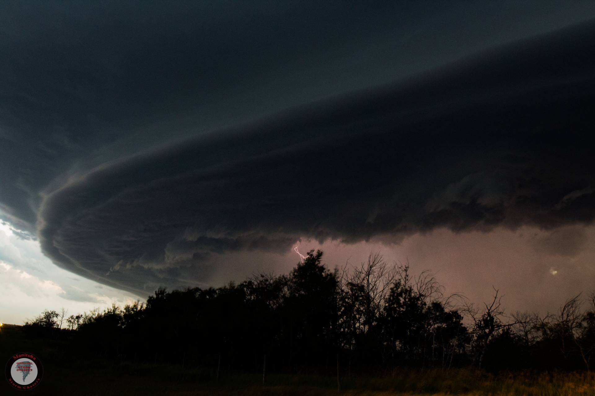
But then out of nowhere, a rotating wall cloud began forming right in front of us, and the storm almost instantly went tornado warned, in a matter of minutes this storm went from 0-100 as this wall cloud rapidly spun and approached us, the chase was on!
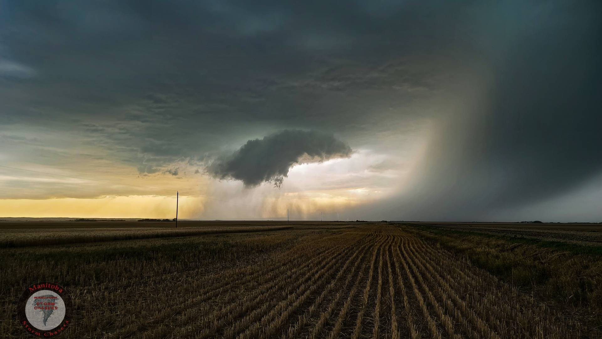

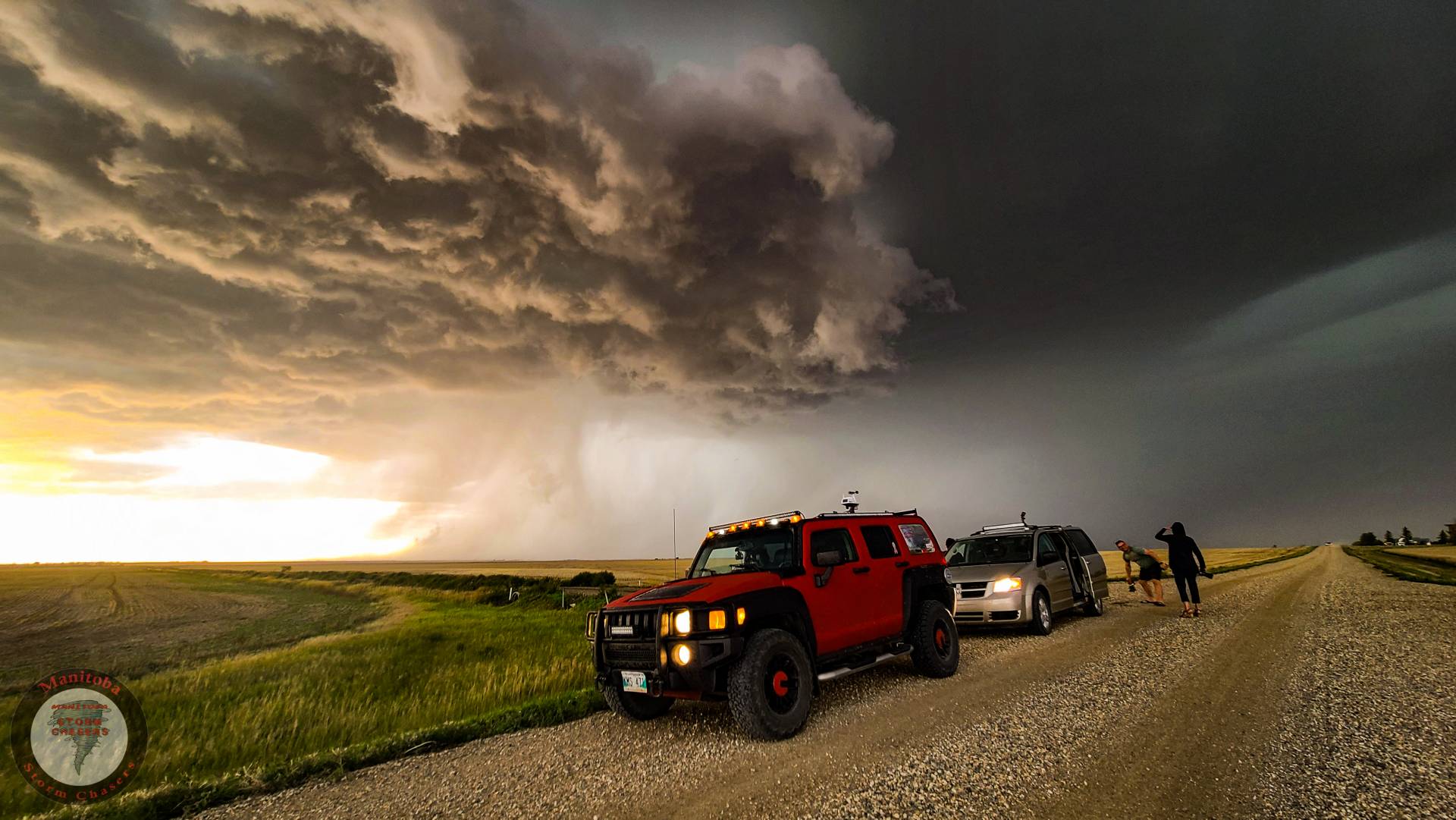
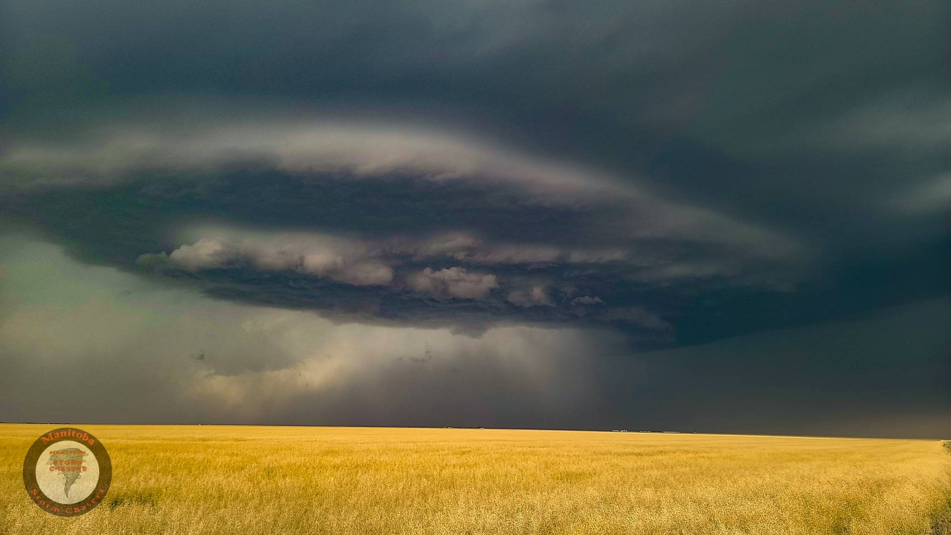
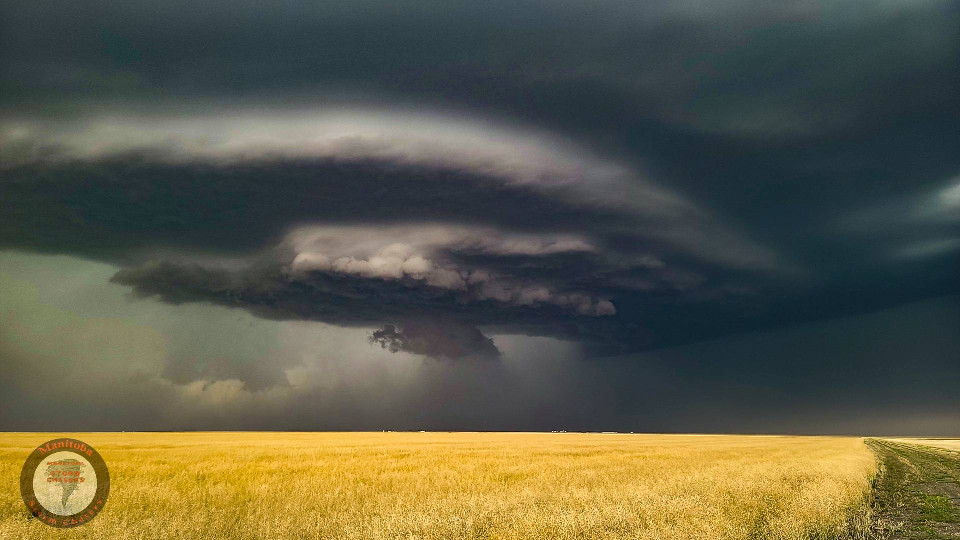
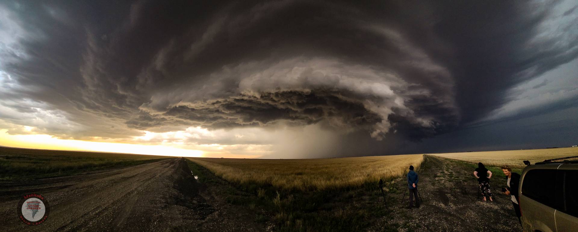
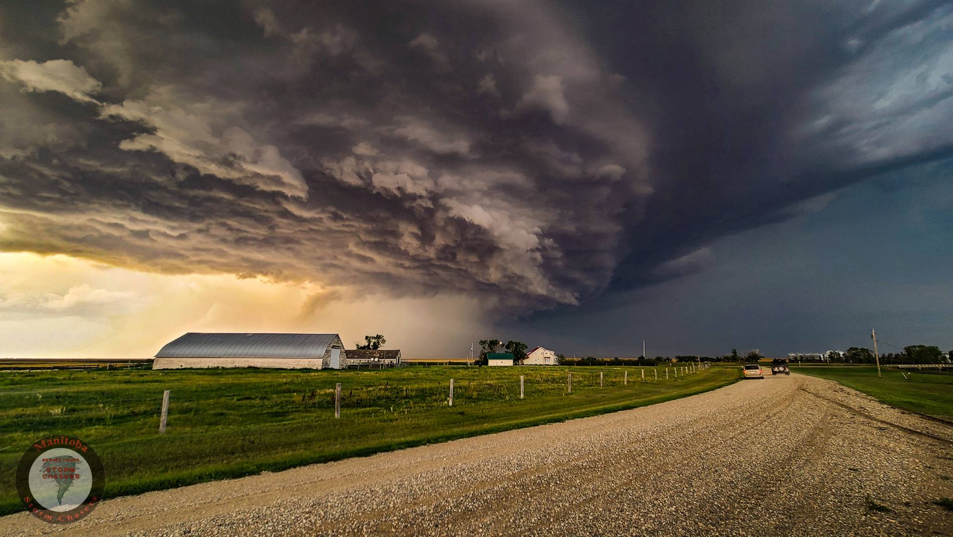
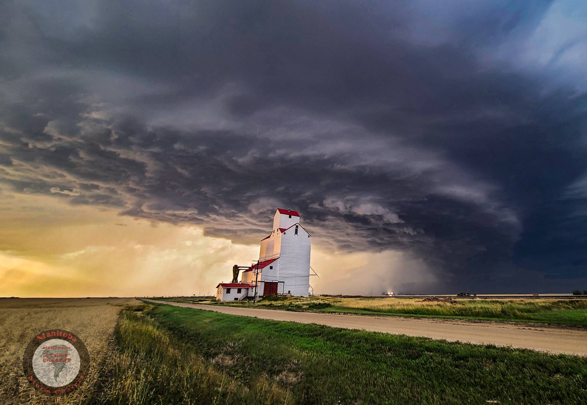
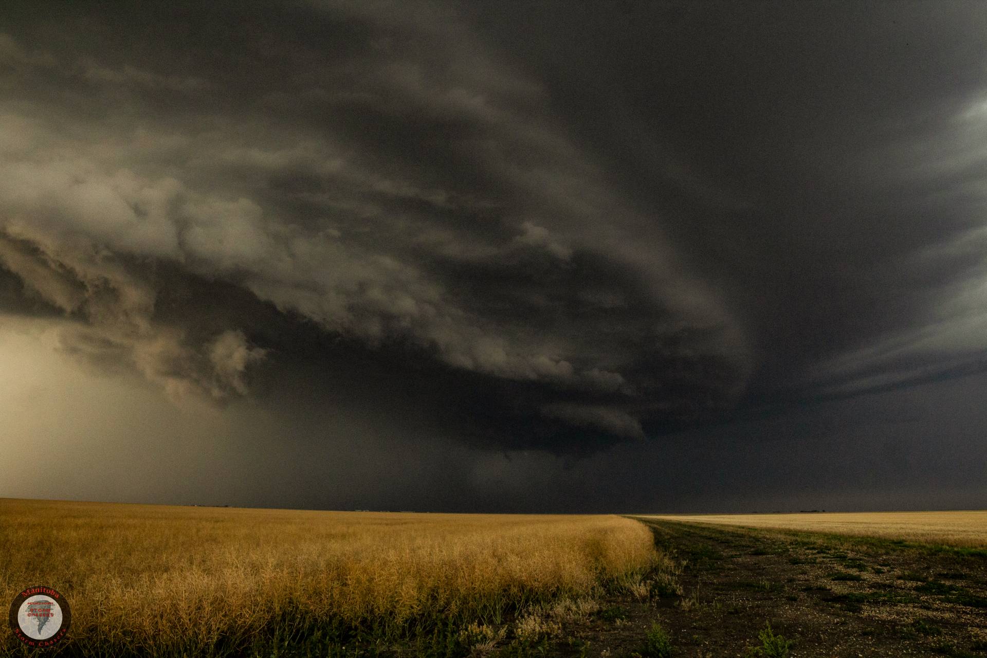
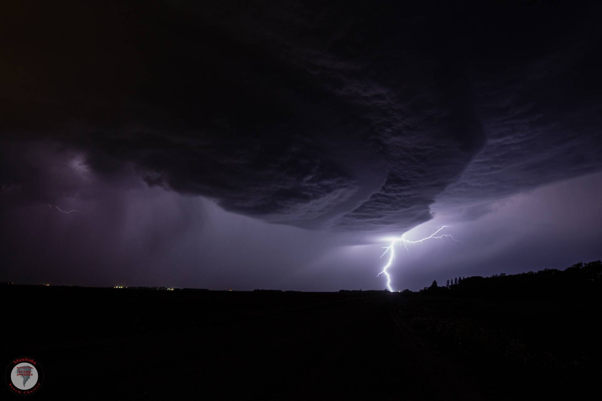
We travelled east towards Rouleau, SK (or Dog River for you Corner Gas Fans!) in an effort to stay ahead of it, while doing so this storm went from a high based thunderstorm with a wall cloud, to a full-on monster supercell which was bringing dramatic skies and very large hail to anyone and anything in its path.
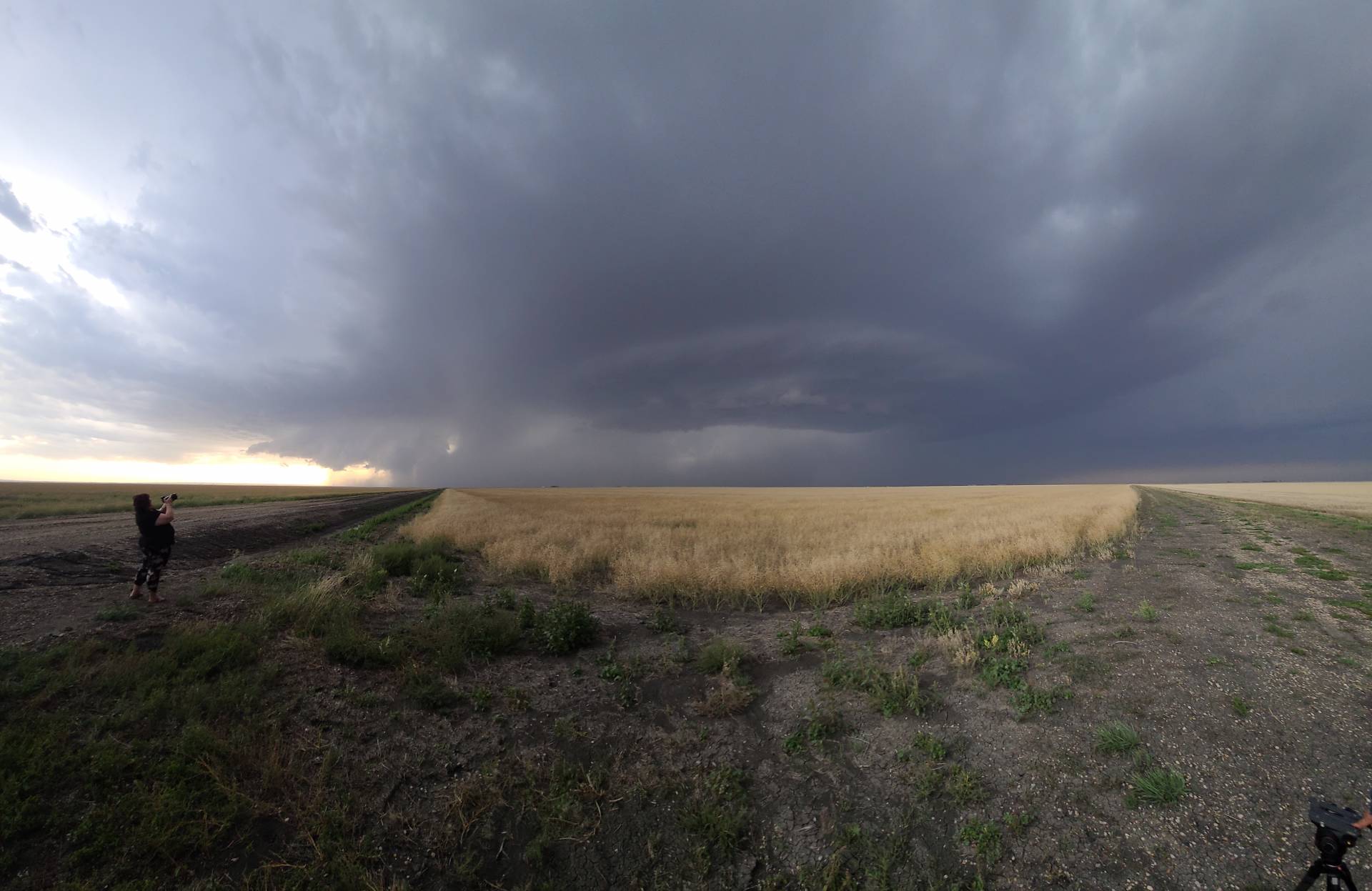
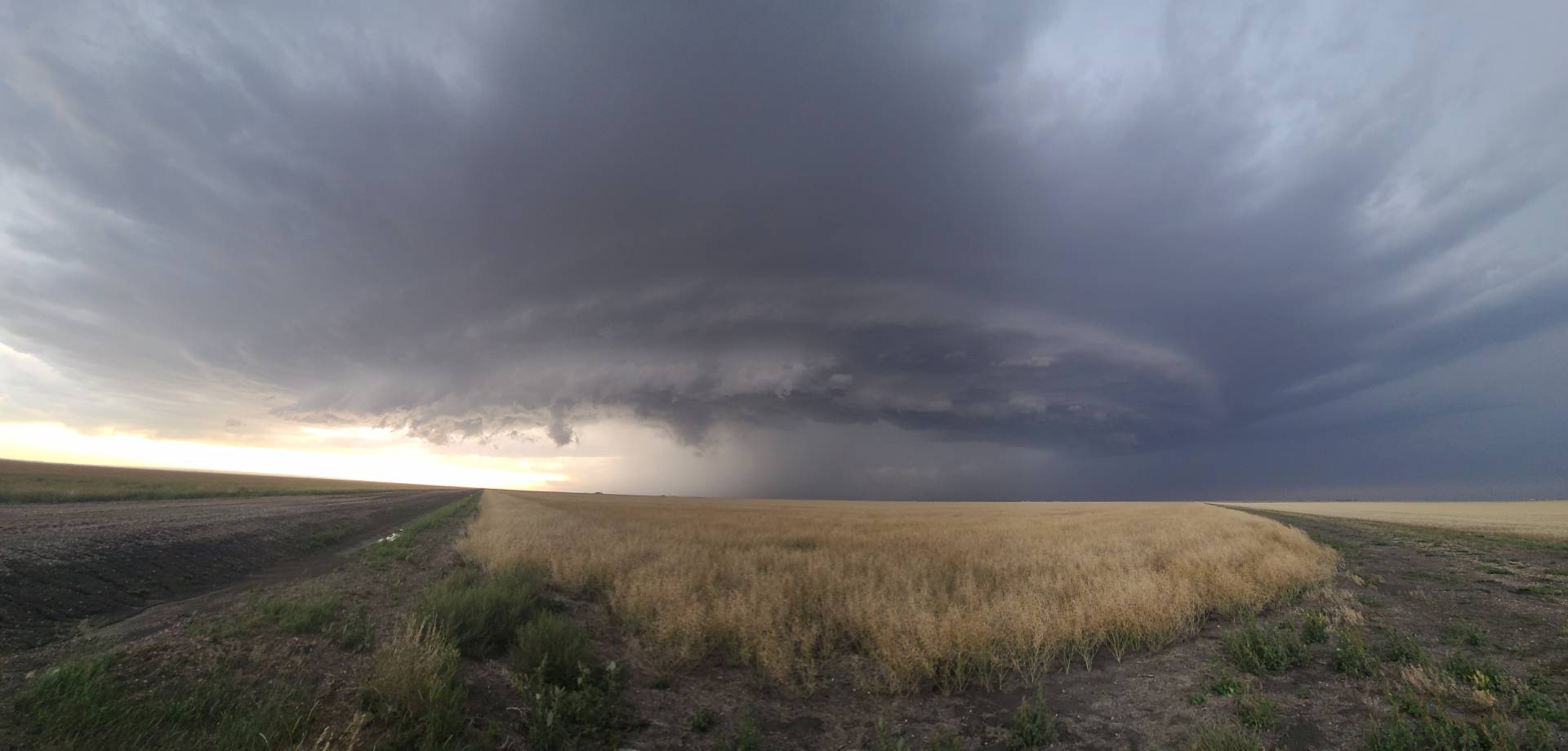
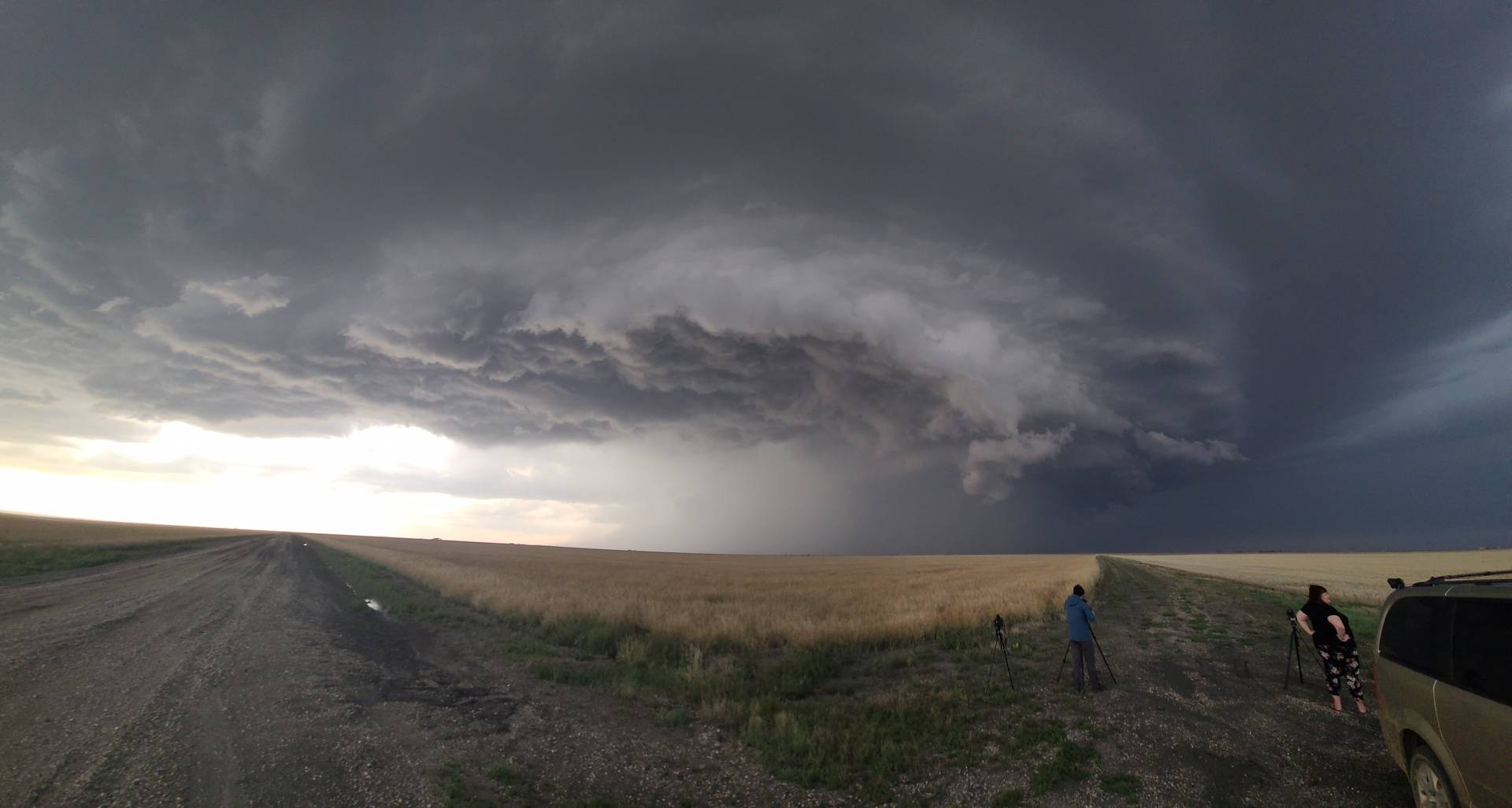
We continued to track along the southeast corner of this storm as it made its way towards and through Regina, causing extensive hail damage within the city, and while it didn’t produce a tornado, it sure was the storm of the year for me! providing an excellent opportunity for some amazing photographs and videos, which you can see below!
Community Comments
There are no comments on this post
Want to leave a comment? Join our community → OR Login →